James’s Fort: An Early Seventeenth-Century Harbour Fortress in Ireland


Site at a Glance
- Rating
- 4.5
- Popularity
- Low
- Country
- Ireland
- Primary era
- Early Modern
- External website
- Open
- Eras represented
- Early Modern
- Civilizations
- English
- Site type
- Military
- Remains
- Fort
On this page8 sections
History
James’s Fort is an early seventeenth-century English bastion fortification in Ireland, located at Kinsale on the River Bandon. Built in the period after the Siege of Kinsale, it defended Kinsale Harbour and the seaborne approaches to it. The fort was designed by Paul Ive, an English military engineer and fortification designer, and construction took place from 1602 to 1607.
Medieval predecessor and English construction
An earlier medieval stronghold called Castle Ny-Parke occupied the site. Spanish forces held it temporarily during the Fourth Spanish Armada of 1601. In the early stages of the Siege of Kinsale, Sir Richard Smyth captured the position with English forces serving under Charles Blount, Lord Mountjoy.
Construction of James’s Fort began in 1602, immediately after the siege. The new fort replaced and supplemented the medieval fortification, with its position intended to protect the harbour and control access by sea. Its name honoured James I of England, who was also James VI of Scotland and king of Ireland.
Williamite War and later decline
During the Williamite War in Ireland, the late-seventeenth-century conflict between supporters of the Catholic King James II and forces backing the Protestant William III and Mary II, Jacobite troops occupied the fort. Williamite forces captured it in 1690 after an explosion in the gunpowder stores damaged the defences.
James’s Fort declined in military use during the eighteenth century. After Charles Fort was constructed on the opposite side of the harbour in the late seventeenth century, James’s Fort became known as the “old fort,” or “Old Fort.” Charles Fort remained a military garrison until the early twentieth century, while nineteenth-century texts and maps described James’s Fort as a ruin.
Archaeology and preservation
Archaeological excavations were carried out during the late twentieth and early twenty-first centuries. A survey commissioned by Dúchas, the Heritage Service, took place in 1998. James’s Fort is National Monument of Ireland number 525, held under state guardianship and managed by the Office of Public Works. Preservation work has been undertaken, although An Taisce placed the site in an “at risk” category in 2016 because it required a long-term conservation management plan to prevent further deterioration.
Remains
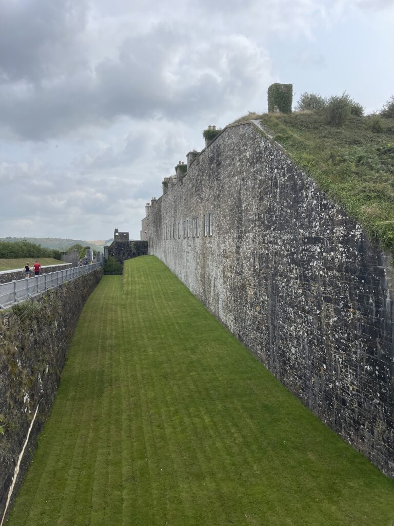
James’s Fort occupies the Castlepark peninsula in Kinsale Harbour, downstream from Kinsale on the River Bandon. Its defences combine a stone fortification with surrounding earthworks, creating a pentagonal, star-shaped plan. A separate fortified structure at the water’s edge formed part of the harbour defence.
Fortification plan
Central fortification
The central work is a four-sided, half-bastioned stone fortification enclosed by pentagonal earthworks. Its projecting angular defences allowed defenders to cover the walls and approaches with intersecting fire, the principle associated with a bastion fort. Together, the masonry core and earthworks form the principal star-shaped defensive layout.
Water-edge blockhouse
A hexagonal blockhouse stands at the water’s edge. Designed as a water battery, an artillery position beside a waterway, it occupied the narrowest point of the harbour channel and was intended to control passage through the channel. The blockhouse and the surrounding bastioned fortification make up the surviving defensive arrangement known as James’s Fort.