Iburg: A Ruined Saxon and Medieval Castle in Germany


Site at a Glance
- Rating
- 4.4
- Popularity
- Low
- Country
- Germany
- Primary era
- Medieval
- External website
- Open
- Eras represented
- Medieval
- Civilizations
- Holy Roman Empire
- Site type
- Military
- Remains
- Castle
On this page9 sections
History
Iburg is a ruined hilltop castle in Germany, near Bad Driburg, whose origins lie in an eighth-century Saxon refuge fortification. The site developed during the Saxon Wars, the late eighth- and early ninth-century campaigns by Charlemagne and the Frankish kingdom that brought Saxony into the Frankish political and Christian sphere.
Saxon and Frankish Origins
Local legends identify Iburg as a possible location of the Irminsul, a sacred pillar or cult object associated with the pre-Christian Saxons, but this connection remains unestablished. Recent research instead associates the castrum Juberg mentioned in the Frankish Royal Annals for 753 with Iburg near Bad Driburg rather than with Bad Iburg near Osnabrück.
After Charlemagne conquered Saxon territory, he ordered the Church of Saint Peter to be built within the former Saxon enclosure. Charlemagne, the Frankish ruler who incorporated much of Saxony and was crowned emperor in 800, donated the castle to the Church of Paderborn in 799. The church became an archdeaconal church in 1231, serving as the principal church of an ecclesiastical district supervised by an archdeacon.
Convent and Medieval Castle
A Benedictine women’s convent, a religious community of nuns following the Rule of Saint Benedict, occupied the site briefly from 1134. In 1189, Paderborn Bishop Bernhard II commissioned a stone castle measuring approximately 180 by 50 metres. This construction created the high-medieval stronghold whose surviving ruins now stand among the earlier Saxon fortifications.
Destruction and Later Memory
Iburg lost importance during the fifteenth century. Duke Otto of Brunswick destroyed the castle in 1444, and it was not rebuilt. After the Lords of Driburg died out, the town of Driburg inherited the castle and the adjacent forests.
The ruins were cleared and archaeologically examined for the first time in 1900. Research excavations and conservation measures followed repeatedly. Iburg also entered regional literary memory as one of the settings in Friedrich Wilhelm Weber’s epic poem Dreizehnlinden and as the subject of a poem by Karl Leineweber. Its name has been adopted by several Bad Driburg institutions, including Iburg Stadium and the School beneath Iburg. A medieval market continued at the castle site annually until 2019.
Remains
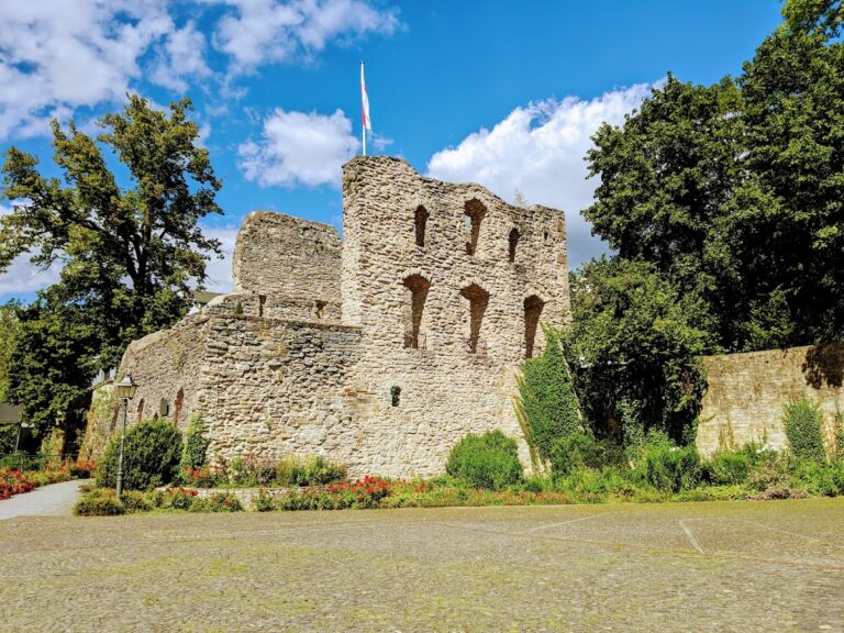
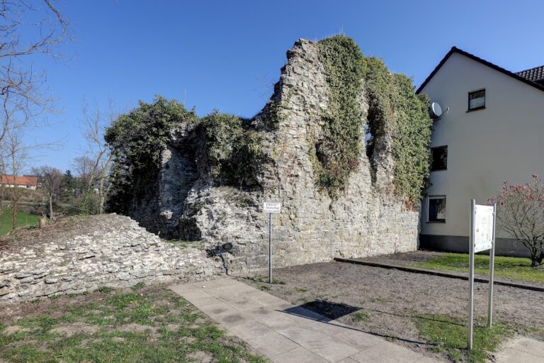
The ruins occupy the Iburg, or Iberg, a wooded and narrow mountain spur extending toward the valley east of Bad Driburg. The mountain rises to 381.2 metres above sea level, within the Teutoburg Forest / Egge Hills Nature Park. The surviving site includes ramparts, ditches, wall remains, foundations, the bergfried, and archaeological traces of earlier construction phases.
Saxon Hill Fort
The eighth- or ninth-century hill fort covered approximately four hectares and measured about 300 by a maximum of 150 metres. Its southern side was defended by a very steep slope. At the narrow western end of the spur, the main rampart was paired with an outer ditch. This ditch can be followed for 60 metres toward the northwest and another 70 metres toward the northeast, where material from the later castle ditch covers it. Elsewhere, the enclosure survives chiefly as the edge of a terrace.
A second western rampart was less substantial and had a flat-bottomed ditch 2.50 metres wide in front of it. The main rampart may have received a 1.20-metre-thick mortared limestone wall in double-shell construction during the tenth century. Massive palisades sunk into the natural bedrock supported the rampart’s outer face. Two limestone walls found in the western Saxon Wall belong to the Saxon and subsequent Frankish phases of the fortification.
Entrances and Defensive Features
A chamber gate gave access to the interior on the eastern side. A circular stone foundation on the main rampart may mark the former position of a tower. These features formed part of the defensive organization of the earlier enclosure, whose earthworks remained incorporated into the later castle landscape.
High-Medieval Castle
The high-medieval castle measured approximately 160 by 60 metres. A ring wall about two metres thick enclosed it, while a ditch reached up to 20 metres in width and eight metres in depth. The northern entrance was formed by a gatehouse approached across an earth bridge. A square tower stood immediately west of the gatehouse, with two adjoining buildings.
Residential and Religious Buildings
Immediately outside the western castle wall stands the conical, truncated ruin of a bergfried, the principal defensive and refuge tower of a medieval castle. It has an external diameter of 13 metres. Its present form is dominated by former infill masonry, while the original sandstone outer shell has been removed.
Three further building plans, including a palas, the main residential and representative building of a medieval castle, have been identified on the southern side of the castle, along with a church. Excavations revealed remains of an older construction phase beneath these buildings and beneath the ring wall, preserving evidence of the site’s development from an earlier fortified enclosure into the medieval castle.
Nearby sites