Hospitaller Commandery of Saint-Jean-d’Acre: Headquarters of the Order of Saint John


Site at a Glance
- Rating
- 4.6
- Popularity
- Low
- Country
- Israel
- Primary era
- Medieval
- External website
- Open
- Eras represented
- Medieval, Early Modern, Modern
- Civilizations
- Crusader, Fatimid, Kingdom of Jerusalem, Knights Hospitaller, Ottoman
- Site type
- Military
- Remains
- Castle
On this page20 sections
History
The Hospitaller commandery of Saint-Jean-d’Acre in Acre, Israel, was a Crusader-period headquarters of the Knights Hospitaller, a religious and military order that cared for pilgrims while maintaining fortified establishments and armed forces. Established after the Crusaders captured Acre in 1104, it developed through the twelfth and thirteenth centuries around the Church of Saint John the Baptist and became the principal center of the order when Acre served as the capital of the reduced Kingdom of Jerusalem.
Foundation and relocation
The Hospitallers first occupied a quadrangular complex southwest of Acre’s Great Friday Mosque. This early site probably incorporated a tenth- or eleventh-century Arab-Fatimid caravanserai, an inn and service complex for travelers and merchants. In 1110, King Baldwin I of Jerusalem confirmed the order’s possession of additional donated buildings north of the Cathedral of the Holy Cross. Construction and expansion began there early in the twelfth century.
The cathedral’s new north portal caused damage to neighboring Hospitaller buildings during works in the 1130s. The order subsequently abandoned the northern location and expanded westward to the area represented by the present commandery. The earliest recorded reference to this new complex dates to 1141, during the regency of Queen Melisende of Jerusalem. The church at its center, dedicated to Saint John the Baptist, is first mentioned in 1149. By 1172, a pilgrim described the establishment as an impressive fortified complex.
A major street passed through the commandery for about 50 meters. Bridges or enclosed passages joined the northern administrative and Hospitaller buildings to the southern church and hospital, while a massive gate could close the route during danger. This arrangement allowed the commandery to function as both a religious institution and a defended urban headquarters.
Acre as the Hospitaller headquarters
Saladin, the Muslim ruler who defeated the Crusaders at Hattin, captured Acre in 1187. The Crusaders recovered the city during the siege of 1189 to 1191, in which Richard the Lionheart took part. Jerusalem remained outside Crusader control, so Acre became the capital of the Kingdom of Jerusalem. The Hospitallers returned to their commandery, which then became the headquarters of the order.
The complex grew in stages from the late twelfth into the thirteenth century. New wings and floors were added to earlier buildings, and after 1271 the grand master also lived there. Later descriptions therefore called the establishment the grand master’s palace, or Grand Manoir. Concessions granted by King Guy of Lusignan in 1192 and King Henry I of Jerusalem in 1193 allowed the commandery to extend toward the old northern city wall.
By the early fourteenth century, the commandery consisted of a northern order house, a southern hospital, and the Church of Saint John between them. The northern section housed the knight-brothers, the order’s administration, a hospice for pilgrims, and a prison. It also contained a sugar-refining operation that contributed greatly to Hospitaller revenues. Pilgrims arriving by sea, as well as those waiting to sail home after visiting the Holy Land, were received within the complex.
The commandery also took part in Acre’s internal conflicts during the Venetian-Genoese War of 1256 to 1270, a struggle between the two maritime powers and their allies for influence in the port city. After the Genoese were expelled in 1257, their possessions were stored in the commandery. A general chapter of the Hospitallers held at Acre in 1263 referred to the Church of Saint John, its baptismal font, and three altars.
Conquest and ruin
The Mamluks, a military ruling elite whose sultanate controlled Egypt and much of the eastern Mediterranean, conquered Acre after a 44-day siege. The city fell on 18 May 1291 under Sultan al-Ashraf Khalil, although the Hospitaller commandery, the Templar fortress, and the Teutonic house resisted for several more days. Seven Hospitallers escaped by sea.
Sultan Khalil ordered the emir Alam al-Din Sanjar al-Shuja’i al-Mansuri to demolish Acre’s churches and fortifications so that they could not be reused as Christian strongholds. Large parts of the commandery survived, but the complex remained largely ruinous until the Ottoman period.
Ottoman transformation
In the early seventeenth century, the Druze ruler Fakhr al-Din II tried to prepare the commandery for military use. The project was abandoned after the Ottoman government ordered it to stop. European drawings from the seventeenth century show the commandery and church as deteriorating ruins, with parts covered by drifting sand.
From the 1740s, the regional ruler Zahir al-Umar developed Acre as a fortified residence and administrative center. He took over the Grand Manoir and, from the 1750s, built an upper citadel on its surviving lower levels. Rubble and sand filled parts of the medieval structures to support the new buildings. The resulting complex included soldiers’ quarters, stores, weapons workshops, a treasury, prison cells, and administrative and residential rooms.
Around 1750, Zahir al-Umar built the first physically separate Old Serail over the surviving crypt and west facade of the Church of Saint John. After administrative functions moved elsewhere, the citadel served mainly the garrison and prison. Ahmad al-Jazzar Pasha stationed foreign mercenaries there and used it as a refuge during unrest. In May 1789, rebellious Egyptian Mamluk soldiers barricaded themselves in the treasury tower and threatened to destroy the Old Serail with its guns before negotiating their withdrawal.
Ahmad al-Jazzar added a representative upper story to the northwest tower around 1797 and built the Diwan-Khan beside the eastern forecourt. His successor, Suleiman Pasha al-Adil, extensively renovated the citadel in 1817 and 1818. During the Egyptian occupation of Acre from 1832 to 1840, the citadel served as a military hospital. Allied bombardment in 1840 caused an Egyptian ammunition depot inside the citadel to explode. The complex ceased to function as a principal defensive stronghold after the Egyptian withdrawal, although the Ottomans later repaired it and built the Kışla barracks around the courtyard.
Prison, investigation, and preservation
During the British Mandate, the upper complex became a prison containing cells, administrative and interrogation rooms, workshops, a hospital section, execution facilities, and separate accommodation for Jewish and Arab prisoners. Israel used the prison as a military prison until 1949 and then as a psychiatric hospital from 1949 to 1981.
Exploration of Acre’s Old City began in 1942. From 1948, investigations examined its Crusader and Arab-Ottoman remains, and excavation of the buried Grand Manoir began effectively in 1954. From the late 1950s, the lower vaults, Grand Manoir, church crypt, commandery courtyard, and areas beneath Ottoman buildings were progressively cleared, studied, stabilized, and restored. Work in the courtyard between 1992 and 1999 removed rubble pressure from the medieval vaults and exposed the central court.
The surviving complex forms part of Acre’s Old City, which came under protection during the British Mandate after the 1942 exploration campaign and was inscribed as a UNESCO World Heritage site in 2001. The former Grand Manoir is presented as the Knights’ Halls. Other parts of the wider complex contain the Old Serail cultural center, the Underground Prisoners Museum, and the Okashi Museum of Art.
Remains
The surviving commandery represents the complex’s final medieval phase in 1291 and covers approximately 4,500 to 5,000 square meters. Built principally of sandstone, it retains two or three levels, with each level generally seven to ten meters high. The Grand Manoir lies north of the modern street crossing the former commandery. Its roughly rectangular plan follows a broad northeast-to-southwest alignment, while halls 7 and 8 stand precisely on a north-south axis.
Central court and northern defenses
The Grand Manoir is organized around a courtyard of about 1,200 square meters, enclosed by four wings and arcades, rows of arches supported by columns or piers. Rubble was cleared from the court by 1999, leaving it open to the sky. An eastern ramp or staircase leads toward the upper levels beneath the Ottoman citadel. Two heavily fortified medieval gates survive in the northern and southern parts of the complex. The northern gate is reached through hall 9 and formerly connected the commandery with the moat beside the old city wall. Traces of a bridge remain nearby.
Northern wing and storage halls
The northern wing follows the old city wall and has an outer wall about 3.5 meters thick. It contains ten vaulted halls. Halls 1 to 6 form a connected group roughly ten meters high and were probably used for storage. Their arches link the rooms, while repairs in the masonry belong to the post-Crusader period. A later opening in the northern wall of hall 2 leads toward a forecourt and the remains of a bridge across the old city moat. This route may have provided rapid access toward the Hospitaller defenses at the Marian Gate in Montmusard.
Water storage and sugar refining
Halls 7 and 8 contain six rooms arranged over three levels. The two lowest rooms are cross-vaulted rainwater cisterns, each about 7.5 meters high and approximately 5 by 13 meters in area. Waterproofed walls and floors gave the two tanks a combined capacity of about 1,000 cubic meters. An inlet from the roof survives in the northern part of hall 8, and a water-drawing opening remains in the southern part of hall 7.
The middle levels contain cross-vaulted rooms about seven meters high. Excavation in hall 7 uncovered hundreds of conical ceramic molds set in straw, together with sugar loaves and dozens of small jars for molasses. These remains identify the commandery’s sugar-refining operation. The upper rooms retain plastered walls painted in black, yellow, and red Gothic-style decoration. A large circular keystone from a collapsed vault carries an elaborate rosette of acanthus leaves.
Gate tower, latrines, and sewer
Hall 9 forms the passage through the northern gate and is surmounted by a massive tower. Together with halls 6 to 8, it defines the northern side of the courtyard. In the northwest corner, hall 10 contains the latrine block. Dozens of drainage pipes from the room above reach its lower level. The latrine room measures about 5 by 10 meters and contains four rows of eight toilets, with three windows opening through the thick northern wall for ventilation.
Roof water traveled through channels built into the walls and flushed the latrines. The lowest floor slopes toward five outlets that connect with the main sewer. About one meter wide and 1.8 meters high, the sewer once ran south beneath the commandery and through the old city toward the former Pisan harbor.
Western and eastern wings
Western wing
The western wing extends beneath the Ottoman Kışla barracks and has not been fully excavated. Two large blocked arches once opened toward the courtyard. Excavated fragments include basket-shaped capitals and Gothic ornaments with human figures, indicating a medieval Gothic wing probably used for the residence and daily activities of the knight-brothers.
Pillar Hall and enclosed passage
The east wing includes the Pillar Hall and the former prison. A four-meter-wide enclosed passage or bridge connects the Pillar Hall with hall 2, allowing movement between the wings while leaving the route below open. It may have offered a rapid connection toward the Hospitaller defenses in Montmusard.
The Pillar Hall probably served as a dormitory. It measures approximately 30 by 45 meters, covers about 1,300 square meters, and contains 24 bays supported by 15 square-plan Romanesque pillars. Its vaults rose as high as eight meters. Later Ottoman construction caused parts of the vaulting to collapse, and the surviving fabric has been repaired and stabilized.
Former prison and Beautiful Hall
The former prison lies east of the Pillar Hall. Its cross-vaults rise five meters and its masonry retains iron rings used to shackle prisoners. The floor was cut into the bedrock and lies about 2.5 meters below neighboring rooms. Originally, a staircase from the south connected it with the main east-west street.
The so-called Beautiful Hall occupies the southeast corner. Its modern name derives from finely cut and carefully laid ashlar masonry. Because it could be reached directly from the street, it probably served as a reception hall and as an initial entrance for visitors arriving from outside.
Refectory and church
Refectory
The south wing contains the refectory, a communal dining hall in a religious institution. Built around the middle of the twelfth century and cleared in 1960, it measures approximately 44 by 22.16 meters. Two naves and four entrances organize the interior, which is covered by rib vaults about ten meters high and divided into eight bays. The vaults rest on three massive circular pillars, each about three meters in diameter.
The building combines Romanesque and Early Gothic features. Pointed transverse ribs and supports inserted for the rib vaults indicate that the original plan may have called for a Romanesque, non-rib-vaulted structure. Two corner corbels, projecting stones supporting part of the vault, carry the fleur-de-lys associated with the French monarchy. They may relate to King Louis VII’s presence in Acre during the Second Crusade in 1148.
Three fireplaces are set into or attached to the eastern narrow wall, and the adjoining room probably served as a kitchen. Excavation produced large quantities of pottery, particularly plain, shallow, mostly broken unglazed bowls that probably formed ordinary tableware. Fragments of a more elaborate glazed bowl carry olive-colored Hospitaller crosses on a pale yellow ground, an early example of the order’s straight-lined twelfth-century cross.
Church crypt and facades
The Church of Saint John stood south of the Grand Manoir, with the Hospitaller hospital extending farther south. Its surviving remains include a crypt, parts of the west and north facades, sections of the church floor, evidence of choir screens, architectural sculpture, and elements from the eastern apse area.
The crypt consists of six parallel vaulted halls running east-west beneath the Old Serail. The two western halls are older, while the four eastern halls are later and reach about 5.5 meters in height. All six open southward toward what was probably the courtyard of the earlier caravanserai. A horseshoe arch in the easternmost hall suggests that the crypt may incorporate the northern wing of a tenth- or eleventh-century Arab-Fatimid caravanserai. Investigations between 1995 and 2003 strengthened the identification of the undercroft as the church crypt.
The former western entrance is blocked by a gray-marble threshold 2.7 meters long, with gaps of about 35 centimeters at both ends. Pilasters flanked the entrance, and two stairways probably rose about four meters from the medieval street to the church floor. The surviving west facade rises approximately 13 meters above the present street and continues around the northwest corner into part of the north facade. Its former windows had trefoil shapes, and fragments of their tracery survive among the excavated material.
Below the Old Serail, the church floor survives beneath a protective layer of rubble. Marble slabs in three colors formed the pavement, and fragments of colored window glass lay among the remains. Evidence of choir screens survived in the eastern wing, while three fallen marble columns and colored marble capitals were found in the nave. One capital bears an orange Hospitaller cross on a black ground. A circular recess in the former narthex, the entrance hall of a church, probably marks the position of the font.
The eastern end originally terminated in three apses, the curved spaces that ended the church’s eastern side. A seventeenth-century view shows their arrangement. A Gothic church portal removed from Acre and installed in Cairo between 1296 and 1303 may have come from Saint John, although it has also been attributed to the Cathedral of the Holy Cross or other Acre churches.
Oratory and hospital precinct
South of the eastern crypt halls stands a free-standing structure altered several times and covered by two superimposed pointed barrel vaults. The upper vault is largely lost and was replaced by a cross vault during the Ottoman period. Its resemblance to prayer spaces commonly placed inside caravanserais suggests that the Hospitallers may have reused the building as an oratory, a small space for prayer.
The former Hospitaller hospital extended south of the church. Its precinct was partly divided by the late-eighteenth-century Turkish Bazaar, whose western end cuts through the hospital complex. A large hall south of the bazaar has been identified as part of the hospital.
Ottoman layers and buried medieval fabric
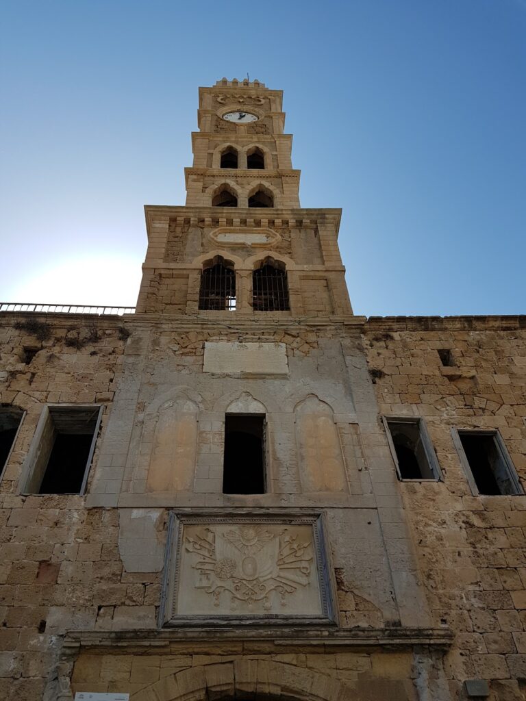
The upper Ottoman citadel stands directly on the medieval Grand Manoir. Its northeast corner is occupied by the treasury tower, Burj al-Khazna, which reaches approximately 40 meters and is the tallest surviving part of the wider complex. Its lower structure has not been excavated, but it incorporates the medieval gate tower known as Porta Domine Nostre.
The Hospitaller structures now lie about seven to eight meters below the modern streets. This difference resulted from the retention of collapsed masonry and rubble in the eighteenth century and the raising of the streets with sand fill. Medieval fabric is therefore partly buried, altered, reconstructed, or concealed beneath Ottoman buildings. Stabilization remains necessary because Kurkar, a calcareous coastal tuff used widely in the eastern Mediterranean, erodes when water penetrates the masonry.