Heuneburg: A Prehistoric Hilltop Settlement and Early Celtic Center
Site at a Glance
- Popularity
- Very High
- Country
- Germany
- Primary era
- Iron Age
- Eras represented
- Bronze Age, Iron Age
- Civilizations
- Celtic
- Site type
- City
On this page21 sections
History
Bronze Age occupation
Heuneburg is a prehistoric and early historic hilltop settlement near Hundersingen, in the municipality of Herbertingen, Germany, above the upper Danube. Its earliest known occupation dates to the Middle Bronze Age, before it became a major early Celtic center during the Hallstatt period, an early phase of the European Iron Age.
During the Middle Bronze Age, people reshaped the hill spur with substantial banks and ditches and fortified its plateau with a timber-framed wall. The settlement was abandoned at the beginning of the Urnfield period, a Late Bronze Age cultural phase associated with cremation burials in urns. A burial area later occupied part of the site where the southern settlement would develop.
Hallstatt-period center
The citadel was occupied and fortified again around 700 BCE. By about 600 BCE, Heuneburg had become a major center of power and trade in Celtic southern Germany. Its settlement was reorganized at roughly this time, with houses arranged more closely and regularly. The community included a citadel, a large outer settlement and a southern settlement that may have joined the outer one.
Estimates suggest that the citadel held about 4,000 people at its height, while the wider center and surrounding area may have had around 17,000. A separate estimate for the outer settlement puts its population at 5,000 to 10,000. Specialized production, extensive settlement and imported goods point to social differences and possibly centralized political authority. The traditional label “princely seat” describes an important fortified Celtic center, but it can imply a political system that is not securely established. Prehistorian Manfred Eggert has criticized its use for Heuneburg on those grounds.
Workshops produced bronze and iron goods, including objects made for export. Heuneburg’s position on the Danube, north of the Alps, connected routes between northern and southern Europe. Greek imports, amber, metal goods and other materials attest to contacts over long distances.
Destruction and later use
A major fire destroyed Heuneburg’s distinctive mudbrick fortification around 530 BCE. A rampart made of wood and earth was used again afterward, and the settlement flourished once more before another destruction in the fifth century BCE. The causes remain uncertain: warfare or internal conflict has not been established, and the later fire may have been accidental. The citadel plateau and outer settlement seem to have lost their former role, although activity and burial continued in the surrounding area. Whether the site was entirely abandoned during the La Tène period, a later phase of the European Iron Age, remains uncertain.
More than 50 burial mounds are known around Heuneburg. Some date to the Hallstatt period, while most are thought to belong to the La Tène period. A richly furnished grave of a two-year-old child, found in 2005, included Etruscan gold pendants and gold clothing fasteners. The grave goods point to pronounced social distinctions.
Some accounts identify Heuneburg with Pyrene, a Celtic city mentioned by Herodotus, a Greek historian of the fifth century BCE. That proposed identification draws on the site’s position near the Danube’s source region, its Greek trade connections and possible Mediterranean influences on its fortifications. Herodotus, however, placed the Celts in his geographical account far to the west, near the Iberian Peninsula, and Pyrene has not been securely identified at Heuneburg or elsewhere. In the medieval period, the hill’s strategic position was used, but Heuneburg did not become a permanent settlement again.
Excavation and modern interpretation
Heuneburg was noted in the 1820s. In 1882, Eduard Paulus recognized it as a prehistoric fortification, though he mistook lower defenses for medieval works. Nearby burial mounds were opened during the nineteenth century, and intermittent excavation on the citadel began in the 1920s.
Gustav Riek excavated the Hohmichele burial mound from 1936 to 1938 as part of the SS-Ahnenerbe, a research organization within the Nazi SS. The work removed about a third of the mound and located its central burial chamber. Siegwalt Schiek led further excavations there from 1954 to 1956. Meanwhile, systematic work on the citadel from 1950 to 1979, directed successively by Adolf Rieth, Kurt Bittel, Egon Gersbach and Wolfgang Kimmig, established that occupation reached back to the Middle Bronze Age.
A multidisciplinary research program on early Celtic centers began in 2003, followed by new excavations in 2004. Investigations then expanded to the outer settlement and its fortified forecourt; excavation of a monumental gate there took place from 2005 to 2008. Teaching excavations examined a ditch system at the site’s northern tip in 2008, 2009 and 2010. From 2014, research also examined the wider landscape, including associated villages, farms, burial places, roads and fortifications.
Airborne laser scanning, which maps the ground with laser pulses from aircraft, revealed further structures, including the line of the outer settlement’s banks and ditches. A possible early Celtic gate identified near the hilltop settlement in 2021 may help clarify the outer settlement’s extent. The area excavated there is estimated to cover about a third of the settlement.
In December 2023, Heuneburg was added to Germany’s UNESCO World Heritage Tentative List with the early Celtic center at Glauberg. A tentative listing is a preliminary step toward possible nomination, not World Heritage inscription. The proposed transnational nomination also includes Mont Lassois in France.
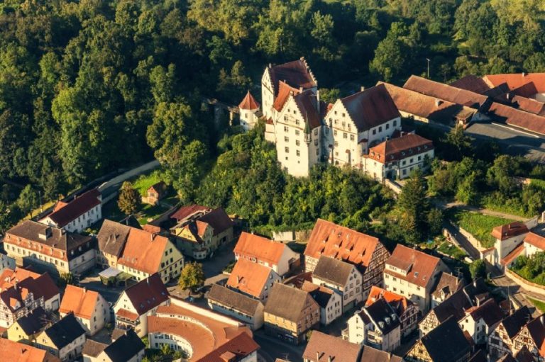
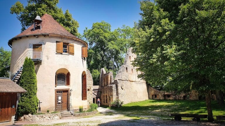
An open-air museum was developed on the plateau from 1997 and built between 1998 and 2001 to present the site’s archaeology. The Heuneburg Museum in Hundersingen occupies a former monastery tithe barn built in 1783.
Remains
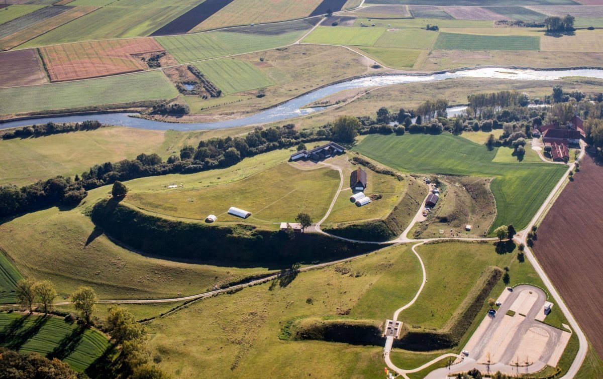
The fortified citadel occupies a spur above the Danube. Its river-facing slope is steep, and the spur rises about 40 metres above the river. The plateau measures roughly two to three hectares, with the citadel about 300 metres long and 150 metres wide. The outer settlement extended across about 100 hectares of terrace above the valley, within a landscape of fertile river plain and rolling hills.
Citadel and defenses
Fortifications
The citadel passed through at least a dozen recognizable phases of occupation over at least 250 years. Earlier defenses were mainly built of wood and earth and needed repeated replacement. From around 700 BCE, a timber-framed rampart protected the plateau. Around 600 BCE, it was replaced by a limestone foundation supporting a sun-dried mudbrick wall about four metres high.
A covered walkway may have raised the wall’s total height to about six metres. Towers projected from it at intervals, and white lime plaster coated the mudbrick, probably requiring regular renewal to protect it from rain. The wall stood for about 70 years before its destruction around 530 BCE. A wood-and-earth rampart was then used again. The mudbrick defenses were an exceptional construction in Celtic Central Europe and are generally considered to have drawn on Mediterranean models.
Citadel gates
Two monumental gates served the citadel. The western gate connected it with the outer settlements. The eastern gate probably led to a stepped route down toward the Danube and may have been linked to a harbor.
Streets, houses and workshops
A regular network of streets and houses occupied the citadel. After the reorganization around 600 BCE, dwellings stood closer together in a more orderly arrangement. Built of wood with clay mixture applied over woven wooden frames, the houses were large and elaborate in comparison with contemporary settlements. They probably served as both homes and workshops.
Metalworking took place in the citadel’s southeast corner. After the destruction around 530 BCE, workshops moved north, and a house about 14 by 30 metres was built in the southeast. It is sometimes interpreted as a residence for a local ruler. Finds from the settlement include locally made painted pottery with incised or stamped designs, fragments of Greek vessels representing about a dozen pots, Baltic amber, Slovenian horn-shaped brooches, transport vessels from Marseille and tin. Evidence for bronze and iron production includes a bronze workshop and metal objects made for export.
Outer settlement and earthworks
Settlement plots
The outer settlement lay immediately west and northwest of the citadel, lower down the slope. It probably occupied this area from the seventh to the fifth century BCE and may have had its own defenses. Fenced or palisaded plots appear to have held a main dwelling, storage areas and land for cultivation, perhaps forming farmsteads for extended families. The southern settlement lay farther south and may have adjoined it.
Triple banks and ditches
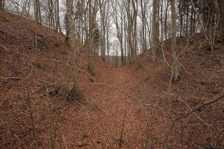
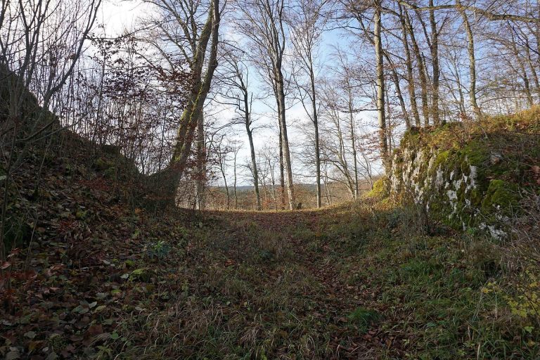
Three banks and ditches enclosed and divided lower ground immediately west of the main settlement, extending for several hundred metres. They partly overlie houses of the outer settlement, indicating that the earthworks were built later. Erosion and ploughing have worn them down, but surviving banks rise more than six metres. The ditches were originally about seven metres deep.
Western monumental gate
A monumental gate in the western outer fortification, excavated from 2005 to 2008, measures about eight by twelve metres. Its limestone core was set in fine clay mortar and faced on both sides with carefully worked limestone blocks. This construction has close parallels with contemporary Mediterranean architecture and is unusual in the Celtic world.
Burial landscape
Gießübel-Talhau
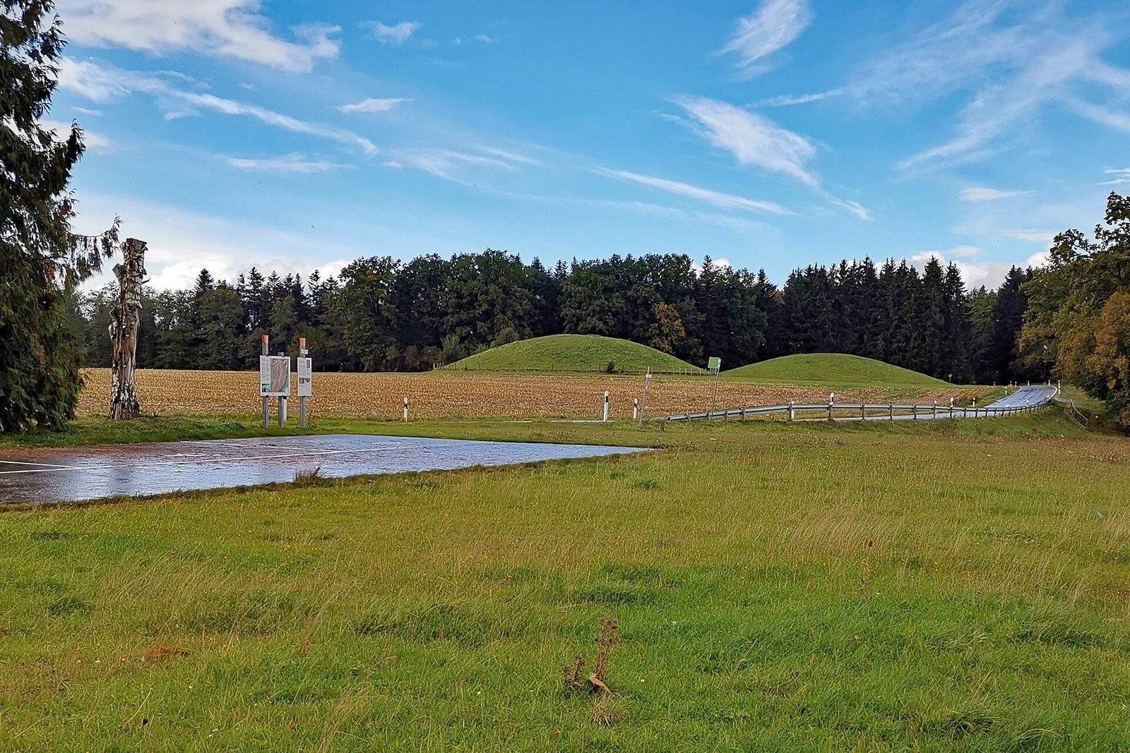
The Gießübel cemetery lies about 500 metres northwest of Heuneburg, over the abandoned western part of the outer settlement. Four mounds remained there in the nineteenth century, each about 50 metres across and seven metres high. Excavations began during that century and became more systematic from the 1950s to the 1980s.
A rectangular wooden chamber in one mound measured about 3.5 by 5.5 metres. Its principal occupant was a man around 50 years old; remains of two women were also found. Although the grave had been robbed in antiquity, surviving finds included weapons, gold and bronze clothing fittings, and amber plaques that probably decorated a couch imported from the Mediterranean. Twenty further burials were placed in or on the mound. A separate robbed grave, Grave 4, contained one individual and metal fittings from a wooden chariot.
Hohmichele
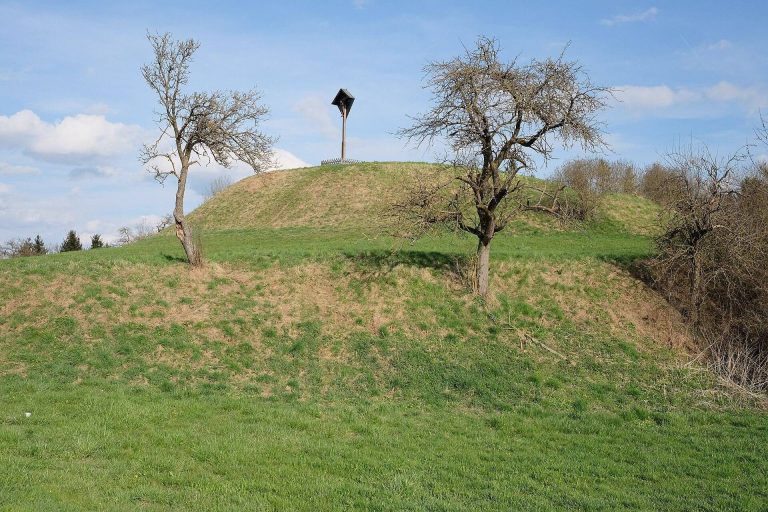
The Hohmichele Group lies about 3.5 kilometres west of Heuneburg, near Altheim, and comprises at least 36 burial mounds. About 14 remain in woodland; erosion and ploughing have obscured many others. The group’s largest mound, the Hohmichele, is about 85 metres across and more than 13 metres high. Used from the late seventh to the late sixth century BCE, it contained 13 burials, several with grave goods.
The central chamber, Grave I, was built of oak at the original ground level. It measured about 5.7 by 3.5 metres and one metre high, and held a man and a woman. It was plundered soon after burial. Remaining finds include horse fittings, nearly 600 glass necklace beads, amber fragments and fine gold threads from a brocade-like textile. Cowskins covered the floor. A central mound about 40 metres across and five metres high covered the chamber.
Grave VI lay about 12 metres southeast of the central chamber and about 2.2 metres above the old ground surface. Its wooden chamber measured about three by 2.4 metres and one metre high. A man and a woman were buried there: the woman lay in a four-wheeled chariot with fittings for two horses, while the man lay on the floor. Their grave goods included bronze eating and drinking vessels, a quiver with 51 iron arrowheads, an iron knife, amber and glass beads, including 2,300 green ones, and embroidered textile remains.
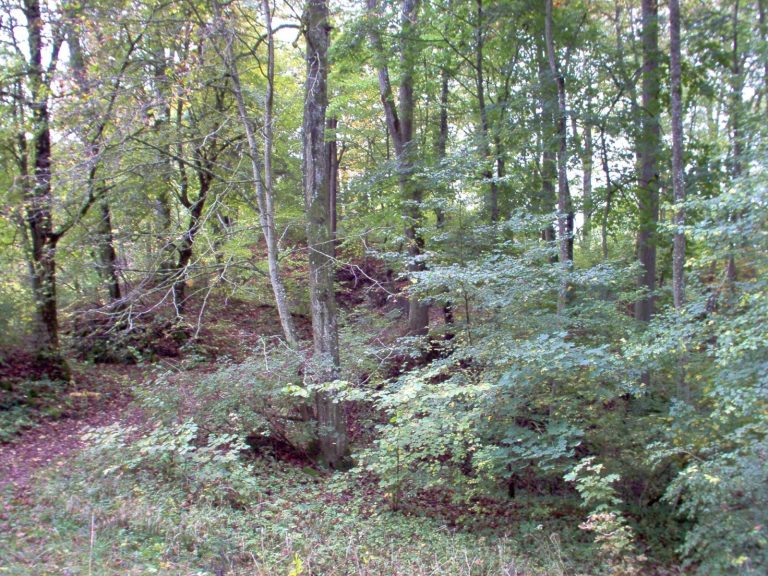
Grave IX, a pyre grave associated with a funeral fire, lay about one metre vertically from Grave VI. It held a woman aged about 18 to 30, with two bronze armlets and more than 20 pottery vessels decorated with incised and stamped designs and red paint. Six other graves were burials of uncremated bodies. Twenty-two hearths in the mound may relate to ritual activity or funeral pyres. The Hohmichele was restored to its original dimensions in 1960 and now stands covered in vegetation in a small forest clearing. A modern war memorial marks its summit.
Bettelbühl and other graves
The Bettelbühl burial ground is one of the burial places associated with Heuneburg. A richly furnished chamber grave discovered near the settlement in summer 2010 was attributed, from its grave goods, to a high-ranking woman connected with the Heuneburg elite. Tree-ring dating places the chamber’s construction in 583 BCE. Because excavation in place was unsafe, the grave was removed in December 2010 as a block of earth about 7.5 by six metres, weighing roughly 100 tonnes. Another mound was investigated from 2019, and its burial was also removed in a block and taken to conservation laboratories in October 2020.
A large mound called Lehenbühl dates to the first half of the sixth century BCE. A separate richly furnished grave of a two-year-old child, found in 2005, contained Etruscan gold pendants and gold brooches. A ceramic vessel among the grave goods of a high-status person dated broadly to 600–450 BCE contained traces of human blood and organs in which pathogens associated with Crimean-Congo haemorrhagic fever, a severe tick-borne viral disease, were detected. This may point to an epidemic in the region.
Modern reconstructions and museum
Open-air museum
The reconstructed open-air museum on the plateau includes a monumental Danube Gate, a mudbrick wall extending more than 80 metres, a large house, a dwelling, a granary and a workshop building. The wall reproduces sun-dried mudbricks on a limestone base, a construction method described as unique north of the Alps in its period.
Heuneburg Museum
The Heuneburg Museum in Hundersingen occupies a former monastery tithe barn, a building used to store produce collected as a religious levy. Built in 1783, it retains historic exterior masonry and roof structure, alongside modern interior installations. The museum displays finds from Heuneburg and nearby Celtic graves and presents the site’s research and settlement phases. Some objects from the Hohmichele graves are displayed at the Württemberg State Museum in Stuttgart.