Alte Burg: A Prehistoric Cult and Assembly Site in Germany


Site at a Glance
- Rating
- 4.8
- Popularity
- Very Low
- Country
- Germany
- Primary era
- Iron Age
- Eras represented
- Iron Age
- Civilizations
- Hallstatt culture
- Site type
- Military
- Remains
- Fort
On this page9 sections
History
Alte Burg, also called Burg Emerfeld, is a prehistoric fortified complex in Germany near Langenenslingen, Baden-Württemberg. Used between the eighth and fourth centuries BC during the Iron Age, it occupies a long plateau on the Burgberg and is interpreted as a probable cult and assembly place for the surrounding population.
Prehistoric construction and use
The complex was built or used between the eighth and fourth centuries BC. Its principal wall belongs to the seventh to fifth centuries BC, a period associated with the Hallstatt culture, an Iron Age tradition of central Europe that preceded and overlapped the early La Tène period. The site was active during the same broad era as the Heuneburg, a major Iron Age settlement in the upper Danube region about 9 kilometers to the southeast.
Another contemporary fortified site, the Große Heuneburg at Upflamör, lies about 5 kilometers to the north-northwest. The proximity of these places has shaped the interpretation of Alte Burg. A settlement of comparable size so close to the Heuneburg is considered unlikely, while the unusual human remains from the central shaft point toward a ceremonial purpose. Alte Burg may therefore have served as a place where regional communities gathered for religious activities, assemblies, and possibly athletic games or contests.
The central shaft and changing interpretations
The central feature was excavated in 1894 and was first understood as a burial mound. Six human skeletons were found in the shaft, and later investigations recovered additional human bones. The absence of burial objects, together with the nature of the feature, has made a sacrificial or other cultic interpretation more likely than the explanation of a grave.
Archaeological investigations in 2006 and 2007, followed by renewed excavations from 2014, examined both the shaft and the fortifications. In 2022, the possibility was proposed that the feature may have formed part of a prehistoric proto-hippodrome, a long arena or racecourse for horse races or similar contests. This idea draws on the unusual layout and similarities between nearby structures and Mediterranean architecture, but remains conjectural.
Research and preservation
A research project begun by the Baden-Württemberg State Office for Monument Preservation in 2014 initially placed construction in the eighth to sixth centuries BC. Later excavation results broadened the understanding of the complex, indicating use or construction between the eighth and fourth centuries BC and dating the main wall to the seventh to fifth centuries BC.
In 2016, the Verein aktiver Langenenslinger Bürger für Heimat, Archäologie und Tradition, known as ALB-HAT, was founded to preserve and interpret the discoveries, particularly the substantial remains of the main wall. A section was restored and reconstructed with original material in 2018 and 2019. For its preservation and public interpretation work, the association received the support award in the 2020 Baden-Württemberg Archaeology Prize.
Remains
Plateau and defensive system
Alte Burg occupies a long, tongue-shaped spur at about 695 meters above sea level near the southern edge of the Swabian Jura. The site covers roughly 2 hectares. Its plateau extends for about 340 meters and is between 55 and 65 meters wide. Parts of the surface were enlarged and levelled artificially by cutting away and adding material. A visible artificial step runs lengthwise across the plateau, with the southeastern part lower than the other section. The step approximately follows the boundary between Emerfeld and Langenenslingen, which formerly also marked the territorial boundary between Württemberg and Hohenzollern.
A system of three successive ramparts or dry-stone walls, built by stacking stones without mortar, encloses the spur, with ditches between them. At the northeastern end, an outer rampart about 1.5 to 2 meters high separates the plateau from the ridge without an intervening ditch. A middle rampart follows outside the main ditch, while the principal rampart forms the strongest part of the northeastern defenses. Below the plateau, a ring ditch and outer bank surround the spur. The ditch lies about 25 meters below the plateau on the northwest side and about 35 meters below it on the southeast side, reaching up to 5 meters in depth.
Ramparts and entrance
The outer rampart was made from rubble and clay. It reached about 2 meters in height and was approximately 18 meters thick. The middle rampart stood at least 1.8 meters high and was built mainly from limestone. The principal northeastern rampart rises as much as 12 meters above the bottom of its artificially cut ditch, giving the defensive line a marked vertical scale.
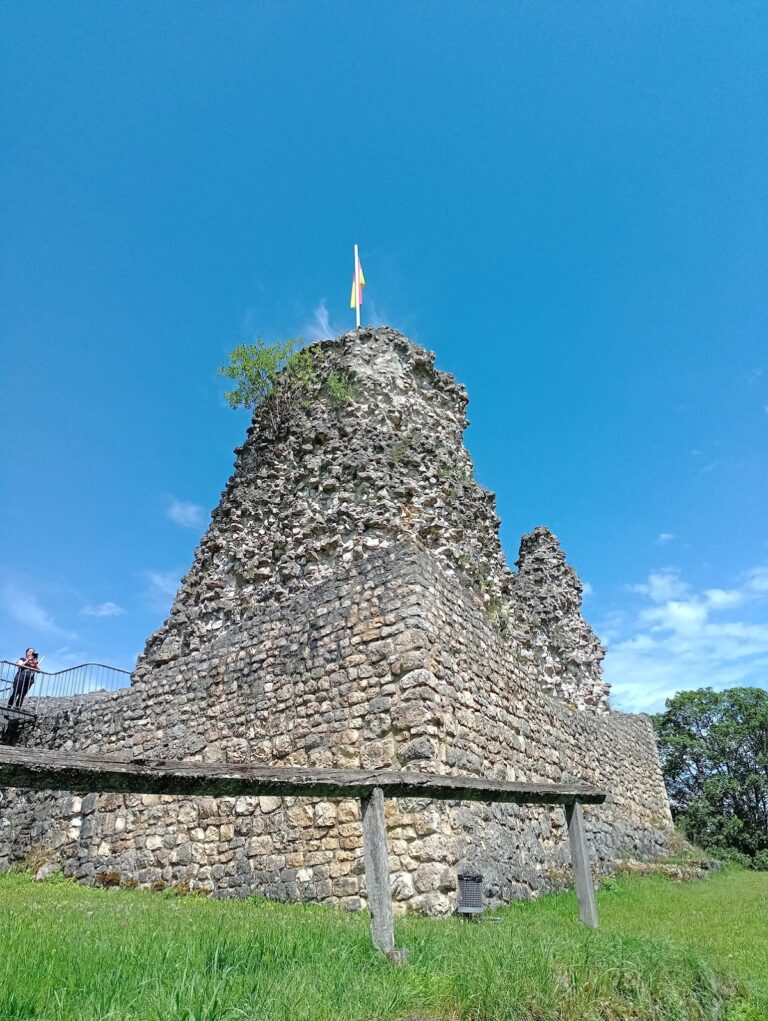
Investigations in October 2014 exposed two dry-stone walls within the principal rampart to a height of 4.2 meters. They apparently formed a corner. Further examination showed that the wall beneath the rampart was about 13 meters thick and had been built from limestone to at least 10 meters high. Outer and inner stone walls enclosed a filling of rubble, stone, and clay. This construction is regarded as the largest known example of its type from the period north of the Alps.
The principal wall joined another dry-stone wall extending northeast for about 40 meters. This second wall was approximately 5.8 meters thick. A gate probably stood at the junction and controlled access to the plateau, with the entrance likely positioned on the northeastern side.
Terraces and internal features
Two artificial terraces follow the long edges of the spur. One lies about 15 meters below the plateau on the northwest side, while the other is about 20 meters below it on the southeast. Each terrace is approximately 5 to 8 meters wide. They end shortly before the semicircular end of the spur and merge into the slope toward the northeast. Their purpose remains unknown, and they are separate from the defensive system.
Small stone walls once divided the plateau, including a line crossing the centre and separating the level area into two halves. The later boundary between Emerfeld and Langenenslingen followed this line. Trees now cover parts of the plateau and ramparts, while the surviving ditches, terraces, and dry-stone walls continue to define the archaeological landscape.
Central mound and shaft
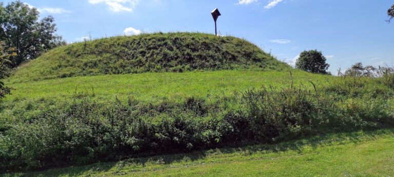
In the southwestern part of the spur, several meters north of the artificial step, a stone feature occupies the plateau. Traditionally called a burial mound, it was probably originally a platform-like limestone mound about 1 meter high and 8 by 8 meters across. The mound may have remained standing when the plateau was levelled.
A shaft was cut about 5 meters deep into the limestone plateau and surrounded by a stone ledge or bank. The 1894 excavation found six human skeletons, while later investigations recovered further human bones and remains from earlier excavations. Materials from the shaft and its surroundings consist mainly of late Hallstatt-period finds, with a smaller number from the early and middle La Tène period. They include early La Tène metal objects, later medieval pottery, and a single pin from the pre-Celtic Urnfield culture.