Hardknott Roman Fort & Thermae: A Roman Military Fort on Hardknott Pass

Site at a Glance
- Rating
- 4.7
- Popularity
- Low
- Country
- United Kingdom
- Primary era
- Classical
- External website
- Open
- Eras represented
- Classical
- Civilizations
- Roman
- Site type
- Military
- Remains
- Fort
On this page13 sections
History
Hardknott Roman Fort & Thermae is a Roman military fort in the United Kingdom, built on a rocky spur above Hardknott Pass early in the reign of Emperor Hadrian, probably between AD 120 and 138. Identified as Mediobogdum, it controlled the route through Eskdale and access between the Cumbrian coast and the interior of the Lake District.
Hadrianic foundation
Hadrian was Roman emperor from AD 117 to 138, and his reign brought a reorganization of the frontier in Britain, including the construction of Hadrian’s Wall from about AD 122 and the strengthening of forts and coastal installations. Hardknott formed part of a wider Roman network linking the forts at Galava near Ambleside and Glannoventa at Ravenglass. Together, these positions helped secure Roman control of the Lake District and the route to the coast.
The only garrison securely identified at Hardknott was the Fourth Cohort of Dalmatians. This auxiliary unit consisted of non-citizen troops recruited from the Dalmatian region of the Roman Empire, corresponding broadly to modern Croatia. The fort’s size suggests a force of about 500 soldiers, who monitored travel, enforced Roman law, and responded to local disturbances.
Reoccupation and later use
Hardknott was probably abandoned by the end of Hadrian’s reign, following military reorganization and the establishment of stronger positions at either end of the road. It was later reoccupied during the second century and remained in use into the later Roman period. A civilian settlement, known as a vicus, developed outside the fort during a later phase of occupation.
The fort may have become strategically redundant after the small fortlet at Ravenglass was replaced by a large permanent fort. Ambleside and Ravenglass continued as active communities until Roman rule in Britain ended at about AD 400. The seventh-century Ravenna Cosmography, a geographical compilation, preserves the name Mediobogdum for Hardknott.
Rediscovery and preservation
William Camden, a Tudor antiquarian, recorded the known location of the fort in 1607. Excavations in the late nineteenth century exposed parts of the walls and bath house, followed by further investigations in the 1950s and 1960s, including work directed by Dorothy Charlesworth. These investigations revealed evidence of barracks and leather objects preserved in peat near the granaries.
A building inscription found near the southern gate identified the garrison and established that the fort was constructed during Hadrian’s reign. Much archaeological material was removed by souvenir hunters before and during the early investigations. The remains are now preserved as an archaeological heritage site on land owned by the National Trust and maintained by English Heritage. William Wordsworth referred to Hardknott as the “lone Camp on Hardknott’s height” whose guardians “bent the knee to Jove and Mars.”
Remains
Fort enclosure
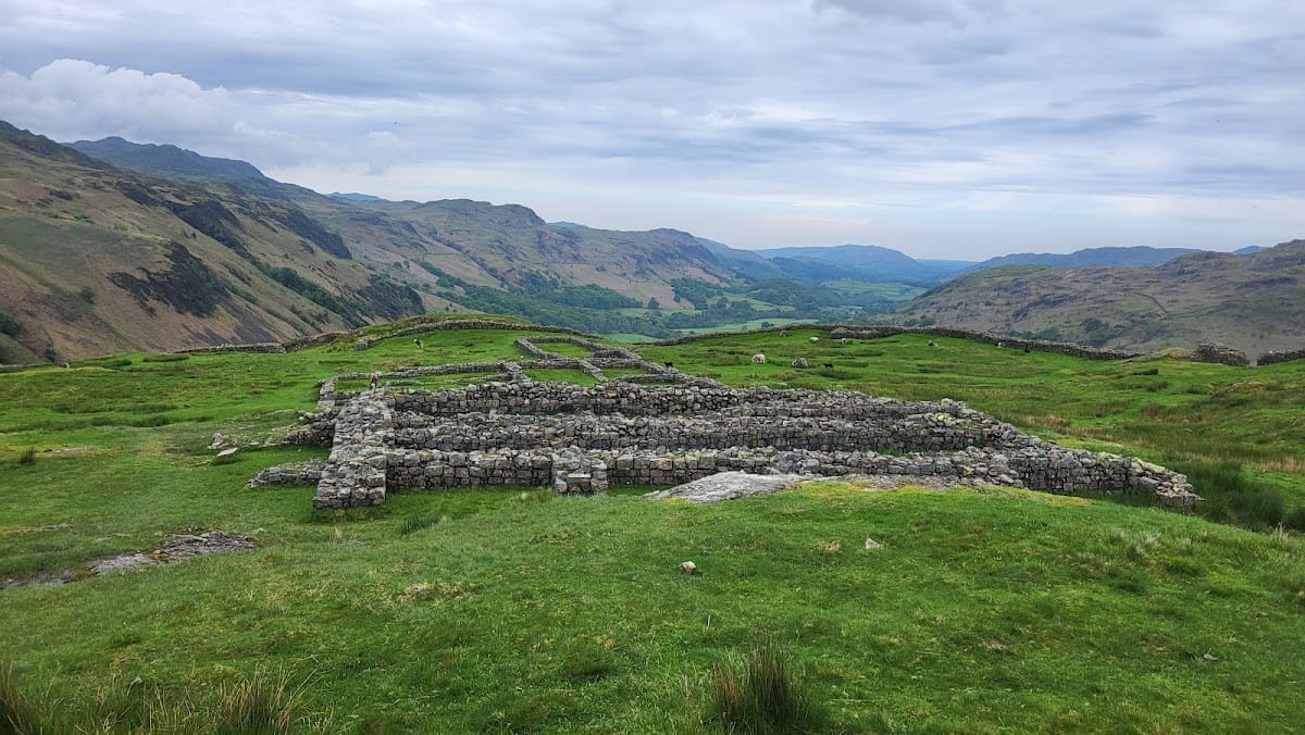
The fort occupies about 1.3 hectares on a rocky spur overlooking the River Esk and the upper and lower Eskdale valley. Its roughly square plan, with rounded corners, follows the difficult ground rather than the elongated shape more commonly used for Roman forts. The external walls measure approximately 114 metres on each side, while the internal dimensions are about 105 metres. A rampart wall around 1.7 metres thick formed the enclosure, with ditches adding to its defenses. The exterior walls survive to about 2 metres high.
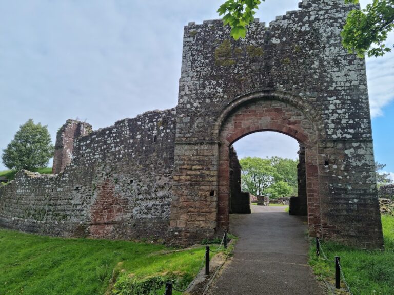
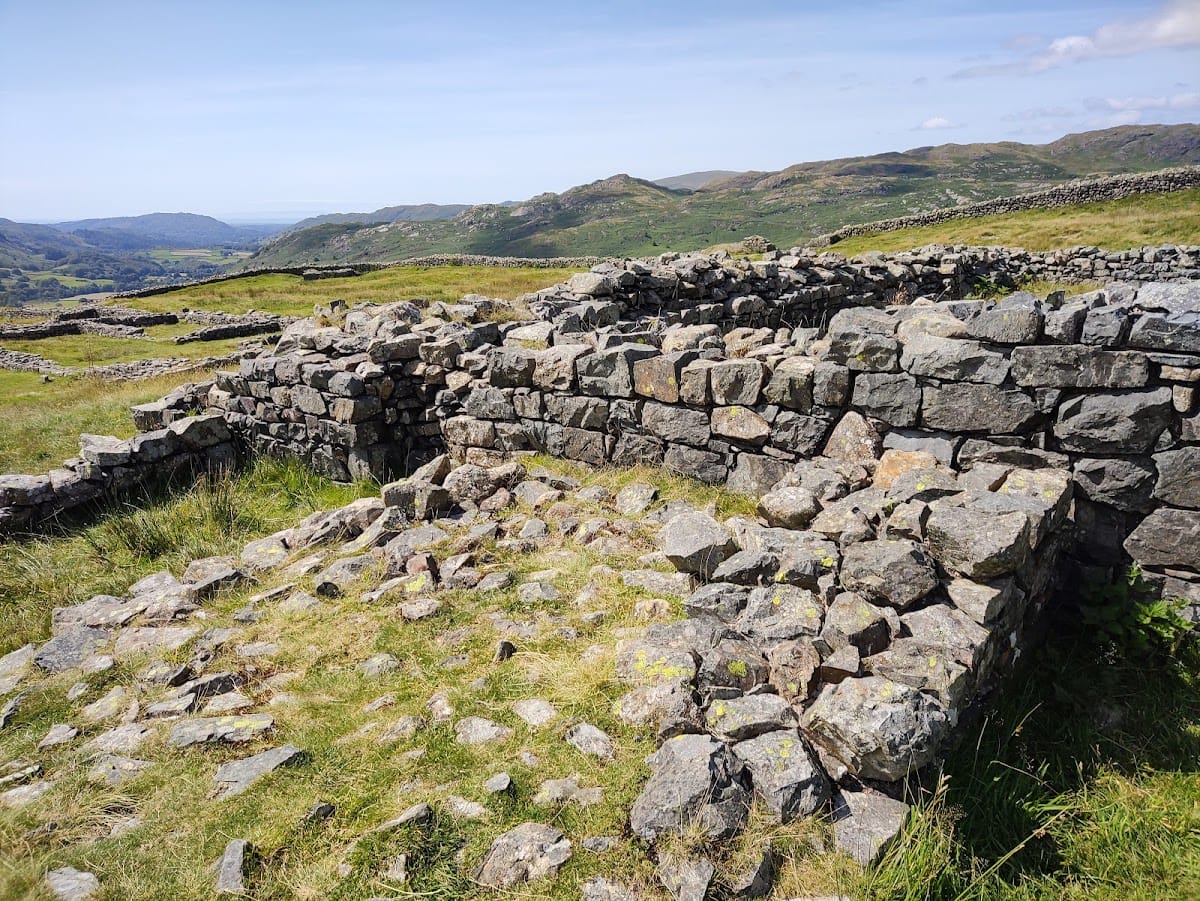
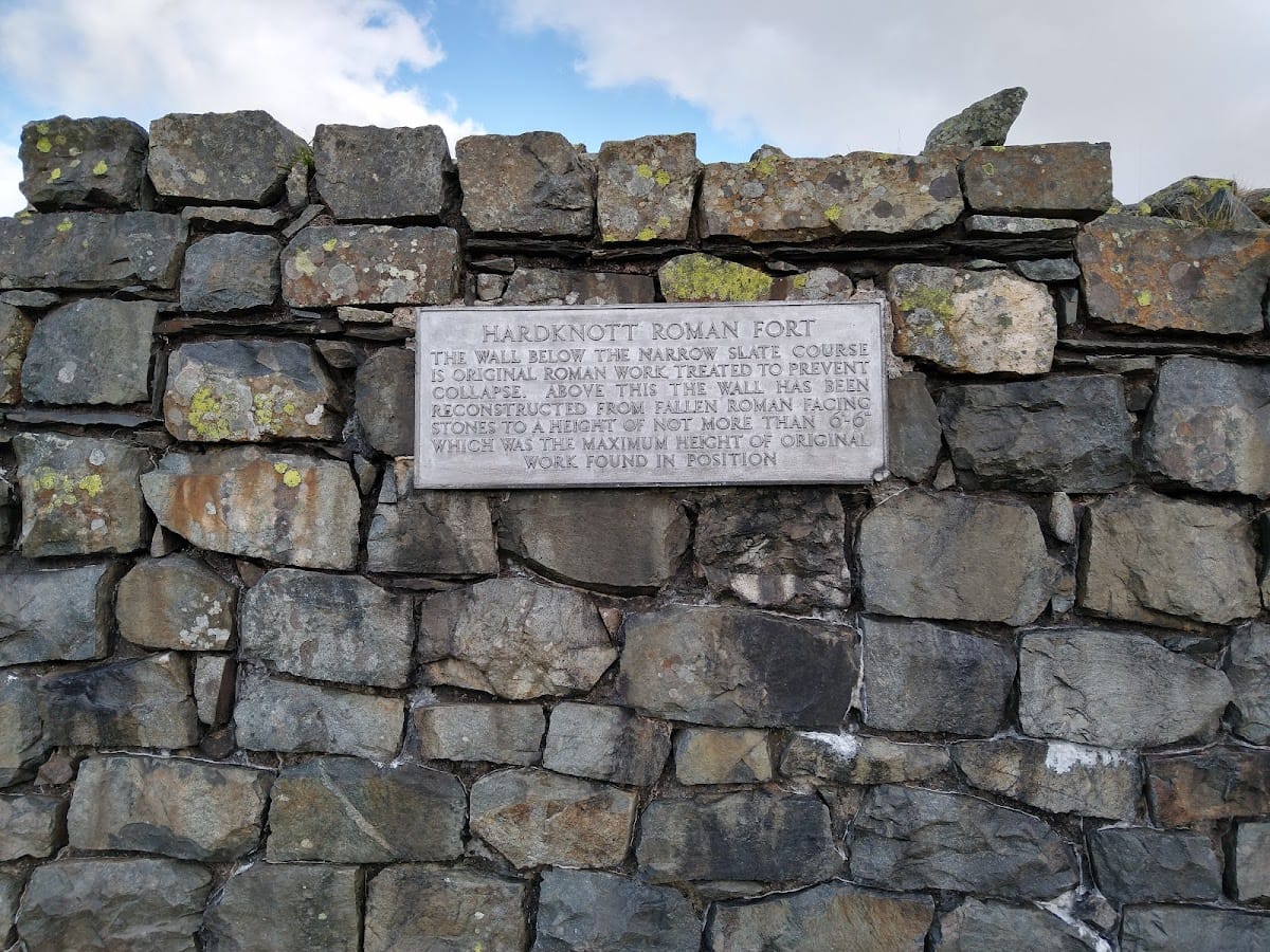
Local stone was used in rough masonry because the rock was difficult to shape. The walls follow the uneven contours of the spur, and some sections were partially rebuilt in the 1950s. A slate course marks the approximate original height beneath the reconstruction. Four gates stood at the centre of the four sides, with a tower at each corner. The southern, eastern, and western gates had two carriageways, while the northern gate had one, probably because it opened towards a steep drop.
Central buildings
Granaries
Three principal stone buildings survive in the central range, including two granaries east of the headquarters. Their thick walls and distinctive buttresses supported heavy roofs designed to help keep stored supplies cool. Peat near the granaries also preserved leather fragments, including several shoes and a piece interpreted as part of a soldier’s jerkin.
Headquarters
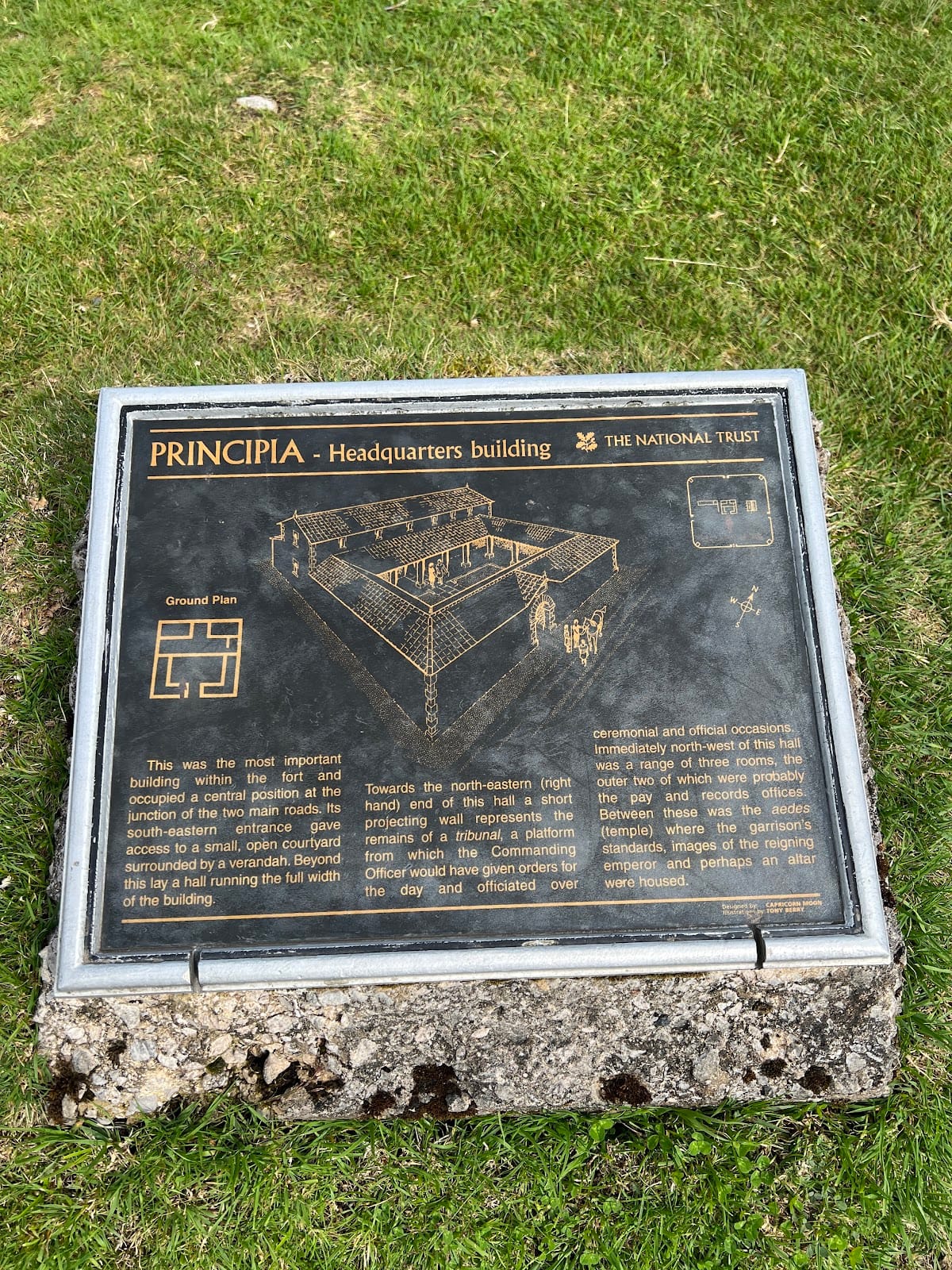
The headquarters, or principia, stood opposite the southern gate. Its offices and regimental records were arranged around the aedes, the shrine where the unit’s standards were kept. A sunken treasury would normally have been placed below the shrine, but the hard rock probably meant that the soldiers’ pay was kept in strongboxes instead.
Commandant’s house
The praetorium, the commanding officer’s residence, stood beside the headquarters. It was a large house appropriate to the commander’s elite status. Such residences normally had four ranges of rooms around a central courtyard, but only one range is visible at Hardknott. The other ranges may have been timber or may never have been completed.
Most of the enclosed area was probably occupied by barracks and other timber buildings. Little evidence of these structures survives, and interpretations of the soldiers’ accommodation include lost timber barracks and possible use of tents because of the difficult ground.
Parade ground
About 200 metres east of the fort, beside a track following the line of a small Roman road, is a levelled military parade ground measuring approximately 140 by 80 metres. Around 5,000 cubic metres of stone and earth were moved to create its level surface. Its size may have allowed both infantry and cavalry training, although the presence of cavalry at Hardknott remains uncertain.
A wedge-shaped artificial mound on the northern side has been interpreted as a tribunal, a raised platform from which the commander watched manoeuvres. Its size and shape have also prompted the alternative interpretation that it was the base of a shrine, perhaps dedicated to the Campestres, goddesses associated with parade grounds.
Bath house
The bath house stood outside the fort to the south. Its main bathing suite contained three rooms arranged in sequence: an unheated room, a warm room, and a hot room, followed by a return to the unheated room for a cold plunge. A separate circular dry-hot room, or laconicum, stood beside the rectangular suite. It may once have been linked to the main structure by a wooden changing room, which would explain its apparently isolated position.
Painted plaster recovered during eighteenth- and nineteenth-century excavations shows that the bath house was decorated as well as functional. Excavation removed some evidence of its heating system, including pilae, small stacks of stones or tiles that supported the floors and allowed hot air to circulate beneath the warm and hot rooms.
Archaeological evidence
The building inscription near the southern gate provides evidence for both the fort’s garrison and its Hadrianic construction. Leather objects recovered in peat near the granaries add evidence for the activities of the soldiers who occupied the enclosure. A nineteenth-century painting of Hardknott by William Gershom Collingwood, who excavated the fort in the 1890s, is displayed at Muncaster Castle.
Nearby sites