Richborough Roman Fort and Amphitheatre: Gateway and Military Base of Roman Britain
Site at a Glance
- Rating
- 4.5
- Popularity
- Low
- Country
- United Kingdom
- Primary era
- Classical
- External website
- Open
- Eras represented
- Classical, Medieval
- Civilizations
- Roman
- Site type
- Military
- Remains
- Fort
On this page18 sections
History
Richborough Roman Fort and Amphitheatre is an archaeological site in the United Kingdom, built and developed by the Romans from the invasion of AD 43 through the early fifth century. It formed part of Roman Britain, the province created after the conquest of Britain, and probably stood at the landing place of the Claudian invasion, although the exact location of that landing remains debated. For more than 360 years, Richborough served as a military base, port, commercial settlement, and later coastal fort.
Before and during the conquest
Human settlement at Richborough began before the Roman conquest. Communities occupied the banks of the Wantsum Channel from the late Bronze Age, and a substantial settlement existed at Richborough in the seventh or sixth century BC. Early Iron Age pottery and ditches show that occupation continued into the centuries before the Roman arrival.
In AD 43, the Roman army established a fortified bridgehead and supply base at Richborough. The position controlled the Wantsum Channel and offered a short sea crossing to the Gallic coast. Its sheltered waterway made it a major military port and naval and supply base for the conquest of Britain. The earliest settlement included long timber buildings used for military stores and equipment, together with defensive earthworks that protected about 700 metres of coastline.
Richborough soon developed into the civilian and commercial town known as Rutupiae or Portus Ritupis. It became a principal gateway into Roman Britain and the starting point of Watling Street, the major road leading towards London and the interior. Its population included people from across the Roman world. During the first and second centuries, the settlement expanded to an estimated 21 to 25 hectares and flourished especially in the second century. It was a trading port known throughout the Roman Empire for the quality of its oysters.
The town and the triumphal arch
Around AD 85, some of the early timber buildings were replaced by more substantial structures. The town included a posting station for officials and travellers, temples, workshops, houses, warehouses, roads, and an amphitheatre. At its centre stood a monumental four-way triumphal arch, a quadrifrons, with four passageways. It may have commemorated the conquest of Britain, the victory associated with Gnaeus Julius Agricola at Mons Graupius, or the completion of the conquest under the emperor Domitian. Its position also symbolically marked entry into the province.
Richborough’s military importance declined when Dover became the principal supply and naval base, but the town remained a prosperous coastal settlement for probably about two centuries. During the mid-third century, political and economic instability led to the site’s re-militarisation. A temporary earthwork fortification was built around the arch, much of the civilian town was levelled, and the monument was demolished so that its stone and marble could be reused.
The late Roman fort
Construction of the stone fort probably began around AD 277 and was completed around AD 285. It formed part of the Saxon Shore, a late Roman coastal defence system of forts and related installations along parts of the coasts of Britain and Gaul. The fort may have been commissioned by Carausius, a Roman naval commander who seized power in Britain and northern Gaul during the late third century.
Richborough remained a military and economic centre during the later fourth century. A detachment of Legio II Augusta, a Roman legion that served in Britain for much of the imperial period, was stationed there under a prefect. More than 20,000 coins dating from AD 395 to 402 were recovered from the fort area. Many were small denominations, indicating continuing regional commercial activity.
Richborough was probably among the last Roman military bases in Britain to be evacuated. Occupation continued into the early fifth century, when Roman administration and military authority in Britain collapsed. Activity at the former fort continued after the army’s departure. A small Christian chapel was built in the fifth century and probably remained in use for some time. Richborough may also have been the landing place of Augustine of Canterbury in 597, when the mission sent by Pope Gregory I re-established contact between Britain and Rome.
Later harbour use and archaeological investigation
The site and harbour continued to be used after the Roman period. A medieval dock discovered in 2008 shows that the area still functioned as a port. The Wantsum Channel gradually silted up from the twelfth century, and its last recorded ship passed through in 1672, after which the harbour was abandoned.
John Leland described the site in 1540, while William Boys recorded Roman remains and roads in 1799. William Stukeley identified the amphitheatre in 1776 and published its first illustration. William Henry Rolfe and Charles Roach Smith investigated it in 1849 after finding part of its arena wall. Rolfe continued the excavation, and the surveyor John Noakes Coleman made accurate measurements. The date 1849 was later found carved into one of the amphitheatre’s chalk blocks.
Major excavations directed by J. P. Bushe-Fox for the Society of Antiquaries of London took place during the 1920s and 1930s, establishing the principal phases of the site. Further excavations followed in 1959 to 1969. Barry Cunliffe’s 1968 synthesis identified the central remains as a four-way triumphal arch. Aerial photography in 2000 and geophysical investigation of 22 hectares in 2001 clarified the extent of the Roman town and the course of its roads. Work in 2001 and 2008 also showed that the ancient coastline closely followed the present course of the River Stour.
In 2008, excavation of a fallen section of the eastern fort wall exposed part of the Roman coastline and a medieval dock. It also demonstrated the scale of the early coastal earthworks and showed that the fort had a square rather than rectangular plan. A planned amphitheatre excavation was delayed by the Covid-19 pandemic and took place in September 2021 under Historic England’s Archaeological Excavation Team. The investigation confirmed the arena wall, examined a chamber and the arena floor, identified the turf outer wall, and revealed industrial and domestic activity outside the building.
The site is under the care of English Heritage and is a Grade I listed building. A replica timber Roman gateway was built in 2023 at the reported location of the Claudian gateway, and the on-site museum was refurbished to display finds from Richborough.
Remains
Richborough occupies a low, isolated hill that formed a peninsula in Roman times, bordered by the Wantsum Channel and the sea. The hill rises about 18 metres above sea level, while former watercourses around it are now marshland. The site lies about 3 kilometres inland from the modern coastline. The Roman harbour was east of the fort near the mouth of the Stour, probably sheltered by the natural breakwater of Stonar Beach. Railway construction destroyed much of the harbour, and later silting turned the area into marshland.
Bridgehead and civilian town
Early defensive earthworks
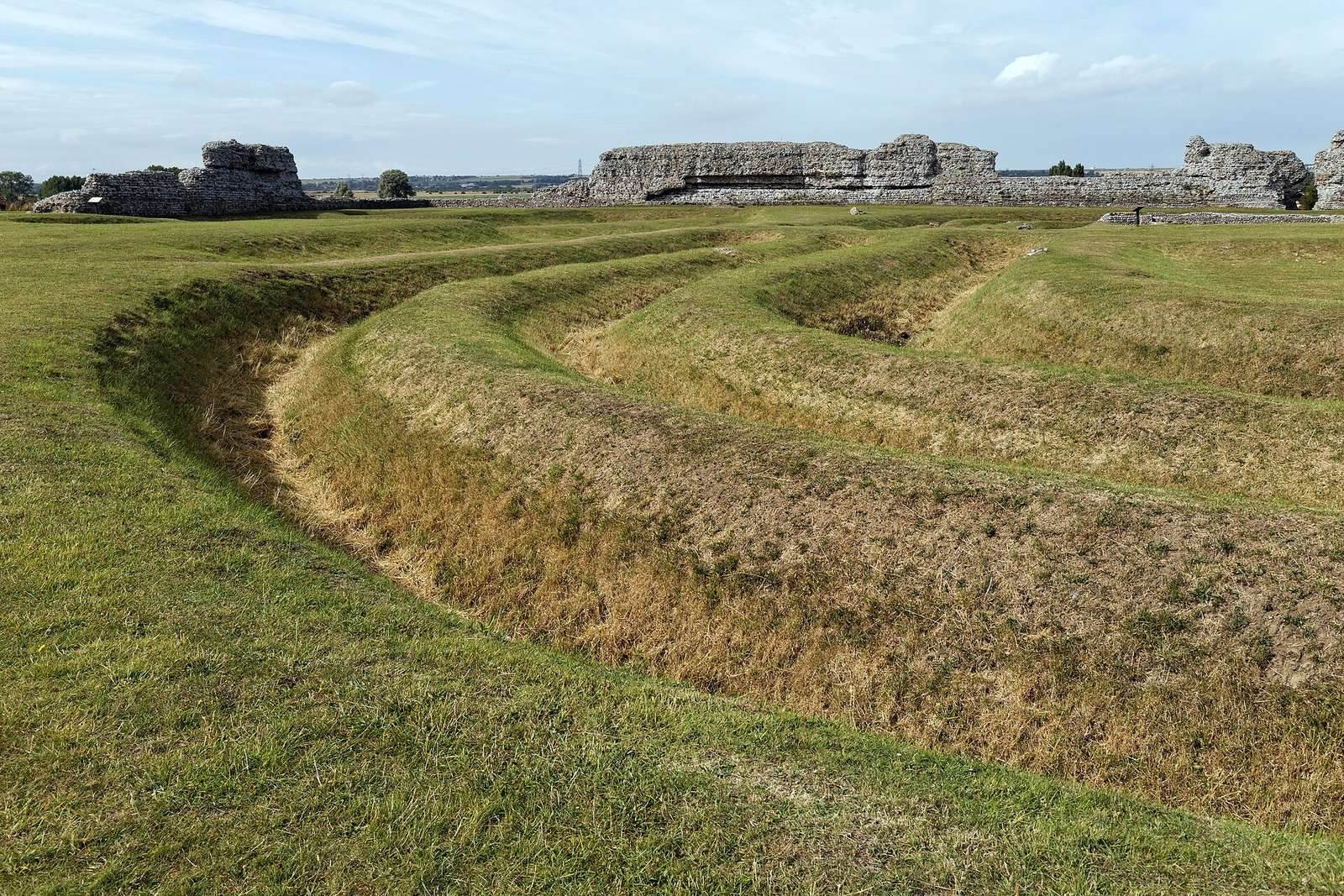
The first Roman bridgehead was a crescent-shaped earthwork running parallel to the ancient coast for probably about 2,700 metres. A turf-and-earth rampart with palisades stood between two V-shaped ditches. About 650 metres of the ditches remain visible. The inner ditch was approximately 3.5 metres wide and 2 metres deep, while the outer ditch was slightly narrower and lay about 2 metres farther out. Near the later fort’s west gate, a paved causeway 9 metres wide crossed the ditches. A gateway 3.25 metres wide was protected by a timber tower supported on four posts.
Rows of long timber buildings formed part of the bridgehead. Some measured about 35 metres in length and 8 metres in width and probably stored military supplies and equipment. A clay-lined well 6 metres east of the later fort was filled roughly ten years after the invasion. Late Celtic and Claudian pottery, together with coins of Agrippa, Tiberius, and Claudius, was found in association with it.
Town buildings and mansio
The civilian town covered about 21 to 25 hectares and followed a regular street grid, particularly along Watling Street and west of the later fort. Most buildings were timber, although some stone foundations survive. Oil-lamp production and metalworking took place among the town’s industrial activities. Two small temples, a cemetery, houses, and other Roman buildings have also been identified.
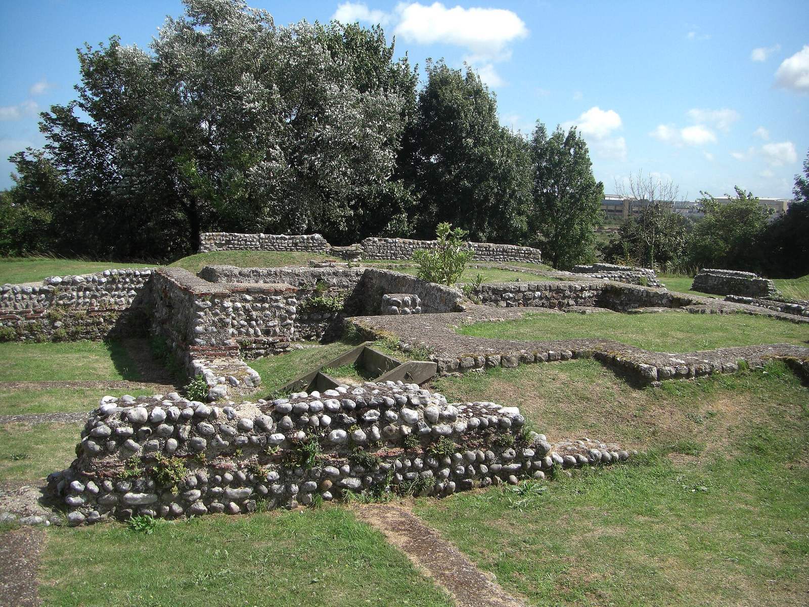
The mansio, an official posting station and lodging house for travellers connected with imperial administration, stood on the seaward side of the town. It began as a timber building arranged around a large courtyard. The structure was rebuilt in stone around AD 70, enlarged around AD 85, and reconstructed again during the second century with a bath suite heated by a hypocaust, a Roman underfloor heating system. The late third-century fortification around the arch spared the mansio, which may then have accommodated the fort commander. It was later destroyed during construction of the stone fort.
Triumphal arch and late Roman fort
Four-way triumphal arch
The triumphal arch occupied a central position in the town and crossed Watling Street. Its foundations measure approximately 45 by 32 metres and are about 10 metres deep, forming a cross-shaped plan that remains prominently visible. The completed monument may have stood about 25 metres high.
The arch was faced with Italian white Carrara marble and had four passages. The eastern and western openings were wider and higher than the others. A box-like upper storey with a flat roof may have supported an equestrian statue or a four-horse chariot group. Bronze fragments, worked marble, and slabs bearing small Roman numerals survive as evidence of its original appearance. The foundations were built from flint bonded with clay. The monument was incorporated into the temporary third-century fortification and was finally demolished between approximately AD 275 and 300. Its stone and marble were reused in the later fort.
Fortifications and gates
The late Roman fort covered about 2 to 2.5 hectares and had an almost square plan without rounded corners. Erosion, landslip, and later railway construction destroyed its eastern side. A landward west gate, two offset east gates facing the harbour, and small postern gates in the north and south walls controlled access through the enclosure.
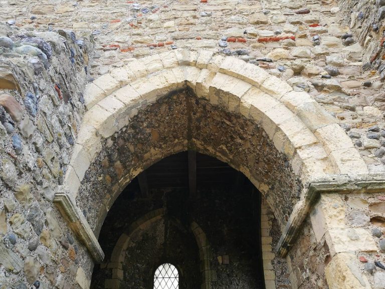
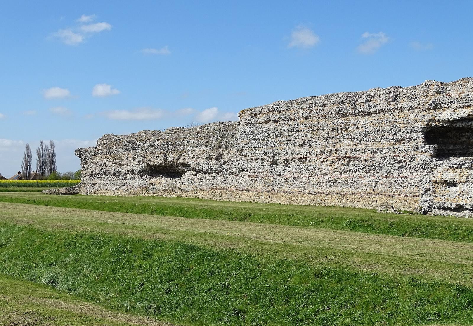
The walls were massive structures of flint, concrete, and other stone, including local limestone and reused material from the triumphal arch. Their foundations were about 3.3 metres thick, and surviving sections reach approximately 8 metres in height. A rubble core bound with cement was faced with roughly dressed blocks. Six double courses of tiles were inserted at intervals of about 1 metre. Putlog holes, which held scaffolding supports during construction, remain in the masonry. Much of the outer stone facing was later removed, probably for the walls of nearby Sandwich, leaving large holes caused by stone robbing.
Four projecting semicircular towers protected the corners. Twelve intermediate towers and four gate towers were rectangular and accessible from inside the fort. Their floors were mainly timber, and they probably contained guard rooms, accommodation, and storage spaces. The intermediate tower north of the west gate contained a latrine. The corner towers may have carried heavy ballista artillery.
Interior buildings and defences
Two V-shaped ditches surrounded the fort. The inner ditch was about 10 metres wide and 3 metres deep, while the outer ditch measured about 8 metres across and 2 metres deep. A third ditch near the west gate was probably the result of a surveying error and was filled soon after excavation.
Seventeen interior buildings have been identified. Most were simple rectangular timber-framed structures with timber partitions. Two large granaries occupied the south-eastern corner. A central stone building on the site of the former arch was probably the principia, the headquarters building of a Roman fort, containing administrative and ceremonial spaces.
Chapel and bathhouse
A small chapel was built against the north-west wall in the fifth century, above the remains of a first-century timber building. It probably had a timber structure and is now largely destroyed. Inside was a hexagonal tiled basin, probably used as a baptismal font.
A small bathhouse stood in the north-eastern part of the fort, aligned from east to west. It was probably constructed at the same time as the fort over the remains of the earlier mansio. The bathhouse appears to have been the only stone-built building within the late Roman fort and was probably abandoned in the fifth century.
At least three rooms have been examined. An unheated room measured 3.40 by 3.60 metres, while a rectangular niche measuring 2.40 by 1.65 metres contained a repeatedly altered piscina, or bathing basin. A tepidarium, a warm room, measured 2.70 by 3.60 metres. The tepidarium and caldarium, or hot room, had hypocaust heating, with a furnace room west of the caldarium. A water basin occupied an apse on the north side. A coin of the emperor Tetricus, dated AD 268 to 273, was found beneath the floor of the cold room.
Amphitheatre
Earthwork and arena
The amphitheatre lies at the western edge of the Roman town, about 300 to 400 metres south-west of the fort, on the highest part of the former peninsula. It survives mainly as a prominent oval earthwork. The outer mound represents the outer wall, while the hollow marks the arena. The arena measures approximately 62 by 50 metres and had entrances at the ends of its long axis. Geophysical survey identified additional features on the short axis, including possible structures or entrances.
The amphitheatre’s outer wall was built from turf rather than stone. This makes Richborough the only known British amphitheatre with this form of construction. The turf wall was about 6.5 metres wide at its base and may originally have been about 4 metres high. It now survives to approximately 1.80 metres. Turf blocks were cut to roughly uniform sizes and laid in overlapping courses, with the grass sides alternately facing upwards and downwards. Organic bands between the courses remain visible and helped preserve the earthwork.
Arena wall and chamber
The arena wall survived to a height of 1.32 metres and was 1.09 metres thick. It was built from local chalk blocks bonded with lime mortar. Its thick mortared face was covered with plaster and painted decoration. Panels were separated by vertical black or red stripes. The decoration may have imitated marble or included geometric or figural designs, but too little survives to establish the original pattern.
A chamber opening from the arena was fully excavated in 2021. It may have been a carcer, a chamber for holding animals, condemned people, or gladiators before they entered the arena. The absence of a rear wall makes that interpretation uncertain, and the chamber may instead have flanked a stair leading from the seating bank.
Later deposits and activity around the building
After the amphitheatre went out of use, the seating bank slumped and eroded into the arena, deeply burying the walls. This protected the arena wall and painted plaster while leaving little detail of the original seating. The 2021 excavation showed that a circular feature identified by geophysical survey was a bank of natural pebbles rather than a structure.
Intense burning affected the amphitheatre’s outer wall. The fire fired some turf blocks and scorched their organic material. A timber building above the wall may have burned, although the cause of the fire remains uncertain. Ditches, structures, and other remains outside the amphitheatre indicate industrial and domestic activity. Animal bones may reflect tanning or butchery, and a cat skeleton, possibly a buried pet, was recovered. Large numbers of late fourth-century coins demonstrate activity in this area towards the end of the Roman period.
A skeleton found during nineteenth-century work may indicate that the amphitheatre later became a cemetery. Other excavations around Richborough have identified two Romano-British temples, furnaces, roads, workshops, buildings, and a medieval dock. Finds from the site, including painted plaster, chalk building blocks, animal remains, and material connected with different parts of the Roman world, are held in the site museum.