Hampi: The Vijayanagara Imperial Capital in India
Site at a Glance
- Rating
- 4.7
- Popularity
- Medium
- Country
- India
- Primary era
- Medieval
- External website
- Open
- Eras represented
- Classical, Medieval, Early Modern
- Civilizations
- Chalukya, Hoysala, Mauryan
- Site type
- City
On this page34 sections
History
Hampi is the historic site of the Vijayanagara imperial capital in Karnataka, India, developed by the Vijayanagara Empire from 1336 in a Dravidian architectural tradition. The city, known as Vijayanagara, became a fortified political, religious, economic, and cultural centre beside the Tungabhadra River and remained the imperial capital until 1565.
Early religious and political history
Hampi was already a pilgrimage centre in the early medieval period, when it was known as Pampakshetra. The name derives from Pampa, an old name for the Tungabhadra River and also a name of Parvati. Local religious tradition holds that Parvati practised asceticism on Hemakuta Hill while seeking Shiva. The region was also associated with Kishkindha in the Ramayana, where Rama and Lakshmana meet Hanuman, Sugriva, and the vanara army while searching for Sita. These traditions helped establish the area as a destination for pilgrims.
Ashoka’s rock edicts at Nittur and Udegolan indicate that the region formed part of the Maurya Empire during the third century BCE. Excavations have produced a Brahmi inscription and a terracotta seal dating approximately to the second century CE. Inscriptions from the Badami Chalukya period, between the sixth and eighth centuries, call the settlement Pampapura.
By the tenth century, Hampi had become a centre of religious and educational activity under the Kalyana Chalukyas. Inscriptions from this period record land grants to the Virupaksha temple. Further inscriptions, dating from the eleventh to thirteenth centuries, record gifts to Hampa-devi and other deities. Hoysala rulers built or supported temples dedicated to Durga, Hampa-devi, and Shiva between the twelfth and fourteenth centuries. An inscription from around 1199 records this activity, while Hoysala-period inscriptions also describe Hampi as a secondary royal residence under names including Virupakshapattana and Vijaya Virupakshapura.
Foundation of Vijayanagara
After the decline of the Hoysalas, the short-lived Kampili kingdom arose in north-central Karnataka. Its capital stood approximately 33 kilometres from Hampi, but the kingdom ended after an invasion by the forces of Muhammad bin Tughlaq. In 1336, the Vijayanagara Empire emerged from the remains of Kampili.
Harihara I and Bukka I are identified as the founders of the new empire. Traditions preserved in several texts connect them with the Hoysala and Kakatiya political worlds and with Vidyaranya, a major Advaita Vedanta religious authority who protected them and established them as rulers. The city was called Vidyanagara in 1336, and its temples and infrastructure expanded as the settlement became the imperial capital.
From 1336 to 1565, Hampi served as the capital of the Vijayanagara Empire. Its fortified urban area contained temples, farms, markets, roads, aqueducts, tanks, public buildings, royal compounds, and sacred complexes. Persian and European travellers, especially Portuguese visitors, described a wealthy and extensive city near the Tungabhadra River. Around 1500, Hampi-Vijayanagara was regarded as the second-largest city in the medieval world after Beijing and probably the richest city in India. Merchants came from the Deccan, Persia, and Portuguese Goa, while Vijayanagara rulers supported intellectual and artistic activity, maintained a strong army, and invested in agriculture, water management, religious buildings, and public works.
The capital was a multi-religious and multi-ethnic urban centre. Hindu and Jain monuments stood near one another, and Muslim buildings formed part of the wider city. The rulers’ conflicts with northern and eastern sultanates continued throughout the period of Vijayanagara prosperity.
Destruction and abandonment
In 1565, a coalition of Deccan sultanates defeated Vijayanagara at the Battle of Talikota. Aliya Rama Raya was captured and beheaded, after which the capital was conquered, pillaged, and burned for approximately six months. Hampi ceased to function as an urban capital and remained largely in ruins.
From the later sixteenth through the eighteenth century, Hampi and the surrounding region were contested by local chiefs, the Hyderabad nizams, Maratha rulers, and Hyder Ali and Tipu Sultan of Mysore. In 1799, Tipu Sultan was defeated and killed after British forces allied with the Wadiyar dynasty, bringing the region under British influence.
Rediscovery and preservation
Colonel Colin Mackenzie surveyed the ruins in 1800 and described an abandoned landscape inhabited mainly by wildlife. Later nineteenth-century writers attributed damage to the armies of Hyder Ali and the Marathas, although that attribution was speculative. Alexander Greenlaw photographed Hampi in 1856, creating an archive of sixty calotype photographs that showed temples and royal structures still standing at the time. The photographs remained in a private British collection until their publication in 1980 and now provide an important record of the monuments’ mid-nineteenth-century condition.
A translation published in the early 1880s of the memoirs of Abd al-Razzaq Samarqandi, a Persian envoy at the court of Devaraya II, described monuments at the abandoned site and helped establish later names such as Zenana. Alexander Rea published a survey in 1885, and Robert Sewell’s study of 1900 brought Hampi to wider scholarly attention. Rea and his successor Longhurst began clearing and repairing the monument group. The Archaeological Survey of India continues archaeological excavations at Hampi, whose remains illuminate both the Vijayanagara period and earlier phases of occupation.
The Group of Monuments at Hampi was inscribed as a UNESCO World Heritage Site in 1986 under cultural criteria (i), (iii), and (iv). The protected area covers 4,187.24 hectares and has a 19,453.62-hectare buffer zone. It was listed as endangered from 1999 to 2006. Hampi also remains an active religious centre. The Virupaksha Temple continues as a Hindu place of worship, and a monastery associated with the Advaita tradition of Adi Shankara remains active. A spring festival and chariot procession commemorate the marriage of Virupaksha and Pampa, while Maha Shivaratri is also observed.
Remains
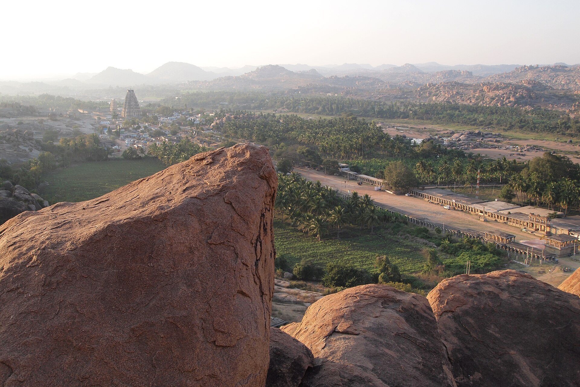
Hampi lies beside the Tungabhadra River in hilly terrain formed by granite boulders. The wider ruins cover approximately 4,100 hectares, or 41.5 square kilometres, and contain about 1,600 identified monuments, structures, and other remains. Most surviving monuments were built between 1336 and 1570. The site is conventionally divided into the sacred centre along the river, the urban or royal core, and the remainder of metropolitan Vijayanagara. Granite is the principal building material. The dominant architectural language is Dravidian, a South Indian temple tradition with sanctums, pillared halls, pyramidal superstructures, and monumental entrance towers, although selected buildings combine local forms with Indo-Islamic arches, vaults, and domes.
Approximately seventy-seven stone inscriptions have helped identify monuments and reconstruct the organisation of the city. The remains include Hindu temples and sacred complexes, six Jain temples or temple groups, Muslim mosques and tombs, forts, gateways, watchtowers, royal buildings, markets, pillared halls, kitchens, feeding halls, tanks, aqueducts, drains, roads, and agricultural infrastructure.
The sacred centre and river temples
Virupaksha Temple
The Virupaksha Temple is Hampi’s oldest surviving shrine and remains an active Hindu worship site. Virupaksha is a form of Shiva, while Pampa is a name of Parvati. The complex contains earlier parts of the Shiva, Pampa, and Durga temples dating from the eleventh century, later Vijayanagara additions, a 50-metre-high eastern gateway tower, smaller shrines, a monastery associated with Vidyaranya, the Manmatha water tank, a community kitchen, and a ruined stone market approximately 750 metres long that ends at a monolithic Nandi shrine.
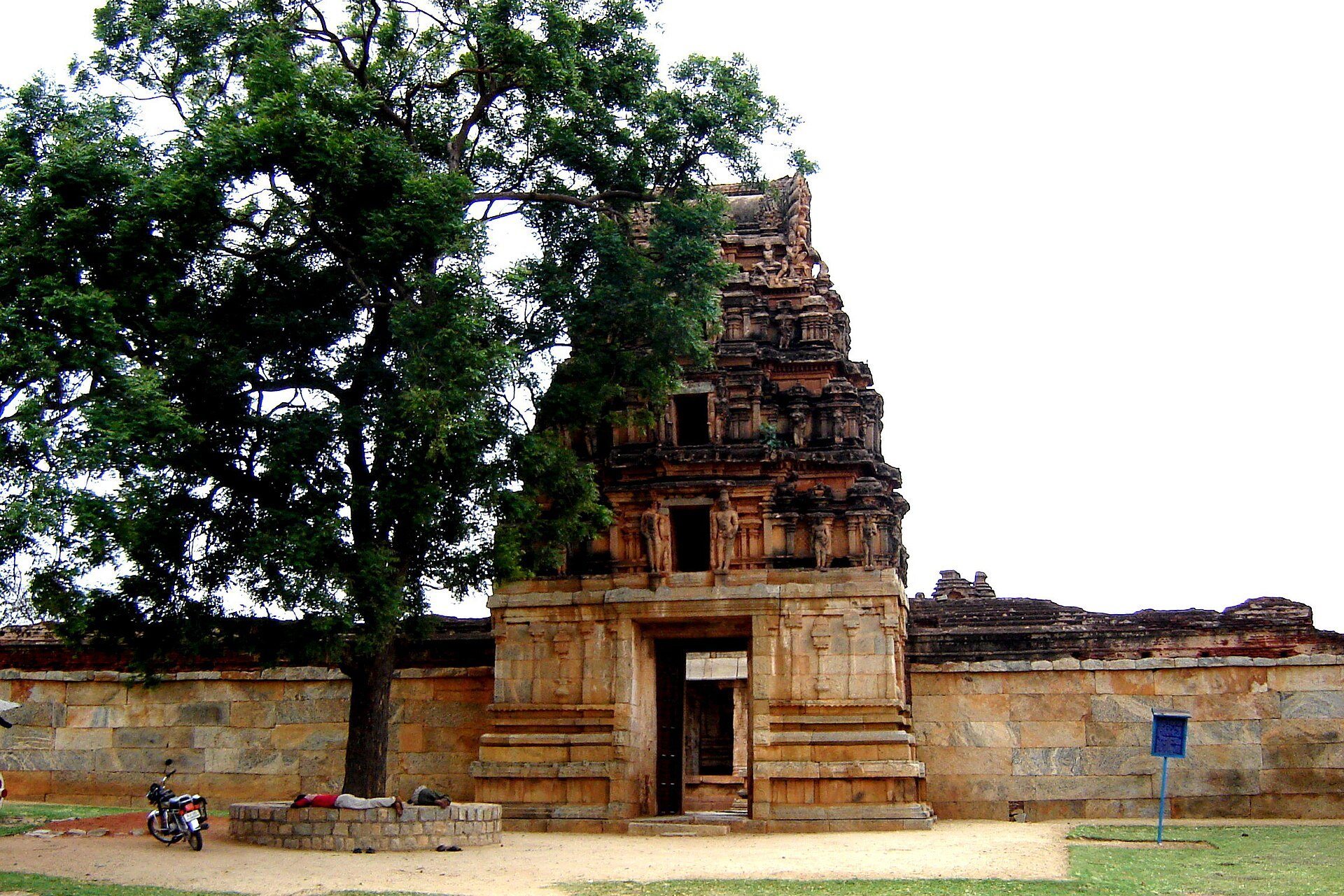
The complex faces east, with the Shiva and Pampa sanctums aligned toward sunrise. Its principal gateway is a pyramidal, storeyed tower decorated with sculpture, including erotic imagery. Beyond it is a rectangular court containing a lamp pillar and Nandi, followed by a smaller gateway dated to 1510. South of this gateway stands a 100-column hall with pillars carved on all four sides. A community kitchen is attached to it, and a rock-cut channel supplied water to the kitchen and feeding hall.
The main Shiva shrine
The main Shiva hall consists of an original square space and a rectangular extension made from two joined squares and sixteen piers. Krishnadevaraya built the extension. Its surviving ceiling paintings show the marriage of Shiva and Parvati, the story of Rama and Sita, Kama shooting an arrow at Shiva, and Vidyaranya being carried in procession. Their details and colour tones indicate a nineteenth-century renovation, while the subjects of the earlier paintings are unknown.
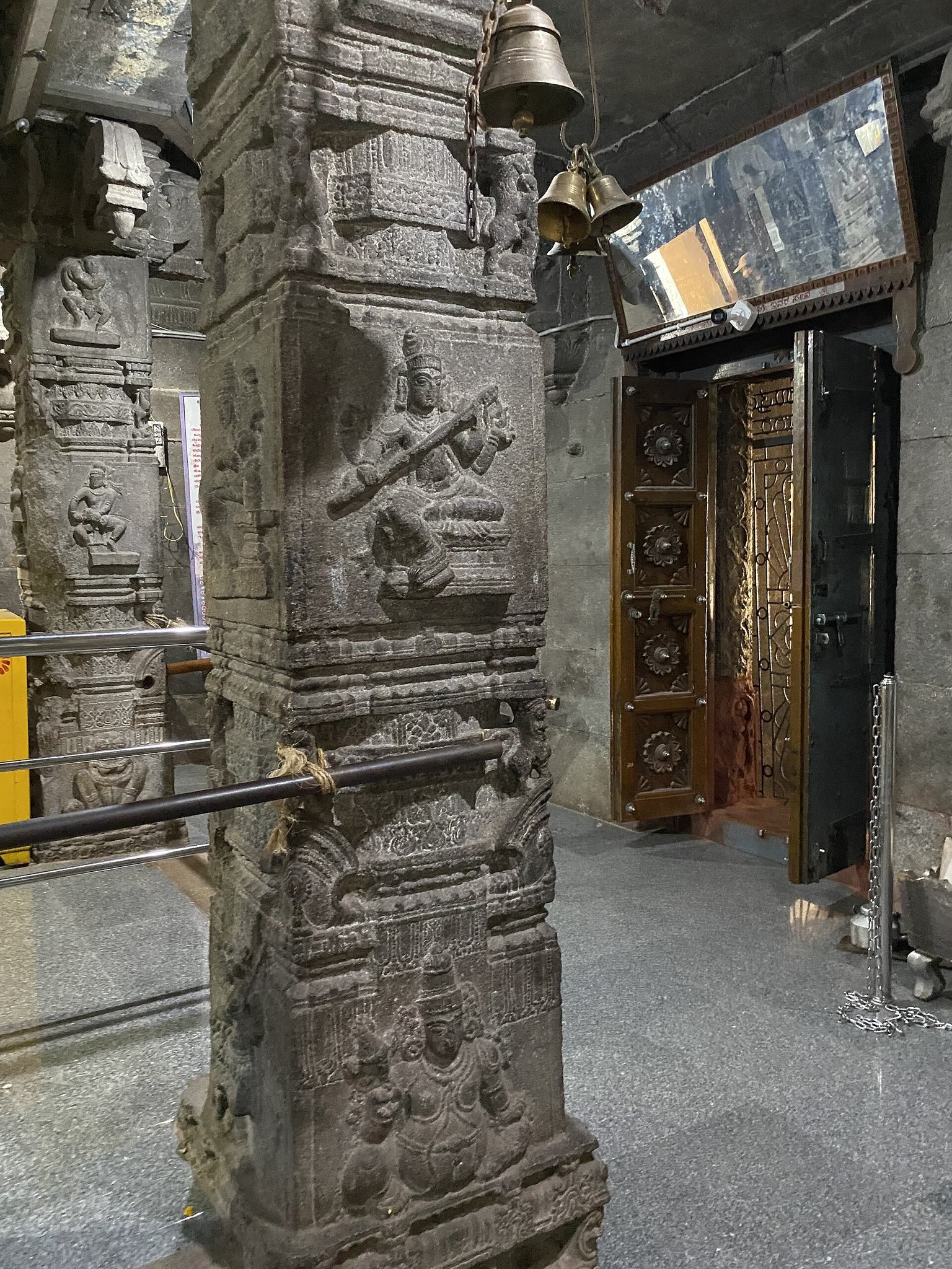
The hall’s pillars carry large yali sculptures, composite mythical animals with features of horses, lions, and other creatures, often ridden by armed warriors. The main sanctum contains a mukha-linga, a Shiva linga with a face embossed in brass. Smaller shrines to Pampa and Bhuvaneshwari stand north of the sanctum. The Bhuvaneshwari shrine is built of granite and displays Chalukyan architectural characteristics.
The Manmatha tank and pilgrimage path
A northern gateway opens toward the Manmatha tank and a stone path leading to the river. West of the tank are shrines associated with Shaktism and Vaishnavism, Hindu traditions centred respectively on the Goddess and Vishnu. The shrines include those dedicated to Durga and Vishnu. Some shrines along the pilgrimage path were whitewashed in the nineteenth century under F. W. Robinson, and the practice continued.
The Manmatha tank predates Vijayanagara and is generally dated approximately to the ninth century. An inscription records its upgrading and the addition of a Durga shrine in 1199, while some associated artwork dates to the thirteenth century.
Krishna Temple
The Krishna, or Balakrishna, Temple stands about one kilometre south of Virupaksha Temple, on the opposite side of Hemakuta Hill. Built in 1515, it occupies an area called Krishnapura in inscriptions. Its ruined market street had colonnaded stone shops, a broad road for moving goods by chariot, and ceremonial and festival functions. North of the road stood a large stepped ritual tank with a decorated central pavilion and a public pillared hall.
The east-facing temple has two gateway towers, outer and inner enclosures, and pillared halls arranged as 25-bay open and 9-bay enclosed spaces. Reliefs of Vishnu’s ten avatars, beginning with Matsya, decorate the gateway. The original Balakrishna image is now in a museum in Chennai. The western gateway has friezes of soldiers and battle formations.
Monolithic images near the Krishna Temple
South of the Krishna Temple is a 3-metre-high monolithic Shiva linga standing in water inside a cubic chamber. Nearby is a 6.7-metre-high seated Yoga-Narasimha, carved from a single block of stone. The image originally included Lakshmi. Extensive damage and carbon staining on the shrine have been interpreted as evidence of an attempted burning. The statue has been cleaned and parts of the shrine restored.
Achyutaraya Temple
The Achyutaraya, or Tiruvengalanatha, Temple stands about one kilometre east of Virupaksha Temple near the Tungabhadra. Inscriptions call the surrounding area Achyutapura and date the temple to 1534. This north-facing Vishnu complex is one of Hampi’s largest. A ceremonial tank and a market street formed its approach.
The complex had an outer gateway, a courtyard with a 100-column hall, and an inner gateway leading to the Vishnu shrine. Pillar reliefs show Vishnu’s avatars, Shiva, Surya, Durga, rishis, amorous couples, jesters, people performing yoga and namaste gestures, and Vijayanagara emblems. The gateway bears the boar of Varaha, a sword, the sun, and the moon. The ruined market layout indicates a major route for chariot traffic.
Kodandarama Temple
The Kodandarama Temple complex lies beside the Tungabhadra, north of Achyutaraya Temple, overlooking Chakratirtha, where the river turns north. The riverbank contains a Vijayanagara-period ghat, a stepped landing, and bathing halls. The complex includes a lamp pillar beneath a pipal tree, a shrine to Rama, Sita, Lakshmana, and Hanuman, and smaller shrines to Vitthala, Anjaneya, Shiva, and other deities extending toward Kotitirtha.
Rock reliefs near the complex depict Anantashayana Vishnu, stories of Narasimha and Prahlada, and the twenty-four avatars of Vishnu. A nearby rock bears 1,008 lingas associated with Shaivism, the Hindu tradition centred on Shiva.
Vitthala complex and northern sacred areas
Vitthala Temple
The Vitthala Temple and market complex lies more than three kilometres northeast of Virupaksha Temple beside the Tungabhadra. Its exact builder and construction date are uncertain, although its main construction is generally placed in the early to mid-sixteenth century. Inscriptions indicate several male and female sponsors and suggest that work continued under more than one Vijayanagara ruler before the destruction of 1565.
Dedicated to Vitthala, a form of Krishna also known as Vithoba, the temple faces east. It has an entrance gateway with two side gateways, subsidiary shrines, and a paved courtyard. The main temple is approximately 25 feet high and has one storey, divided into a sanctum, an entrance hall, and a large public hall. The courtyard measures about 500 by 300 feet and is enclosed by three rows of pillars.
Stone chariot and musical hall
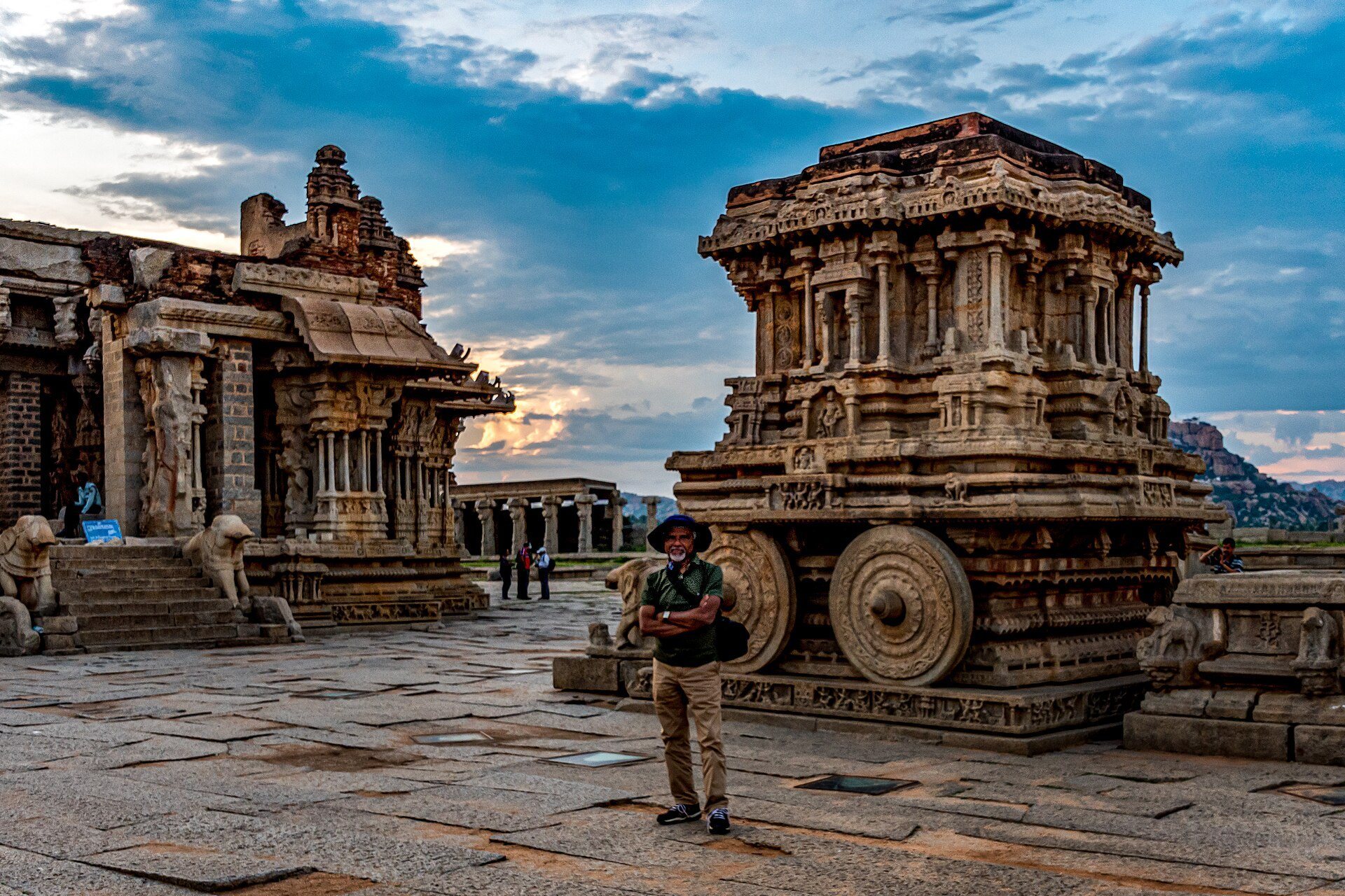
The courtyard contains a Garuda shrine shaped as a stone chariot. Its upper tower was removed during a later restoration. In front of it is a large four-part open-pillared hall, two sections of which align with the main sanctum. Fifty-six carved stone elements of different sizes, forms, lengths, and surface finishes produce different tones when struck. Local tradition associates the hall with public music and dance celebrations.
A closed circumambulatory passage links the hall to a circuit around the sanctum. The circuit includes the Garuda shrine, a marriage hall, a 100-column hall, an Amman shrine, and a festival hall. The walled compound covers approximately 1.3 hectares and has colonnaded verandas. A kitchen with a roof window occupies the southeast corner.
Vitthalapura markets and monastery
East and southeast of the temple compound is a ruined colonnaded market street nearly one kilometre long. Another market lies to the north, together with a south-facing shrine bearing imagery from the Ramayana, the Mahabharata, and Vaishnava traditions. The northern street ended at a temple dedicated to Ramanuja. The surrounding area, called Vitthalapura, contained a Vaishnava monastery associated with the Alvar tradition and was also a centre of craft production.
Hemakuta Hill and sacred images
Hemakuta Hill lies between the Virupaksha complex to the north and the Krishna Temple to the south. It preserves more than thirty small and medium-sized temples, water cisterns, gateways, and secular pavilions dating from before and the early period of Vijayanagara. The latest examples date to the early fourteenth century.
The hill contains stone-built temple prototypes and completed monuments in several styles, including Phamsana forms. Two temple groups have triple towers above the sanctums, shared square halls, and pyramidal granite superstructures formed from eleven diminishing square tiers topped by Deccan-style square finials. Both groups are Shiva temples with triple lingas. An inscription records that Kampila built one monument in the early fourteenth century. The hill’s Chalukya, Rashtrakuta, Kampili, and Vijayanagara forms suggest that it served as a setting for experimenting with temple designs. A similar Narasimha monument east of Hampi has an inscription indicating activity in 1379.
Kadalekalu Ganesha
The Kadalekalu Ganesha is a monolithic image more than 4.5 metres high, carved in place from the granite on the east side of Hemakuta Hill near Matanga. It stands in an open-pillared hall. The tusk and other parts are damaged, while the left hand holding a rice-cake sweet survives.
Sasivekalu Ganesha
The Sasivekalu Ganesha is a 2.4-metre-high monolith near the Krishna Temple, southwest of the Kadalekalu Ganesha. It was carved in place with Ganesha seated on Parvati’s lap, although Parvati is visible only from the rear. The image stands in an open-pillared hall, and its left hand and tusk are damaged.
Royal centre and ceremonial architecture
Hazara Rama Temple
The Hazara Rama Temple, called the Ramachandra Temple in inscriptions, occupied the western part of the urban core within the royal centre. It was the ceremonial temple of the royal family and was dedicated to Rama, an avatar of Vishnu. The temple is attributed to Devaraya I in the early fifteenth century.
Bands on the outer walls depict elephants, horsemen, soldiers, dancers, musicians, and public processions associated with Dasara and Holi. The inner walls carry extensive friezes from the Ramayana. An entrance hall and a ritual hall were designed so that smoke and fumes could escape through the roof.
Four finely carved Hoysala-style pillars show Rama, Lakshmana, and Sita, Durga as Mahishasuramardini, and Shiva with Parvati. The square sanctum has lost its images, while a smaller shrine contains friezes of Vishnu’s avatar legends. The ruined complex retains thousands of carvings and inscriptions, elaborate frescoes, and a large courtyard with gardens.
Pattabhirama Temple
The Pattabhirama Temple complex, also called Varadevi Ammana Pattana, lies about 500 metres south of the main city area. Probably built in the early sixteenth century, it was associated with economic and cultural activity in the suburb. The east-facing complex has an enclosed pillared courtyard, an 8-by-8-pillared roofed hall before the sanctum, and a probable six-tier eastern gateway. A 100-column hall, probably a feeding hall, was attached to the southern enclosure wall.
Mahanavami Platform
The Mahanavami Platform, also called the Great Platform, Audience Hall, Dasara, or Mahanavami Dibba, occupies a 7.5-hectare enclosure at a high point in the royal centre. Its largest monument has three ascending square granite stages supporting a large square platform. A wooden hall probably stood above it and was burned during the destruction of Hampi.
The lower levels carry reliefs of elephants, horses, camels, musicians, dancers, battle processions, couples, and people celebrating Holi. The adjacent audience hall probably also had a wooden pavilion, represented by one hundred stone supports, and was likewise burned. South of the platform is an aqueduct leading to a large symmetrical stepped granite tank excavated in the 1980s. The complex also contains another large pool, possibly used for water sports, a garden, several halls, and a ruined temple-like monument.
Square Water Pavilion
The Square Water Pavilion, commonly called the Queen’s Bath, lies southeast of the royal centre. It contains a pavilion, a water basin, channels for supplying fresh water and removing used water and overflow, and an ornate pillared and vaulted enclosure. Its interior arches show Indo-Islamic influence. The name Queen’s Bath may be inaccurate, since the building may instead have been a public bath for men and travellers.
Lotus Mahal and elephant stables
The Gajashala, or elephant stables, lies east of the royal centre. It contains eleven square chambers arranged from north to south. The openings are arched, ten chambers have alternating fluted and plain domes, and stairs in the centre lead to the roof.
The Lotus Mahal is a two-storeyed pavilion within the royal-centre enclosure near the elephant stables. Its symmetrical square plan follows a Hindu mandala arrangement, while lobed arches, vaults, and domes give it an Indo-Islamic character. Its basement and pyramidal towers follow Hindu temple forms. No inscription establishes its date or function, and its purpose remains uncertain, although a council hall has been proposed.
King’s Balance
Near the southern bank of the Tungabhadra and close to the Vitthala complex is a monument now called the King’s Balance. Its form resembles structures used at South Indian temples for weighing-gift ceremonies, in which a donor gives an offering equal to or greater than the donor’s body weight.
Water management and public infrastructure
Hampi’s water system included tanks, stepped reservoirs, aqueducts, channels, and drains. Excavations in 1990 identified twenty-three wells and cisterns in the Hampi-Vijayanagara metropolis. Thirteen stood outside the city walls and ten inside. Twelve were beside roads, eight near temples, ten in residential areas, and two were used for irrigation in the urban core. Further agricultural water infrastructure was found in Daroji Valley.
Major temples contain integrated kitchens and feeding halls with one hundred or more pillars. A public food hall, or Bhojana shala, included numerous dish-shaped depressions carved into rock on both sides of a water channel near an octagonal fountain south of the royal centre. Inscriptions associate it with an eating-connected canal.
Fortifications and Jain monuments
Fortified gateways
Vijayanagara rulers constructed forts, fortified gateways, and watchtowers to guard against raids and invasions. Many gateways use Hindu-style corbelled arches. A gateway southeast of the Ganagitti Jain Temple has a barbican designed to confuse an attacker through three changes of direction. Another stands on the northeastern road toward the Talarighat monument and Vitthala Temple.
Ganagitti Jain Temple
The Ganagitti Jain Temple stands near Bhima’s Gate in the southeast of the urban core, with a monolithic lamp pillar before it. Facing north, it was built in 1385 during the reign of Harihara II, according to its inscription, and was dedicated to the Jain Tirthankara Kunthunatha. Its plain walls, pillared hall, decorated doorways, square sanctum, and Dravidian pyramidal tower survive, while the principal image is missing.
Jain temple group
A Jain temple group lies approximately 150 metres east of the elephant stables. The north-facing Parshvanatha Temple was built by Devaraya II and dated by inscription to 1426. Two ruined temples stand before it, one dedicated to Shiva and one to Mahavira. Images of Jain Tirthankaras also occur in reliefs inside Hindu temples.
Muslim quarter and associated buildings
Hampi’s Muslim quarter includes Islamic tombs, two mosques, and a cemetery. Some Muslim monuments lie within the urban core, while others stand in the suburbs. Parts of the northeastern valley are deeply silted, concealing abandoned temples, roads, water tanks, gateways, and residential areas.
A Muslim complex southeast of the urban core, on the road from Kamalapura to Anegondi, was first built in 1439 by Ahmad Khan, a Muslim officer in Devaraya II’s army. It includes a mosque, an octagonal well, and a tomb. The mosque is a pillared pavilion without a dome, while the tomb has a dome and arches. Additional Muslim buildings and a cemetery were added later.