Bellary Fort: A Hilltop Fortification in Karnataka
Site at a Glance
- Country
- India
- Primary era
- Early Modern
- Eras represented
- Early Modern, Modern
- Civilizations
- British
- Site type
- Military
- Remains
- Fort
On this page13 sections
History
Bellary Fort is a ruined hilltop fortification on Ballari Gudda in Bellary, Karnataka, India. Hanumappa Nayaka, a local ruler serving the Vijayanagara Empire, built it in the sixteenth century. The Upper Fort later served as the Hande family’s official residence, and the fort’s strategic importance helped make Bellary a British military station.
Regional history and construction
The history of Bellary and its district reaches back to about 300 BCE. Over the centuries, the area came under the Mauryas, Satavahanas, Kadambas, Chalukyas of Kalyana, Kalachuryas, Sevunas, and Hoysalas. An inscription from the Ganga dynasty’s period refers to Sindha Vishaya, a territory that included what are now Bellary and Dharwad districts. In the Hoysala period, the Bellariya Naredu lineage is said to have ruled Bellary, then known as Kuntala Desha; regional traditions later associated the area with the names Vallari and Vallapuri.
Local traditions offer different explanations for Bellary’s name. One links it to Indra’s defeat of a demon called Balla. Another associates the area with the Ramayana, placing Rama’s meeting with Sugriva and Hanuman near Hampi, about 30 kilometres away. These traditions sit alongside the fort’s later, more specific history, which begins with its construction by Hanumappa Nayaka under Vijayanagara rule.
Vijayanagara’s decline and Shivaji’s capture
After the Vijayanagara Empire fell in 1565, political upheaval affected the region, which came under the Bijapur sultans. In 1678, Shivaji, founder of the Maratha kingdom, captured the fort after its garrison ambushed some of his advance scouts during a campaign. He later returned the fort on the condition that tribute be paid.
Hyder Ali and British rule
In 1761, the fort came under Basalat Jung of Adoni. After the Nayaka chief quarrelled with him and refused tribute, the chief sought help from Hyder Ali, ruler of Mysore. Hyder defeated Adoni’s forces, then took the fort and surrounding territory for himself. Bellary became one of his strongholds. Hyder also surprised forces sent by the Nizam, the ruler of Hyderabad, under the French commander M. de Lally. He besieged the fort and secured control. During his rule, the Upper Fort was refurbished and the Lower Fort was built with the assistance of a French engineer.
After the Third Anglo-Mysore War, a conflict between Mysore and British power, Bellary district passed to the Nizam of Hyderabad. In 1796, Asaf Jah II accepted British military protection through Lord Wellesley’s Subsidiary Alliance, an arrangement requiring Indian rulers to accept British protection and pay for its troops. Asaf Jah ceded extensive territory, including Bellary, to the British East India Company to compensate for the cost of its force at Hyderabad. Bellary became part of the Madras Presidency, a British Indian administrative province, and the Ceded Districts, territories transferred under agreements with Indian rulers.
Tipu Sultan, Hyder Ali’s son, was defeated and killed in the Fourth Anglo-Mysore War in 1799. Mysore territory was subsequently divided among the Wodeyar ruling dynasty, Asaf Jah II, and the British. British control over Bellary was established around 1800. The British administration classified the fort as first class, and its historical importance contributed to Bellary’s selection as a cantonment, or permanent military station. From 1823 to 1864, Muzzaffar Khan, the Nawab of Kurnool, was confined at the fort for the murder of his wife.
Remains
Setting and overall layout
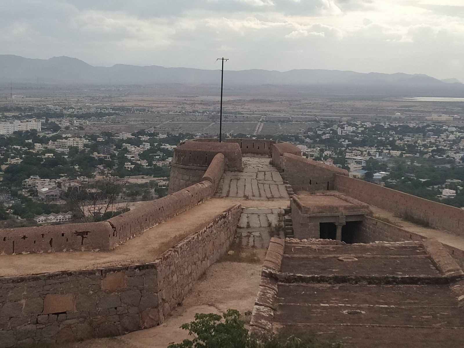
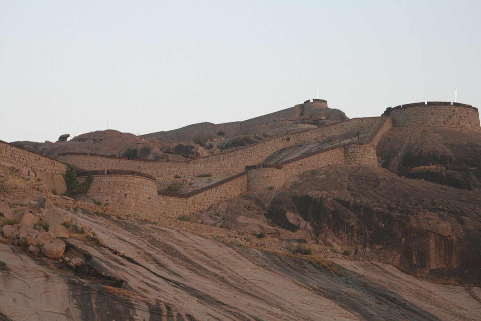
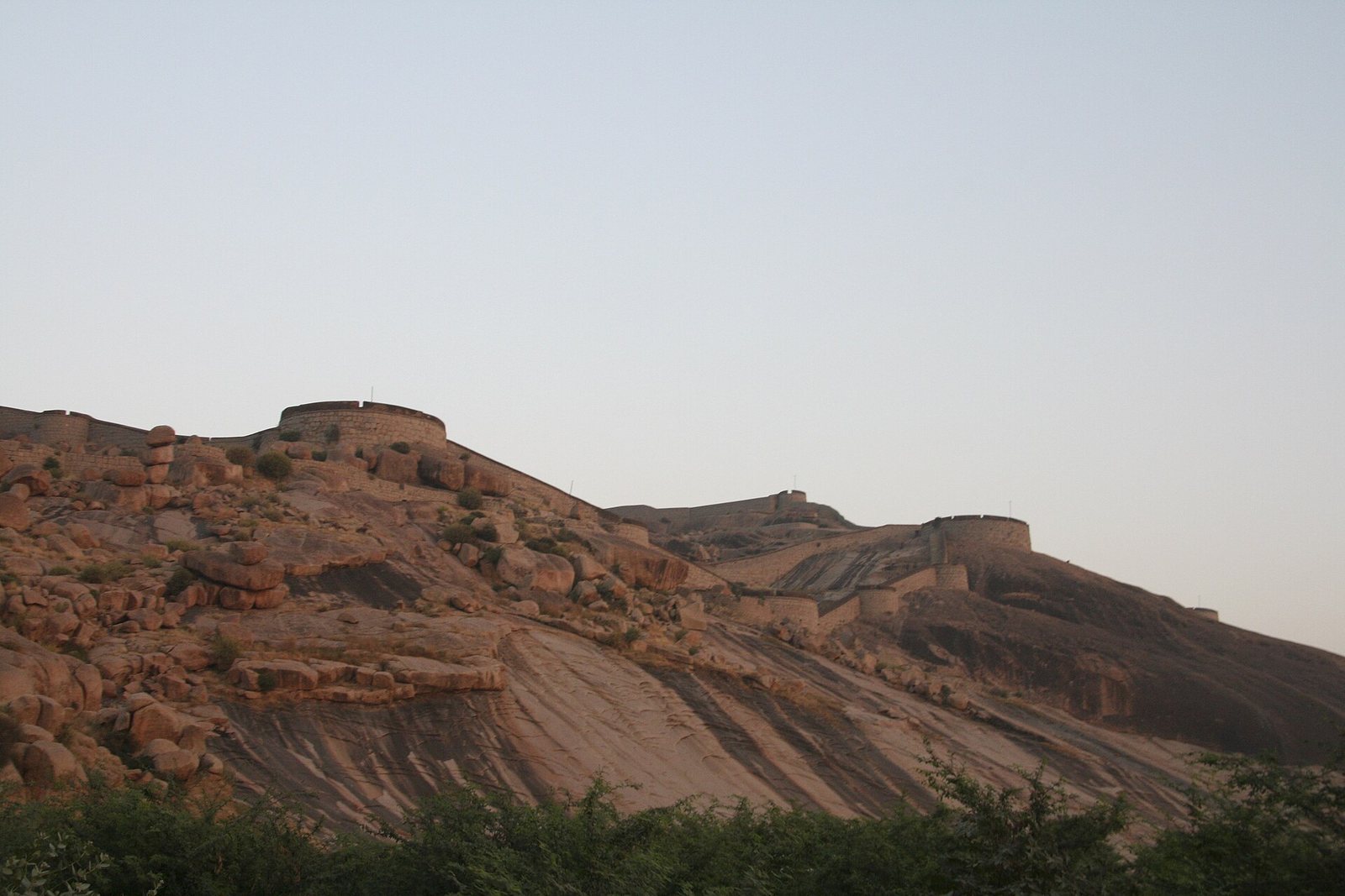
The fort occupies a rocky spur of the Sandur range near the Karnataka–Andhra Pradesh border. Its two parts are the Upper Fort on the summit of Ballari Gudda and the Lower Fort at the rock’s eastern base. Granite and mud are among the construction materials. The hill is semi-elliptical, with a longer northern side, and rises abruptly above the plains. Across from Ballari Gudda stands Kumbara Gudda, a granite hill that rose higher than the fort and created a military disadvantage. The granite formations include large, angular diamond-like and prism-shaped forms mixed with feldspar.
Upper Fort
Citadel and water storage
The Upper Fort has a quadrangular plan and a circumference of about 1.5 miles (2.4 kilometres). It stands 1,976 feet (602 metres) above sea level and about 460 feet (140 metres) above the surrounding plains. At the summit, a citadel, a fortified stronghold within the larger fort, is protected by three tiers of defenses. Within it are strongly built structures and reservoirs set into clefts in the rock, as well as numerous cisterns, or water-storage tanks, cut into the stone. Outside the citadel are a small temple, the remains of several cells, and deep pools.
Approach and outer defenses
A winding path through rocky ground and scattered boulders leads to the Upper Fort. Turreted ramparts, or defensive walls, surround it; beyond them lie a ditch and a covered passage. A large mural of the Indian flag faces east from the main eastern turret.
Lower Fort
Enclosure and entrances
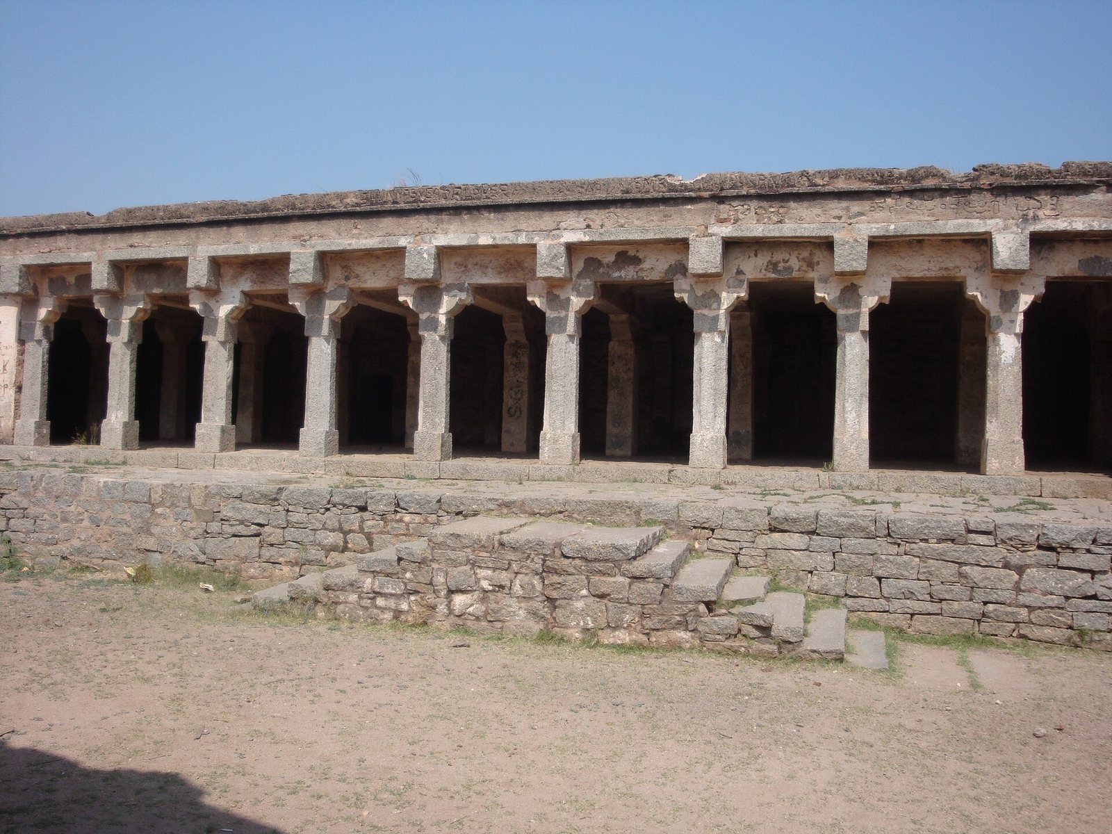
The Lower Fort measures about 0.5 miles (0.80 kilometres) in diameter. Ramparts with numerous projecting bastions, defensive works built into the walls, enclose it. A deep ditch and an outer sloping defensive surface, called a glacis, add to its defenses. Its two entrances are at the western end and on the eastern side. The Lower Fort probably once contained an arsenal and barracks.
Temple and inscribed grave
Just outside the eastern gate stands Kote Anjaneya Temple, dedicated to Hanuman. A grave near the east gate dates to 1769. Its inscription identifies the occupant as an "unknown French engineer"; local Muslims have also regarded the grave as the tomb of a Muslim saint.
Later buildings and present use
During British rule, additions to the Lower Fort included supply stores, a Protestant church, an orphanage, a post office, private homes, and a Masonic lodge, a local meeting place for Freemasons. The Lower Fort now contains public buildings, offices, educational institutions, temples, and churches.