Guogai Hillfort: A Defensive Hilltop Site in Lithuania
Site at a Glance
- Popularity
- Very Low
- Country
- Lithuania
- Primary era
- Medieval
- Eras represented
- Classical, Medieval
- Civilizations
- Grand Duchy of Lithuania
- Site type
- Military
- Remains
- Fort
On this page15 sections
History
Guogai Hillfort, also known as Piliuona Hillfort, is a fortified hilltop site in Guogų village, Kaunas District Municipality, Lithuania, about 2 km southeast of Piliuona. Its nearby settlement was occupied in several periods, and the last three of four rampart-building phases are thought to date to the 13th and 14th centuries.
Early settlement
The settlement beside the hillfort had three periods of occupation. The earliest dates to the first half and middle of the first millennium CE. A second phase began toward the end of the first millennium and continued into the start of the second.
Medieval rebuilding
The hillfort’s ramparts were constructed in four phases. The final three reconstructions are thought to belong to the 13th and 14th centuries, when the summit was also levelled and enlarged.
Later occupation
After the settlement had been abandoned, homesteads were established there during the 17th to 19th centuries.
Erosion and archaeological investigations
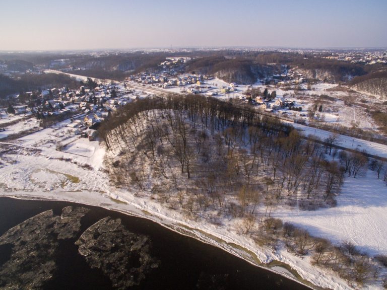
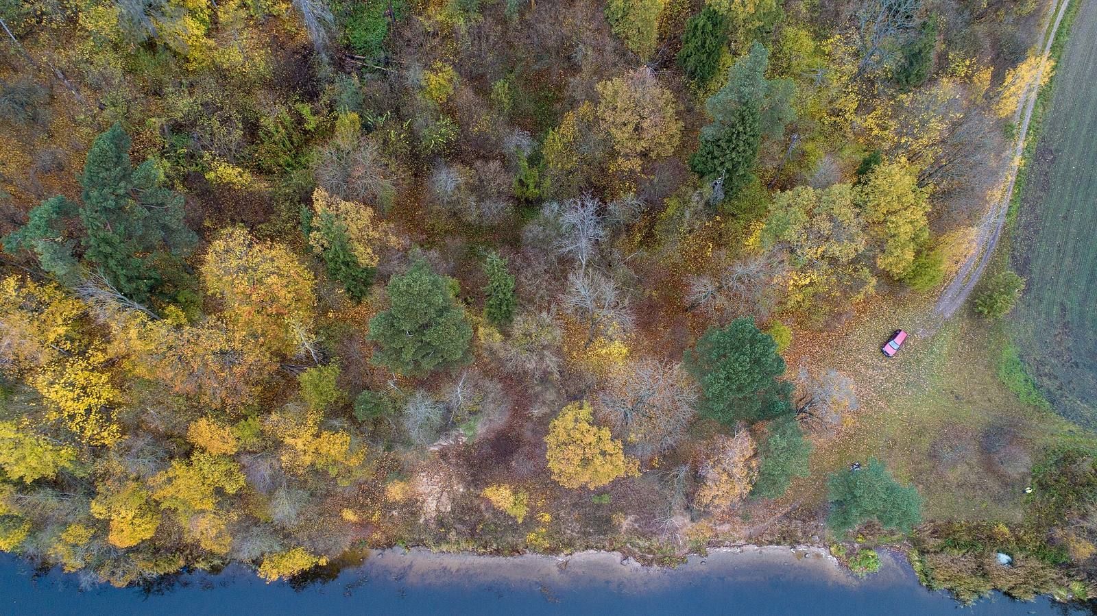
The Nemunas had eroded away the hillfort’s southern part during the first half of the 20th century, before the Kaunas Reservoir was created. Erosion intensified after the reservoir’s creation, and most of the hillfort collapsed between the 1960s and 1980s.
Petras Tarasenka described the hillfort in 1953. In 1955–1956, as construction of the Kaunas hydroelectric plant began, the Lithuanian Institute of History undertook exploratory investigations directed by Ona Kuncienė and Adolfas Tautavičius. The work examined part of a rampart and 660 m² of the settlement. Gintautas Zabiela led further investigations in 1989, examining remains of the rampart and summit platform.
Remains
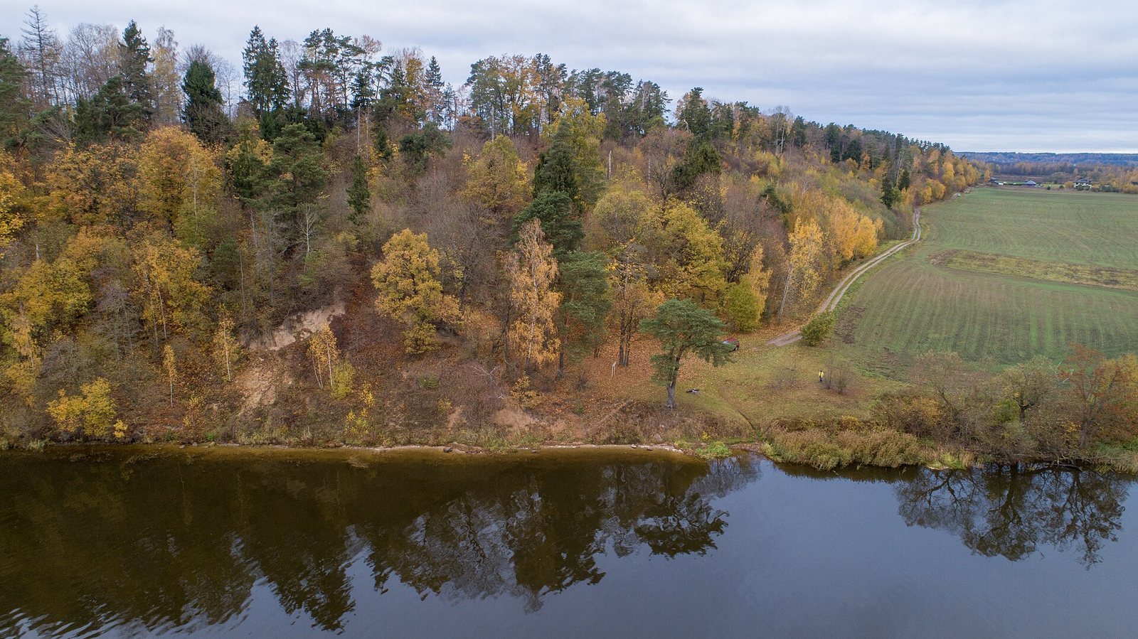
The site lies on the left bank of the Nemunas, beside the middle stretch of the Kaunas Reservoir, between the mouth of the Strėva and Darsūniškis. Its surviving layout includes a summit platform and defensive earth banks on a projecting area of high ground, with settlement remains at the hillfort’s feet and farther east. The river valley borders the site to the southeast, east, and northwest; deep ravines separate it from higher ground to the south and southwest. Trees and shrubs cover the surviving ground at the northern edge, while the southwestern part remains unstable and continues to collapse toward the Nemunas.
Summit and defensive works
Summit platform
The oval platform measures about 22 m by 15 m and covers approximately 250 m². Its surface is uneven and slopes eastward. In his 1953 description, Tarasenka gave the hill’s height as about 8 m. He described its southern slope toward the Nemunas as already slipped away and the eastern descent toward a ploughed field as about 15 m high. The western slopes reached up to 6 m, and other slopes up to 9 m. Their upper parts were very steep, at angles of 45 to 60 degrees, and had been levelled by people. A depression more than 30 m wide separated the hillfort from higher ground to the west and north; beyond it, the land rose a further 25 m. The surface soil was sandy, with traces of an occupation layer.
Ramparts and timber wall
A defensive bank, or rampart, about 4 m high survives along the southern and southwestern edges of the platform. Excavation found stone and clay reinforcement within it. Tarasenka also described a separate bank at the platform’s western end, about 2 m high and occupying roughly one-third of the platform. At the platform’s edge, excavators found the remains of a burned wooden defensive wall about 7 m long. Longitudinal logs in the wall were joined by crosswise logs.
Settlement remains
Settlement areas and deposits
Settlement remains occur at the hillfort’s northern, northeastern, and northwestern foot, where later homestead construction disturbed them. Another settlement area extends eastward across cultivated land toward the track to Piliuona. It is especially evident in an area of about 2 hectares beside the Nemunas. The settlement’s cultural layer, soil containing traces of past human activity, is generally 0.6 to 1.0 m thick. In the eastern area, dark deposits were estimated at 0.8 to 1.2 m thick, with clusters of stones 0.2 to 0.4 m across visible in places in the lower part.
Burials
Two graves dating from the second century BCE to the first century CE lay beneath the hillfort’s rampart. One contained a skull and vertebrae; the other contained bones. Beneath the settlement layer in its eastern part, a separate grave dating to the first or second century CE was found.
Finds
Settlement assemblages
In the earliest settlement layer, a stone pavement measuring 4.0 by 6.5 m lay beneath burnt material, probably the remains of a burned building. Finds from this layer include handmade pottery with brushed or rough surfaces, clay spindle whorls used in spinning thread, an iron knife tang (the part of a blade fitted into its handle), an iron belt buckle, a stone whetstone, a bone awl handle, and clay daub.
Material from the middle layer includes black or blackish wheel-thrown pottery decorated with wavy patterns, two clay crucibles (heat-resistant vessels for heating or melting materials), pieces of iron bloom, and slag from metalworking. Finds from the latest layer include plain wheel-thrown pottery and thin-walled vessels shaped like jars. Pottery collected from the settlement field and the eroded slope beside the Nemunas was mostly wheel-thrown, made of prepared dark-red clay, with walls 4–5 mm thick, pronounced profiles, outward-turned rims, and even-edged, relatively thin bases. This pottery was dated to the 12th to 15th centuries. Handmade sherds with rough surfaces were also recovered. Other settlement finds include numerous sherds, stone grinders, broken stones, and a flint core.
Hillfort finds
Other finds from the hillfort include handmade pottery with brushed and rough surfaces, remains of small sickle-shaped knives, and a fragment of bronze sheet. Finds from the investigations are held by the Lithuanian National Museum.