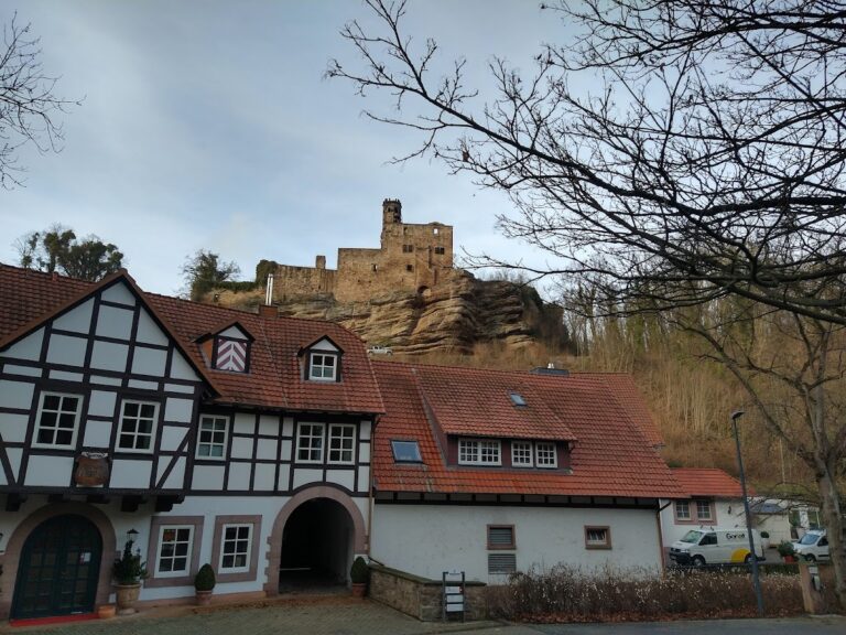
Grubenhagen Castle: A Medieval Hill Castle in Germany


Site at a Glance
- Rating
- 4.5
- Popularity
- Very Low
- Country
- Germany
- Primary era
- Medieval
- Eras represented
- Medieval, Modern
- Civilizations
- German, Holy Roman Empire
- Site type
- Military
- Remains
- Castle
On this page10 sections
History
Grubenhagen Castle is a medieval hill castle in Germany near Einbeck in southern Lower Saxony. Its construction is generally placed in the twelfth or thirteenth century, probably during the reign of Henry the Lion, a Welf duke of Saxony and Bavaria, although the Counts of Dassel and the Welfs are both possible builders. The castle later gave its name to the Welf Principality of Grubenhagen.
Origins and Welf rule
The castle first appears in written records in 1263. Members of the Grubo or Grube family then served as castellans. They belonged to the ministerialis class, medieval service nobles who carried out administrative, military, and castle-holding duties for a higher lord. By the end of the thirteenth century, Grubenhagen had returned to the dukes of Brunswick-Lüneburg.
Henry the Admirable established the Principality of Grubenhagen in 1291, and the castle supplied its name. It was not the principality’s regular residence. The site first appears as a ducal house in the early fifteenth century, while the dukes generally lived at Heldenburg and later at Herzberg am Harz. The name Grubenhagen for the principality is first known from around 1617; its earlier name is not known. The Welfs also pledged the castle in 1340 before it later returned to their possession.
The siege of 1448
In 1448, Henry III of Brunswick-Grubenhagen took refuge at the castle after raiding the area around Hofgeismar and taking hostages for ransom during his return. Landgrave Louis I of Hesse then formed a coalition of cities and princes against him, with the support of the archbishop of Mainz. The coalition included numerous towns and several of Henry III’s Brunswick relatives.
The besieging army reportedly numbered 16,000 men and included 2,000 cavalrymen and 1,500 wagons. Göttingen supplied 1,000 men and two guns, the Makefrede and the Scherpe Grete. The latter burst during the fighting. Several assaults failed over four weeks, partly because the attackers disagreed about the castle’s future. The towns wanted it demolished as a base for raids, while the Hessian landgrave wanted to retain it as a northern stronghold.
After the siege was abandoned, the coalition devastated the nearby villages of Altendorf, Reinsen, Bensen, and Rotenkirchen. Rotenkirchen was rebuilt in 1520 as a ducal supply estate, residence, and administrative centre. The castle itself was subsequently occupied only rarely. The Grubenhagen branch of the Welf dynasty ended in 1596, after which the site passed among other Welf lines and remained unused for about two centuries.
Later use and preservation
In 1815–1816, Duke Adolf Frederick of Cambridge took possession of the Rotenkirchen domain. As viceroy of the Kingdom of Hanover, he commissioned the master builder Laves to convert a timber-framed manor house at Rotenkirchen into a hunting lodge and added a stable to the surviving castle tower. Rotenkirchen served as a summer residence of the kings of Hanover from 1861 to 1866.
After the Second World War, neglect caused further deterioration at Grubenhagen Castle, and the tower entrance was bricked up. Since 1977, the Grubenhagen Castle Society, which developed from a citizens’ initiative, has maintained the site. Donations and grants enabled the keep to be renovated, while the former stable gained a continuing use for events. A limited investigation in autumn 2010 recovered evidence relating to the castle’s later history and to the siege of 1448.
Remains
Hilltop layout and defenses
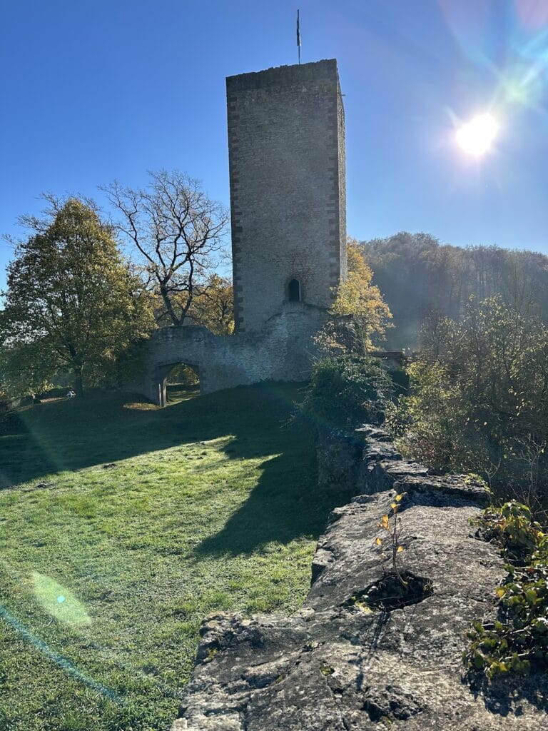
The ruins stand at about 298 metres above sea level on the summit of the Ahlsburg ridge, south-southwest of Einbeck and east of the Solling hills, between the Ilme basin and the Leine valley. The main ward occupies a small, oval, slightly kidney-shaped plateau measuring about 63 by 32 metres, with the outer ward below it. A double ditch surrounds the castle on three sides, while a steep natural slope protects the fourth. Retaining or revetment walls survive on the northeastern and southwestern sides.
The outer ramparts of the main ditch probably carried a defensive wall with a northwestern wall-walk, a passage along the top of a fortification. A Merian engraving from around 1650 shows the round keep and a roofless, gabled building in front of it. It also depicts remains of a defensive walkway to the north and northwest, with embrasures, openings through which weapons could be used. A short excavation trench in a hollow of the outer ward exposed a foundation 1.8 metres wide, interpreted as a projecting bastion intended to strengthen the castle wall.
The keep and later attached building
Round keep
The principal surviving structure is the round bergfried, the main defensive tower of a medieval German castle, designed chiefly for defense and refuge rather than permanent residence. It rises about 17.5 to 18 metres and measures approximately 6.5 metres across. The tower extends nearly 4 metres into the ground, reaching the underlying limestone bedrock, and its interior was divided by seven timber floors. The original entrance stood almost 6 metres above ground level, a position that strengthened the tower’s defense. During the eighteenth or nineteenth century, the entrance was moved to the ground floor.
Material removed from inside the keep during the 2010 investigation consisted largely of repair material from the eighteenth century onward. It included pottery and glass fragments from the modern period, and the excavation reached natural limestone at a depth of 2.2 metres. The restored keep can again serve as a viewing tower.
Nineteenth-century stable
A building attached to the southeastern side of the keep dates from the nineteenth or twentieth century. It is historically identified as a horse stable and forms part of the later fabric associated with the Rotenkirchen domain. The building survives and can be used for events, alongside fragments of the castle walls.
Archaeological evidence of the siege
Metal-detector surveys around the castle recovered objects associated with the fighting of 1448, including numerous crossbow bolts and fragments of gun barrels. These finds complement the surviving ditches, wall traces, and earthworks by locating material connected with the prolonged assault on the hilltop.
Two small earthworks lie about 900 metres from the castle. One, examined archaeologically in 1950, consisted of a low bank and an outer ditch about 40 centimetres deep. Its connection with the siege of 1448 remains uncertain.