Gleaston Castle: A Medieval Enclosure Castle in England
Site at a Glance
- Rating
- 4.1
- Popularity
- Very Low
- Country
- United Kingdom
- Primary era
- Medieval
- Eras represented
- Medieval
- Civilizations
- English
- Site type
- Military
- Remains
- Castle
On this page14 sections
History
Gleaston Castle is a medieval enclosure castle in England, probably built in the fourteenth century for John Harington, 1st Baron Harington. It stands in Cumbria on the Furness Peninsula, near Gleaston village between Ulverston and Barrow-in-Furness. The castle probably replaced Aldingham Motte as the administrative centre of the manor of Muchland, later called Aldingham manor.
Foundation under the Haringtons
The Harington family acquired the manor in 1291, and the construction of Gleaston Castle followed the family’s expansion in status and responsibility. Work may have begun around 1326, when John Harington was summoned to the English Parliament. The choice of a new centre may have reflected several pressures affecting the manor, including Scottish attacks on the Furness Peninsula, coastal erosion threatening Aldingham Motte, the need for more accommodation, and the family’s rising social position.
Some parts of the castle may belong to an earlier defensive phase, but most of the structure was probably erected after Scottish attacks in 1316 and 1322. The speed of construction and the use of relatively poor local materials have been interpreted as possible signs of financial pressure. Gleaston was first recorded by name in 1389. John Harington, 2nd Baron Harington, is said to have died there in the 1360s, and the castle probably already contained a chapel before 1415. In that year, John Harington received a papal indult, or formal permission from the papacy, allowing private worship through a chapel and portable altar for celebrating Mass.
Transfer, abandonment, and decay
Gleaston remained the principal seat of the Barons Harington until William Harington, 5th Baron Harington, died in 1458. Marriage then transferred the property to William Bonville and later to Thomas Grey, 1st Marquess of Dorset. The Bonvilles made Shute their principal residence, and Gleaston was probably abandoned during this period. The castle subsequently deteriorated rapidly.
William Bonville and his son died during the Wars of the Roses, the series of dynastic conflicts that brought rival aristocratic factions into armed struggle for the English crown. Gleaston later passed through the Grey family. When Henry Grey, 1st Duke of Suffolk, was executed for treason in 1554, his property was taken into royal ownership. By that time, Gleaston was already ruinous.
Farm reuse and modern investigation
Thomas Preston, 3rd Baronet Preston, bought Aldingham manor, including Gleaston Castle, in 1671. Ownership later passed through the Preston family to the Cavendishes and then to private owners in the 1920s. During the later history of the property, an active farm incorporated parts of the medieval castle into its buildings. Much of the present farm may have been constructed under Cavendish ownership.
Antiquarian records trace the continuing decline of the ruin. John Leland described it in 1540, while Samuel and Nathaniel Buck illustrated it in 1727. William Close produced a later representation in 1805, followed by William Green in 1809 and Edwin Waugh in 1860. These depictions show a ruinous castle from at least the eighteenth century, with its general condition remaining broadly similar thereafter. Up to four human skeletons were reportedly found during nineteenth-century construction of the farm buildings.
Gleaston is a Grade I listed ruin and a scheduled monument, a legally protected archaeological or historic site in England. It has appeared on the Heritage at Risk register since at least 2016, when its condition was described as very bad and at immediate risk of further rapid deterioration or loss of fabric. A 1998 assessment by the Lancaster University Archaeological Unit contributed to efforts to understand its condition, although no consolidation scheme was agreed. In 2015, Greenlane Archaeology carried out an aerial survey for the Morecambe Bay Partnership, creating plans and elevations and identifying possible lost buildings. A geophysical survey by the University of Central Lancashire in 2016 indicated former garden remains north of the castle and timber structures within the enclosure.
Remains
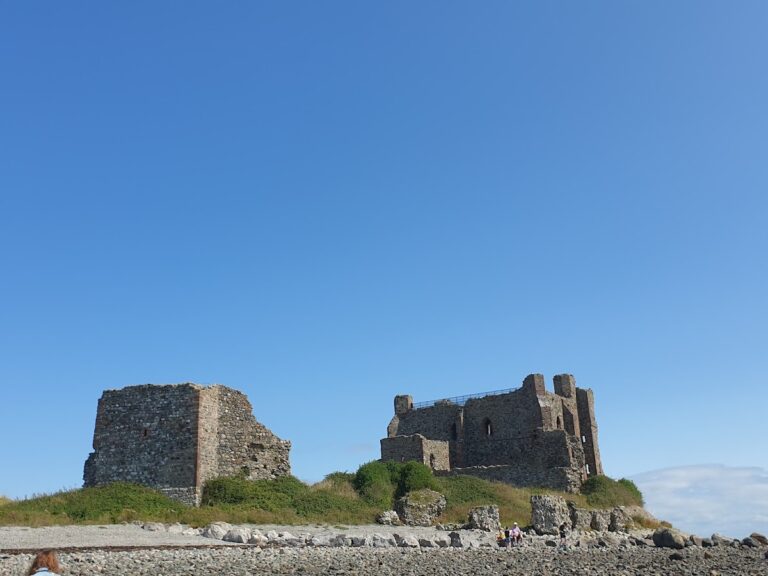
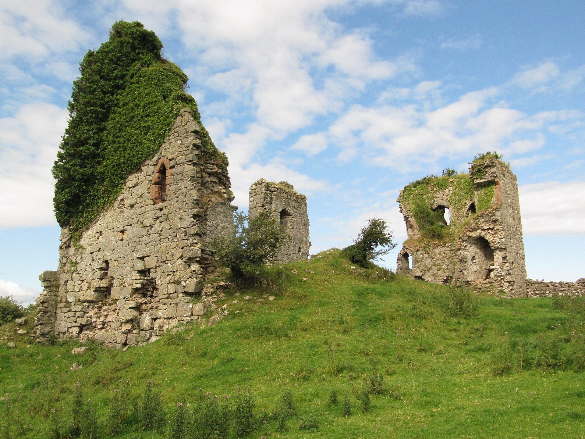
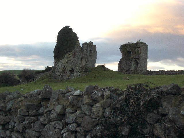
Gleaston Castle occupies a valley near Gleaston village. Its roughly rectangular enclosure extends about 73 metres from north to south, measuring approximately 37 metres across at the southern end and 46 metres across at the northern end. The ground rises northward, so the northern part of the castle stands higher than the southern part. Four corner towers were linked by curtain walls, the enclosing defensive walls joining towers around an internal courtyard.
Towers
North-west tower
The largest tower stands at the north-west corner and measures about 26 by 16 metres. Three sections of standing masonry survive, reaching a maximum height of approximately 12 metres. Its scale and position suggest that it probably contained the main hall, making it a principal building within the enclosure.
South-west tower
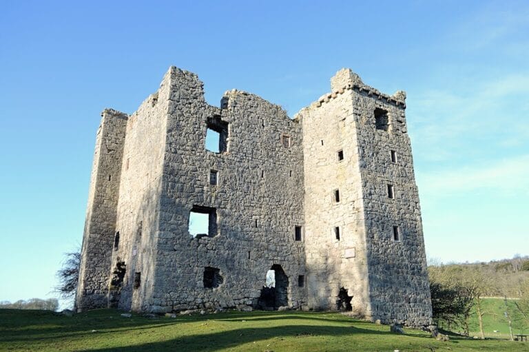
The south-west tower measures about 10 by 9.4 metres and rises roughly 19 metres. It survives as a four-storey structure, although a large vertical crack runs through its western wall. Its standing masonry forms one of the most substantial surviving parts of the castle.
South-east tower
The south-east tower measures approximately 9.5 by 13 metres and remains about 12 metres high. A farm building had been attached to it by 1727, showing how the medieval fabric was incorporated into later agricultural use. One of the southern towers may also have remained habitable during the sixteenth century.
North-east tower
The north-east tower has largely collapsed and survives chiefly as earthworks. Parts of its masonry may have been absorbed into the modern farm buildings, where medieval material forms part of the later complex.
Enclosing walls and defensive features
Western curtain wall
The western curtain wall is about 3 metres thick and reaches approximately 9 metres in height in places. It was built mainly from limestone rubble. A ruined bastion, a projecting defensive work intended to strengthen a wall and defend its approaches, stands midway between the north-west and south-west towers.
Eastern and southern enclosure
The eastern curtain wall has been partly incorporated into the modern farm buildings, preserving masonry to a height of about 4 metres. The walls at the south-west corner contain clay cores, while the cores of the other walls are described as slate mortar, which was also used to plaster the walls. The northern and southern walls survive through archaeological evidence and the broader enclosure plan, while the visible ruin combines collapsed sections, standing masonry, cracking, and later farm construction.
Materials and internal remains
The castle was built mainly from locally quarried limestone. Red sandstone was used for door and window details and to dress the towers. Because sandstone was not available locally, it may have been brought from a beach about 3.2 kilometres away. The stone resembles material used at nearby Furness Abbey.
Archaeological surveys have identified possible lost buildings and timber structures within the enclosure, together with a probable garden to the north. A former manor mill may also have stood nearby, although its precise location remains uncertain. These findings extend the surviving evidence beyond the standing towers and walls, showing that the castle complex included internal and adjoining features now represented chiefly by buried remains and earthworks.
The ruin is in a poor and unsafe condition, with extensive collapse and major structural cracking. Medieval fabric also survives within the later farm buildings. The castle’s present form therefore combines tall fragments of the original enclosure, earthwork traces of collapsed structures, and masonry reused in the agricultural complex.