Gezer: The Ancient Canaanite City and Archaeological Tell in Israel
Site at a Glance
- Rating
- 4.5
- Popularity
- Medium
- Country
- Israel
- Primary era
- Bronze Age
- External website
- Open
- Eras represented
- Stone Age, Bronze Age, Iron Age, Classical
- Civilizations
- Canaanite, Israelite, Roman, Seleucid
- Site type
- City
On this page19 sections
History
Gezer is an archaeological tell, or settlement mound formed by successive occupations, in Israel, identified with the ancient Canaanite city of Gezer. Occupied for roughly 5,000 years from the end of the Neolithic or Chalcolithic period, the Copper Age, through the Roman period, it later saw Byzantine, Crusader, Mamluk, Ottoman, and modern activity. Its importance came from its position beside the ancient coastal highway linking Egypt and Syria and the routes through the Ayalon and Sorek valleys toward Jerusalem, Beth-Shemesh, Philistia, and Judah.
Early settlement and the Canaanite city
The earliest settlement dates to the end of the fourth millennium BCE, when inhabitants used large caves cut into the rock as dwellings. An unfortified settlement covered the tell during the early third millennium BCE, but it was destroyed around the middle of that millennium and then abandoned for several centuries. Occupation was interrupted again during parts of the Early and Middle Bronze Ages.
Gezer became a wealthy and strongly fortified Canaanite city during the Middle Bronze Age, probably in the first half of the second millennium BCE. Its military strength is reflected in substantial defenses, while its large cultic complex indicates the importance of organized religious activity. The city was destroyed by fire, probably during the first campaign of the Egyptian pharaoh Thutmose III, conventionally dated to around 1482 BCE in one chronological reconstruction. Burned mudbrick, a destruction layer, and storage vessels buried beneath the ruins have been associated with this event, although the precise historical correlation remains uncertain.
Gezer recovered during the Late Bronze Age under Egyptian influence and became an important center in southern Canaan. Imported objects, Egyptian-style goods, and Egyptian inscriptions reflect its political and commercial connections. The Amarna letters, fourteenth-century BCE diplomatic tablets written mainly in Akkadian, preserve roughly nine or ten letters from Gezer rulers, including Milkilu and Yapahu, to their Egyptian overlords. They identify the city, called Gazru in Babylonian, as an Egyptian-aligned city-state governed by several local leaders.
Egyptian records mention Gezer in the campaigns of Thutmose III, in the victory inscription of Merneptah near the end of the thirteenth century BCE, and in the campaign lists of Shoshenq I. The site is also associated with Gazru in an eighth-century BCE Assyrian royal relief attributed to Tiglath-Pileser III. Merneptah’s campaign was followed by another decline, and parts of the city were later destroyed. Gezer was then partly resettled, with imported goods and Philistine pottery indicating renewed contacts and a mixed Canaanite-Philistine population during the early Iron Age.
Biblical traditions and the Iron Age
The Hebrew Bible describes Joshua’s defeat of Horam, king of Gezer, when Horam came to aid Lachish. It also places Gezer on the border of the territory allotted to Ephraim, describes the city as not fully conquered and paying tribute to Ephraim, and identifies it as a Levitical city for the Kohathites. These accounts are textual traditions rather than independently established historical events.
According to the biblical account, an unnamed Egyptian pharaoh conquered and burned Gezer in the early tenth century BCE, killed its Canaanite inhabitants, and gave the city as a dowry to his daughter when she married Solomon. Solomon then rebuilt and fortified it. The pharaoh is sometimes identified with Siamun, while other interpretations connect the destruction with Shoshenq I, so the identification remains uncertain.
Gezer underwent major urban development during the tenth century BCE. It was probably destroyed in the third quarter of that century, possibly during Shoshenq I’s campaign, but continued in a reduced form rather than being completely abandoned. Between 734 and 732 BCE, Tiglath-Pileser III attacked the city, which was probably captured by the Assyrians. Fire destroyed parts of Gezer, including the gate and residential buildings. The city then became an Assyrian administrative and military center overseeing the coastal plain. Two Assyrian documents dated to 651 and 649 BCE preserve local personal names, including those of a city official and an Israelite land merchant.
Persian, Hellenistic, and Hasmonean Gezer
After the Assyrian period, Gezer was abandoned until the Persian period, when it formed part of the province of Yehud. Settlement remained limited, while graves, house walls, and water installations continued to mark the site.
During the Hellenistic period, Gezer, also known as Gazara, became a Seleucid military center in the Shephelah, the low hill country between the Judaean Mountains and the coastal plain. Its forces participated in campaigns against Judah Maccabee, including the battles of Beth-Horon and Emmaus. Bacchides rebuilt the city gate and repaired its fortifications.
Simon Thassi captured Gezer in 142 BCE, expelled its pagan inhabitants, settled observant Jews there, removed cult images and other religious installations, and strengthened the city. Gezer became part of the Hasmonean kingdom, the Jewish dynasty that emerged from the Maccabean revolt, although it later faced renewed Seleucid claims. Simon’s son, John Hyrcanus I, used Gezer as a base and built a fortress there.
Gezer remained within the Hasmonean kingdom until its end, although Emmaus replaced it as the principal regional center. Under Herod, its status declined. The city was sparsely occupied in the Roman period and was gradually abandoned during the late Roman or early Byzantine period as other population centers assumed its regional role. Roman and Byzantine occupation was limited, while later Mamluk inhabitants reused a Byzantine cemetery. During the Crusader period, Gezer belonged to the lordship of Ramla and was probably an unfortified settlement. In 1177, the surrounding plain was the scene of the Battle of Montgisard, in which the Crusader army under Baldwin IV defeated Saladin’s forces.
Ottoman and modern history
The Ottoman-period Arab village of Abu Shusha stood at the foot of the tell. The tell’s lands were acquired in stages by the Bergheim family, purchased by Baron Rothschild in 1913, and later transferred to Herbert Bentwich’s Zionist land company. During the First World War in 1917, Ottoman forces held a position at Abu Shusha before withdrawing during the British advance under Edmund Allenby.
A settlement group established near Gezer in 1945 was attacked and captured by Jordanian forces in June 1948, when 28 defenders were killed. The area was subsequently retaken by the Palmach and became part of Israel. The Gezer Regional Council takes its name from the tell.
Identification and archaeological investigation
Charles Clermont-Ganneau identified the site with ancient Gezer in 1871, using medieval Arabic accounts and boundary inscriptions found near the tell. Written in Hebrew or Aramaic and Greek, the inscriptions refer to the boundary of Gezer and to Alkios or a related personal name. They provided the principal archaeological confirmation of the site’s identification with biblical Gezer.
Robert Alexander Stewart Macalister excavated Gezer for the Palestine Exploration Fund in 1902 to 1905 and again from 1907 to 1909. His extensive trench system and limited control of the layers led to many finds being assigned incorrectly, and later investigations revised his interpretation of the settlement sequence. A Muslim cemetery also prevented him from fully excavating the acropolis. Alan Rowe investigated the site in 1934.
Excavations by the Hebrew Union College and associated institutions under George Ernest Wright, William G. Dever, and Joe Seger continued from 1964 to 1974. Dever returned in 1984 and 1990. These campaigns clarified the sequence of the fortifications and supported the identification of the structure once called the Maccabean citadel as an earlier gate. Excavations resumed in 2006 under Steve Ortiz and Sam Wolff, with related investigations continuing through 2017.
From 2010, the Israel Nature and Parks Authority and the New Orleans Baptist Theological Seminary investigated the ancient water system. Work was directed at different stages by Jim Parker, Dennis Cole, Dan Warner, and Tsvika Tsuk. Wet-sieving in 2012 recovered pottery dating from the Early Bronze Age through the Persian period. A Middle Bronze Age hoard of silver and gold objects wrapped in textile was found in 2016 and was probably deposited as a ritual offering. In 2017, excavators found the remains of three people, including an adult and a child wearing earrings, probably killed during a thirteenth-century BCE Egyptian invasion. An Egyptian amulet, scarabs, and cylinder seals accompanied the remains.
Gezer was declared a national park in 2010. A severe fire affected the archaeological site and national park in 2022, although an initial inspection indicated that the principal archaeological monuments were not dramatically damaged.
Remains
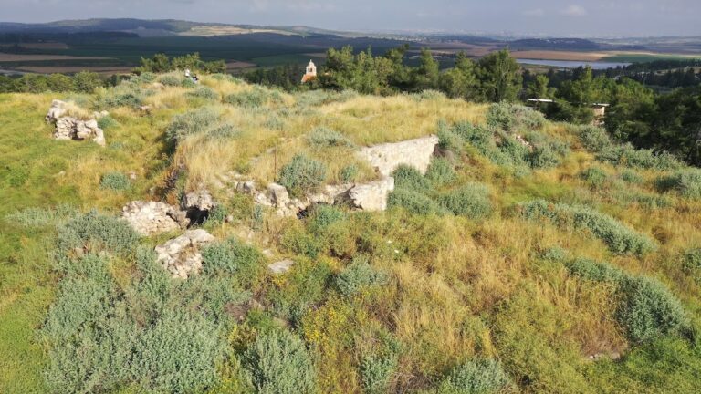
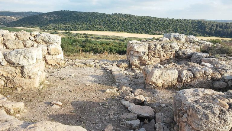
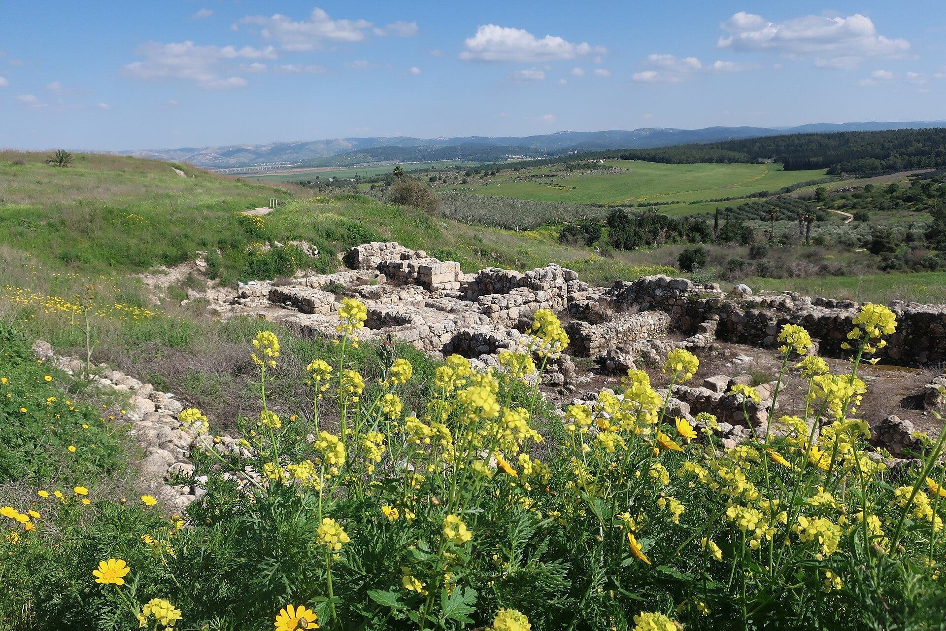
The tell occupies a prominent hill about 600 metres long from northwest to southeast and 200 to 250 metres wide, rising approximately 220 to 229 metres above sea level. Steep sides and a narrow neck connecting the hill with the lower Shephelah formed part of its defensive setting. The site overlooks the Mediterranean coast to the west and the Judaean hill country to the east. The ancient settlement covered about 130 dunams, or 32 acres, and contains approximately 26 settlement levels from the Chalcolithic period through the early Roman period. Most surviving remains belong to the Middle and Late Bronze Ages and the Iron Age.
Fortifications and water supply
Walls and towers
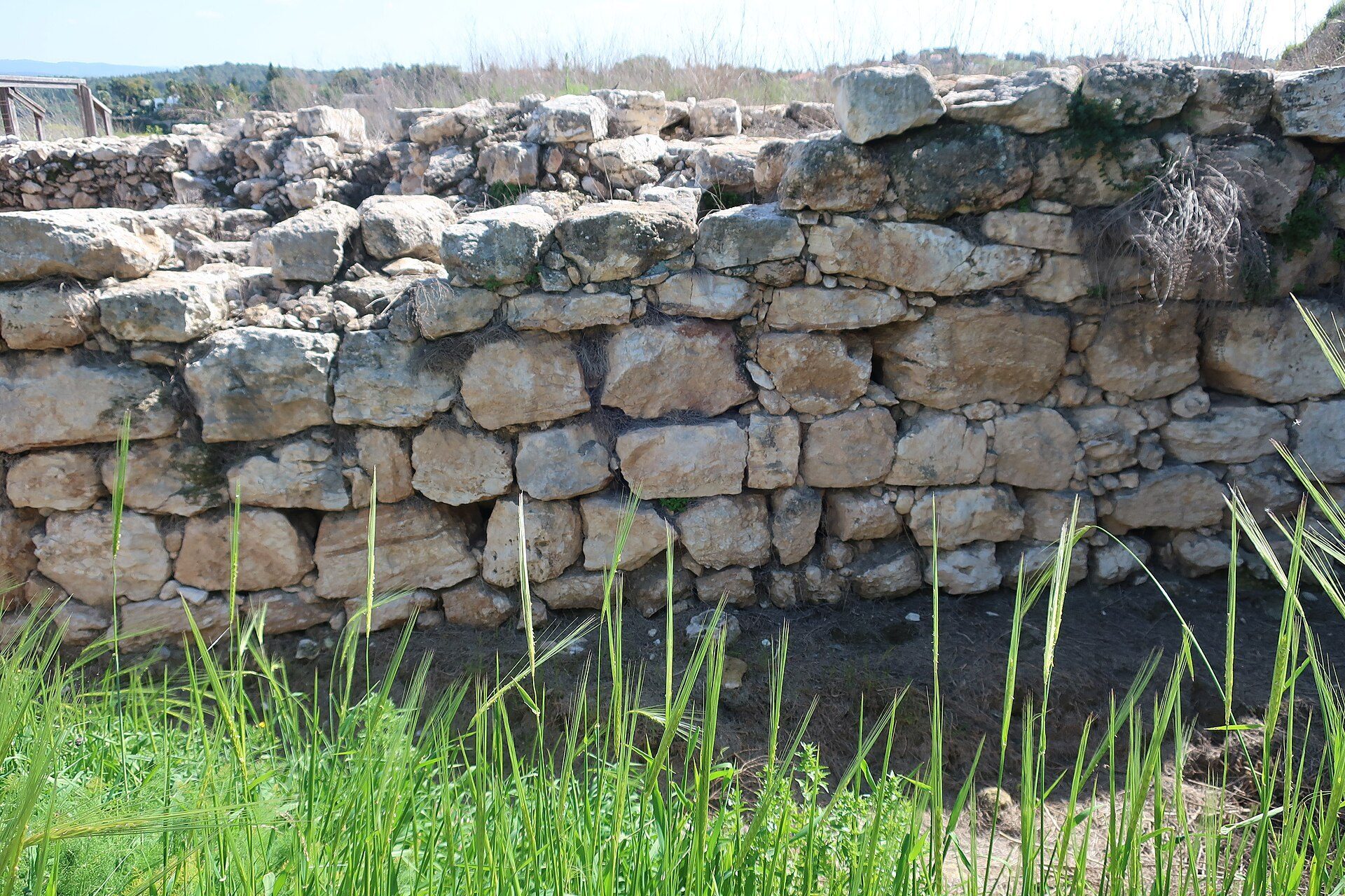
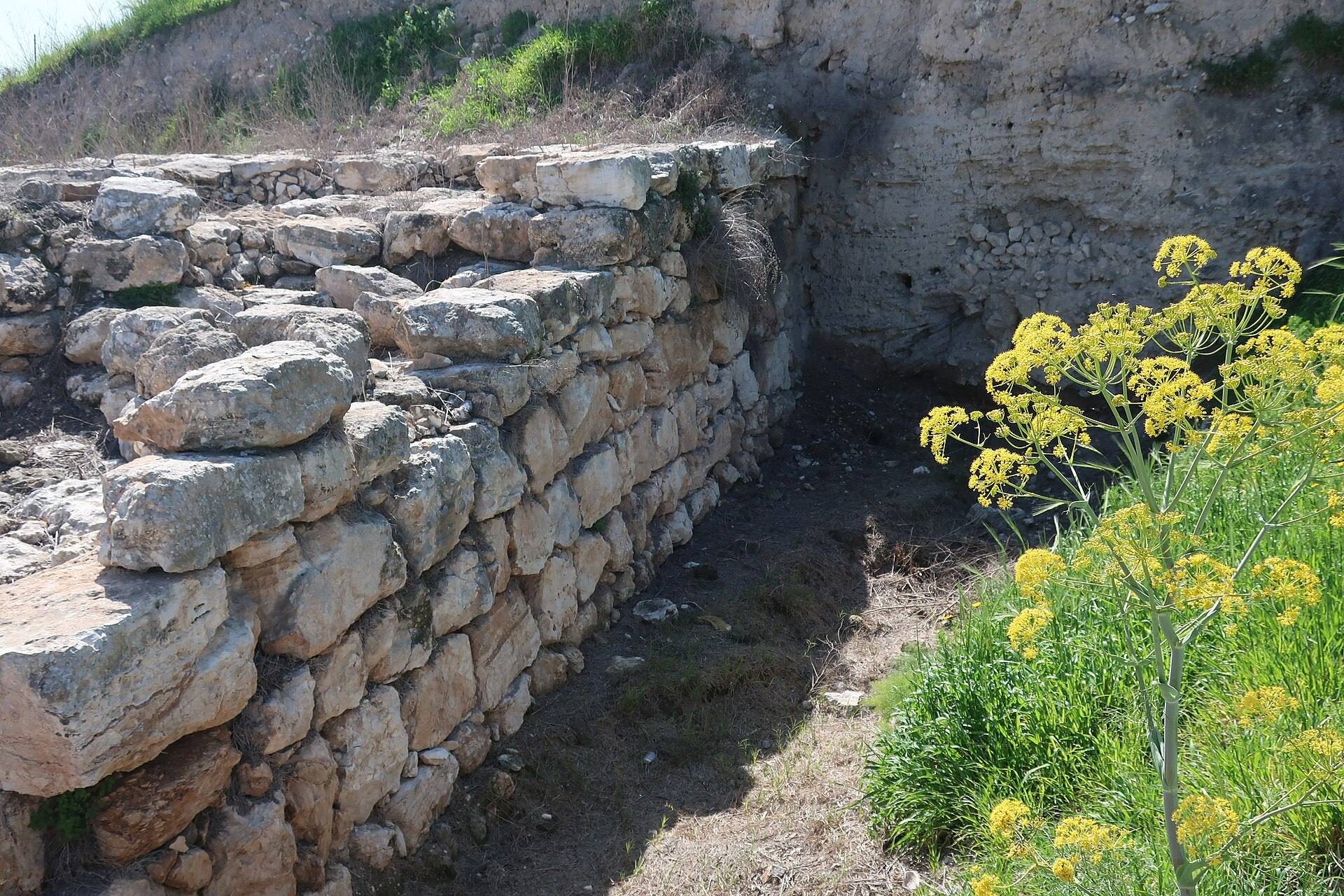
Gezer’s defenses included an inner wall, an outer wall, and an intermediate feature whose interpretation remains disputed. The inner wall is about 1.2 kilometres long and approximately 4 metres wide. It was built with roughly hewn stone masonry, large stones at its base, and an external glacis, a sloping defensive embankment, that rises about 5.5 metres at an angle of roughly 30 degrees. The wall probably contained about 25 towers and turrets. Nine towers have been exposed, including a fortified structure about 16 by 20 metres beside the southern gate. The date of the inner fortification remains debated, with proposals ranging from Early Bronze Age I and II to Middle Bronze Age II and the transition from Middle Bronze Age II to III.
The intermediate wall is a short, thin stone feature between the inner and outer defenses, supported by sloping earth fill. Macalister interpreted it as an earlier Early Bronze Age wall, while later excavators regarded it as part of the Middle Bronze Age fortifications rather than a separate city wall. The outer wall was built lower down the slope during the Late Bronze Age. About 1,100 metres long and 4 metres wide, it expanded the city by at least one quarter. Up to approximately 4.5 metres of this wall survives. It was repaired or rebuilt in later phases, including a construction episode attributed to Solomon, and later sections were plastered and rebuilt.
Gates
The inner fortification had northern and southern gates, each formed by two elongated, massive stone towers separated by a passage. The southern gate had a paved passage, three pairs of jambs, and possibly a movable wooden barrier. It was later blocked when the outer wall was built.
The so-called Solomon Gate is a six-chambered gate made of high-quality ashlar masonry. Its passage contained benches, a roof, and a drainage channel. Four pairs of pillars and three pairs of side chambers flanked the passage, while towers stood at the entrance. A short section of casemate wall, a defense containing enclosed rooms or compartments, adjoined it.
Macalister initially interpreted the gate as a second-century BCE Maccabean citadel because of Hellenistic pottery and a nearby Greek curse inscription. Yigael Yadin later compared its plan with gates at Hazor and Megiddo and identified it as a tenth-century BCE structure. Excavations by Dever’s team and the Hebrew Union College exposed it more fully. Work in 1990 found built foundations rather than the trench foundations proposed by Yadin, while pottery from the foundation fill dated to the middle of the tenth century BCE. The gate was altered repeatedly, with its floor raised and a new drain installed, before it was rebuilt as a four-chambered gate and later as a two-chambered gate. Assyrian attacks eventually destroyed it. Proposed dates include the ninth century BCE and an earlier phase supported by radiocarbon and stratigraphic evidence.
Water system
A large diagonal water system descends toward the groundwater. It consists of a vertical entrance shaft about 7 metres long and a stepped, sloping tunnel or cavern approximately 60 metres long. The installation was probably used to obtain water during sieges. Its date remains uncertain. Comparisons with systems at Hazor and Megiddo support an Iron Age II date, while its position beside Middle Bronze Age fortifications and finds from its deepest section have prompted proposals for a Middle Bronze Age or Late Bronze Age date.
Macalister emptied much of the passage, removing evidence that might have allowed more precise dating. Modern excavations cleared the tunnel, removing approximately 299 tons of debris. They exposed a sealed cavern about 9 by 9 metres and 2 metres high and reached a floor and pavement laid during Macalister’s work. Pottery from the passage belongs mainly to the Middle and Late Bronze Ages.
Palaces, houses, and production areas
Late Bronze Age buildings
The acropolis, the upper fortified part of the settlement, contained a two-storey Egyptian-style palace constructed of stone and lime at the end of the fourteenth century BCE. A separate elite building known as the House of the King of Gezer also belonged to the Late Bronze Age. A possible Egyptian governor’s residence has been proposed in the northern part of the tell.
Late Bronze Age houses had thickened walls, plastered courtyards, and drainage channels leading toward the buildings. Egyptian-style glass and gold objects, imported pottery, ivory ornaments, a Mycenaean coffin, scarabs, cylinder seals, and a scarab bearing the cartouche, or oval frame around an Egyptian royal name, of Amenhotep III were found at the site.
Iron Age building
An Iron Age building on the acropolis, dating to the twelfth or eleventh century BCE, contained multiple rooms and courtyards. Grinding stones and wheat grains suggest that it functioned as a granary. Macalister also identified an olive press with collecting vats. The building was repeatedly destroyed, rebuilt, and converted into large domestic structures.
Cultic and written remains
Middle Bronze Age high place
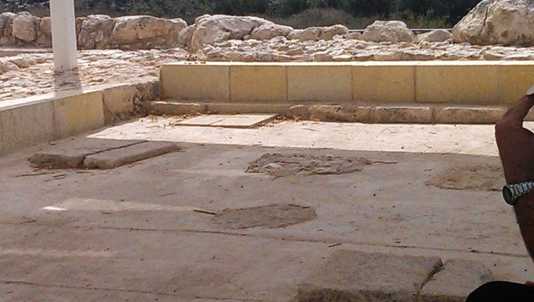
A Middle Bronze Age cultic area, usually called the high place, contained ten standing stones arranged approximately north to south. A high place was an elevated cultic area. The stones vary in height, shape, spacing, and surface treatment, with the tallest reaching about 3 metres. Several have cut holes that may have assisted their transport. A square installation with a square depression stood behind the fifth and sixth stones. It has been interpreted as an altar, the base for another standing stone, a ritual installation, or a washing facility, although its exact purpose remains uncertain. No traces of burning were found there.
The seventh stone differs from the others because it was not made from local Gezer stone. Jerusalem and its surrounding hills have been proposed as its source. A double cave beneath the high place predates the standing stones and is not structurally connected with them.
Calendar and boundary inscriptions
The Gezer Calendar is a small plaque bearing a text that lists agricultural seasons or months. Its function has been interpreted as a school exercise, a record used to collect agricultural taxes, or a popular or children’s song. The plaque is important for studying early Northwest Semitic writing and ancient agricultural practices.
Thirteen boundary stones have been identified at locations from less than 200 metres to nearly 2 kilometres from the tell. Most are bilingual, combining Hebrew or Aramaic with Greek, and probably date to the Late Hellenistic period, although Hasmonean and Herodian dates have also been proposed. Their inscriptions probably marked property boundaries or the limits between city land and private estates. Two stone inscriptions record land transactions in cuneiform and preserve names of foreign settlers of Mesopotamian and Aramaic origin who were brought to the region by the Assyrians.
Hellenistic and Hasmonean remains
Hellenistic and Hasmonean levels produced coins of Ptolemy VI, Demetrius II, and Antiochus VII, along with pottery and iron tools. A Greek inscription carved on stone records a curse invoking heavenly fire against the house of Simon. Seven stepped water installations in the upper settlement level have been identified as Jewish ritual baths, or mikvaot. Their plastering, stepped design, hydraulic arrangements, and associated rainwater reservoir resemble ritual baths at Jerusalem and Jericho. One bath was added to an earlier Hellenistic house, probably after its pagan occupants had been removed.
The Hasmonean fortress built by John Hyrcanus I stood over or reused the area of the earlier Solomonic Gate. Its identification as a separate Maccabean citadel by Macalister was later revised.
Roman and Byzantine remains
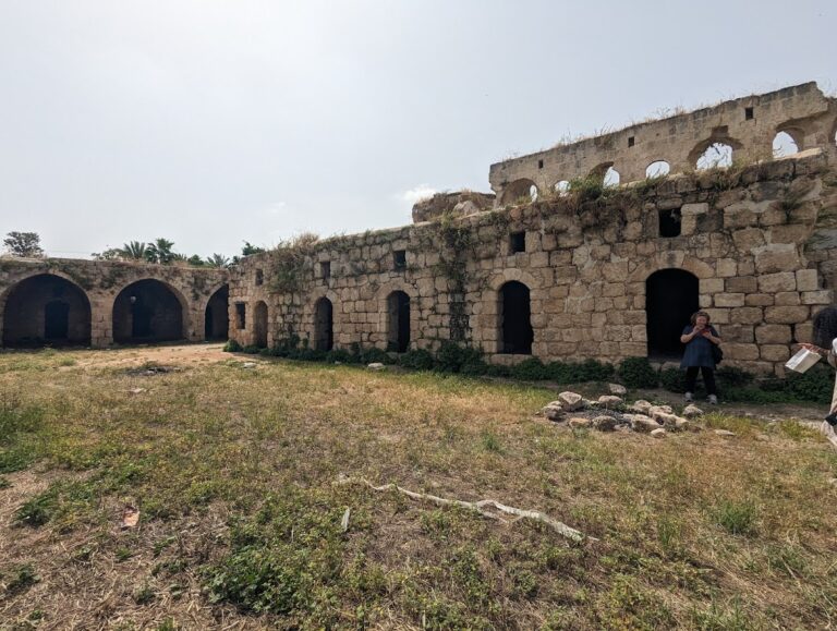
Roman-period remains include two bathhouses, several ritual baths, rock-cut tombs, a large boundary wall that was not primarily defensive, and a number of huts. Byzantine remains include additional tombs. Across the settlement levels, excavations and surveys have revealed houses, storage facilities, walls, towers, gates, drainage systems, graves, caves, water installations, ritual buildings, and imported objects. The site is presently in ruins.