Gaztelu Zahar gaztelua: A Frontier Fortress in Spain


Site at a Glance
- Rating
- 4.3
- Popularity
- Low
- Country
- Spain
- Primary era
- Early Modern
- Eras represented
- Early Modern
- Civilizations
- Crown of Castile, Spanish
- Site type
- Military
- Remains
- Castle
On this page7 sections
History
Gaztelu Zahar gaztelua is a sixteenth-century fortress in Irun, Spain, built in 1518 on the orders of Ferdinand II of Aragon, known as Ferdinand the Catholic, to defend the Castilian frontier against Franco-Navarrese attacks. It controlled the Behovia crossing of the Bidasoa River, the principal frontier passage and the only route suitable for heavy artillery, while also helping protect Irun, which then lacked town walls.
Foundation and frontier defence
The decision to construct the fortress was taken in November 1512, after a Franco-Navarrese army invaded Gipuzkoa and briefly occupied Irun. The attack formed part of an attempt to recover the recently conquered Kingdom of Navarre. Built on a hill above the Bidasoa passage, the castle was entrusted by 1518 to Hernán Pérez de Yarza.
Capture, destruction, and military decline
In October 1521, Franco-Navarrese forces captured Hondarribia, while French troops commanded by Admiral Bonnivet crossed the area with little resistance. In June 1522, the attackers decided to abandon and destroy Gaztelu Zahar because it was difficult to defend. Castilian troops under Captain Ochoa Sanz de Asua captured it during the Battle of San Marcial and prevented its demolition, although the fighting left the fortress in worse condition.
In 1539, Charles I of Spain, who was also Holy Roman Emperor Charles V, ordered the castle demolished to prevent Navarrese forces from using it as a stronghold during a possible attempt to reconquer the kingdom. The demolition took place in 1542, and much of the fortress’s ashlar stone was reused in the walls of Hondarribia. Proposals to rebuild the site were made during the seventeenth century, while restoration and fortification work followed in 1719 in connection with the consequences of the War of the Spanish Succession.
Later name and heritage status
The fortress was formerly known as Behovia Castle. Its later name, Gaztelu Zahar, means “old castle.” The site forms part of the Basque Interior Way of Saint James. In 1997, the Basque Government gave it preliminary recognition as a potential archaeological zone. In 2010, it was included in the protected monument ensemble associated with the route, beginning proceedings for classification as a cultural asset. It is also identified as a cultural asset subject to special or intermediate protection.
Remains
Triangular fortress plan
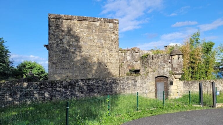
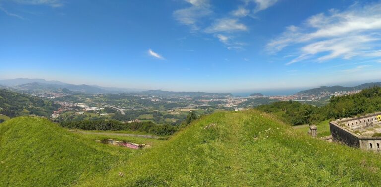
The remains occupy a hill near the Behovia crossing, overlooking the passage of the Bidasoa. The fortress had a triangular plan attributed to Diego de Vera. Each side measured approximately 22 by 5 metres, and the castle had two storeys. Its thick walls combined limestone rubble masonry, made from irregular stones set in lime mortar, with an ashlar facing of regularly cut and finished stone. Entry was through a doorway in the southern side.
Loopholes, small openings that allowed weapons to be fired while limiting defenders’ exposure, were arranged at low level and at about 6 metres above the ground, corresponding to the second floor. Circular towers, each approximately 21 metres in diameter, occupied the three corners. Each tower had its own loopholes, and one was surmounted by an additional tower.
Surviving walls and towers
Two sides of the triangular fortress survive for their full length, reaching approximately 9 metres in height. One corner tower remains, while parts of the other two are also preserved. The surviving fabric includes sections of the inner wall structure and the trace of one bastion, retaining elements of the defensive arrangement that once guarded the Bidasoa frontier.