Gallo-Roman Villa of Lassalles: An Agricultural Estate and Late Roman Palace


Site at a Glance
- Rating
- 4.6
- Popularity
- Very Low
- Country
- France
- Primary era
- Classical
- External website
- Open
- Eras represented
- Classical
- Civilizations
- Roman
- Site type
- Domestic
- Remains
- Villa
On this page17 sections
History
The Gallo-Roman villa of Lassalles in France was a Roman agricultural estate near Montmaurin, established around the middle of the first century AD during the Pax Romana, the long period of relative stability under Roman imperial rule. Its lands extended across more than 1,000 hectares and supported about 500 workers. The estate later developed into a luxurious residential palace, reflecting the prosperity of southwestern Gaul between the fourth and sixth centuries.
Foundation and agricultural expansion
The original estate combined the owner’s residence with a large agricultural complex. Several dozen buildings for farming and workers stood beside the Save, while the wider complex was enclosed by a wall surrounding an area of approximately 18 hectares. The residential sector and the service and agricultural areas formed one integrated estate, whose scale required a substantial labour force and extensive landholding.
A flood of the Save affected the villa during the second century, but farming continued. Another flood, dated to the late second or third century, may have led to a period of abandonment or reduced occupation. The agricultural complex was enlarged around AD 250, demonstrating renewed investment before a possible destruction during an incursion around AD 276.
Late Roman rebuilding
The estate was reused in the fourth century and may have suffered a major fire around AD 350 to 375. Despite that damage, occupation and agricultural activity continued. During the late fourth or early fifth century, two large remodelling campaigns changed the estate into an exceptionally luxurious residential palace. These works transformed a working agricultural centre into a residence organised around formal courtyards, gardens, ceremonial spaces, and richly decorated rooms.
The villa remained inhabited until the end of the fifth century or the beginning of the sixth century. Its abandonment may instead have taken place at the beginning of the fifth century, so the final date of occupation remains uncertain. The scale of the palace has been connected with the exceptional prosperity of southwestern Gaul during the fourth to sixth centuries.
Possible imperial connections
A possible association with the imperial family of Rome has been proposed. Nepotianus, a short-lived usurping emperor who held power in Rome in AD 350, was the grandson of Constantius Chlorus and Theodora through his mother, Eutropia II. Eutropia II may have lived at Montmaurin during her youth. Another interpretation connects a possible owner of the estate with the name Nepotianus and with Nébouzan, a historical district whose name has been tentatively derived from the ancient name Nepotianum. Neither connection is certain.
Rediscovery and archaeological investigation
In 1865, the archaeologist Anthyme Saint-Paul identified the remains as Roman. Before that recognition, the ruins had been interpreted as a former Templar convent. Between 1879 and 1881, Isidore Miro acquired the parcels to prevent the remains from being looted. He and Abbé Jean-Marie Couret carried out initial investigations between 1879 and 1882, and Couret published a general plan in 1903.
Georges Fouet began extensive excavations in the late 1940s, with campaigns continuing until 1960. The villa was designated a historic monument on 5 December 1949 under the name “Gallo-Roman villa of Montmaurin.” In 2010, its administration passed to the Centre des monuments nationaux. Statues, coins, and other objects recovered during excavation are exhibited at the Montmaurin museum.
Remains
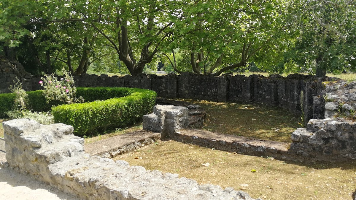
The surviving remains belong chiefly to the final building phase from the fourth century onward. The complex occupies a terrace or small plain beside the Save, in the foothills of the Pyrenees, approximately one kilometre south of the entrance to the Save gorges and near the Save bridge. It is oriented from southwest to northeast, and its principal façade reaches about 117 metres at its greatest length. The fourth-century palace covered approximately 5,800 square metres, while the later complex is described as extending across about two to four hectares and containing roughly 200 rooms.
Approach and ceremonial spaces
Forecourt and portico
A long approach led to a semicircular forecourt or portico. Colonnades bordered this formal space, which contained a hexagonal temple of Gaulish type. An altar also stood in the portico area. From the forecourt, a ceremonial vestibule provided entry to the central residential block.
Residential courts and gardens
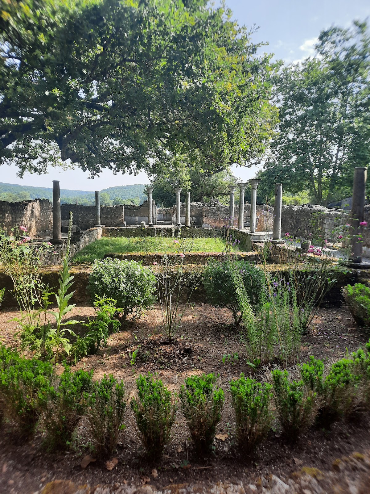
Principal peristyle
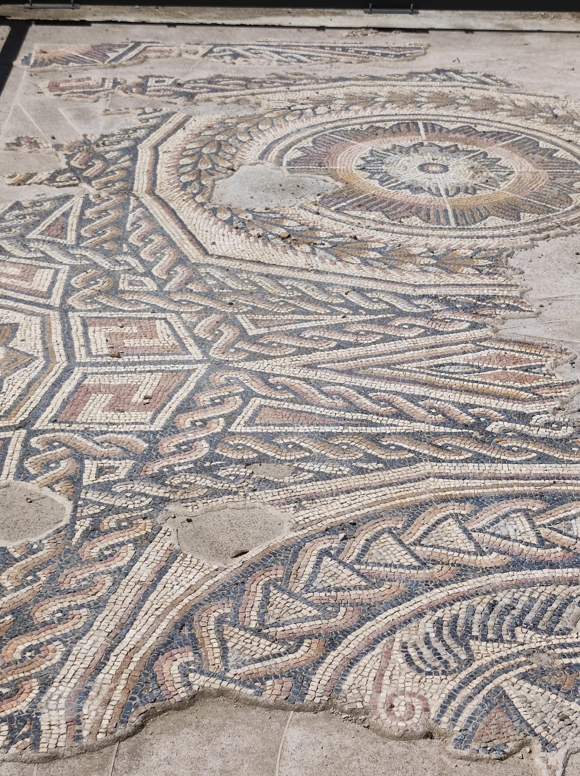
The living quarters were arranged around several courtyards and internal gardens. Their design incorporated views towards the Pyrenean landscape. The principal peristyle, a courtyard surrounded by a colonnade, measured approximately 60 metres in diameter and was encircled by rooms. Marble, mosaics, and statues enriched the residence, and a mosaic decorated one of its antechambers.
Second peristyle
A smaller second peristyle extended the residence towards the northeast. Its apses were associated with gardens and aquaria, adding shaped water and planted spaces to the residential plan. Together with the principal court, this area formed part of the palace’s internal arrangement of open spaces and rooms.
Bathing and service areas
Bathing wing
A bathing wing stood northwest of the main residential area. It included a nymphaeum, an ornamental water installation, an outdoor pool, and a frigidarium, the cold-water room of a Roman bath complex. An atrium and a basin were also among the components of the villa.
Workshops and heating system
The estate’s supporting buildings included smithies, a workshop for tiles and bricks, and a weaving workshop. The residential complex was heated by a hypocaust, an underfloor system in which hot air circulated through a space beneath the floor.
Building II and the deep shaft
Building II
Near the southern end of the principal façade, about 60 metres from the Save, Building II contained several rooms. One room held a solid mass 3.42 metres high that appears to have supported a heavy object placed above the floor. Its purpose remains tied to the interpretation of this unusual structural feature.
Sealed pit or shaft
Approximately two metres outside the northern corner of Building II was a sealed pit or shaft. It contained ashes, bones, a bracelet, coins, assorted tools, demolition material, and other debris. The bottom lay 10.60 metres below ground, on blue marl and 6.08 metres above the level of the Save.
The shaft has been interpreted in two possible ways. The absence of water infiltration led to the suggestion that it collected rainwater. Its substantial lower construction, an ash deposit confined to the lowest 2.60 metres, and several closures have also prompted an interpretation as a possible funerary well. These features preserve evidence of activities and deposits associated with the later estate, while leaving the shaft’s original function unresolved.