Aqueduct Fréjus: Roman Water Supply in France


Site at a Glance
- Rating
- 4.5
- Popularity
- Very Low
- Country
- France
- Primary era
- Classical
- Eras represented
- Classical, Modern
- Civilizations
- French, Roman
- Site type
- Infrastructure
- Remains
- Aqueduct
On this page25 sections
History
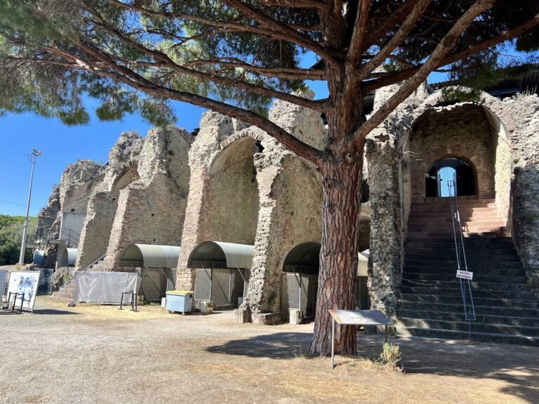
The Aqueduct Fréjus is a Roman water-supply system in Fréjus, France, built for Forum Iulii during the middle or second half of the first century AD. The city had been founded by Julius Caesar in 49 BC, and Augustus, the first Roman emperor, later established a colony there for veterans of the Eighth Legion. The aqueduct supplied the growing settlement, whose public works included ramparts, an amphitheatre, a theatre, and harbour installations.
Forum Iulii and the first water supply
Part of the fleet captured from Mark Antony at Actium was stationed at Fréjus, helping to establish the city as an important Roman centre. The aqueduct was built after the city ramparts had been constructed. Its first route began at the La Foux spring near Fondurane and extended for about 26 kilometres to Fréjus.
About twenty years later, the system was extended by approximately 13.5 kilometres to the more abundant Neissoun spring in the Siagnole valley. The result was a two-source, or bicephalous, aqueduct, meaning that its supply came from two springs whose branches were connected within the wider system. The original La Foux source was apparently abandoned for the main supply after the Neissoun extension, although later changes altered the relationship between the two branches.
Roman operation and later medieval use
The aqueduct supplied Forum Iulii for several centuries. Its exact period of operation remains uncertain. Mineral deposits inside the conduit have been used to estimate about 305 years of use, while other descriptions place its service at more than four centuries and conclude that it ended during the fifth century. The date of construction, the length of the building process, its cost, and its financing are likewise not known with precision.
After antiquity, parts of the aqueduct were abandoned, damaged, or adapted for other purposes. Sections in the Fondurane plain were used for irrigation, while another part served a mill and a sawmill. The upper section may also have been maintained by the Villeneuve family to supply its fiefs at Beauregard, San-Peyre, Pibresson, Cananilles, Font-Bouillen, Velnasque, and Tourrettes.
During the siege of Fréjus in 1590, the French commander Bernard de La Valette reportedly put the aqueduct out of service in an effort to force the siege to end before moving against Mons. The date when the entire system finally ceased to operate is otherwise unknown.
Modern reuse and damage
In 1794, part of the Roman channel was reused for a water supply known as the Second Convention. A concession established in 1874 used the ancient channel to provide about 26,000 cubic metres of water per day for irrigation around Caillan and Montauroux. Around 1892 or 1894, the system was partly rebuilt and extended, including the installation of a 40-centimetre-diameter asbestos-cement pipe, to supply Fréjus and Saint-Raphaël.
The capacity was later increased to approximately 32,500 cubic metres per day and, after the First World War, to about 37,000 cubic metres per day. This water served Fréjus, Saint-Raphaël, nearby mountain towns, military camps, and a hospital. The upper part of the aqueduct remains partly reused, while most of the ancient system is disused.
The Malpasset dam was built in the Reyran valley in 1950. In 1959, heavy rain and the failure of its eastern support along an unrecognized geological fault caused the dam to collapse. The resulting flood killed 420 people, destroyed extensive infrastructure, and washed away several sections of the aqueduct. About 4.5 kilometres of the ancient route had already been submerged by the reservoir before the disaster.
Construction of the Saint-Cassien dam in 1962 created another reservoir that inundated parts of the aqueduct. Sections beneath the water were observed during the severe drought of September 2006. Elsewhere, agricultural development, housing estates, parking areas, and urbanization affected the route, especially around Callian, Montauroux, and Fréjus.
Investigation and conservation
The Aqueduct Fréjus was designated a French Historic Monument in 1886. Archaeological work on spring deposits, archives, surviving structures, and construction traces clarified the relationship between the La Foux and Neissoun branches. Restoration work is recorded in 1941 and 2018, while other portions remain damaged or require conservation. Fieldwork and the study of carbonate deposits continue to explain the aqueduct’s route, periods of use, and changing condition.
Remains
The aqueduct extends for approximately 42 kilometres, with a more precise recorded length of 41.567 kilometres. It descends from the Neissoun spring, at about 515 to 516 metres above sea level, to the city’s water-distribution basin at approximately 34 to 35 metres. The total fall is about 481 metres. Its average gradient is approximately 1.1 to 1.2 percent, decreasing to about 0.14 percent in the Biançon and Vaux section and to between 0.16 and 0.12 percent near Fréjus.
About 36.4 kilometres of the route was carried in a covered conduit. Elsewhere, the water channel crossed the landscape on bridges, along walls, through tunnels, or in rock cuttings. The route included 36 aqueduct bridges, of which 28 were in the Reyran valley. After crossing the watershed near the Vaux valley, it followed both the Siagne and Reyran drainage systems.
Construction and water channel
The Roman structure generally had a concrete floor about 0.40 metres thick, side walls about 0.45 metres thick, and a vault formed over temporary supports. The complete structure was about 2.4 metres high. Within it, the specus, the enclosed channel through which the water flowed, was approximately 1.6 metres high and 0.60 to 0.70 metres wide. A surviving section at Fondurane measures about 0.60 to 0.68 metres wide and 1.4 to 1.5 metres high.
The builders used lime concrete containing centimetre-sized aggregates and a waterproof mortar mixed with crushed brick and tile fragments. Materials varied along the route because it crossed karstic, sedimentary, metamorphic, and volcanic geological zones. Several quarries and lime kilns are associated with the aqueduct.
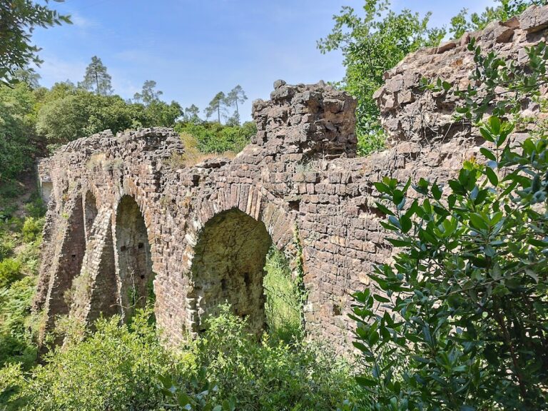
Exposed bridge and wall surfaces were faced with regular courses of small coloured stones, often alternating red and green masonry. Some sections used alternating bands of stone and tile. The arches generally have two rings of wedge-shaped blocks, called voussoirs, including an inner ring of thin, elongated pieces. Their double arrangement was probably ornamental. Pillars often have sloping buttresses that give them a cross-shaped plan, and some bridges also contain lower cross-bracing arches.
Sources and upper route
La Foux spring
The La Foux spring lies near Fondurane at about 160 metres above sea level and approximately 26 kilometres from Fréjus. It was rediscovered in 1982, and deposits examined in 1990 demonstrated its original connection with the Roman aqueduct. A manhole stands about 2.5 metres from the spring, where the channel occupies a trench approximately 2.2 metres wide.
The aqueduct passed east of the spring, crossed the Biançon valley, turned east along the river’s right bank, and then crossed the Carpenée valley. The Carpenée bridge retains visible bridgehead remains, while the Biançon crossing is no longer visible. The Saoutet bridge and other crossings at Fontfreye and La Fustière lie beneath the Saint-Cassien reservoir.
Neissoun spring
The Neissoun spring is on the left bank of the Fil, also called the Siagnole de Mons, about 300 metres below Mons. Its ancient source installations have not survived. Farther downstream, the conduit was built from large ashlar blocks joined with metal clamps and covered by flat stone slabs in a cutting along the left bank. A bridge made from large limestone blocks crossed to the right bank about 100 metres downstream, but only its left bridgehead remains.
Near the source, the channel followed the right bank of the creek underground. It included the Saint-Thomas bridge, the Roche Taillée cutting, a small bridge over the Ambus creeklet, and another bridge at Saint-Peire that has disappeared.
Rock cuttings and buried channel
The Roche Taillée is a cutting through Jurassic limestone, approximately 12 metres deep and 30 metres long. A rock arch was left standing to stabilize its sides. An earlier attempt to cut a shallower trench near the edge of a 150-metre-high cliff collapsed into the valley, so the later channel was made farther into the rock at greater depth. The reused channel known as the Jourdan canal still runs along the bottom.
Near Jas Neuf, the aqueduct passed through another limestone cutting about 15 metres deep. Between Jas Neuf and Fondurane, it was buried for approximately 9 kilometres and descended steeply toward the Camiole valley. Gradients reached about 10 percent and locally 24 percent west of Callian. Chutes may have been used on this steep section, although their remains have not been found.
Branching of the two sources
The two branches underwent several changes. La Foux initially supplied Fréjus, after which a branch from Neissoun took over the beginning of the La Foux channel. La Foux later supplied a nearby mill through a new conduit, and its channel was subsequently restored. The Neissoun branch then joined it about 250 metres from its beginning. A separate branch crossing the Biançon near the springs may have provided an alternative route when the principal crossings were vulnerable.
Reyran valley bridges
In the Reyran valley, the aqueduct followed the left bank for about 5.3 kilometres as a buried channel, crossing side valleys on bridges and wall sections. The Jaumin bridge was doubled. Its older western bridge has collapsed, while the two conduits join downstream. The Madeleine structure, a section carried on a wall upstream from the Malpasset dam, was destroyed in the 1959 flood.
Esquine bridge
The Esquine, or Bonhomme, bridge crossed the Apié d’Amic creek. It originally had eight arches, of which five downstream arches survive, reaching about 10 metres in height. A second conduit and additional arches were later added on its north side. The bridge stood in a side valley outside the main flood flow and survived the Malpasset disaster.
Central Reyran crossings
The Grisolle 2 bridge was one of four double bridges in the valley. Only part of its downstream bridgehead survives. The Collet du Reyran bridge, also called Arche Magail, has a small 1.53-metre arch set within a 25-metre supporting wall. The Bouteillière bridge retains three arches, reaching up to 12 metres high, together with massive bridgeheads.
Other crossings include the damaged single-arch Castellas bridge, the skew-arched Biaise bridge, the Pont de la Moutte with six arches reaching up to 12 metres high, and the single-arch Gargalon North bridge. Wall sections also survive or are recorded at Malpasset-aval, Bosquets, Sainte-Brigitte, and Gorgo-Vent.
Sénéquier bridge
The Sénéquier, or Escoffier, bridge is a double structure made up of two bridges that diverge a few metres apart. The eastern bridge is older. Each bridge has six arches with sloping buttresses reaching about 12 metres. The western bridge has unequal spacing between its pillars, including an offset pillar that supports one narrow arch and one wide arch. The wide arch has a lower cross-bracing arch.
Mineral deposits inside the channels show that both conduits functioned simultaneously for at least part of their history. The duplication may have followed the collapse of part of the first bridge.
Gargalon bridge
The Gargalon bridge crossed a broad valley for approximately 234 metres and originally had 14 arches reaching up to 12 metres high. One arch still spans the road, while other arches survive among fields. Four tall pillars have sloping buttresses. The bridge was intact in the nineteenth century, but one arch collapsed in 1967, and the remaining structures are heavily overgrown. The covered conduit and a manhole are visible on the north side of the valley.
Bérenguier and Combe de Rome bridges
The Bérenguier bridge is approximately 60 metres long and has five arches reaching up to 5 metres high. The Combe de Rome, or Bonnet, bridge originally had five arches reaching up to 6 metres. Two of its arches were demolished during later development.
Vaux gallery and submerged sections
The route used principal tunnels at San-Peyre, Pibresson, Esquine, and the 852-metre Vaux gallery. Shorter underground passages occurred at Gayet, Boson-Escoffier, and Moutte. The Vaux gallery crossed the watershed between the Siagne and Reyran river systems and has remained beneath the Saint-Cassien reservoir since the reservoir was formed.
At Fondurane and elsewhere, parts of the route are concealed by the reservoir or by later development. The surviving fabric includes buried and exposed channels, bridgeheads, arches, wall sections, rock cuttings, tunnels, manholes, and sections modified by modern water conduits.
Approach to Fréjus
Saint-Brigitte wall
The Saint-Brigitte wall is approximately 37 metres long and between 1 and 1.5 metres high. Parts of the enclosed water channel survive within it, showing how the aqueduct was carried across lower ground without a full bridge arcade.
Sainte-Croix arcade
Near Fréjus, the aqueduct emerged from the ground in the Parc de la Villa Aurélienne. It then ran briefly on a wall before continuing as an arcade toward the city. This arcade was approximately 710 metres long and originally contained 87 arches, with pillars reaching up to 16 metres. Surviving sections use small coloured masonry, and some pillars have alternating tile courses and prominent sloping buttresses.
The final arcade is also known as the Arcs de Sainte-Croix. It changed direction where it met the route of the Via Aurelia, which ran parallel to part of the arcade. Ten arches and nine isolated piers remain visible in the park and along Avenue du XVe Corps.
City ramparts
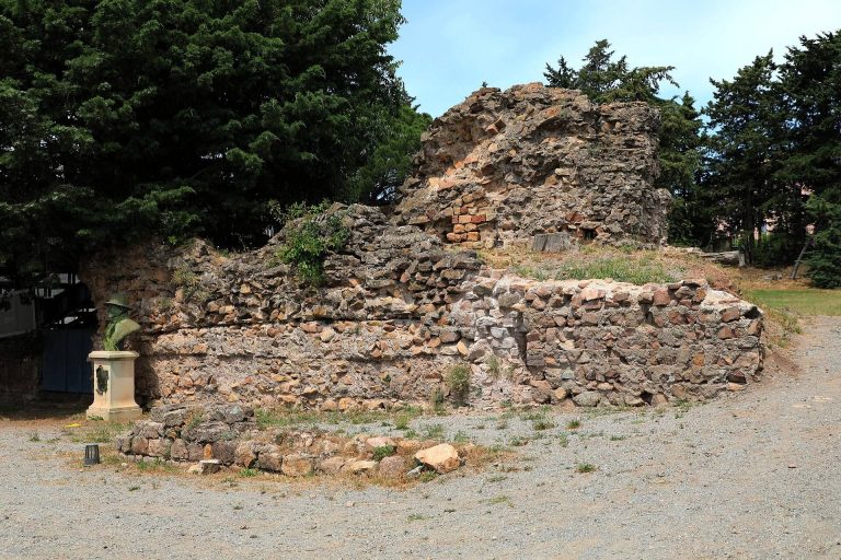
For its last 700 metres, the conduit followed the top of the Roman ramparts. It crossed the northern gate over the north tower, passed through or over towers on the northeast and northwest sides, and cut across the northwest corner of the wall rather than following the wall’s entire angle. Several arches survive, although the associated gate towers and other towers have collapsed or disappeared.
Castellum aquae
The aqueduct ended at a castellum aquae, a Roman water-distribution basin that divided the incoming supply among the city’s networks. The basin stood near the Moulin à Vent quarter at the end of Rue du Bel-Air, approximately 35 metres above sea level. The site has been built over by a private house, but an open channel from the city’s internal distribution system remains in Rue du Bel-Air.
Mineral deposits and preservation
Mineral-rich water formed carbonate deposits inside the conduit at an estimated rate of about one millimetre per year, reaching roughly 10 centimetres per century in some conditions. These layers narrowed the water passage and added weight to the bridge structures, making periodic cleaning necessary. Their annual layering has also been used to investigate past climate conditions.
Urbanization around Fréjus destroyed or concealed much of the secondary distribution network and the Villeneuve baths. The remaining channels, bridges, cuttings, tunnels, and arcades preserve the physical record of a water system that had to cross steep valleys, unstable geological formations, and the watershed between two drainage basins.