Forte Sapé: An Italian Fortification Controlling the Susa Valley


Site at a Glance
- Rating
- 4.3
- Popularity
- Very Low
- Country
- Italy
- Primary era
- Modern
- External website
- Open
- Eras represented
- Modern
- Civilizations
- Italian
- Site type
- Military
- Remains
- Fort
On this page7 sections
History
Forte Sapé is a concrete military fortification in Italy, built between 1884 and 1886 to control the Salbertrand plain and the opposite slope of the Susa Valley. Designed by the military engineer Darbesio and constructed by the military engineering corps, it formed part of the Exilles fortress group, a network of defensive works intended to control routes through the valley and its surrounding approaches.
Planning and construction
In 1874, the Italian Ministry of War planned the Sapé Battery as a two-storey casemated work. A casemate was a protected chamber for artillery or troops. The proposed battery was to stand within a large ditch and carry four 9 ARC Ret guns, firing toward the access routes to Forte Fenil on the opposite side of the valley.
The same plan gave supporting roles to Forte Clot Riond, which was intended to cover the Salbertrand plain, and Forte Icharette. Neither work was built. Military spending cuts instead led to the consolidation of the planned Clot Riond and Sapé works into a single fort, and the completed Forte Sapé absorbed the functions originally assigned to both positions.
The finished fort differed substantially from the 1874 design. Its artillery was placed in open barbette positions, meaning gun platforms from which artillery fired over a parapet, and the building rose mainly to one storey rather than two. It received eight 12 GRC Ret guns. Four covered the Salbertrand plain, replacing the 15 GRC Ret guns intended for Forte Clot Riond, while the other four covered the opposite side of the Susa Valley in place of the planned casemated battery.
Military use and decommissioning
The four guns aimed toward the left side of the valley formed the lower battery. The other four, directed toward the Salbertrand plain, occupied the higher battery. The artillery of the Exilles fortress group was supplied with 600 rounds per gun, consisting of 200 grenades, 390 shrapnel rounds, and 10 cases of machine-gun ammunition. Shrapnel ammunition was designed to scatter many small projectiles over an area.
Forte Sapé’s strategic function ended in 1915. Like the other fortifications of the Exilles fortress group, it was disarmed during the First World War, and its guns were sent to the Eastern Front. The works were abandoned after the war, apart from Forte Fenil, which was converted into a shell depot for occasional batteries planned for the area during mobilization.
Forte Sapé was definitively decommissioned in 1928. Its position more than 20 kilometres from the French border, together with its earlier decommissioning, meant that it was not demolished when Italy was defeated in the Second World War.
Remains
Artillery batteries
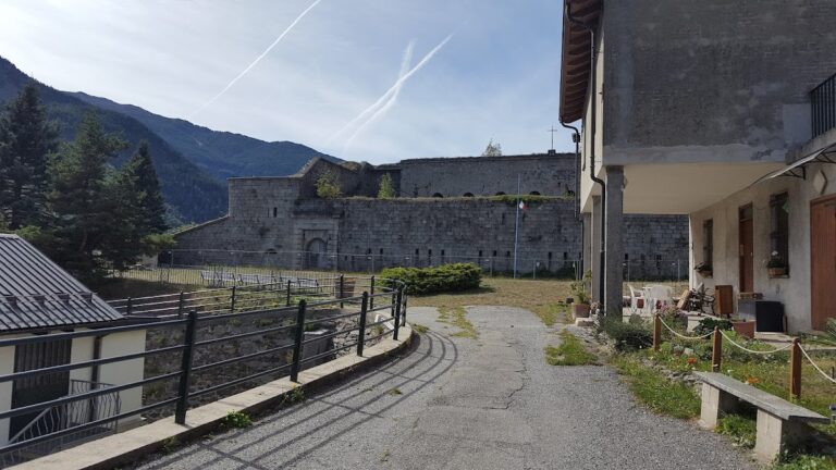
Forte Sapé stands at an elevation of 1,187 metres on the edge of the Gran Bosco di Salbertrand Natural Park. The lower battery occupies the lower northwestern line and is divided into two sections by traverses, protective barriers that cross or interrupt a ditch and contain ammunition recesses. The higher battery lies at a greater elevation and faces west toward the Salbertrand plain. A high parapet protects its right flank.
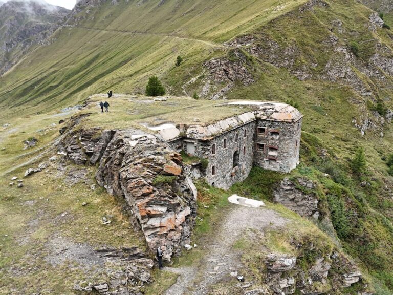
The fort’s concrete structure survives in moderately good condition, although trees and shrubs have almost completely overgrown it. Its artillery, interior furnishings, and metal components were removed long ago. A road beginning west of the lower-battery line, near the riflemen’s position, climbed toward the higher battery through tight switchbacks, with steps on some sections.
Interior arrangement
The ground floor contained the troop quarters, while the powder magazine stood at the western end. A shaft with a spiral staircase connected the magazine to the higher battery. The southern end of the fort rose to two storeys, with the entrance vestibule and guardroom on the upper level. From the vestibule, a staircase descended to the lower level, where the quarters and magazines were arranged.
The rooms opened onto the western ditch through a row of loopholes, while windows on the eastern ditch provided light for the quarters. The vestibule also gave direct access to the lower battery. A long corridor ran along the full length of the main wing, ending at the south in a hoist shaft and spiral staircase that led to the ammunition recess between the two sections of the higher battery. A traverse in the southern ditch contained the kitchen and sanitary facilities.
Ditches and entrance defenses
The entrance was on the southern side and originally crossed the ditch by a bridge that combined a fixed section with a drawbridge. A bridge-support pier carried the crossing, but the drawbridge has since been removed. The main entrance can therefore no longer be reached by its original approach. Entry through much of the fort remains possible from around the work and up the western terreplein, a level defensive platform formed by an earth-filled rampart, toward the lower battery.
A caponier, a fortified structure projecting into a ditch for flanking fire, interrupted the eastern ditch. On one side it connected with a counterscarp gallery, a defensive passage along the outer side of a ditch, extending beside the eastern and northern ditches. On the other, it connected with the powder magazine beneath the uphill earthwork.
The unbuilt 1874 scheme would have given the work a northwestern front, two caponiers, and a broad ditch separated from the fort by a counterscarp wall supporting the excavation sides. It also provided for ground-floor quarters and services, a powder magazine at the west-southwestern corner, four upper-storey casemates with rifled-gun embrasures, officers’ quarters, and a flat roof. The planned roof consisted of a one-metre concrete slab over semicircular barrel vaults, covered by two metres of earth. A parapet with rifle loopholes was to run along the southeastern edge, and a drawbridge at the east-southeastern corner was to lead directly to the casemate level.
Nearby sites