Fortaleza de Sagres: A Portuguese Coastal Fortress in the Algarve


Site at a Glance
- Rating
- 4.4
- Popularity
- Very High
- Country
- Portugal
- Primary era
- Early Modern
- External website
- Open
- Eras represented
- Medieval, Early Modern, Modern
- Civilizations
- Portuguese
- Site type
- Military
- Remains
- Fort
On this page21 sections
History
Fortaleza de Sagres is a military fortress in Portugal, near Sagres in the Algarve, probably built during the fifteenth century on the orders of Henry the Navigator. It defended the western Algarve coast, maritime routes between the Atlantic and Mediterranean, and the port of Sagres, which supported Portuguese exploration and fishing. Its position also made it useful to early Portuguese voyages, since ships could shelter in nearby coves, traffic could be watched, and information from expansion into North Africa could be processed in an isolated setting.
The promontory before the fortress
The wider Sagres region was occupied from at least the Early Neolithic, and Roman remains found nearby indicate activity in the surrounding area. Classical writers associated the wider promontory with sacred traditions and possible worship of Saturn or Hercules. It was also linked with Saint Vincent, whose remains were transferred to Lisbon on the orders of King Afonso I of Portugal in the twelfth century.
During the Muslim period, a sanctuary or church associated with Saint Vincent may have stood on the promontory. The medieval geographer Muhammad al-Idrisi described a place there as the Temple of the Raven. The precise location and extent of the ancient sacred promontory remain uncertain, while the tradition connected with Saint Vincent probably continued until the transfer of his remains.
Henry the Navigator and Vila do Infante
On October 27, 1443, the Portuguese Crown granted Cape Saint Vincent and its surrounding territory to Henry the Navigator for life. The area was then described as lonely, deserted, and distant from villages. Henry intended to colonize it by creating one or more settlements, and subsequently developed an estate and settlement known as Vila do Infante. He also called it his town of Terçanaball or Terçanaval.
A theory advanced in 1961 places Vila do Infante where the fortress later stood, and traces of earlier masonry were found there. The original complex may have contained a walled group of buildings and a central residence or palace, although its precise arrangement remains uncertain. The settlement expanded during the 1450s through the arrival of Henry’s associates and the exile of various people there.
On October 14, 1459, Henry established the parish of Santa Maria and entrusted it to the Order of Christ, a Portuguese religious and military order that inherited the institutional role of the medieval Knights Templar in Portugal. Henry moved to the western Algarve in 1459 and died at Vila do Infante in Sagres on November 13, 1460.
A tradition holds that Henry founded a navigation school at Sagres. The existence of a formal school is doubtful. The settlement began functioning only around 1446, after major advances such as Gil Eanes’s passage of Cape Bojador, and Lagos was the principal center of Portuguese voyages during Henry’s lifetime. Sagres nevertheless played an important part in the beginnings of the Portuguese discoveries.
Decline, administration, and coastal defense
After Henry’s death, Sagres declined and passed through several forms of administration. In 1471, Afonso V granted the fief extending to Cape Saint Vincent to Rui de Sousa. Rodrigo Anes received the captaincy of Sagres in 1487, and in 1495 King John II granted him the highest local alcaidaria, the jurisdiction of a local governor or military commander responsible for a fortified place. Rui de Sousa’s son João later inherited the lordship, which subsequently passed to the Counts of Prado and Marquises of Minas.
Sagres initially depended on the distant parish of Aldeia do Bispo for religious services. Manuel I founded the parish of Sagres on November 12, 1519, and ordered a parish church to counter the settlement’s decline and its increasingly military character. In 1521, Alexandre de Freitas received the offices of captain and chief mayor. After his death at Azemmour, his brother Manuel de Freitas took office in 1536.
The fortress formed the principal element of a coastal-defense system supported by the nearby fortresses of Belixe and São Vicente. In 1587, the English privateer Francis Drake raided Sagres, sacked the settlement, and destroyed much of the fortress. An English depiction made before the raid provides probably the oldest surviving visual evidence of the fortification.
In 1631, King Philip III of Portugal ordered repairs to sections of the damaged outer walls. Following the restoration of Portuguese independence in 1640, an additional outer fortification was installed according to the system associated with the Count of Pagan. A modernization designed in 1621 by the military engineer Alexandre Massai was not carried out. Later seventeenth-century works reused parts of the older walls and added artillery batteries, while the new outer walls remained incomplete beside the earlier defenses.
Earthquake reconstruction and military decline
The 1755 Lisbon earthquake and the tsunami that followed severely damaged the fortress and destroyed its original walls. Reconstruction began in 1793 under José de Sande Vasconcelos, who coordinated work according to a substantially altered plan. The rebuilding focused on the barracks, Governor’s House, the building beside the cistern, the church, military stores, and the outer wall. The access tunnel and central turret were constructed over approximately twenty-four years during the transition from the eighteenth to the nineteenth century. Traces of an earlier wall, probably associated with Henry’s period, survived in the turret’s north wall.
During the nineteenth century, the fortress lost its strategic importance. By 1843 it had a small garrison and its moat had disappeared; in 1886 it was occupied by a small infantry detachment belonging to the Lagos garrison. It still coordinated the western Algarve defense line during continuing nineteenth-century conflicts, but its defensive functions ended by the close of that century. A memorial to Henry the Navigator was installed near the entrance in 1840.
Restoration and historical interpretation
After its military role ended, the fortress became closely associated with Portugal’s Age of Discovery. This association became especially prominent during the Estado Novo, Portugal’s authoritarian regime from 1933 to 1974, whose official culture promoted national history, maritime expansion, and Henry’s image. Plans for a monument to Henry inside the fortress led to several unsuccessful competitions between the 1930s and 1950s.
Major restoration campaigns took place in the 1950s and 1960s, when the fortress was in an advanced state of decay. Buildings traditionally associated with Henry’s period were reconstructed or restored, the church was repaired, and an auditorium was created for documentaries about Henry. The interventions were controversial because some critics regarded them as an attempt to recreate an authenticity that had never existed.
Further restoration occurred during the 1980s. New buildings designed by the architect João Carreira were begun inside the fortress in 1991, provoking local opposition because of their modern design. A planned 260-meter corridor, 8 meters high and 6 meters wide, intended to present the Via dos Descobrimentos, was not completed. Work in 1996 and 1997 reorganized the exterior and produced the white coating now applied to the outer walls.
Archaeological surveys in 2005 examined the original entrance, the development of its architecture, the drawbridge, and earlier access routes, establishing the size and form of the moat. Archaeological monitoring in 2008 accompanied work on the access tunnel and central court and helped identify changes to these features over time. A requalification project carried out from 2009 to 2010 combined landscape work, conservation maintenance, reorganization of the fortress, geophysical study of the Rose of the Winds, improved accessibility, and adaptation of buildings erected in the 1990s. Storm damage in 2005 and severe weather in 2017 led to further repair work.
Fortaleza de Sagres was designated a Portuguese National Monument by decree on June 16, 1910. A Special Protection Zone was established in 1962 and amended in 1986 and 1987. The fortress received the European Heritage Label in 2015 and was included in the First Globalization Places list as a UNESCO World Heritage Site on January 31, 2017. It is maintained as a museum and remains central to the historical interpretation of Henry the Navigator and the Portuguese discoveries.
Remains
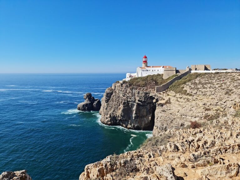
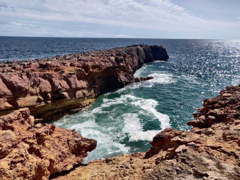
The fortress occupies a steep promontory east of Cape Saint Vincent, approximately 1 kilometer long, 300 meters wide, and 40 meters high. Cliffs protect three sides, while the fortification closes the landward approach. Within the Southwest Alentejo and Vicentine Coast Natural Park, the complex follows a broadly polygonal plan in Renaissance-Mannerist architecture, combining Renaissance planning and classical forms with the more complex proportions associated with Mannerism. The principal landward wall is combined with six batteries facing the ocean, with bastions at both sides and a central raised artillery platform, or cavalier, facing inland.
Walls, entrance, and artillery
Landward defenses
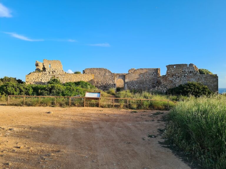
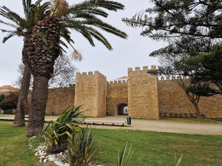
The walls rebuilt from 1793 were lower and more compact than the earlier defenses. Their rendered mortar was intended to absorb the impact of artillery. Two half-bastions, projecting defensive works with one full flank, stood at the ends of the landward wall. They are dedicated to Saint Barbara and Saint Anthony. Other batteries, guard structures, and wheeled cannons formed part of the fortress’s defensive equipment.
Central cavalier and portal
In 1843, the central cavalier was approximately 11.43 meters high and square. Its parapets formed a pentagonal outline and carried cannons. The central turret and access tunnel belong to a later phase, although the turret incorporates an earlier wall in its north side.
The neoclassical monumental portal has carved stone wedge-shaped blocks, two padded stones, and a third stone serving as a base. Restoration altered the corners and widened them from 60 centimeters to 1 meter. Above the portal are a coat of arms and an inscription commemorating Nuno José Fulgêncio João Nepomuceno de Mendonça e Moura, governor of the Algarve in 1793. A memorial plaque to Henry the Navigator appears on the inner side of the entrance.
Entrance tunnel and moat
The portal opens into a tunnel leading toward the grass-covered inner court. The passage ran beneath the central repairs and turret through a vaulted room, which connected with the fortress interior beside the entrance to the guardhouse. Archaeological investigations revealed the former moat and drawbridge, a movable bridge that controlled access across the defensive ditch.
Buildings and domestic spaces
Residences and military buildings
The interior contained the House of the Cosmographer, the Governor’s House, the House of the Infante, the later House of the Captains, residences, chambers, warehouses, military stores, and barracks. A southern building first identified as a warehouse was later used as a stable, whose ruins survive. The cistern, a built reservoir for storing water, is an original element associated with Vila do Infante.
Central and western buildings
West of the church stood a rectangular building with a hipped roof and nine doors. The central building was square and originally consisted of two two-story bodies joined by a curtain wall. One body had three doors, two windows on the first floor, and five on the upper floor. The eastern body, known as the Governor’s House, was rectangular and had two doors and two upper-floor windows.
Later cultural buildings
The fortress contains an auditorium and later exhibition and multimedia buildings. The proposed exhibition corridor for the Via dos Descobrimentos was not completed, while some buildings from the 1990s were later adapted for cultural and interpretive purposes. Historic structures and the promontory are connected by descriptive paths, and a two-kilometer walkway was installed to improve access for people with reduced mobility.
Religious features and the Rose of the Winds
Rose of the Winds
The circular Rose of the Winds is formed by irregular stones arranged as a radiating star with 32 directions inside a circle. It was discovered in the seventeenth century and rediscovered in 1921. It is generally considered a sundial or the gnomon, the projecting part that casts a sundial’s shadow. It may have been associated with a circular hermitage dedicated to Saint Mary.
Church of Our Lady of Grace
The Church of Our Lady of Grace, founded during Henry’s period and originally dedicated to Saint Mary, has a longitudinal single nave, a quadrangular apse, and a similarly shaped sacristy on the south. The nave has a barrel vault, a continuous curved ceiling, beneath a gabled roof. The chancel, the part containing the main altar and reserved for the clergy, is covered by a dome on horns, a dome supported above a square space by transitional structural elements.
The church facades are divided into plain bays and include the entrance portal, belfry, sacristy, and nave. An eastern stairway leads to the bell tower, and the interior contains a series of tombstones. The present building may have replaced an earlier Saint Mary chapel around 1570. Its sacristy and belfry were enlarged after the 1755 earthquake, while the bell tower occupies the former location of the cemetery ossuary. Since 1997, the church has housed the Baroque altarpiece from the Chapel of Saint Catherine at the Fortress of Belixe, transferred there for security reasons.
Lighthouse and archaeological materials
Lighthouse
A lighthouse has stood inside the fortress since the late nineteenth century. The present lighthouse, built in 1960, is the third on the site. It is 11 meters high and stands 53 meters above sea level. Its red light flashes every two seconds and is remotely controlled from the nearby Cape Saint Vincent lighthouse.
Excavated objects
Archaeological excavations recovered ceramic containers, earthenware, building materials, glass fragments, and metal components. Together with the surviving walls, buildings, church, cistern, batteries, central turret, stable ruins, and access works, these materials contribute to the interpretation of the fortress’s successive military, religious, domestic, and cultural uses.