Fort van Beieren: An Early-Eighteenth-Century Fortification near Bruges


Site at a Glance
- Rating
- 4.3
- Popularity
- Low
- Country
- Belgium
- Primary era
- Early Modern
- External website
- Open
- Eras represented
- Early Modern
- Civilizations
- French
- Site type
- Military
- Remains
- Fort
On this page6 sections
History
Fort van Beieren is an early-eighteenth-century French fortification near Koolkerke in Bruges, Belgium. French troops established it at the beginning of the eighteenth century during the War of the Spanish Succession, a European conflict over the Spanish throne that followed the death of Charles II without a direct heir. The fort was intended to defend Bruges against attacks from the Northern Netherlands.
French construction and military use
The design is sometimes attributed to Sébastien Le Prestre de Vauban, the French military engineer whose fortress principles influenced European defenses, but it was probably produced by one of his collaborators. Vauban was in Bruges during this period and prepared a large project to rebuild the city walls completely, although that scheme was never carried out.
Five French battalions were stationed at Fort van Beieren, but the fort was never attacked. After English and Dutch forces occupied Flanders in 1706, its military purpose declined. Flanders came under Austrian rule in 1715, and the last soldiers departed in 1748.
Later ownership and archaeological work
The fort remained in private ownership during the nineteenth and twentieth centuries. German forces used it again during the Second World War. A small castle beside the fort suffered such severe wartime damage that it was later demolished, while several associated elements survived.
The Province of West Flanders purchased Fort van Beieren in 1998. In 2012 and 2013, the northern bastion was reconstructed using surviving remains, historic plans, and archaeological research. The work restored about one quarter of the fort to its original form and formed part of the cross-border European project Forten en Linies in Grensbreed Perspectief, which reassessed the State-Spanish Lines, a network of early-modern defensive works linked to conflicts among the Dutch Republic, Spain, Austria, and France in the Low Countries.
Remains of the Ter Stappen castle estate were excavated immediately beside the fort in 2017. Working with residents of Koolkerke, archaeologists planned from the end of 2020 to expose all remaining traces of the estate.
Remains
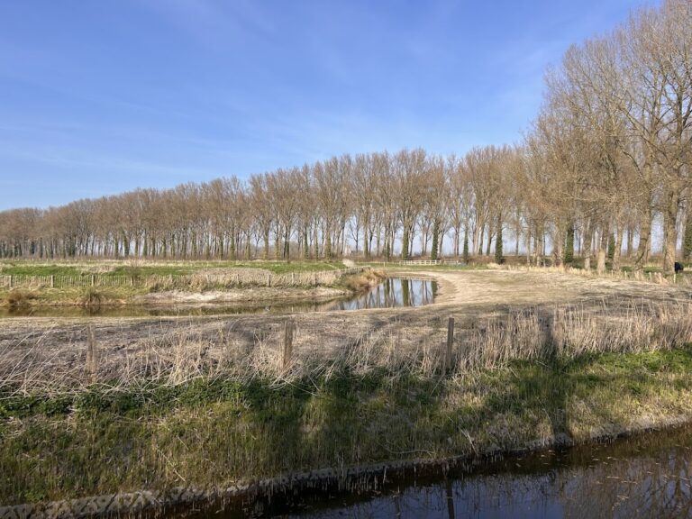
Fort van Beieren is an earthen fort with a square plan whose contours remain well preserved. A central courtyard is enclosed by an earthen rampart with four bastions, projecting sections designed to allow defensive fire along adjoining walls. Beyond this rampart is a moat containing a ravelin, a detached defensive work placed in front of a fortification. A second earthen rampart and an outer moat complete the layered defensive arrangement.
Reconstructed northern bastion
The northern bastion was reconstructed in 2012 and 2013 from the surviving earthworks, historic plans, and archaeological evidence. This intervention restored approximately one quarter of the fort to its original form while preserving the broader square layout and its surrounding defensive elements.
Castle remains and Ter Stappen estate
The adjacent castle has disappeared, but its entrance gate, a small outbuilding, an icehouse, and a walled garden survive. Remains of a greenhouse were present before being removed in 2012. Archaeological traces of the Ter Stappen castle estate lie immediately beside Fort van Beieren and were excavated in 2017.