Fort Uitermeer: A Dutch Water-Line Fort near Weesp


Site at a Glance
- Rating
- 4.2
- Popularity
- Low
- Country
- Netherlands
- Primary era
- Modern
- External website
- Open
- Eras represented
- Early Modern, Modern
- Civilizations
- Dutch
- Site type
- Military
- Remains
- Fort
On this page11 sections
History
Fort Uitermeer is a Dutch defensive site in the Netherlands near Weesp, developed from a sixteenth-century earthwork into a nineteenth-century tower fort. It guarded the passages between the Naardermeer and the Vecht, including the Amsterdam–Amersfoort railway and the road from Hilversum to Weesp along the present N236. Its position also allowed its guns to support Fort Hinderdam and the fortress of Weesp, while a nearby inundation lock could regulate water levels and flood the surrounding land for defence.
From earthwork to water-line fort
An earthwork was established here around 1589 to protect Weesp. After the construction of the ’s-Graveland Canal and its lock, the position became part of the Old Dutch Water Line, a Dutch defensive system that used controlled flooding to hinder an advancing army. In 1673, the earthwork was strengthened into a fort protecting the lock and the inundation area between the Vecht and Naarden.
The fort was integrated with navigation rather than intended to stop it. Ships continued to pass through the lock, paying two stuivers for a large vessel and half a stuiver for fishing and milk boats. The lock therefore served both transport and defence, allowing water traffic to continue while making it possible to inundate the adjoining land.
The Prussian invasion and French period
Fort Uitermeer fell during the Prussian invasion in the autumn of 1787. On 17 September, a Prussian reconnaissance force approached with a lieutenant, 40 cavalrymen, and 16 sharpshooters. The fort had only six soldiers and a sergeant in defence. The defenders had taken shelter from the rain in the guardhouse and had left the fortress bridge in the care of a farm laborer. After the lieutenant addressed him forcefully, the laborer lowered the bridge, and the fort was taken without a fight.
The position deteriorated during the French period, the era of French political and military dominance in the Netherlands, particularly under Napoleon. Its decline was reversed in 1845 with the construction of a tower fort. This was the first of three related tower forts, followed by the West Battery at the mouth of the Vecht near Muiden in 1852 and the tower fort at Ossenmarkt in Weesp in 1861.
Nineteenth-century modernization
A gun shed was added in 1874 to accommodate guns, ammunition, and their crews. Soon afterward, changes in artillery made the original tower increasingly vulnerable. In 1876, the introduction of explosive shells, artillery projectiles designed to burst through blast and fragments, prompted major alterations. The moat was filled, the drawbridge was removed, and the original entrance was sealed with masonry. A new guardhouse and an earth covering were added to protect the tower.
The lock was moved to the north side of the tower fort in 1878, and the ’s-Graveland Canal was rerouted around the position. Additional gun shelters followed in 1885. Around 1910, plans were prepared to rebuild Fort Uitermeer as a standard fort of the Stelling van Amsterdam, the defensive ring around Amsterdam that combined forts, artillery positions, inundation works, roads, and railways. The plans were withdrawn shortly after the outbreak of the First World War.
Twentieth-century military use
Fort Uitermeer was incorporated into the Stelling van Amsterdam in 1913. Approximately 175 men were assigned to guard the inundation lock and defend the two elevated routes into Amsterdam, the Amsterdam–Amersfoort railway and the canal with its adjoining road.
During the 1930s, groups of shelters and bunkers were built east of the fort, in the open ground and among the trenches. The shelters protected soldiers during bombardment. Strategically positioned bunkers, particularly those beside the railway, were equipped for either a machine gun or a cannon. The Dutch surrender in May 1940 took place before the front reached Fort Uitermeer. During the Second World War, German occupying forces used the fort for storage.
A Royal Decree of 25 January 1951 classified the fort as a “fortification of no class.” In 1954, the 102nd Mechanical Equipment Company of the Engineering Corps, based at Wezep, was ordered to demolish the fort and level the ground. The entrance gate was blown up in June, followed by the remaining bunkers during the summer, but the tower fort was only partly demolished. Its military function ended, although Defence continued to use the site for ammunition storage.
Conservation and later ownership
The state sold Fort Uitermeer to the province of North Holland in 1995. The province established a base there for road maintenance and muskrat control. On 22 April 2009, ownership passed to the Stichting Uiteraard Uitermeer for further development of the site. The fort is now partly used for hospitality, while the moat is managed by the Dutch nature organization Natuurmonumenten.
Fort Uitermeer forms part of both the former New Dutch Water Line and the Stelling van Amsterdam. The New Dutch Water Line was a defensive system based on controlled flooding around important towns and routes. The fort is legally protected as a national monument under the Dutch Rijksmonument system.
Remains
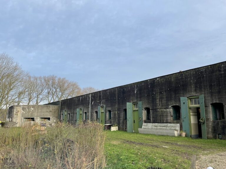
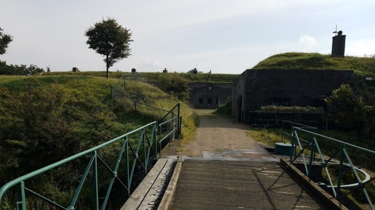
Fort Uitermeer occupies the east bank of the Vecht near the hamlet of Uitermeer. Its surviving military landscape combines the circular masonry tower fort, the gun shed, the surrounding moat, the former inundation works, and scattered twentieth-century shelters, magazines, and bunkers. Excavation has made the former lock visible again, while the relocated lock and rerouted canal reflect the changes made around the tower in the nineteenth century.
The tower fort and gun shed
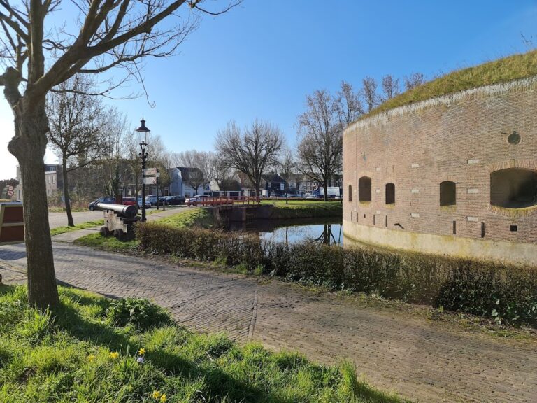
The tower fort built in 1845 is approximately 30 metres in diameter. Its two storeys surround an open courtyard, with a staircase running along the inner wall. The upper storey contained 12 rooms, each fitted with 10 bunks. Five further troop rooms occupied the ground floor, together with rooms for the guard and commander, an infirmary, and magazines for ammunition and food. Every room, including those on the ground floor, had three loopholes in the outer wall for defence.
The 1876 alterations changed both the protection and access of the tower. The original entrance was closed with masonry, and the brick parapet on the roof was replaced by a thick layer of sand. A new guardhouse was built on the south side, with a small doorway connecting it to the tower. An earth covering extended from the guardhouse and the east side of the tower across the roofs of both structures.
The earth covering was removed during the 1954 demolition, and much of the tower was destroyed. The outer brick walls remain standing. The former entrance survives through its foundation and a doorway that is still sealed with brickwork. The moat remains around the fort, and the tower overlooking the Vecht was restored in 2007.
The gun shed, added in 1874, survived the demolition of the 1950s and remains one of the two principal surviving fort buildings. It was designed to house guns, ammunition, and the crews who operated them, forming part of the later nineteenth-century defensive arrangements.
Twentieth-century defensive landscape
Shelters and bunkers
The shelters built east of the fort during the 1930s lie in the field and among the trenches. They were intended to protect soldiers during bombardment. Nearby bunkers were placed at strategic points, especially along the railway, and were equipped to accommodate either a machine gun or a cannon. Together, these structures preserve the later defensive layer of the fort’s military landscape.
Ammunition magazines and road obstacle
The period of ammunition storage is represented by small, scattered magazines for ammunition or explosives. These magazines belong to the site’s twentieth-century military fabric alongside the shelters and bunkers. A road-blocking “asparagus” obstacle was also installed on Provincial Road 236, the road leading to the fort.
Nearby sites