Fort Lillo: A Historic Military Fort on the Scheldt in Belgium


Site at a Glance
- Rating
- 4.3
- Popularity
- Medium
- Country
- Belgium
- Primary era
- Modern
- External website
- Open
- Eras represented
- Early Modern, Modern
- Civilizations
- Belgian, Dutch, French
- Site type
- Military
- Remains
- Fort
On this page19 sections
History
Fort Lillo is a former military fort in Belgium on the right bank of the Scheldt, north of Antwerp. Built by the people of Antwerp in the late sixteenth century at the initiative of William the Silent, the principal leader of the Dutch Revolt against Spanish rule, it formed part of the Antwerp Defence Line, a system of fortifications protecting the city and controlling approaches along the river. Together with Fort Liefkenshoek on the opposite bank, it helped regulate access to Antwerp and the Scheldt.
Early strategic importance
The site already had military importance by 836, when Vikings maintained a fortification there. From this position, they used the incoming tides to raid toward Antwerp and the Rupel valley. The name Lillo probably came from an early marsh farm recorded in 1210 as Lindelo ter hoeve, later shortened to Linlo. Its elements are associated with a linden tree and a grove on a sandy elevation.
The naval Battle of Lillo took place opposite the fort in 1574, during the Dutch Revolt. Zeeland Sea Beggars, Protestant privateers and rebels from Zeeland who fought Spanish rule, destroyed and partly captured a Spanish fleet anchored in the Scheldt.
Construction and the siege of Antwerp
The exact date of the fort’s initial construction is uncertain, but Antwerp’s inhabitants built it in the late sixteenth century to defend against an expected Spanish attack. In 1584, it was enlarged according to William the Silent’s plan, and the engineer David d’Orliens constructed a casemate, a fortified enclosed chamber for troops or artillery, for the rebel forces.
That same year, Spanish troops commanded by Alexander Farnese, Duke of Parma and a leading Habsburg military commander, besieged Antwerp. Forces under Mansfeld and Mondragon failed to capture Lillo. Farnese then ordered breaches in the Scheldt dikes, flooding the surrounding land. Lillo remained underwater and uninhabited for about sixty years.
Dutch control and the Lower Scheldt
After Antwerp fell on 15 August 1585, Fort Lillo and Fort Liefkenshoek remained under the control of insurgents in the northern Netherlands. They later became key positions in the Dutch Republic, the Protestant state formed by the northern Netherlands during the revolt, and its control of the Scheldt. The Peace of Westphalia assigned both forts to the United Provinces, another name for the Dutch Republic.
During the Twelve Years’ Truce and afterward, Lillo functioned as a Protestant enclave in the southern Netherlands. Secretly Protestant residents of Antwerp attended services there and had their children baptized. The fort and its counterpart at Liefkenshoek also controlled shipping connected with Antwerp. A toll and customs station collected Zeeland tolls as well as changing import, export, and transit duties.
Direct sea traffic between Antwerp and the North Sea was prohibited. Cargo was transferred to smaller vessels on the Zeeland section of the Scheldt, while the roadstead of Walcheren served as an outer port. These arrangements reinforced Zeeland’s sovereignty over the Lower Scheldt and contributed to the diversion of overseas trade toward Dunkirk and Ostend.
Habsburg, French, and Belgian periods
French forces captured and occupied Fort Lillo for one year in 1747 during the War of the Austrian Succession, a European conflict over the Habsburg inheritance. The Peace of Aix-la-Chapelle returned the fort to the Dutch Republic in 1748. The Treaty of Fontainebleau transferred it to the Austrian Netherlands, the southern Netherlands governed by the Habsburg monarchy, in 1785, with the handover completed in February 1786.
France captured Lillo again in 1794 and substantially altered it, including the construction of a new barracks. During the British expedition against Antwerp from July to December 1809, Fort Lillo and Fort Liefkenshoek formed part of an emergency defensive line organized by Vice Admiral Burgues de Missiessy. The defences halted the British advance and helped save Antwerp, then the Empire’s largest shipyard and a major strategic site.
After the Belgian Revolution of 1830, the fort and Fort Liefkenshoek remained in Dutch possession until 1839. Lillo generally housed about 200 civilians between 1585 and 1786. In 1830, 34 civilian houses stood inside the fort and contained 128 inhabitants, making the settlement an unusual feature among forts of its kind.
Demilitarisation and preservation
Fort Lillo underwent repeated alterations over the centuries. It was removed from military service in 1894 and dismantled between 1896 and 1898. Its main fortification was demolished between 1903 and 1906, while part of the moat on the Scheldt side was filled and a small harbour was created.
In 1958, Lillo was incorporated into Antwerp together with Berendrecht and Zandvliet. From that year, residents of Oud-Lillo and Lillo-Kruisweg were expropriated, and those settlements and much of the surrounding polder landscape were demolished for port expansion. A polder is low-lying reclaimed land protected from flooding by dikes. Fort Lillo was preserved because it did not obstruct the plan and became the only surviving part of the former village.
Lillo had 1,375 inhabitants in 1950, but the population had fallen to about 800 by the mid-1960s after the demolitions. Since Antwerp’s decentralization in 2000, the former municipalities of Lillo, Berendrecht, and Zandvliet have formed the district of Berendrecht-Zandvliet-Lillo, commonly abbreviated as Bezali. The fort was designated a protected monument in 1981. The Poldermuseum, founded in 1958 in the demolished village of Wilmarsdonk, moved to Fort Lillo in 1963 and preserves evidence of everyday life in the northern Antwerp polders.
Remains
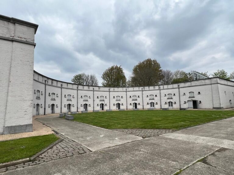
The present layout largely follows the seventeenth-century plan, although most surviving buildings and much of the visible fortification date from the first quarter of the nineteenth century. The ramparts and most of the moat survive around the former military enclosure, which also incorporated a permanent civilian settlement. The Scheldt-side section of the moat became a small tidal basin between 1903 and 1906. Known as the killetje, it is an enclosed water area whose level changes with the tides.
Fortifications and harbour
Ramparts and moat
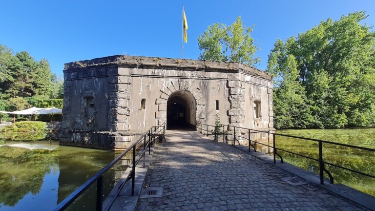
The surviving ramparts preserve the principal defensive outline of the fort. Most of the moat remains in place, retaining the relationship between the raised fortification and the water around it. On the Scheldt side, part of the moat was reshaped into the killetje, a small tidal basin that contains yachts and boats and grounds at low tide.
Civilian enclosure
The fort’s enclosed area also held a civilian community. In 1830, 34 houses stood within the fort and accommodated 128 people. This residential use formed part of the surviving physical character of Lillo, where military structures and village buildings occupied the same fortified enclosure.
Religious and civic buildings
St Benedict’s Church
St Benedict’s Church, formerly called St Joseph’s Church, was built in 1883 in the Neo-Gothic style. Its small bell tower is topped by a Neo-Classical pediment. The church became the parish church of the settlement in 1965 and contains statues and furnishings transferred from demolished churches in the former village of Lillo, particularly St Benedict’s Church at Lillo-Kruisweg. It replaced a Reformed church that had previously occupied the site.
Napoleonic barracks and powder magazine
The barracks built during the Napoleonic period were converted into apartments in 2005. A powder magazine from the same period was being adapted as a museum in 2007, preserving the military function of the building within the later cultural use of the fort.
Landshuis and Commander’s House
The former town hall was restored by engineer Wim Goossens, renamed Landshuis, and used for exhibitions and cultural events. It adjoins the Commander’s House and the Poldermuseum, bringing civic, military, and local historical buildings together within the surviving settlement.
Poldermuseum
The Poldermuseum occupies a former biscuit factory. Its approximately twenty rooms contain objects illustrating daily life in the northern Antwerp polders, linking the fort’s preserved buildings with the communities and landscape altered by the expansion of Antwerp’s port.
Windmill and surrounding landscape
De Eenhoorn tower windmill
De Eenhoorn, meaning “the unicorn,” is a gallery tower windmill, a tower-shaped mill with an elevated platform giving access to its sails and machinery. Dating from 1735, it is the oldest gallery tower windmill of its type in Flanders. Originally located at Lillo-Kruisweg, it was dismantled in 1966 and reconstructed near Fort Lillo in 1969 using the recovered materials.
Galgeschoor and Potpolder
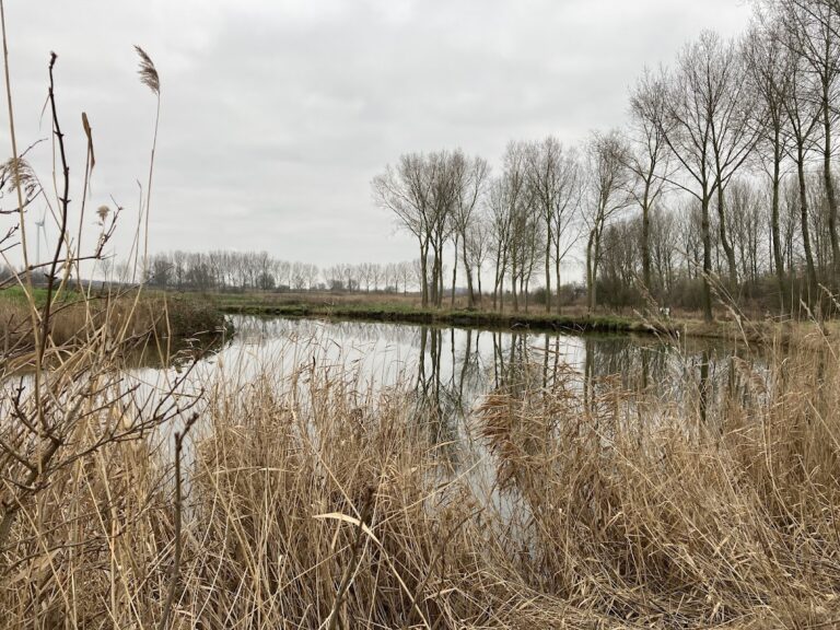
The Galgeschoor lies north of Fort Lillo as a 46-hectare brackish marsh outside the dike system. To the east, the approximately 10-hectare Potpolder was excavated in 2012 as part of nature restoration in the Scheldt estuary. It contains a birdwatching island.
Ferry jetty
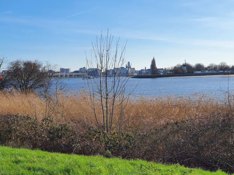
A long jetty serves as a landing place for a ferry operating between Lillo and Doel during the summer months.