Fort Den Haak: A Coastal Defence Fort in the Netherlands
Site at a Glance
- Rating
- 4
- Popularity
- Very Low
- Country
- Netherlands
- Primary era
- Early Modern
- Eras represented
- Early Modern
- Civilizations
- Dutch
- Site type
- Military
- Remains
- Fort
On this page13 sections
History
Fort Den Haak is a former coastal defence fort near Vrouwenpolder in the Netherlands, built by the States of Zeeland in 1588 during the Eighty Years’ War, the long conflict in which the Dutch provinces resisted Spanish rule. Its purpose was to protect the beach at Den Haak, where earlier Spanish landings had exposed Walcheren’s vulnerability.
Spanish landings and construction
Spanish forces landed near Breezand in Vrouwenpolder on 7 May 1572 and at Den Haak on 14 August 1573. The second force briefly occupied Middelburg, but Walcheren ultimately remained under the control of the Prince of Orange, a leading title of the Dutch revolt then held by William the Silent. The attacks encouraged repeated proposals for a fort at Den Haak. A first plan was prepared in 1577, but it was not carried out.
On 12 March 1588, the States of Zeeland authorized construction and required the work to be completed by the end of May. Simon Claus and Jan Simonsse van der Vere were appointed master builders. The fort was completed on 23 May 1588, when its first soldiers took up station.
Declining military value
During the seventeenth century, advancing dunes approached from the landward side and reduced the fort’s strategic value. The sea also damaged it. In 1682, large sections of the southern side were washed away. Although Fort Den Haak was still in reasonable condition when the First Anglo-Dutch War began in 1652, doubts about its usefulness resulted in limited investment and maintenance.
Its armament changed over time. In 1793, it carried thirteen 24-pounder guns and two howitzers, weapons designed to fire shells on a relatively high trajectory. By the 1809 invasion, the fort held four 24-pounder guns, three 12-pounder guns, and ten 7.5-pound mortars, short-barrelled weapons intended mainly for steep-angle fire.
The Walcheren expedition of 1809
In 1809, the Batavian Republic and the Kingdom of Holland were French-aligned states at war with Great Britain. King Louis Napoleon feared a British attack, but an inspection found Fort Den Haak dilapidated and largely unsuitable for modern warfare, especially after the loss of its two southern bastions.
Britain planned its invasion of Walcheren to support Austria, which Napoleon had invaded in April, and to seize Antwerp’s important naval base. An expeditionary force of about 40,000 soldiers under Lord Chatham, the title held by John Pitt, approached Walcheren at the end of July and was detected on 28 July.
Lieutenant-General Stewart John Bruce established his post at Fort Den Haak on 29 July with about 350 infantry and artillery troops, including men sent from Middelburg and Domburg. British troops landed at Breezand on 30 July. After a few shots had been fired from the fort, Bruce withdrew toward Veere, and plans were made to evacuate his force to Zuid-Beveland. British troops under General Fraser then captured Fort Den Haak with little resistance.
Lord Chatham used the fort as his headquarters during the night after its capture. Veere and Middelburg fell the next day, and after Vlissingen surrendered on 15 August, prisoners were assembled at Fort Den Haak before being transported to England. The British expedition ultimately failed, and the last British troops left Walcheren in December 1809. During the withdrawal, they burned the guardhouse and dismantled the fort as extensively as possible.
Abandonment and later use
When Napoleon visited Walcheren in 1810, he ordered Fort Rammekens and the fortified towns of Vlissingen and Veere to be modernized. Fort Den Haak was considered insufficiently valuable for restoration. After the French withdrawal in 1814, the Dutch Ministry of War still classified it as a third-class defensive work, but the fort was relinquished in 1854 and lost its military function.
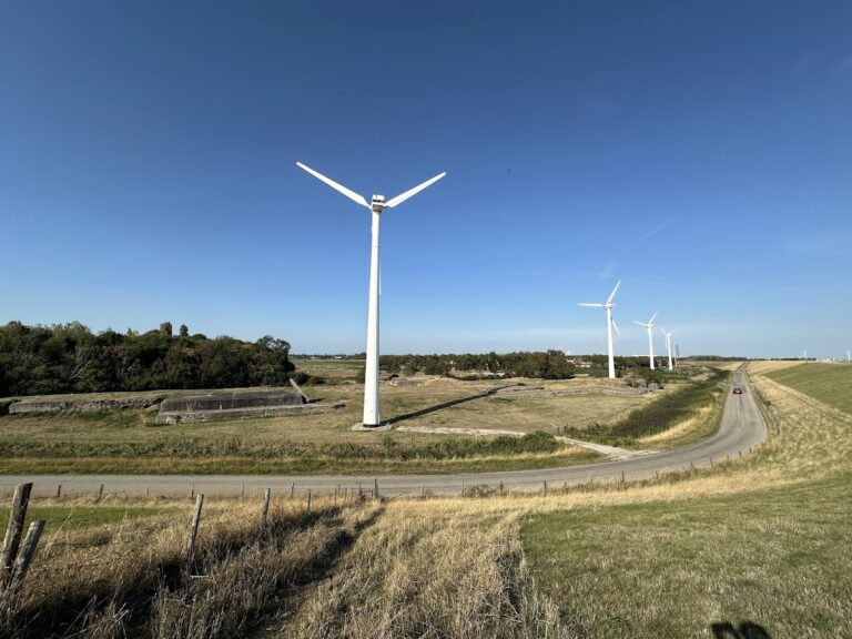
The former powder chamber continued to serve as a home for a poor family until the beginning of the twentieth century. In the 1960s, construction of the Veerse Gatdam connected Walcheren with Noord-Beveland. The N57 road across the dam now runs beside the former fort, whose surviving traces are incorporated into a nature area managed by Staatsbosbeheer, the Dutch state organization responsible for publicly owned nature areas and forests.
Remains
Fort Den Haak originally had a square plan organized around four projecting bastions, fortified sections designed to let defenders cover adjoining walls and the ground beyond them. Two were half-bastions on the seaward side, while two full bastions stood on the landward side. Earth ramparts connected the bastions, and a wet ditch enclosed the landward edge. The surviving landscape traces reflect this earthwork design and the later destruction caused by the sea and military dismantling.
Fortification earthworks
Landward bastions
The outlines of the two landward bastions remain visible in the landscape, particularly those of the western bastion. These surviving earthworks preserve part of the fort’s original square defensive arrangement and its system of ramparts. By 1809, however, the walls had become structurally dilapidated, while the two southern bastions had already been washed away, leaving the position almost indefensible.
Seaward bastions
The former seaward bastions occupied the locations now used by a snack bar and a restaurant. Their loss formed part of the wider erosion of the fort’s southern side, which had begun before the British expedition and was compounded by the fort’s later dismantling.
Internal buildings and modern setting
Powder chamber
The former powder chamber survived the fort’s military decline and was used as a dwelling until the early twentieth century. Its later domestic use represents a continuation of the building after Fort Den Haak had ceased to function as a defence work.
Guardhouse
The guardhouse was burned during the British withdrawal in December 1809. Its destruction accompanied the dismantling of the fort as British forces left Walcheren.
Veerse Gatdam nature area
The former fort lies beside the N57 on the Veerse Gatdam, the structure built in the 1960s to connect Walcheren with Noord-Beveland. The remaining earthwork outlines are part of a nature area managed by Staatsbosbeheer.