Fort de Bron: A French Detached Military Fort in Lyon’s Second Defensive Belt


Site at a Glance
- Rating
- 4.5
- Popularity
- Low
- Country
- France
- Primary era
- Modern
- External website
- Open
- Eras represented
- Modern
- Civilizations
- French
- Site type
- Military
- Remains
- Fort
On this page12 sections
History
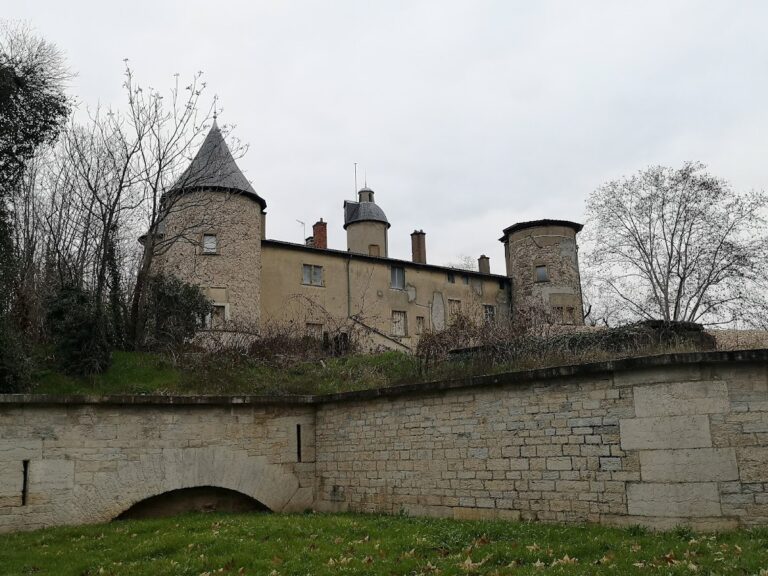
Fort de Bron is a detached French military fort in France, built between 1875 and 1877 in the post-1870 system of fortification known as the Barrière de fer. It formed part of Lyon’s second defensive belt, created after the Franco-Prussian War and the Treaty of Frankfurt, through which France lost Alsace and part of Lorraine.
Construction after the Franco-Prussian War
The defeat of 1870 led France to reorganize its defenses in 1874. Bron was placed within the ring of detached forts intended to protect Lyon, and an order to begin the work was issued on 8 May 1874 by General de Cissey of the Ministry of War. The contractor Jean Claret carried out construction from 1875 until its completion in 1877.
Fort de Bron belonged to an eastern defensive cordon that also included the forts of Vancia, Feyzin, and Mont Verdun. Between 1875 and 1885, the commune received the Lessivas and Parilly batteries, as well as a fortified enclosure with four bastions along the Grenoble road. Fort de Bron is the only surviving element of this group.
Changing artillery and military use
The fort was supported by annex batteries at Lessivas and Parilly. Advances in artillery soon made Lyon’s forts increasingly vulnerable to modern shells and limited their effectiveness in the city’s defense. A later plan to install two Mougin casemates, each armed with a 155 mm Model 1877 gun, was not carried out.
During the First World War, the region did not experience fighting, and Fort de Bron served as a barracks and equipment depot rather than an active defensive position. German forces used it as a prison during the Second World War. The French Army continued to use the fort until 1962 as an annex of the Lyon-Bron air base. It was decommissioned in 1963, remained military property until 1975, and was then abandoned by the French air force.
Transfer, preservation, and public management
In 1975, the Greater Lyon authority purchased the fort with the intention of constructing two water reservoirs. The army retained six hectares of woodland, including sections of the ditches and the diamond ditch, for a planned extension of the Lyon-Bron Army Medical Service School. Negotiations to preserve the entire fort did not succeed at first.
An agreement involving Bron mayor André Sousi and Prime Minister Raymond Barre allowed the municipality to purchase 9,878 square metres of disputed land for 10 francs per square metre, a total of 98,780 francs. This acquisition made it possible to establish a fitness trail around the fort in 1983. A proposal dated 23 September 1976 to use the abandoned ditches as a public rubble landfill was ultimately abandoned.
The Association of Fort de Bron was established on 25 March 1982 and manages the site in association with the Lyon Metropolis and the City of Bron. The former military complex has since accommodated heritage activities, theatrical performances, a craft exhibition, a museum, an aviation museum, archery, fitness facilities, and an adventure course. A biennial theatrical event ran for two months at a time and included a production of Homer’s Odyssey in 2009. It drew 15,000 spectators in 2011 before being discontinued in 2015.
Remains
Fort de Bron stands on a hill 212 metres above sea level, around 7 to 8 kilometres from Lyon by the range of contemporary cannon. Its elevated position overlooks the Rhône plain toward Saint-Priest and allowed the fort to cover approaches around Décines, Chassieu, and Saint-Priest. The polygonal complex is surrounded by a circular moat about 6 to 8 metres deep and 12 to 14 metres wide, with caponiers, covered defensive structures projecting into or alongside a ditch, arranged to protect it.
Entrance and defensive works
Ravelin and bridges
The entrance is protected by a ravelin, an outwork placed in front of a fortification entrance, and is reached by a rear access bridge. The bridge retracts sideways by sliding on steel rollers and could be housed in a dedicated room when withdrawn. A fixed bridge and a double caponiere form part of the entrance defenses.
Artillery positions and boundaries
The fort’s defensive arrangement included 17 guns on the cavalier, a raised artillery platform within a fort, 13 guns on the lower fortified enclosure, 10 light guns for defending the ditches, and five mortars, giving a total of 45 artillery pieces. Another inventory lists 26 rampart guns of 155 or 120 mm, eight 22 cm howitzers, and ten flanking guns. These figures describe the listed rampart and flanking armament alongside the more detailed artillery arrangement.
The cannon originally had a range of about 6 kilometres, extended to approximately 8 kilometres in 1880 with the use of de Bange guns. An expropriation judgment dated 10 June 1874 allocated the fort 24 hectares, 21 ares, and 19 centiares of land. Stone boundary posts marked the military property, and each post carried an engraving on its cap showing the direction of the next post.
Barracks and internal services
Parados and cavalier barracks
The buildings occupy about 1,500 square metres, with some spaces buried beneath an earthen covering. The complex contains the parados barracks, associated with the rear defensive earthwork, and the cavalier barracks. Officers and non-commissioned officers occupied the upper floor of the parados barracks, while the remaining soldiers lived on the first floor of the cavalier barracks, with 56 soldiers assigned to each room.
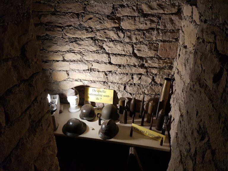
The accommodation was designed for 841 people, including 784 soldiers, 39 non-commissioned officers, and 18 officers. About ten horses were also kept at the fort. A later water reservoir was built above the parados barracks, and three rooms there now house the museum of the Lyon Society of Aviation History and Aeronautical Documentation.
Water, food, and daily operation
The internal facilities included a bakery, two kitchens, a well, a cistern, latrines, a forge, stores, and disciplinary rooms. The bakery required a reserve of 69,400 kilograms of flour. A pump drew drinking water from the groundwater table at a depth of 37 metres, supplying up to 50 cubic metres per day and filling a 13-cubic-metre cistern. The cistern could supply the fort for three days if the pump failed.
Petroleum lamps, candles, and light wells provided illumination. The central disciplinary rooms included a guard room and four cells. Together, these installations show how the fort was equipped to house its garrison and maintain its operations within the enclosed defensive complex.
Later alterations and surviving grounds
Later reservoir works occupied about half of the fort’s built area. Approximately 300 metres of the southern ditch was adapted as a safety spillway. Woodland, sections of the original ditches, and the diamond ditch remain within the grounds, while the historic barracks contain the aviation museum. The surviving structures and altered water installations together reflect both the fort’s military design and its later transformation after decommissioning.
Nearby sites