Fort Binġemma: A British Polygonal Fort in Malta


Site at a Glance
- Rating
- 3.1
- Popularity
- Very Low
- Country
- Malta
- Primary era
- Modern
- Eras represented
- Modern
- Civilizations
- British
- Site type
- Military
- Remains
- Fort
On this page7 sections
History
Fort Binġemma is a British polygonal fort in Malta, built between 1875 and 1878 as the first of three forts constructed along the Victoria Lines. Its position at the western extremity of the defensive system gave it a role in protecting the northern approach to the island and in supporting coastal defence.
The Great Fault and the Victoria Lines
The fort formed part of a defensive project designed to use Malta’s Great Fault, a major geological escarpment whose cliffs and elevated ground created a natural military barrier. The defensive value of this terrain had been recognized by 1722, during the rule of Grand Master Marc’Antonio Zondadari, who led the Order of St John, the Catholic military order that governed Malta before British rule. Under his successor, António Manoel de Vilhena, stone buildings and fortifications were placed at strategic points along the fault to help defend the former capital from the more accessible northern side of the island.
During the second half of the nineteenth century, the British established a new defensive line along the Great Fault. Malta’s strategic importance had increased after the opening of the Suez Canal in 1869, at a time when British military power was expanding. The system was initially known as the North West Front and extended for roughly 12 kilometres, from the area near Baħar iċ-Ċagħaq and Swieqi in the east to the western coast around Fomm ir-Riħ Bay. It separated the more densely populated south from the north, where an attack was considered more accessible.
The other two forts in the original group were Fort Madliena and Fort Mosta. The North West Front was renamed the Victoria Lines in 1897 during celebrations of Queen Victoria’s sixtieth birthday. Fort Binġemma was built at the western end of this chain, which also incorporated defensive walls, batteries, fortified infantry positions, and searchlights.
Military use and later occupation
The Victoria Lines were abandoned in 1907, but Fort Binġemma and Fort Madliena continued to serve in coastal defence because of their strategic positions. In 1904, a 9.2-inch breech-loading gun, loaded from the rear, was installed on the seaward side of Fort Binġemma in response to the fitting of long-range guns on Italian naval vessels.
From 1949 to about 1952, the fort was used to train Albanian insurgents involved in Albanian Subversion, the post-Second World War Western-backed effort to support opponents of Albania’s communist government. The site later became a communications centre for 235 Signal Squadron of the Royal Corps of Signals, the British Army branch responsible for military communications. It remained in use into the 1970s.
In 1981, the Government of Malta leased Fort Binġemma to Gaetano Buttigieg for use as a pig farm. The lease expired in 1997 but continued through annual renewals until 2009. After the lease ended, Buttigieg and his family continued to occupy the fort without authorization. Government officials were refused access in 2011, while an iron gate and dogs guarded the site. Illegal development took place inside the fort in 2013, and in 2015 the fort was reported to be used occasionally as an illegal restaurant and for cattle and other animal farming.
The Buttigieg family was evicted in August 2025, returning full control of Fort Binġemma to the Maltese government. Restoration is planned, together with a future use as an astronomical centre. In 1998, the Government of Malta submitted the Victoria Lines for inclusion on the UNESCO World Heritage List.
Remains
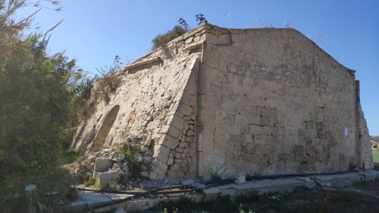
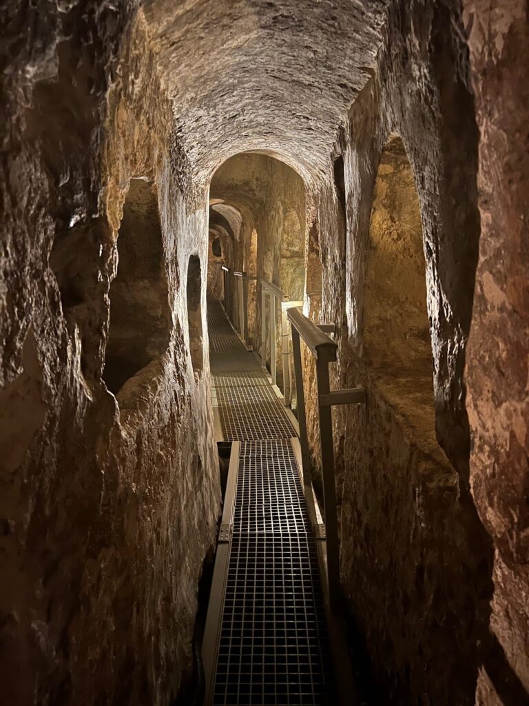
Fort Binġemma stands on an elevated hill above Tas-Sabti in the limits of Rabat, approximately 200 metres above sea level. It has an irregular, broadly pentagonal plan typical of a polygonal fort, whose angled sides allowed defensive fire to cover approaches more effectively than a purely rectangular design. A cliff face protects the fort to the north, while a ditch forms its southern defence.
Fort plan and defensive position
Fortification layout
The fort’s position placed it at the western extremity of the Victoria Lines and connected it to a wider chain of fortifications. That chain included a wall with infantry firing positions, as well as forts, batteries, fortified infantry locations, and searchlights. The fort itself was built of limestone and concrete, and its artillery had an arc of fire measuring 210 degrees. This field covered the sea to the northwest and the ridges to the northeast.
Artillery installations
Its armament included two six-inch guns and one 9.2-inch breech-loading gun. The larger weapon was added on the seaward side in 1904, responding to the installation of long-range guns on Italian naval vessels. The fort is described as intact but neglected. Before its construction, the site contained a Roman village, placing the later military structure within an older archaeological setting.
Nearby sites