Ercavica: An Ancient Roman Municipium in Spain


Site at a Glance
- Rating
- 4.4
- Popularity
- Low
- Country
- Spain
- Primary era
- Classical
- External website
- Open
- Eras represented
- Iron Age, Classical
- Civilizations
- Celtiberian, Roman
- Site type
- City
On this page10 sections
History
Ercavica was an ancient Roman municipium in Spain, located in the territory of present-day Cañaveruelas in Cuenca. Its origins lay in the Iron Age among the Lusones, a Celtiberian people, and the Roman city developed from the second century BC before undergoing major transformation during the Augustan period.
Celtiberian origins and Roman conquest
Ercavica first enters written history during the campaign of Tiberius Sempronius Gracchus in Celtiberia in 179 BC. Livy, the Roman historian, relates that the powerful city opened its gates to the Romans after witnessing the disasters suffered by neighboring peoples. The surrender was not lasting, however, and hostilities resumed after Gracchus withdrew his troops.
The city described by Livy was a Celtiberian predecessor of the later Roman settlement. It stood several kilometers away on the opposite bank of the Guadiela River, while the Roman city was established on a promontory near the river. The earlier settlement was later used as a military camp during the Sertorian War, a Roman civil conflict in Spain during the first century BC, and is now submerged beneath the Buendia reservoir.
Roman urban development
From the second century BC, the Roman Ercavica acquired a regular street plan, a city wall, and the public and private buildings expected of a Roman town. Under Augustus, between the final years of the first century BC and the beginning of the first century AD, its urban development was completed or substantially reshaped through the construction of monumental civic buildings.
Ercavica became a municipium, a Roman city with recognized local institutions, during the Augustan or immediately subsequent Julio-Claudian period in the province of Hispania Citerior Tarraconensis, later called Tarraconensis. Its coinage confirms this municipal status. A date connected with Augustus’s visit in 15–14 BC is often proposed, while another proposal places the change around 11–10 BC. The evidence does not establish the date conclusively.
The city reached its greatest prosperity during the first and second centuries AD. A gradual decline began in the third century, and Ercavica ceased to function as a Roman urban center between the fourth and fifth centuries.
Coinage and later history
Around the middle of the second century BC, the Celtiberian mint of Erkauika produced two bronze issues, both using the unit as their only denomination. Later municipal coins were issued in the names of Augustus, Tiberius, and Caligula. The Augustan issues probably relate to the foundation or municipal establishment of the Roman city, although that interpretation rests on the style of Augustus’s portrait rather than secure chronological evidence.
Tiberian asses name the municipal magistrates, identified as the II Viri, or two chief magistrates. The Tiberian asses also show a bull, while the semisses bear a laurel wreath around the name of the municipium. A Caligulan sestertius associated with the mint shows Caligula on the front and his three sisters facing forward on the reverse. It cannot be securely linked to the issue naming Terentius Sura and Lucius Licinius Gracilis because their names do not appear on that coin. Differences in the presence or absence of the title Pater Patriae indicate that some Caligulan pieces may belong to the period after AD 37, when Caligula received the title.
The site appears to have been occupied again under the name Arcavica. It was mentioned in 675 at the Eleventh Council of Toledo and in later Toledo councils as an episcopal see. The bishopric was subsequently transferred to Cuenca, and the site’s final abandonment is placed in the eleventh century. Ercavica became a protected cultural-interest property in 1978.
Remains
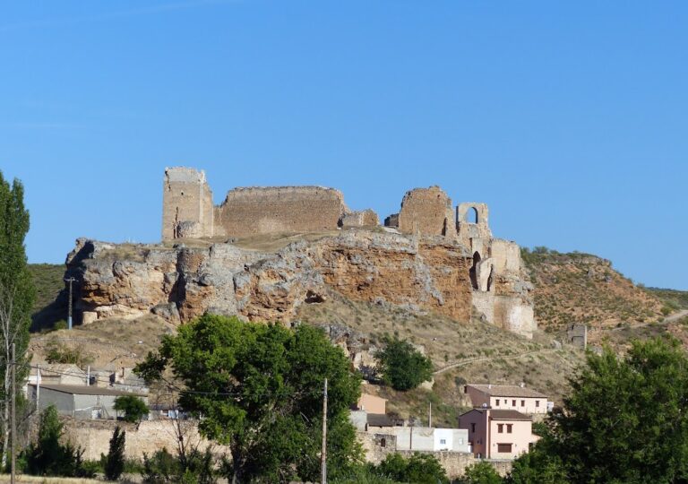
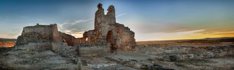
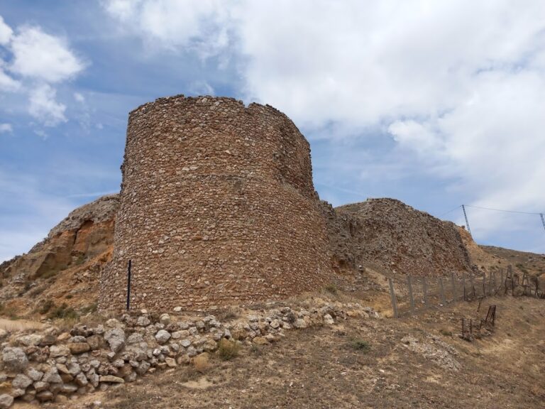
The Roman remains occupy a promontory on the hill of Santaver above the Buendia reservoir, near the Guadiela River. The settlement was enclosed by a city wall and organized around a regular street plan. Cobble-paved streets and arcaded main roads ran through residential blocks, while the principal civic buildings were concentrated around the forum.
Forum and civic buildings
Forum
The forum formed Ercavica’s public and civic center. It was a rectangular square paved with large stone slabs and enclosed by arcades. During the Augustan transformation, the civic area was given a monumental form that included the forum, a basilica, and one or more temples.
Basilica
The basilica stood along the southern side of the forum. This large public building served judicial functions and formed part of the civic complex created during the Augustan reshaping of the city.
Shops and the eastern extension
A group of small houses or shops occupied the western side of the forum. Their entrances opened onto the cardo maximus, the principal north–south street of the town.
On the eastern side, a monumental base and an extension of the forum were constructed above a two-storey cryptoporticus, a covered gallery or passage. These features formed another part of the built framework surrounding the civic square.
Residential quarters
Residential blocks, known as insulae, were arranged along the cobbled streets and arcaded main roads running perpendicular to the city’s principal axis. The best-known residence is the so-called Medical House, whose rooms were organized around an atrium. At its center, an impluvium, a basin for collecting rainwater beneath the roof opening, was supported by four columns.