Els Vilars: An Iron Age Fortified Settlement in Spain
Site at a Glance
- Popularity
- Medium
- Country
- Spain
- Primary era
- Iron Age
- Eras represented
- Iron Age, Modern
- Civilizations
- Spanish
- Site type
- Military
- Remains
- Fortified Town
On this page18 sections
History
Els Vilars is a fortified settlement near Arbeca in Spain. Its founding phase, Vilars 0, dates to about 800/775–700/675 BCE, and the settlement belonged to the Urnfield cultural tradition, associated with cremation and the burial of ashes in urns. Occupation lasted from around 775 to 325 BCE, roughly 450 years, across archaeological phases known as the First Iron Age and Early Iberian period.
The fortification housed a chief who held military and religious authority over a community estimated at 150 to 175 people. Local tradition held that the chief descended from a heroic ancestor. The settlement stood on an open plain rather than on nearby hills that offered easier defense. Its position provided access to water and fertile river-deposited land, while routes across the surrounding landscape allowed people, goods, and materials to move through the region.
The founding community and its resources
Els Vilars lay above the Aixaragall ravine, within the flood-prone area of the Corb River, which flows into the Segre. The Segre and the Noguera Pallaresa and Noguera Ribagorçana rivers connected the region with parts of continental Europe and supplied pebbles and stone for tools and mills. The Ebro could be reached by way of the Segre, linking the area with the Atlantic and Mediterranean. A route across the Prades range via the Francolí offered another connection to marine resources and exchange with Phoenician and Greek communities.
Farming centered on dry-grown cereals, especially hulled barley and common and durum wheat. People also cultivated smaller quantities of emmer and millets, along with lentils, beans, grapes, and figs. Flax was grown, possibly for making textiles, and stubble left after harvest could feed livestock. The surrounding landscape included oak and holm-oak woodland, kermes oak and mastic, and riverside woodland. Fields, gardens, and pasture lay around the settlement. Wood and brush provided fuel and materials for buildings and household use; acorns, blackberries, wild grapes, and other plants added to the diet, and some plants were used medicinally. Water, clay, and mainly limestone served in construction and in making pottery, mills, and tools.
Sheep and goats, cattle, pigs, dogs, and horses were kept for labor and for products such as milk, wool, and manure. After slaughter, hides, meat, and bones were used. Horses had particular standing and were especially associated with rituals. Deer, rabbits, and hares were hunted occasionally, in activities connected with social status, while farming and herding remained more central. Over time, people ate more cattle and sheep or goats, and less pork.
Processing grain was a major daily task. Saddle querns, which grind grain by moving a handstone back and forth over a stationary stone, dominated the earliest phases and still made up about 90 percent of the mills in the Early Iberian period. Rotary mills, which grind by turning one stone over another, appeared in the early fifth century BCE. Three forms were used at the site: saddle querns, hand-operated rotary mills, and rotary mills operated with a lever on a support. The earliest rotary mills at Els Vilars are the oldest known in Europe and the Mediterranean.
Changes to the settlement
In Vilars I, dated to about 700/675–550/525 BCE, houses were rebuilt with substantially altered plans and dimensions. They were reduced to about half their earlier size and no longer had vestibules. The defensive perimeter remained in place and was strengthened.
During Vilars II, the perimeter and the basic urban arrangement continued, although the central space and some streets serving the entrances changed. Houses became more complex and were divided into smaller spaces. Earth gradually accumulated in the moat and among the upright defensive stones, leaving both features close to disuse by the end of this phase.
At the beginning of Vilars III, about 450/425–375 BCE, a major redesign altered the arrangement and general direction of circulation spaces. A central well-cistern was built, and a new, large moat was cut outside the earlier one and lined with a new wall. The eastern tower gate was probably closed.
Vilars IV, dated to 375–about 350/325 BCE, represents the occupation immediately before abandonment. It is poorly understood and preserved. Evidence includes small quantities of domestic food remains and the deliberate closure of the central cistern.
Abandonment and later history
Els Vilars was abandoned abruptly, without an attack. The reason is unknown. Disease, exhaustion of cultivated land, and the settlement’s success have all been proposed as explanations. A more likely possibility is that its defenses no longer met the community’s needs: the walls, large moats, and towers restricted expansion.
About two centuries later, local communities including those around Els Vilars underwent Iberization, the adoption or development of cultural practices associated with Iberian communities. The people of the region became known to ancient writers as the Ilergetes. Later, Romans at Arbeca reused stone from the fortification to build houses.
Discovery and archaeological work
The site was discovered in the mid-1970s, but limited resources delayed excavation until the mid-1980s. Urgent work began in 1985–86, and the wall was identified in 1986. Investigations from 1987 to 1992 established a scientific team and interdisciplinary project, revealing features including the upright-stone defenses, the site’s radial internal organization, and the central cistern. Excavations expanded across the settlement from 1993 to 1998 to establish its perimeter.
Excavation and conservation continued from 1999 to 2013. Work addressed flooding, investigated and emptied parts of the moat, examined the northern fortified approach, and established the full profile of the cistern. The water system was found to have served both as a well supplied by the floodable moat and as a cistern when water levels fell. Walls, towers, and sections of the defenses were consolidated or restored. Emptying the well-cistern in 2013 yielded finds and further evidence about water management. A proposal made in 1996, Vilars Virtual, aimed to create a three-dimensional model of the fortification, its buildings, and surrounding landscape for research and public interpretation. In 1998, the Government of Catalonia declared Els Vilars a Cultural Asset of National Interest in the archaeological-zone category.
Remains
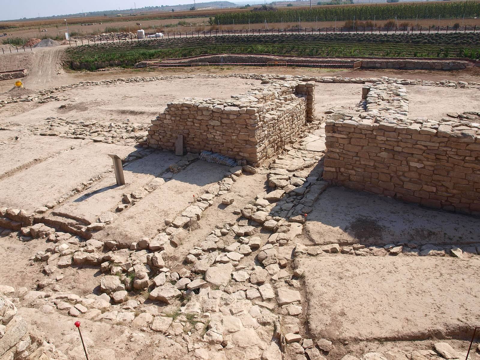
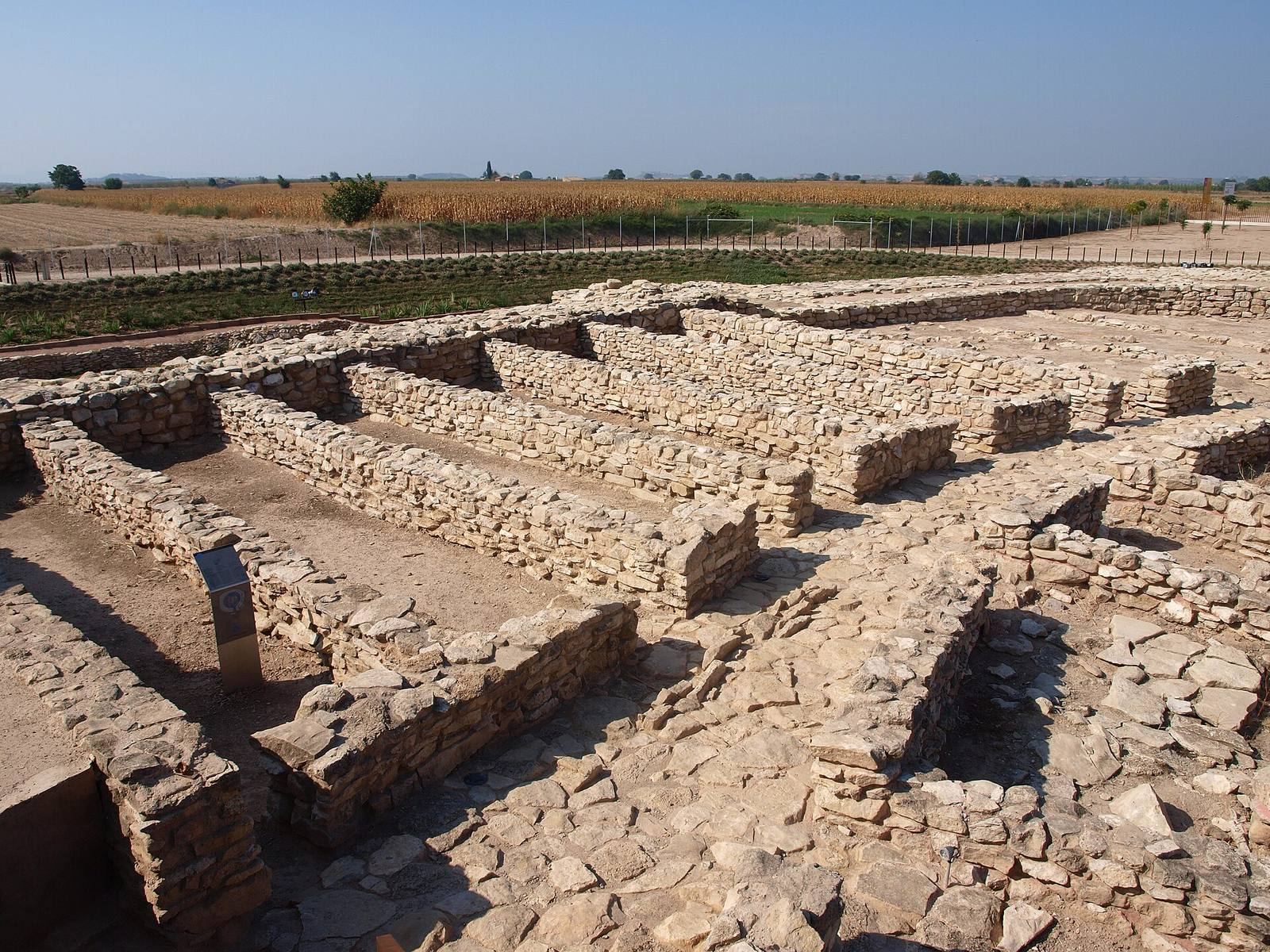
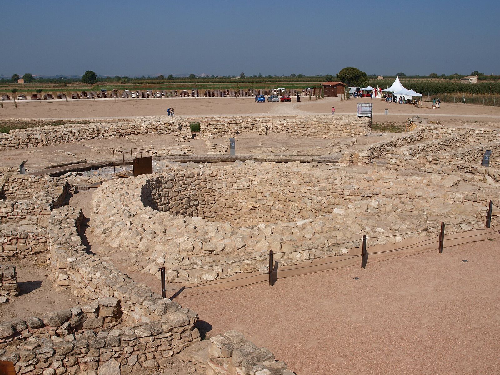
The enclosure stands on a plain about four kilometres from Arbeca, above the Aixaragall ravine and overlooking alluvial land. Its oval plan is formed by two intersecting circles drawn from the same center. The habitable area covered about 2,200 square metres, excluding the wall, towers, and outer defenses, and remained broadly stable despite some additions. Stone construction, a ring of dwellings, and layered outer defenses shaped the settlement.
Defensive circuit and approaches
Wall and outer defenses
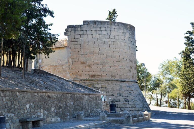
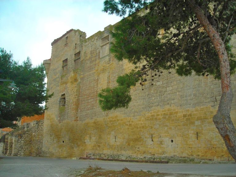
The wall extended about 173 metres, measured roughly five metres thick and stood about five metres high. It was accompanied by semicircular towers. The earliest arrangement had 11 towers; the later defensive circuit had 12. Construction began with the inner wall, houses, and a tower. An outer wall and fill were then added against the tower, followed by a barrier of upright stones, and the exterior of the wall was strengthened later.
Beyond the wall lay a double, stone-walled moat system about 13 to 15 metres wide and four metres deep. The upright-stone obstacle, known as a chevaux-de-frise, was intended to impede movement on foot or horseback. In the northern field, investigations and geophysical survey supported possible interpretations of an extended approach ramp, an outer defensive work, an advanced moat, and a channel feeding the moat system.
Gates and access routes
The earliest entrances were an eastern gate passing through a tower and a smaller western secondary gate. The eastern entrance had a paved passage 1.5 metres wide through a square-plan tower whose side walls were two metres thick. The western opening was set into the wall and flanked by two square bastions smaller than the other known towers.
A northern entrance was later defended by two towers. One belonged to the settlement’s foundation, while a new tower stood farther forward, lengthening the narrow approach. The western secondary gate was blocked when this northern entrance was established. A fortified ramp formed part of the northern approach.
Houses and central water system
Streets and dwellings
A main street ran parallel to the wall, separating two groups of generally rectangular houses. One group stood against the inner fortification, and the other lay between the street and the central plaza. Changes to the houses over time included rebuilding with different plans and subdividing rooms. Microscopic study of wall and ceiling material indicates that rooms were plastered with gypsum, made by pulverizing and heating gypsum from local rock before mixing it with water.
Plaza and well-cistern
The central plaza was organized around a monumental, stone-lined well-cistern reached by a descending passage or ramp. Study of the water system showed that it functioned as a well when supplied by the floodable moat and as a cistern when the water level fell. Excavation established the structure’s full profile without emptying it; the well-cistern was emptied in 2013.
Rooms and hearths
Central-space room
A roughly quadrangular room in the central area was only partly excavated because a concrete casing had been installed to protect its hearth. The room appears to have been undivided. Its possible entrance, in the unexcavated eastern wall, would have opened onto the street leading toward the eastern tower gate. The hearth, aligned north to south, measured 160 by 100 centimetres. Its slightly concave sides ended in pointed projections, giving it a bull’s-hide shape. A gravel-filled basin lay beneath a reddish clay floor marked by heat. The hearth is poorly preserved, but its form remains clear.
Adobe benches, each 65 to 70 centimetres wide, ran against the inner north and south walls. The room also contained a receptacle north of the hearth and a small pit beneath the floor holding the bones of several people who had not reached adulthood.
Northern building
The northern building measured about 11 by 5 to 7 metres and had a trapezoidal plan. It bordered the inner face of the northern wall and the perimeter street, and shared walls with houses to its east and west. Three spaces connected through aligned corner doors: a partly paved vestibule of about 12 square metres opening from the main street, an intermediate room of about 11 square metres, and a principal room of about 39 square metres.
Three successive floors in the principal room contained three hearths built one above another. The earliest was square, measuring 145 by 140 centimetres, with a gravel-filled basin, a fire-hardened clay surface, and a yellow-clay border. A small semicircular receptacle beside it held ashy sediment. A second hearth, measuring 130 by 90 centimetres, was built over the first in the same position. It had a bull’s-hide outline, a gravel-filled basin, and reddish clay bearing a brown fire mark. The third, also bull’s-hide shaped, measured 133 by 95 centimetres and had a reddish-clay border.
Other features in the principal room included a wall structure measuring 50 by 100 centimetres, covered with a thin layer of clay plaster, and a nearby shelf or bracket. A plastered storage niche in the eastern part of the same wall measured one metre wide and 50 centimetres deep. A flat-based, truncated-cone ceramic vessel found at its foot was probably linked to the nearby installations.
Northeast of the hearth stood an auxiliary altar made of broken adobe and small stones with a thin clay coating. A small clay cylinder was fixed in the floor beside it. An indented base from an Iberian storage jar was set in a pit 35 centimetres wide. A badly deteriorated bronze chain inside the jar base may have suspended an implement used to draw water or another liquid.
Burials and material finds
Founding-phase burials
Three burial pits from the founding phase lay at the back of the same room. Two held one perinatal individual apiece, while a third contained three individuals buried at the same time. That shared grave was a simple, elongated cut with rounded ends, 90 by 26 centimetres and 16 to 18 centimetres deep. The three bodies partly overlapped. One lay on the left side at the eastern end; another was positioned centrally, with its head on the first individual’s legs; the third lay over the second’s pelvis and legs, flexed on the right side.
One of the single burials was in an oval pit, slightly wider to the north, with a concave bottom. The individual was seated on the hip bones, with the back nearly vertical against the eastern side and the body turned slightly to the right. The other pit measured 30.5 by 18 centimetres and was 10 to 12 centimetres deep. The perinatal skeleton lay in anatomical connection with the head facing west, the body leaning right, and the legs bent.
Objects and pottery
Metal finds include pendants, bracelets, chains, awls, an arrowhead, rings, and clothing brooches, or fibulae. One pendant takes the form of a goat. Other restored objects include a large iron ring, a bronze buckle, an unidentified bronze object, and a twisted bronze ring.
The pottery includes part of a painted urn, fragments of two Athenian red-figure drinking cups, and a floral-decorated vessel for mixing wine and water. A handmade tripod mortar had red slip on its projecting rim. It may have been made beyond the region, perhaps in southern Valencia, and reached Els Vilars through exchange along the Ebro and Segre. Two fragments of monochrome gray pottery represent open vessels with horizontal rims and rounded lips.
A fragment of a wine-press bed was reused in a wall built in the fourth century BCE, showing that the press had been used before the wall was constructed. Pottery associated with Vilars IV includes wheel-made wares with oxidized surfaces, both plain and painted with bands and compass-drawn circles, as well as handmade local vessels and wheel-made pottery inspired by black-glazed wares. Attic black-glazed vessels include large plates. Radial stamped palmettes help date this final phase to the second half of the fourth century BCE.