El Chal: A Maya Archaeological Site in Guatemala
Site at a Glance
- Rating
- 4.5
- Popularity
- Very Low
- Country
- Guatemala
- Primary era
- Medieval
- Eras represented
- Classical, Medieval
- Civilizations
- Maya
- Site type
- City
On this page20 sections
History
El Chal is a pre-Columbian Maya archaeological site in Guatemala, in the upper San Juan River valley of southeastern Petén. The Maya occupied it from approximately 300 BC to around AD 1300, from the Late Preclassic through the Early Postclassic, with Middle Preclassic activity preserved in the acropolis. During its principal period of growth, the Late Classic, El Chal became an important centre in southeastern Petén and developed a distinct political identity represented by its Emblem Glyph.
Early settlement and the civic centre
During the Late Preclassic, settlement was concentrated around an E-Group, a Maya ceremonial arrangement usually formed by a western pyramid and an eastern platform. This complex stood about 2 kilometres northeast of the later site core. It was first built during the Late Preclassic, lightly occupied in the Early Classic, and enlarged by two structures during the Late Classic. The civic centre later shifted to the acropolis, which became the focus of major construction.
The E-Group remained on the city’s periphery after this change. Its east platform, west pyramid, and smaller north and south structures surrounded a small plaza. Ceramic material from the east platform and west pyramid spans the Late Preclassic, Early Classic, and Late Classic, while the north and south structures are probably Late Classic. The arrangement preserves evidence of El Chal’s earlier ceremonial focus before major activity moved to the acropolis.
Late Classic growth
The Late Classic was El Chal’s principal period of occupation and architectural expansion. Construction reshaped the acropolis and the surrounding plazas, while residential groups spread through the Central, Arrepentimiento, Panorama, and Municipal sectors. The city occupied a well-drained part of the central Petén wet savanna, at about 270 metres above sea level in a karstic landscape within the San Juan River valley. The San Juan is a tributary of the Pasión River.
El Chal also lay along a natural north-south communication route between the Maya Mountains and central Petén. This route continued to be used during the Colonial Period and probably followed a pre-Conquest line of movement. The city’s political status is reflected in its Emblem Glyph, a hieroglyphic expression associated with a particular Maya political centre or ruling polity. All known hieroglyphic texts from El Chal’s monuments date to the eighth century AD, are heavily eroded, and remain undeciphered. Their sculptural style resembles monuments from Sacul, Ucanal, and Naranjo.
Terminal Classic transformation
Building continued intensively from the Late Classic into the Terminal Classic. During this later period, El Chal remained the primary centre of the San Juan valley, eclipsing El Edén and El Tigrillo to the west and Copoja, La Puente, and El Ocote to the southeast. It also developed its own ceramic-production industry. New construction phases were added to major buildings, and additional monuments were erected.
At the same time, activity declined in peripheral residential sectors and in parts of the site core compared with the Late Classic. This reduction probably contributed to the city’s eventual abandonment. Occupation nonetheless continued into the Early Postclassic. Ceramic fragments from Structure 1 in the Northwest Plaza and a small number of sherds from Group 15 in the Central Sector show that people remained at the site after the main period of civic activity had ended.
Rediscovery and protection
The name El Chal appears in a Spanish Colonial watercolour of 1735, where the place is also written as El Chacal, and on an 1860 map of central and southeastern Petén. Later, stone from the ruins was stripped for construction in the modern settlement. Modern houses were built on ancient mound platforms, while other mounds were damaged or destroyed for streets and building materials. Houses near the acropolis were relocated during the late twentieth-century Guatemalan Civil War because of guerrilla activity.
Richard Kirsch and Ian Graham visited El Chal in 1974 and 1975, although their work was not published. In 1975, Guatemala’s Department of Prehispanic Monuments designated approximately 0.07 square kilometres as a protected archaeological site. The Atlas Arqueológico de Guatemala mapped the site and catalogued its remaining monuments in 1989. Test excavations began in 1993, together with exploration of approximately 4 square kilometres around the site core.
During the 1970s, FYDEP, a Guatemalan agency involved in the development and settlement of Petén, removed several sculpted monuments and later transferred them to Tikal National Park. By the mid-1990s, their exact locations and identities had been lost. Further investigations took place in the West Plaza in 2003, the East Plaza in 2004, the acropolis in 2005 and 2006, and the Northwest Plaza in 2006. The site remained under the protection of Guatemala’s Instituto de Antropología e Historia, the national institution responsible for archaeological and historical heritage, and very little restoration had been undertaken by 2010.
Remains
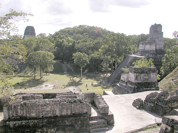
El Chal’s remains are organized around an acropolis, several large plazas, an E-Group, residential sectors, water installations, and smaller architectural groups. Archaeologists mapped 268 structures in 53 groups arranged around approximately 68 patios in the site core. Most plazas and residential buildings occupy naturally level ground, while the acropolis rises on a natural limestone hill. An artificial reservoir northwest of the acropolis and a natural reservoir to its south provided water within the civic centre.
The acropolis
The acropolis stands on a limestone hill about 30 metres high. Its nearly square base measures approximately 140 metres on each side and faces north toward the southern side of the West Plaza. The summit was levelled into three broad terraces, each averaging about 2,800 square metres, and a sunken stairway on the north side connects the terraces. The complex is divided into six groups and contains patios with residential, administrative, and ceremonial buildings dating mainly to the Late and Terminal Classic.
Terrace 1 and Patio A
Terrace 1 is the highest acropolis terrace. It contains Patios A, B, and C and ten structures. A three-flight stairway approached the terrace from the south. The upper flight descended seven steps to a small room, while the middle flight led to another similar room and the lowest flight descended in the opposite direction toward Patio F on Terrace 3. A sculpted bas-relief frame decorated the upper-flight wall, and the middle-flight wall was stuccoed and painted red and black.
Patio A occupies about 432 square metres on the west side of Terrace 1. Its five buildings had multiple rooms and internal benches resembling palace arrangements used for elite domestic or administrative activity. The patio was entered through a short stairway on its southeast side and was built in three phases, the first two during the Late Classic and the final one during the Terminal Classic. Its buildings used finely dressed limestone blocks, approximately 40 centimetres square, which narrowed toward the rear to grip the structural fill.
Patio A structures
Structure 1 formed the northern side of Patio A. It was a long platform reached by a 23-metre-wide southern stairway. The final building measured 34 by 8.5 metres and stood 1.4 metres high. Its superstructure included a C-shaped bench, and its construction belongs to both the Late Classic and Terminal Classic.
Structure 2 stood on the northeast side of the patio as a single-level platform measuring 8 by 5 metres and 2 metres high. Its projecting stairway was 5 metres wide. Trenches in front of it produced 378 Middle Preclassic sherds associated with Burial 265, an infant burial that represents the earliest known activity at El Chal. A later cache at the stairway base contained two eccentric obsidian objects shaped like centipedes, a flint arrowhead, waste flint, flint blades, and obsidian prismatic blades.
Structure 3 separated Patios A and B. Built from small limestone blocks around a rubble core, it grew through several phases from a stucco-covered platform 1.3 metres above the patio into a rectangular platform measuring 17 by 14.5 metres and standing 3 metres high. Its wide stairway was divided by a central block and supported a large bench. An incomplete human skeleton, Burial 73, lay beside its south wall with broken Terminal Classic ceramics.
Structure 4 originally measured 31 by 6.5 metres and supported a long room with three doorways. A full-width bench later became a broad three-step stairway. The building was deliberately demolished in antiquity, then enlarged during a second phase to create three benched rooms while retaining the same doorway arrangement. Its walls survived to more than 2.5 metres on the east side.
Structure 5 was the highest platform on the acropolis. It measured 19.5 by 6 metres and stood 1.5 metres high, with an eastern stairway joined to a sloping lower wall and projecting cornice. Only the lowest limestone courses survived, and the upper courses were probably stripped in antiquity. Finds near its southeast corner included a greenstone axe fragment, two spherical stones, human bone, and broken domestic ceramics probably dating to the end of the Terminal Classic. Burial 278, an infant interred beneath the floor, dates to the Late Classic.
Patios B and C
Patio B was created by filling the area with rubble until it reached the level of Patio A. The courtyard covers about 768 square metres and is bounded by structures on its north, east, and south sides, while Structures 1 to 3 of Patio A form its western edge. Structure 6 is a square, two-level platform measuring 14.5 by 12.5 metres. Its final phase included upper benches, a broad northern stairway, and a smaller stairway at the southeast corner. Bone fragments from three individuals and domestic ceramics were recovered there.
Structure 7, on the east side of Patio B, was a low platform measuring 22.5 by 4 metres. It supported a bench and a broad step and was the last structure built on the patio, after Structures 6 and 8. Structure 8, on the north side, was a rectangular platform measuring 18 by 8.5 metres with a south-facing stairway. Finds from the group represent the Late Preclassic, Late Classic, and Terminal Classic.
Patio C was added northwest of Patio A at the same time as Patio B. It lies slightly lower and was formed by extending the terrace with rubble. The fill beneath it is 6 metres deep, corresponding to the former height of Patio A’s retaining wall. Patio C had two construction phases and served an administrative function associated with Patio A. Its West Structure contained a narrow room and a rear room with a bench or throne, while its North Structure was a low stuccoed platform painted red. Materials from the west building date mainly to the Late and Terminal Classic, with a small amount of Postclassic material.
Terraces 2 and 3
Terrace 2 lies 10 metres below Terrace 1 and contains Patios D and E, divided by a 9-metre-high pyramid temple. Patio D was reached from the West Plaza by a two-section stairway with a lower terrace. It was laid out at the beginning of the Late Classic, resurfaced repeatedly, and extended during the Terminal Classic with Patio G. Patio E was also reached from the acropolis base, although its stairway is poorly preserved.
Terrace 2 Structure 1, north of Patio D, was a low rectangular platform apparently used for administration during the Late Classic and domestic activity during the Terminal Classic. Later deposits included a metate fragment, an obsidian knife, and two flint knives. Structure 2 was a 9-metre-high pyramidal platform without a surviving summit building. Its upper east side collapsed, while sloping walls and traces of red paint remain. Burial 264 occupied a stone-lined burial container near the front of the structure and was accompanied by a lidded Late Classic ceramic pot.
Structure 3 enclosed the west side of Patio D but faced west toward Patio G. It had two stepped levels and a summit stairway and appears to have been built in a single Terminal Classic episode. Terrace 3, southwest of the acropolis, supports Patio F, a residential courtyard formed by five structures. Its buildings include narrow rooms with benches, and ceramics from Structure 3 are mainly Terminal Classic with a few Postclassic pieces.
East and West Plazas
East Plaza
The East Plaza covers approximately 6,300 square metres, making it the largest open ceremonial space at El Chal. It is bounded by two structures to the east, the acropolis to the south, a structure of the West Plaza to the west, and the south structure of the Northeast Plaza to the north. Six stelae and three altars were found there. The plaza was built and modified during the Late Classic and Terminal Classic, and levelling required substantial work because the limestone bedrock lay at different depths.
East Plaza Structure 1 is a two-level platform 7 metres high, measuring 20 by 15 metres. Its lower level used finely dressed limestone, while the poorly built upper level is badly preserved. A summit bench included a projecting section, and numerous Late Classic flint chippings were recovered. Structure 2 is a west-facing platform measuring 17 by 10 metres, with a broad stairway and summit bench. Broken Stela 6 lies in front of it. Its associated ceramics are mainly Terminal Classic, although Late Classic material was found in a pit on the summit.
West Plaza
The West Plaza covers about 3,500 square metres. The acropolis forms its southern side, while four structures higher than 5 metres enclose the other sides. The western building reaches 13 metres. A passage between two structures leads toward the Northwest Plaza, and six monuments were found within the plaza. During the Terminal Classic, refuse at the acropolis base shows that residents also used part of the plaza for light perishable buildings.
West Plaza Structures 1 and 2 are rectangular platforms on the north side. Structure 1 has two construction phases beginning in the Late Classic and supports a large bench. Structure 2 has a projecting southern stairway and is the only West Plaza building without a summit bench. Structure 3 separates the West and East Plazas. It contains two earlier rubble-filled substructures beneath its final platform, which stood 4.45 metres high and supported a large bench. Flint, obsidian blades, metate fragments, and domestic ceramics were found near its final stairway.
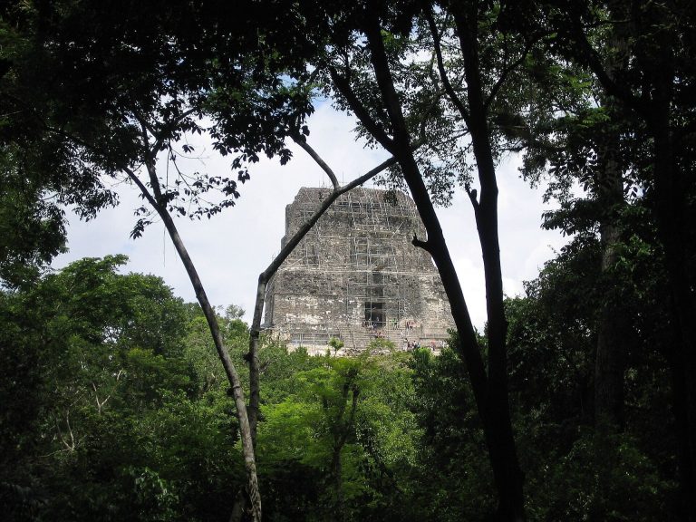
Structure 4 is the tallest building at El Chal. Its rectangular base measures 46 metres north to south by 30 metres east to west and consists of three stepped sections. Erosion caused extensive collapse, although the north side is better preserved. A long superstructure faced the West Plaza and developed from a single room into several rooms. The rooms stood on a low summit platform reached by a broad stairway, and stucco fragments with pigment show that their walls were painted. A metate fragment, a mano, and abundant domestic ceramics were recovered, while Stela 1 and Altar 7 stood in front.
Ballcourt
The ballcourt lies north of the West Plaza and runs north to south. It measures 18 by 4.8 metres and has side structures about 4 metres high that supported rectangular stone benches. A looters’ trench damaged the west structure, which originally had a western stairway. Sculpted stone blocks decorated the court aprons. Four surviving blocks bear geometric designs and portions of deity masks, and the stucco floor at the southern end remains well preserved. The ballcourt dates to the Late Classic.
Northeast and Northwest Plazas
Northeast Plaza
The Northeast Plaza covers approximately 850 square metres and is enclosed by four similarly sized structures around an area measuring about 30 by 35 metres. Its buildings are stepped rectangular platforms of finely dressed limestone, and excavations revealed superstructure remains and rooms with different doorways. Construction dates to the Late Classic.
Northeast Plaza Structure 2 probably had three stepped levels. Some blocks carried a double-trapezoid design and some were coated with cream-coloured stucco. The stairway and upper portions were deliberately destroyed in antiquity, leaving lower courses and a well-preserved southeastern sloping wall. Five Late Classic stucco floors covered the upper platform. Burial 67 lay in a stone-lined container beneath the second floor and was marked by a painted red circle. The burial included a painted plate beneath the head and another over the knees, both showing seated anthropomorphic figures with jaguar-claw gloves.
Northwest Plaza
The Northwest Plaza covers approximately 3,600 square metres and is enclosed by two structures, including a large pyramid on the west. Three Late Classic construction levels were identified. Structure 1 has a rectangular base measuring 44 by 25 metres and includes an inclined lower wall and a broad projecting stairway. Later resurfacing added another sloping wall and a small bench-like extension. Its ceramics are mainly Late and Terminal Classic utilitarian wares, with additional evidence of Postclassic occupation.
Structure 2 is a 5.5-metre-high pyramid with a base measuring 30 by 24 metres. It was built from small irregular blocks, has badly collapsed sides, and contains a looters’ pit on the west. Inset corners survive on its north and south sides. Terminal Classic ceramics, part of a ceramic incense burner, and broken obsidian prismatic blades were recovered there.
Residential sectors and the E-Group
The residential area was divided into four sectors. Central contained 25 groups, Arrepentimiento about 40, Panorama 53, and Municipal 18. Municipal was associated with the city’s ritual complex, while Panorama included a chert-working area. The Municipal Sector lies north of the highway between Flores and Dolores, and part extends into the municipality of Santa Ana. Its 18 residential groups surround the E-Group about 2 kilometres from the site core.
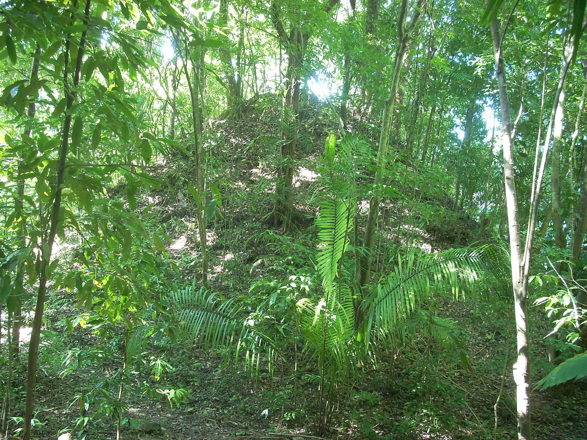
Arrepentimiento extends northward from the highway for about 600 metres toward the dry bed of the Río El Chal. Most groups occupy karstic hills or cattle pasture. Their structures are generally low platforms, 10 to 40 centimetres high, arranged around patios with alignments of uncut stones. Most date to the Late Classic. Panorama, about 3 kilometres from El Chal along the highway toward Santa Elena, contains 53 groups and a causeway. Its ceramic assemblages include Late Classic and Terminal Classic domestic wares.
Panorama also contains an artificial platform made by levelling a natural rise and Group 19, a probable Terminal Classic chert workshop. Waste material suggests that the group may have produced flint cores. Group 16 includes a causeway at least 70 metres long and 9 metres wide, bordered by low parapets. Stela 19 and Altar 9 were found about 40 metres east of Group 9 and are the only known monuments from Panorama.
The E-Group’s east platform is built of limestone blocks and was entered by a rear stairway. Unlike many E-Groups, it lacks lateral structures and has only a central upper platform, which rises 8 metres and produced Late Preclassic ceramics. The west pyramid is probably a Late Preclassic radial pyramid. The north and south structures are not securely dated but are probably Late Classic.
Other residential groups contain low platforms and small patios. Groups 13 and 15 lie outside the protected archaeological zone, and their ceramics span the Late Preclassic, Late Classic, Terminal Classic, and Postclassic, with most dating to the Terminal Classic. Group 18, northeast of the site core, contains four low structures around a plaza of about 300 square metres. Its first construction phase dates to the Late Preclassic and its second to the Late Classic. Burials 68 and 69 were accompanied by ceramic vessels, while a small pyrite disc, obsidian blades, and a flint projectile point were also recovered.
Monuments and burials
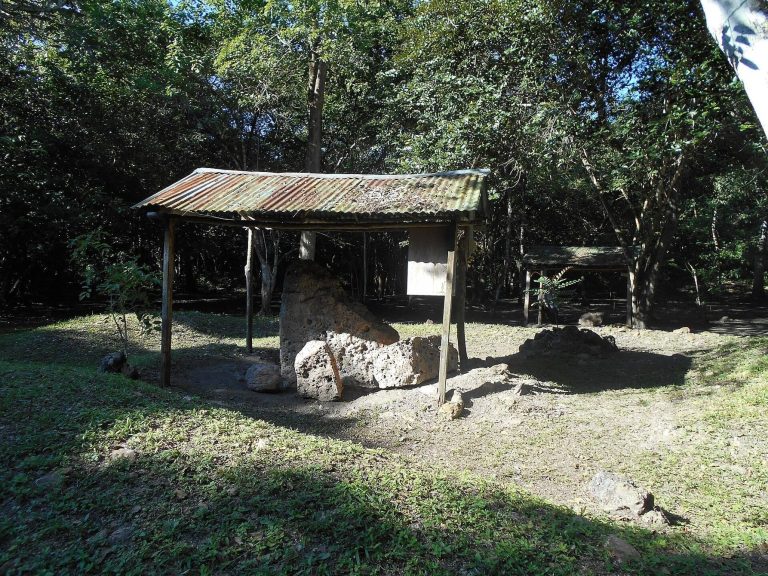
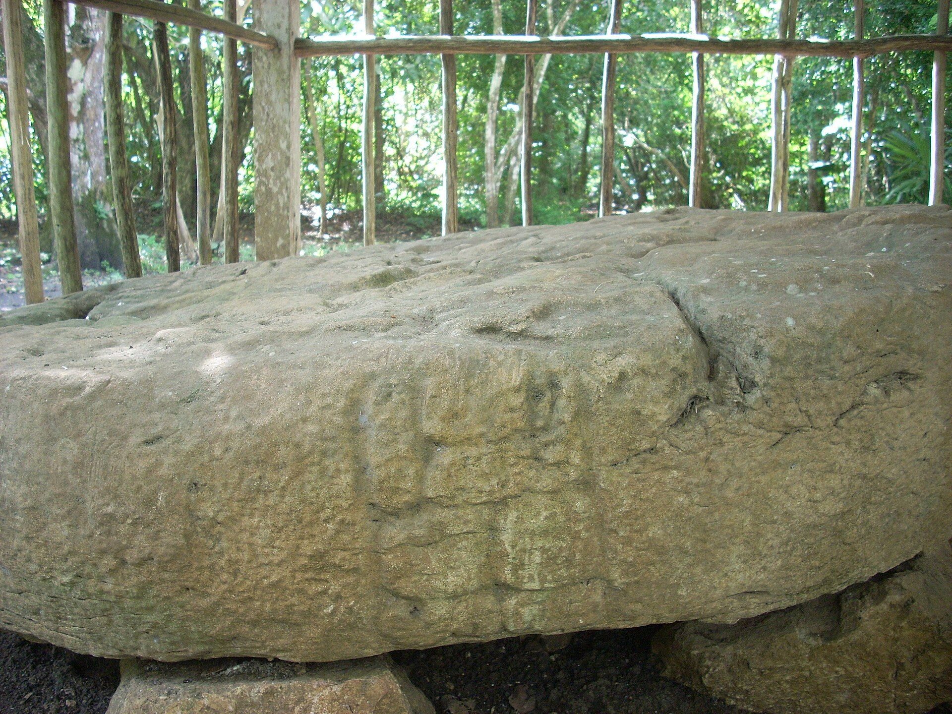
Nineteen carved stone monuments were originally recorded at El Chal. Most are badly eroded, several are broken, and only five stelae and three altars retain sculpted designs. Stelae are upright carved stones, while altars are stone monuments used for display, commemoration, or ritual activity. Stela 1, from the West Plaza, shows a standing figure with an elaborate feathered headdress and a staff within a rectangular frame. Its vertical text included a calendrical date, but the monument is now broken into fragments.
Stela 4 is the only El Chal monument carved on both sides. Its front includes a calendrical date interpreted as 17 March 761, El Chal’s Emblem Glyph, and a bloodletting scene in which a richly dressed figure stands on three seated prisoners. Stela 5 depicts a left-facing figure carrying a zoomorphic head and what appears to be a staff of rulership. Its incomplete date falls between December 740 and November 805, and its inscription names Shield Jaguar as the dedicating king and includes El Chal’s Emblem Glyph.
Other monuments include the eroded Stela 10 and Altar 6 in Group 21, Stela 12 and Altar 9 in Panorama, and several plain or damaged stelae and altars from the East, West, Southeast, and Northeast Plazas. Stelae 6 to 9 were removed in the 1970s and are now lost. The surviving monuments, together with painted funerary vessels, ceramics, flint, obsidian, metates, manos, and other objects, reflect the ceremonial, domestic, and craft activities carried out at El Chal.
Burials provide evidence for activity across several periods. Burial 265, a seated infant buried with a newborn beneath Terrace 1 Structure 2, is associated with Middle Preclassic ceramics and represents the earliest known activity at the site. Burial 264, beneath Terrace 2 Structure 2, dates to the Late Classic and was placed in a stone-lined container with a lidded ceramic pot. Burial 278, an infant beneath Terrace 1 Structure 5, also dates to the Late Classic. Several structures and monuments are now looted, eroded, collapsed, buried, deliberately destroyed, or partly incorporated into modern streets and buildings.