Adullam: A Biblical Settlement and Archaeological Site in Israel
Site at a Glance
- Rating
- 4.7
- Popularity
- Very Low
- Country
- Israel
- Primary era
- Iron Age
- Eras represented
- Bronze Age, Iron Age, Classical, Early Modern
- Civilizations
- Canaanite, Israelite, Ottoman
- Site type
- City
On this page14 sections
History
Adullam is an archaeological site in Israel associated with a Canaanite royal city and the northern Shephelah, the belt of low hills between the central hill country and the Mediterranean coastal plain. The settlement is mentioned repeatedly in the Hebrew Bible, whose traditions connect it with Judah, David, Joshua, Rehoboam, and the postexilic community. Its two archaeological elevations contain remains from multiple periods, reflecting a long history of settlement in the Valley of Elah region.
Canaanite and Judahite Traditions
Biblical tradition places Judah, son of Jacob, at Adullam after he separated from his father and brothers. There he formed a friendship with an Adullamite named Hirah and married the daughter of Shuah. During the Israelite conquest of Canaan, the king of Adullam was said to have been defeated and killed by Joshua and the Israelites. The surrounding territory was then allotted to the tribe of Judah.
Adullam is also traditionally associated with David during his flight from Saul, an earlier king of Israel. According to the Book of Samuel, David sheltered in the Cave of Adullam, where people in distress, debt, or discontent gathered around him. The same tradition tells how David’s men obtained water from Bethlehem, then held by a Philistine garrison, although David refused to drink it. The precise cave connected with this account remains uncertain.
Judahite Kingdom and Imperial Pressures
In the tenth century BCE, Rehoboam, the first king of the divided kingdom of Judah, fortified Adullam and other towns against Egypt. The settlement may have served as an administrative and military center with a garrison and stored food and weapons, rather than as a fortress in the strict sense.
The Book of Micah mentions Adullam in the context of Assyrian pressure on Judah. Sennacherib’s campaigns, followed by Neo-Babylonian domination and the deportation of Judean inhabitants in the sixth century BCE, affected the towns of the region, including Adullam. During the Persian period, approximately 539 to 331 BCE, members of the postexilic community resettled the area and traced their ancestry to Judah.
Hellenistic, Roman, and Later Settlement
In 163 BCE, Judas Maccabaeus, the principal military leader of the Maccabean revolt against Seleucid rule, withdrew to Adullam after fighting the Idumaeans and the Seleucid commander Gorgias. The settlement stood near the route through the Valley of Elah that later became the Roman road between Jerusalem and Beit Gubrin.
In the early fourth century CE, Eusebius, a Christian bishop and historian, described Adullam as a very large village about ten Roman miles east of Eleutheropolis, the ancient name of Beit Gubrin. A network of underground chambers on the southern side of the hill has been tentatively associated with the Bar Kokhba revolt, a Jewish uprising against Roman rule in Judaea during the second century CE. Parts of these installations were investigated during excavations in the 1990s.
Adullam remained inhabited in the late sixteenth century. An Ottoman tax register of 1596 lists thirty-six Muslim households, the cultivation of wheat, barley, and olives, and annual revenue of 5,160 akçe, a small silver Ottoman coin. The village was later abandoned. By the nineteenth century it was largely deserted and was used seasonally by shepherds during the rainy period.
Names and Archaeological Identification
The hilltop ruin is known as Khirbet esh-Sheikh Madkur after Madkur, a local Muslim holy man traditionally described as a son of Sultan Beder. A shrine built for him on the summit led to the earlier name Wely Madkur. A local explanation of the name A’id el-Miah, translated as “Holiday of the Hundred,” linked it to a story about a battle in which one hundred people were killed and the settlement destroyed. This is a popular etymology rather than a reliable explanation of the ancient name.
In 1871, Charles Clermont-Ganneau proposed identifying A’id el-Minya with biblical Adullam, based on its location, the approximate resemblance of the names, and ceramic evidence. Modern historical geographers have generally associated the lower site with Adullam proper and the upper site with “upper Adullam,” although the identification of the upper site remains inconclusive. Victor Guérin argued in the nineteenth century that the upper and lower ruins formed one ancient city divided into upper and lower sections.
The site was surveyed in the nineteenth century, again in 1992 and 1999, and during later archaeological projects. A limited excavation in September 2015 examined six squares on the western part of the upper ruin to a maximum depth of about 0.2 metres. Pottery recovered in place ranged from the Early Bronze Age to the Ottoman period, and Ottoman-period coins were also found. A systematic ceramic survey followed in December 2016, dividing the summit into collection units and recording visible surface finds in preparation for broader stratigraphic investigation. The site is maintained within Adullam Park by the Jewish National Fund, while its position near the Green Line has left it vulnerable to unauthorized digging.
Remains
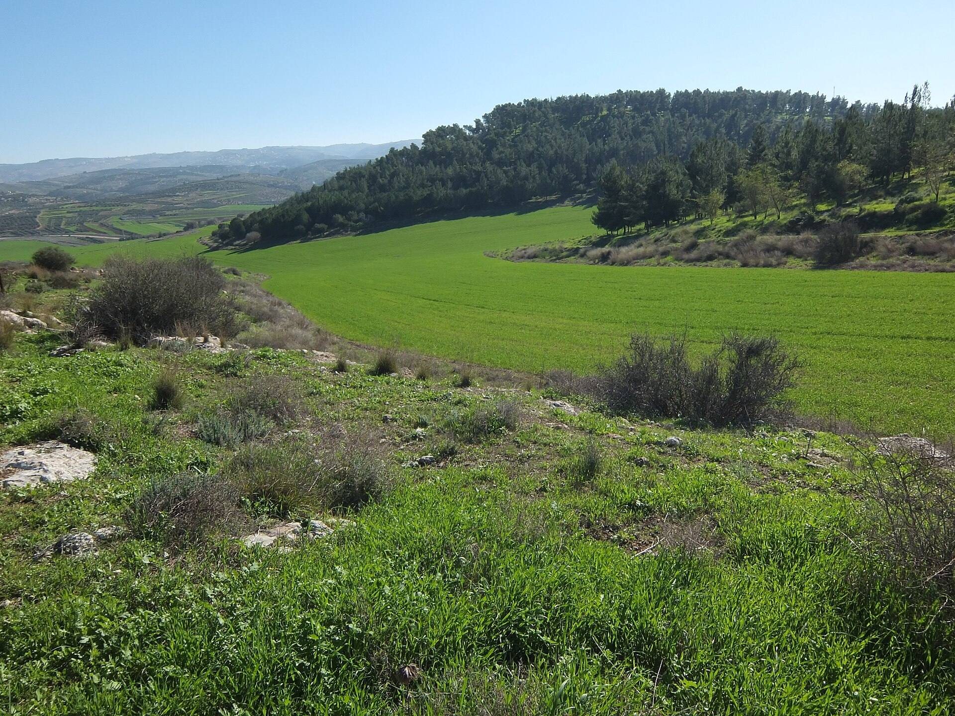
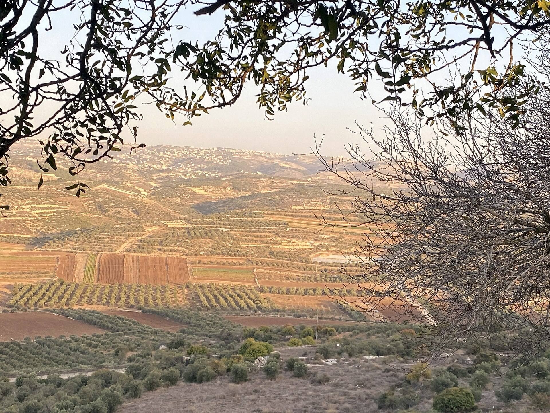
Adullam consists of two adjacent archaeological elevations, the upper hill of Khirbet esh-Sheikh Madkur, about 434 metres above sea level, and the lower ruin of Khirbet A’id el-Minya, about 351 metres above sea level. The upper summit lies above the Valley of Elah, while the lower ruin occupies the southern end of Wadi es-Sur, an extension of the valley. Superimposed remains from different periods occur across both areas.
Upper and Lower Settlements
Upper Hill of Khirbet esh-Sheikh Madkur
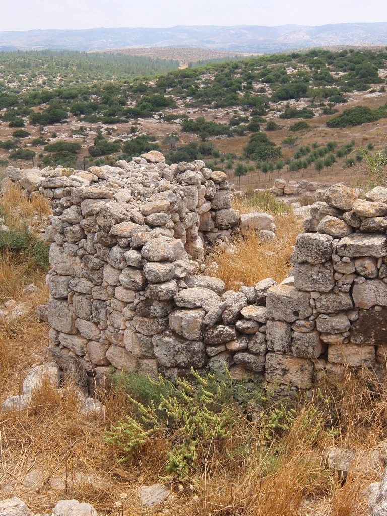
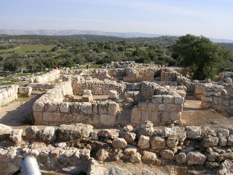
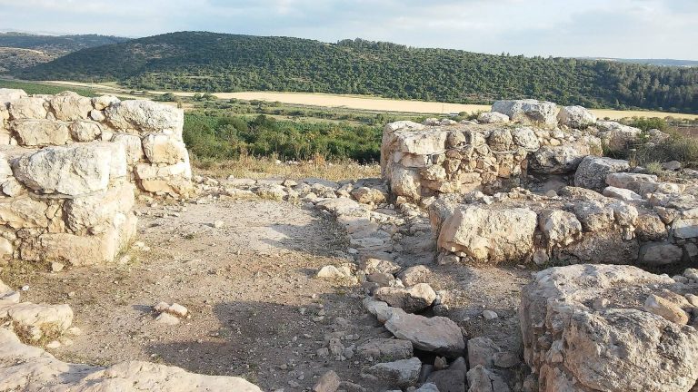
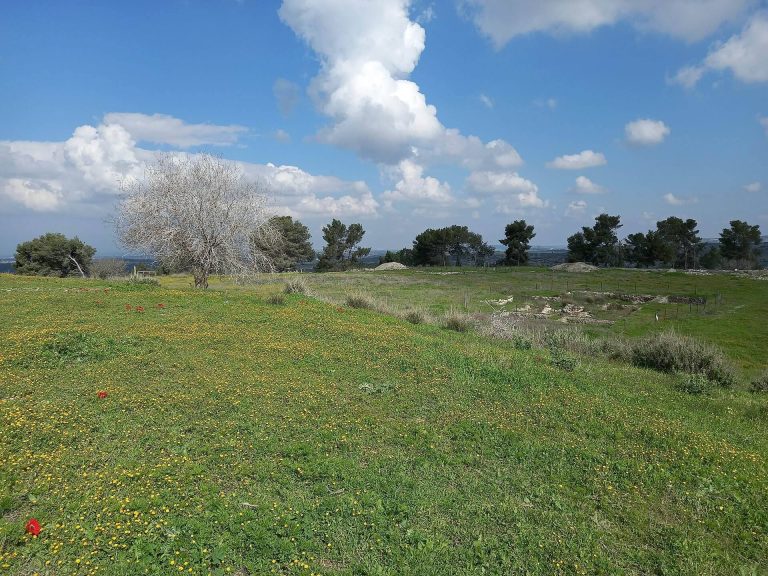
The upper site occupies a mostly level summit. Its northern and western sides descend toward narrow valleys, while a narrow southern neck connects the hill with the surrounding mountain range and gives it a naturally defensible position. Olive groves and pine trees cover the summit, which is enclosed in places by stone walls. Ruined stone buildings, scattered architectural debris, small towers, arches, and remains of a later Arab village are visible across the hilltop.
Lower Ruin of Khirbet A’id el-Minya
The lower ruin lies at the southern end of Wadi es-Sur and is overgrown with vegetation and trees along the northern flanks of the hill supporting the upper site. Earlier descriptions recorded about sixty collapsed houses in the lower settlement, including the remains of a mosque. The relationship between the upper and lower settlements is interpreted as part of the site’s development, although the surviving evidence does not fully demonstrate how the two areas were organized together.
Water Installations and Caves
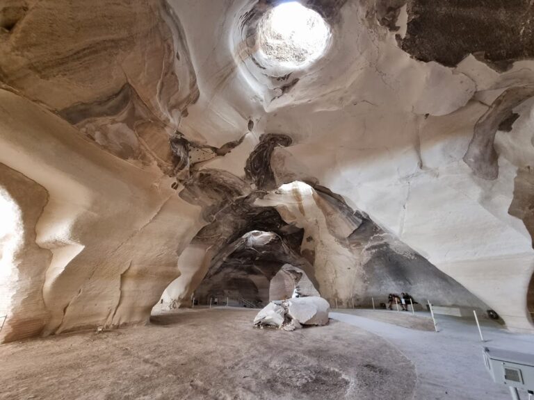
Numerous cisterns were cut into the bedrock of the upper site to collect rainwater. Caves and other rock-cut cavities occur on the summit and along the northern and eastern slopes. Some limestone caves on the western slope were used historically as livestock pens. Two wells in the northern valley are surrounded by approximately thirty ancient stone troughs, while a stone water trough and the shaft of a stone column remain visible at the lower ruin.
Summit Shrine
The Maqam of Sheikh Madkur stands on the summit. This small Muslim shrine, also called a maqam or wely, is associated with a holy person or local religious tradition and preserves the later religious identity attached to the hilltop site.
Archaeological Evidence and Subterranean Features
Pottery and Excavated Finds
Surface pottery from the site and the lower tell, an archaeological mound formed by successive settlements, includes Late Chalcolithic material. Other ceramics range from the Early Bronze Age through the Ottoman period. The 2015 excavation on the upper ruin produced pottery spanning the Early Bronze Age to the Ottoman period, together with Ottoman coins. The 2016 survey recorded surface ceramics across the summit and prepared the site for wider investigation. Excavation-based evidence for Chalcolithic activity remains limited, and the Late Bronze Age is represented by a relatively small body of stratified evidence.
Rock-Cut Chambers
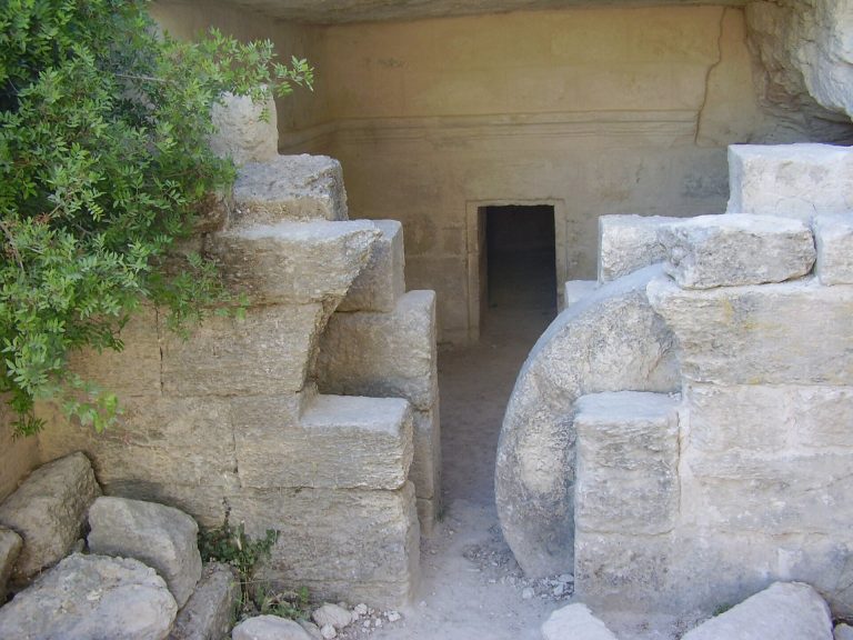
A network of underground rock-cut chambers extends along the southern side of the hill. These installations have been tentatively linked with the Bar Kokhba revolt in the second century CE, and parts of the network were examined during archaeological work in the 1990s. Together with the cisterns and caves elsewhere on the hill, the chambers form part of the site’s subterranean archaeological remains.
The surviving remains are generally ruined. Stone walls, collapsed buildings, water installations, caves, towers, arches, the later village remains, and the summit shrine preserve evidence of settlement and use across many centuries, while the limited scale of excavation leaves the wider stratigraphic history of the two elevations under continuing investigation.