El-Assasif: An Egyptian Necropolis and Ritual Landscape
Site at a Glance
- Popularity
- Medium
- Country
- Egypt
- Primary era
- Iron Age
- Eras represented
- Bronze Age, Iron Age
- Civilizations
- Egyptian, Kushite
- Site type
- Burial
- Remains
- Necropolis
On this page25 sections
History
El-Assasif is an ancient Egyptian necropolis in Al ‘Asasif, near Al Qarna in Luxor Governorate, Egypt. Burials and tombs accumulated here from the Middle Kingdom through the Late Period, while ritual activity continued into the Ptolemaic era, a period ruled by a Hellenistic dynasty. Its history was closely tied to the Feast of the Valley, a Theban festival in which a procession linked Amun’s temple at Karnak with mortuary temples on the west bank and honored the dead.
Early burials and royal routes
The earliest remains are associated with the causeway of Mentuhotep II, an Eleventh-Dynasty ruler who built the route to connect the valley with his mortuary temple at Deir el-Bahari. The causeway opened a direct passage through El-Assasif. Tombs were cut into the exposed rock faces from the Eleventh Dynasty into the early Eighteenth Dynasty, although some graves may have been there earlier and were damaged during the route’s construction. The Eleventh Dynasty was an early period of intensive burial in the necropolis.
During the Seventeenth and early Eighteenth Dynasties, people often used older tombs again for burials. Pottery and coffin fragments belong to this activity, as do deliberately broken vessels that may relate to a funerary rite known as the breaking of the red pots.
Eighteenth-Dynasty temples and processions
Hatshepsut’s mortuary temple and its causeway reshaped the area. The route continued to carry processions, especially during the Feast of the Valley, when Amun’s procession visited the royal mortuary temples. Hatshepsut’s temple remained active into the Ptolemaic period, and its sacred importance grew again during the Late Period.
Because Hatshepsut’s temple occupied the available approach, Thutmose III cut another causeway through the plain, north of Mentuhotep II’s route. Its construction removed some tombs and reduced the southern part of the ridge. An avenue of trees was planned, probably in the king’s 54th regnal year, but was not completed. Dried roots indicate that the plantings were no longer maintained soon after his death. At least part of the route remained in use through the end of the New Kingdom. Around 750 BC, later tomb building cut into its northern wall.
Burial activity increased again late in the Eighteenth Dynasty, particularly under Amenhotep III. Large private tombs, including that of Kheruef, stood near the festival route. In the Ramesside era, the period of the Ramesses rulers, smaller tombs for officials reused older walls and colonnades. During the Twenty-first Dynasty, some older shaft tombs received simple coffin burials with few grave goods.
New Kingdom construction and later burial
In the Twentieth Dynasty, Ramesses IV began a large mortuary temple in the eastern part of El-Assasif. Ramesses V and Ramesses VI continued the work, but the building was never finished. By the end of the New Kingdom, people were quarrying it for stone. Its construction and dismantling also destroyed the causeways of Mentuhotep II and Thutmose III.
From the Third Intermediate Period onward, tombs spread into ground made available by the dismantled routes. Some were cut into the ridge’s steep southern face and covered by simple mudbrick houses; others later extended across the plain. In the Saite period, associated with the Twenty-sixth Dynasty, people reused and sometimes enlarged older tombs and burial shafts. Some structures also served as dwellings, storerooms, or stables into Coptic times, the later history of Egypt’s Christian communities, and the Islamic period.
Late Period cemetery and festival rites
During the Late Period, El-Assasif again became a burial ground for high-ranking officials. Its crowded cemetery combined monumental tombs with smaller burial installations. Owners of many monumental tombs had served as chief estate administrators for the God’s Wives of Amun, a high-ranking female religious office. The tomb of Nespekaschuti was fitted into the forecourt of a Middle Kingdom tomb.
The placement of tombs remained connected to processional routes and the Feast of the Valley. The Late Period cemetery developed around Harwa’s tomb, near the crossing of Mentuhotep II’s former causeway and a route toward Medinet Habu. Saite-era paths followed former causeways and linked other parts of the cemetery to Hatshepsut’s route. These alignments were understood to ensure that tomb owners could continue to take part in the festival.
Festival observances included offerings and meals in tombs. In one rite, worshippers made a fire offering to Re-Horakhty, a form joining the sun god Re with Horus of the Horizon, or to Amun-Re in a tomb forecourt. Priests, singers from Amun’s temple, women associated with Hathor, and a chorus then entered with bouquets from the temple. Food, drink, dancing, and music probably followed in a court or above-ground tomb structure. Hathor, a goddess associated with motherhood and worship, may also have played a part in a rite in which torches were extinguished in milk. Depictions show Amun’s sacred boat spending the night beside the Golden Lake among milk basins and torches; at dawn, the torches were dipped in milk before the boat crossed to Karnak. Milk was considered regenerative, but Hathor’s precise role in this rite remains uncertain.
Vessel breaking during burial may also have been part of the red-pots rite. From the Late Period into the Ptolemaic era, some vessels were deliberately pierced before burial, apparently to reserve them for the dead. During the Ptolemaic period, Harwa’s tomb became an important cult place and was probably associated with the tomb of Osiris at Umm el-Qaab, an ancient royal burial ground at Abydos.
Archaeological work and modern discoveries
Archaeological work began in 1883 under Egypt’s antiquities authority. Herbert Eustis Winlock led a Metropolitan Museum of Art expedition in the 1920s, followed by work from the University of Vienna and the Austrian Archaeological Institute in Cairo between 1969 and 1977 under Manfred Bietak. Later research and conservation focused on individual tombs, including TT414. Spanish researchers worked in the chapel of TT28 from 2009 to 2014; the Middle Kingdom Theban Project began studying TT103 and TT366 in 2014, and a Polish project begun in 2013 examined Middle Kingdom private tomb architecture. A French mission has studied the construction and later use of TT33 since 2018. The South Asasif Conservation Project began work on tombs including TT223, TT390, and TT391 in 2006.
El-Assasif forms part of the Theban Necropolis, which is included on UNESCO’s World Heritage List.
Remains
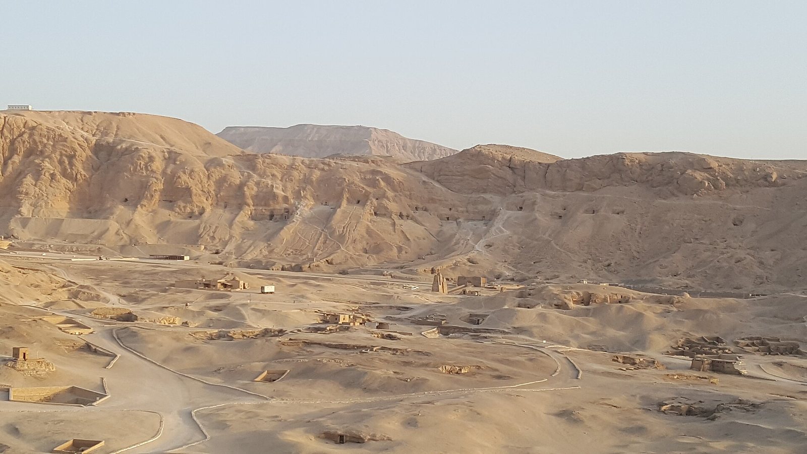
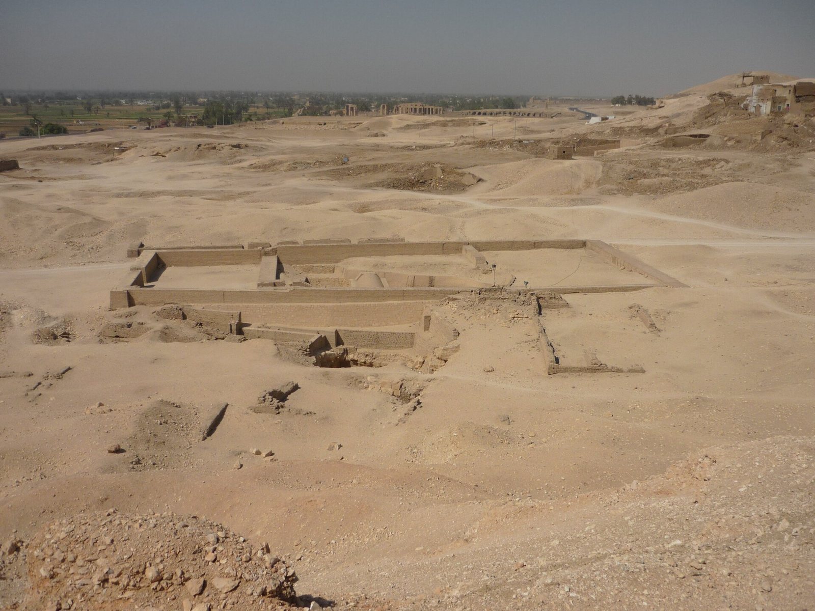
The necropolis occupies a valley east of Deir el-Bahari, between the rock basin and the edge of cultivated land. A ridge about 104 metres high once divided its northern and southern parts, though Eighteenth-Dynasty causeway building altered that division. Tombs, processional routes, temple remains, and later structures occupy the valley and its slopes.
Middle Kingdom route and tombs
Mentuhotep II’s causeway
The causeway associated with Mentuhotep II measured about 960 metres long and 46 metres wide and was built in at least three main phases. Its route passed through a cut in the plateau and continued toward Deir el-Bahari. Mudbrick paving is the principal surviving trace. Most stone boundary walls were dismantled, and some of their blocks were reused in later temples.
Rock-cut tombs
Rock-cut tombs flanked the causeway, generally set at right angles to it, and extended toward the Deir el-Bahari basin. Many early examples are saff tombs, a type with a row of pillars across the front and corridors behind. Tomb positions varied, with some occupying favored locations connected to their owners’ rank.
Eighteenth-Dynasty routes and temple
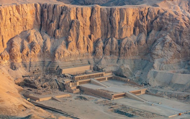
Hatshepsut’s valley temple
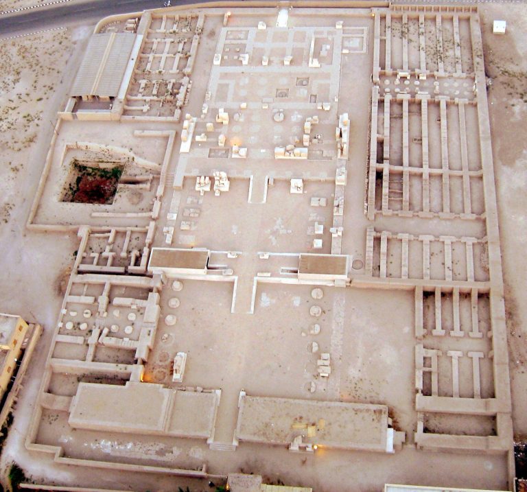
Excavated remains of Hatshepsut’s valley temple lie at the eastern end of her causeway. The plan echoed her terrace temple and included lower and upper courts separated by a pillared hall. The lower court was a shallow rectangle ending at the hall. The open, rectangular upper court had a limestone enclosure wall about six metres high and a gateway on its north side. The temple may have remained unfinished at Hatshepsut’s death. Its excavated portion was later reburied or destroyed, and many blocks were reused in other buildings, including Ramesside temples and the Ramesseum.
Excavations by Lord Carnarvon and Howard Carter between 1908 and 1911 recovered an ancient hoe, a stonemason’s hammer, and bricks bearing the royal names of Thutmose I and Hatshepsut. A hieratic inscription on the underside of enclosure-wall blocks identifies Puimre as the builder; his tomb lies in el-Khokha.
Causeways and tree plantings
Hatshepsut’s causeway crossed northern El-Assasif. Thutmose III’s separate route, 32.5 metres wide, ran north of Mentuhotep II’s causeway. Planting pits for its planned tree avenue were cut as much as 10 metres into the rock and filled with dark clods of Nile mud and mudbrick. Some pits include a white-plastered planting bed, while others were left unfinished. The eastern part of the avenue appears to have been completed.
Twentieth-Dynasty temple remains
Ramesses IV’s mortuary temple
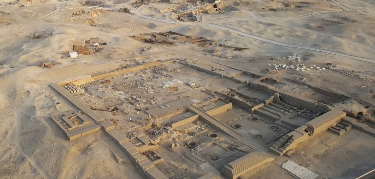
The unfinished mortuary temple begun by Ramesses IV measured 240 by 60 metres. Its plan included a large eastern entrance gateway, two courts with columns, and a western sanctuary. A massive foundation basin declined in height from west to east and was filled with clean sand. Only a few blocks survive.
Colonnaded temple
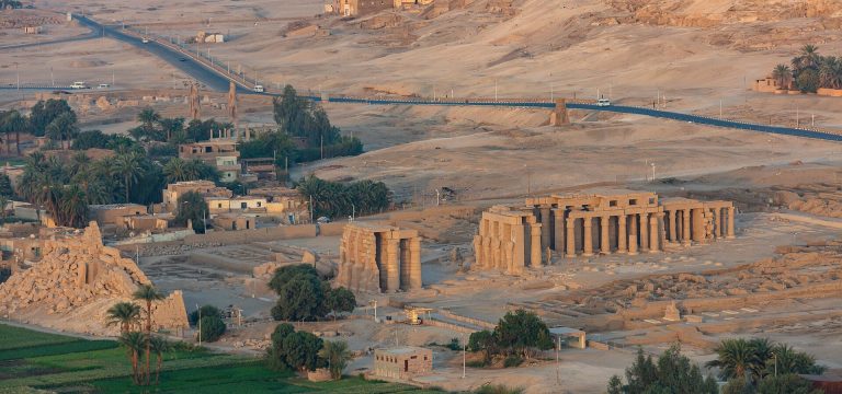
A separate colonnaded temple of Ramesses IV was found near Hatshepsut’s valley temple in 1911, about 82 metres south of its enclosure wall and level with the upper court. It probably had seven pairs of columns, and eleven columns have been identified. A foundation deposit in its northeast corner contained 143 faience and electrum plaques bearing Ramesses IV’s name. The building may have served as a station for a sacred boat and was probably connected with the Feast of the Valley.
Late Period tombs and cemetery routes
Superstructures and burial rooms
Late Period tombs followed no single plan, adapting to the ground and available space. Many stood on the plain beneath free-standing, east-west-oriented mudbrick superstructures, or structures built above the burial rooms. Niches, small clay funerary cones impressed with names or titles, and plantings of trees or palms could articulate their façades. A monumental gateway, or pylon, commonly marked the entrance. Large rock-cut cult and burial rooms lay underground and were reached by stairs. Many tombs also had an open-air court, possibly connected with a cult of Re and Osiris, the god associated with the dead and the afterlife.
Access in tombs of the Twenty-fifth and early Twenty-sixth Dynasties was generally direct and aligned with the main axis; later plans more often turned before reaching the burial rooms. The architecture drew on several traditions, including royal enclosure walls with niches, royal tombs in the Valley of the Kings, mortuary temples, and private rock-cut tombs. The tombs of Pedamenopet, Pabasa, and Mutirdis contain afterlife guides, funerary texts previously used in New Kingdom royal tombs.
Decoration and named tombs
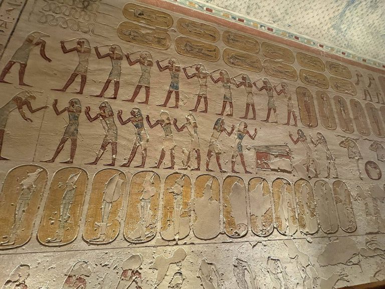
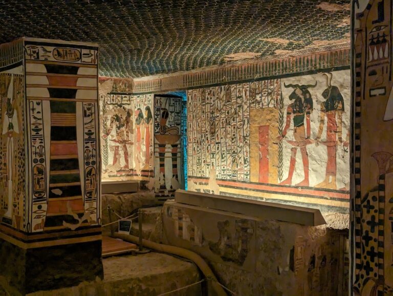
In monumental tombs, decoration was concentrated in rooms outside the burial installations and could also cover the above-ground structures. Stone doorjambs often carried the owner’s name and titles. Decoration was concentrated around the entrance niche and doorframes, at the cult focus, and in the open court. Scenes in Basa’s court show the owner receiving offerings and include Book of the Dead spells, solar hymns, and scenes of daily life. The Book of the Dead was a collection of spells intended to help the deceased in the afterlife.
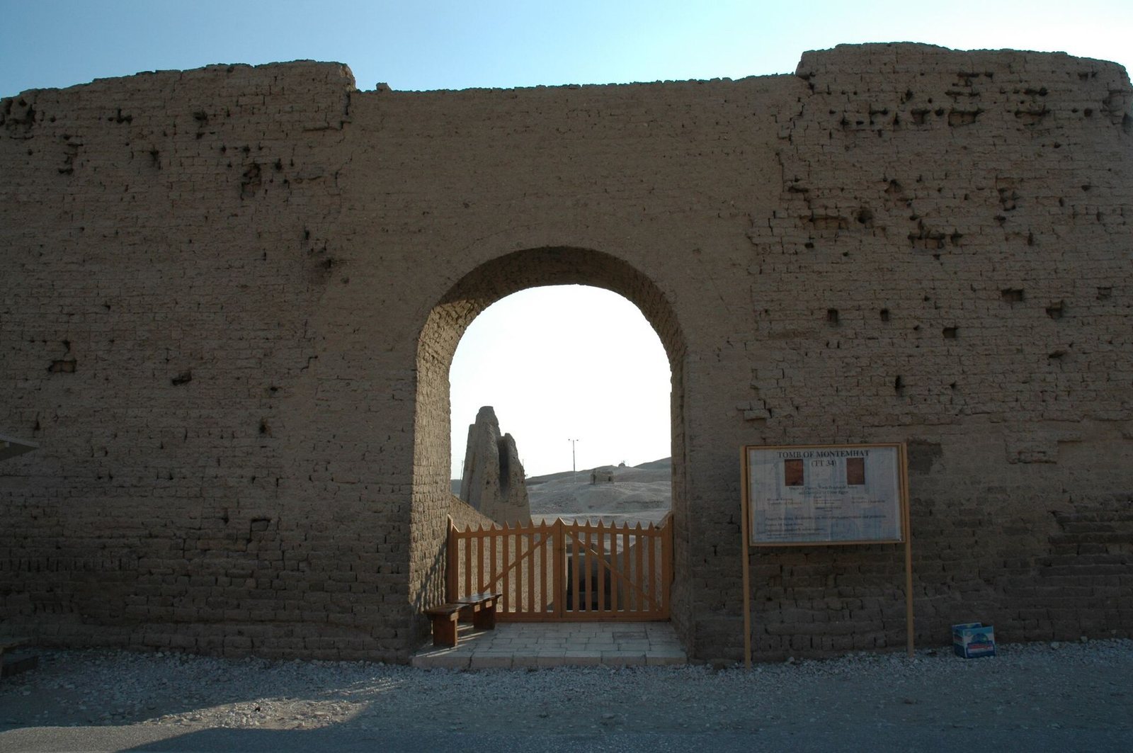
Named tombs include TT33 of Pedamenopet, TT34 of Montouemhat, TT37 of Harwa, TT192 of Kheruef, TT279 of Pabasa, TT389 of Basa, TT410 of Mutirdis, and TT414 of Ankh-Hor. Other examples include TT27, TT36, TT188, TT223, TT388, TT390, TT391, and TT409. TT is short for Theban Tomb, the numbering system used for tombs in the necropolis.
Cemetery paths
A Saite-period route followed Mentuhotep II’s former causeway. TT36 and TT196 stood at its western end, and their superstructures obstructed access to western tombs such as TT37. Another path ran along the eastern side of TT33, whose large enclosure wall blocked the earlier causeways; the path connected with Hatshepsut’s route. The pylon of TT196 was offset from the main axis toward a point on Hatshepsut’s causeway where the processional boat first became visible again above the ridge. Remains of a small way-station chapel were found nearby.
Burial finds and later use
Offerings and funerary deposits
Hundreds of small incense burners and offering cups were deposited in the court of Harwa’s tomb during the Ptolemaic period, perhaps for fire offerings. Fill from Late Period tomb superstructures also contained many vessels associated with Bes, with traces of milk. Their find locations suggest that they may have been used for milk offerings in superstructures or stairways.
Chapel, sarcophagi, and coffins
A Twelfth-Dynasty funerary chapel uncovered in a tomb court in 2014 contained part of a limestone altar and funerary offerings. In November 2018, two sarcophagi thought to be more than 3,500 years old were found with two well-preserved mummies and about 1,000 funerary figurines. One painted tomb contained a woman’s body; the other had previously been opened by Egyptian antiquities officials.
In 2019, an Egyptian archaeological mission found a cache of 30 Twenty-second-Dynasty coffins in front of Hatshepsut’s temple. They held the mummies of 23 adult men, five adult women, and two children. Many coffins were sealed and intact, with painted images of Egyptian deities and hieroglyphic texts, including passages from the Book of the Dead.
Kampp 23
Kampp 23 is a rock-cut tomb with a T-shaped plan, a form typical of Nineteenth- and Twentieth-Dynasty tombs. Later use left painted plaster over earlier reliefs and fragments of funerary figurines called ushabtis, which were intended to perform tasks for the dead. In 2025, a joint Egyptian-Canadian mission identified its owner as Amun Mes, a high-ranking Ramesside official and mayor of Thebes. Inscriptions gave his titles, including tax collector, royal adviser, divine father of Amun, and overseer of quarry expeditions. Excavation also revealed later reuse of the tomb.
Southern necropolis
The southern part of El-Assasif lies in a valley between Sheikh Abd el-Qurna to the north and Gournet Murai to the south, west of the Ramesseum. Its tombs date mainly to the Third Intermediate Period, especially the Twenty-fifth Dynasty. An unfinished causeway planned for Mentuhotep III’s mortuary temple was intended to cross this valley. The modern settlement of Horobat covers much of the area. Tomb rooms and original masonry were adapted into later buildings, and tombs also served as stables and sources of building stone. Flooding in the 1990s caused some rooms to collapse and further damaged the necropolis.