Dolmen de la Siureda: A Prehistoric Collective Burial Monument
Site at a Glance
- Popularity
- Very Low
- Country
- France
- Primary era
- Bronze Age
- Eras represented
- Bronze Age
- Civilizations
- Unclassified
- Site type
- Burial
- Remains
- Tomb
On this page11 sections
History
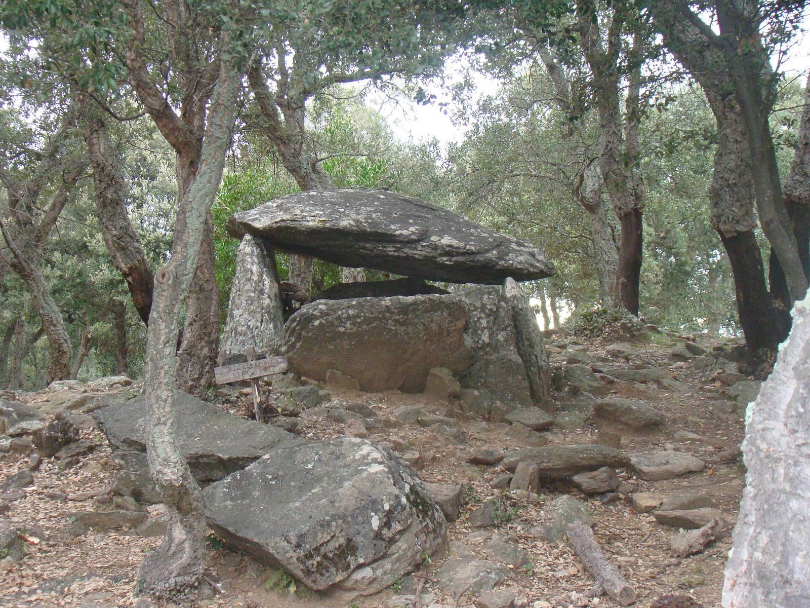
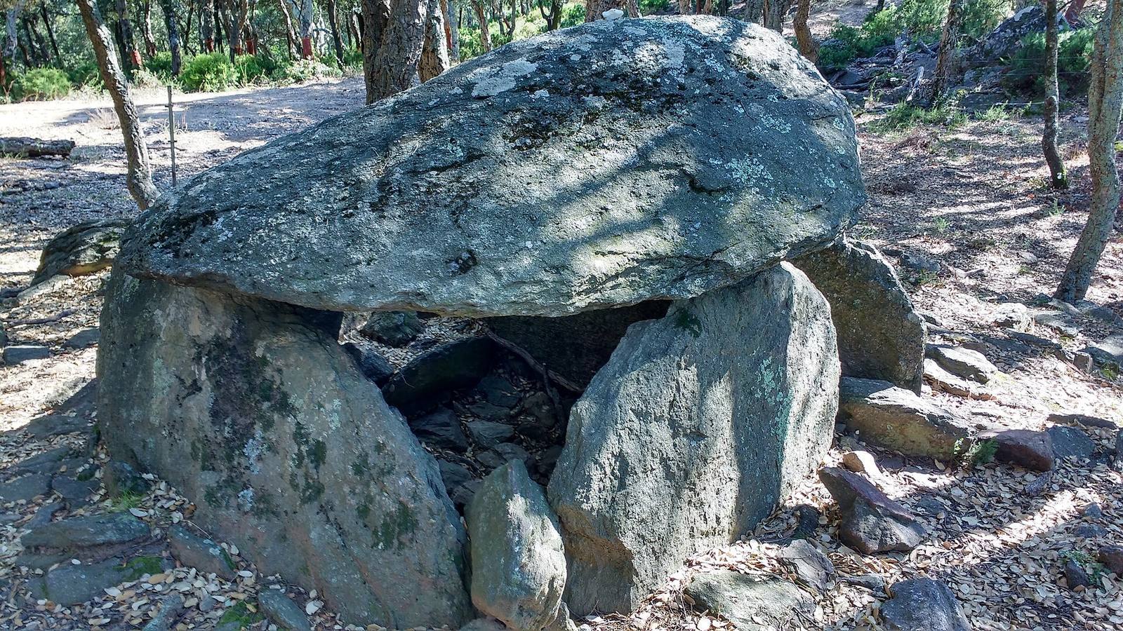
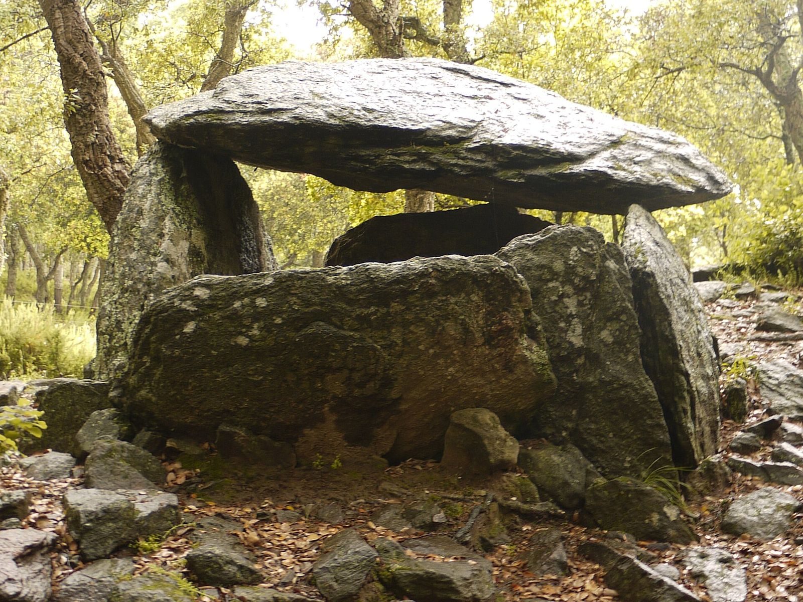
The Dolmen de la Siureda is a prehistoric burial monument in Maureillas-las-Illas, France, made from upright stones supporting a capstone. Erected in the second half of the third millennium BC, it served as a collective burial place.
Prehistoric and later use
The monument was reused during the Late Bronze Age, the final phase of the Bronze Age, around 1100–700 BC. It may then have served as a shelter or burial place. People used it again in historical times. At an unknown date, the burial chamber was emptied or looted.
Rediscovery and archaeological work
Gilles Borrat, a resident of Céret, rediscovered the dolmen in 1985. It was the first dolmen in Vallespir, a historic region in the eastern Pyrenees, to receive public notice. On 6 October 1986, the local newspaper L’Indépendant reported the discovery under the name “dolmen de Maureillas.”
Work to improve the surroundings took place in 1985–1986. From June 1986 to 1988, the Vallespir and Aspres Prehistory Group excavated the site under the direction of Françoise Claustre, an archaeologist specializing in prehistory. The dolmen is one of 148 recorded in the Pyrénées-Orientales, a total that includes sites mentioned in older records but not relocated. Six place-names in the commune may refer to other megalithic locations; one is 900 m away.
A model of the dolmen and its mound has been displayed at Céret’s Maison de l’archéologie since the museum opened in July 1995. The museum was later renamed the Maison du Patrimoine Françoise-Claustre.
Remains
Setting and plan
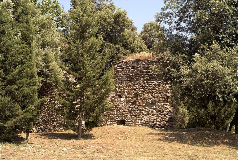
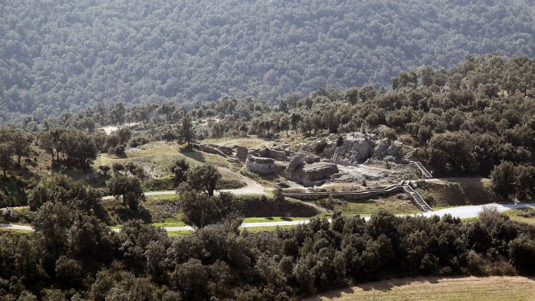
The monument has a simple rectangular plan aligned northwest to southeast, with its entrance facing southeast. It stands at the center of a mound on a level section of ridge, at an elevation of 440 m. The ridge lies on the eastern slope of Pic de Miralles, between the Còrrec de la Siureda valley to the south and the Còrrec del Bruguer valley to the north. The site is about 3 km from Maureillas and Céret. Its hillside is covered in cork-oak woodland; Siureda derives from a Catalan word for a cork-oak grove. The surrounding hills consist of metamorphic and crystalline rock, overlook the Roussillon Plain and Tech Valley, and offer views as far as the Mediterranean.
Burial chamber
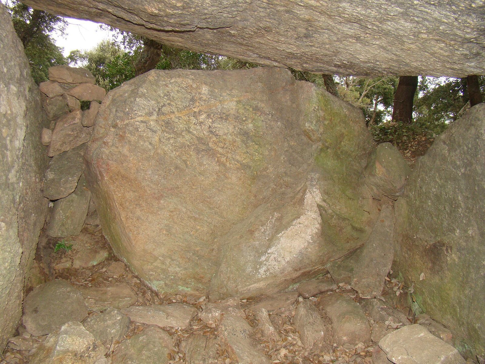
Three upright slabs support a capstone measuring 2.35 by 1.35 m. The inner chamber measures 1.60 by 1.70 m. The stones are locally gathered gneiss, a metamorphic rock. The southwest slab is the largest, at 2.15 by 1.45 by 0.45 m; the northeast slab measures 2 by 1.15 by 0.30 m. The northwest, or head, slab measures 1.55 by 1.10 by 0.20 m. It has collapsed, probably after being damaged. The dolmen is relatively well preserved.
Movable entrance
Three small upright stones set into the ground formed part of an opening system at the southeast entrance. They measure 0.75 by 1.05 m, 1.05 by 0.50 m, and 0.65 by 0.60 m. A larger slab, 1.35 by 0.85 by 0.25 m, could be moved like a door and now lies fallen outside. With its movable slab and access at mid-height, this arrangement is classified as a Pyrenean chamber, a regional type of megalithic burial chamber. The opening may have allowed bodies to be placed inside at different times.
Burial mound
The mound is about 10 m in diameter and is made of earth and stones, partly incorporating natural features. Gneiss slabs paved its surface. It stands about 1 m high at its highest point and was probably taller when built. Most stones measure 20–30 cm across, while some are 40–80 cm; larger stones line the southern and western edges. The mound is generally well preserved, though its eastern side is particularly damaged.
Excavation evidence
Deposits and pottery
Excavation exposed about 80 cm of earth and stone in the chamber, arranged in four layers. The upper layer was about 30 cm of brown earth with a few stones. Beneath it lay 40–45 cm of darker brown earth containing more stones, including quartz. Two lower layers, each about 5 cm thick, consisted of light-brown and reddish sediment. Pottery from the three upper layers represents different periods. Wheel-thrown fragments from the top layer belong to historical times, while Late Bronze Age sherds occur throughout those three layers. The highly fragmented vessels include urns, plates, bowls, and cups. Surviving rims and surface decoration include cup-shaped impressions, fluting, fingerprints, geometric patterns, and applied cords.
Other finds
The earliest finds among the excavated objects date to around 2200–2000 BC and include several pottery fragments and a turquoise-colored variscite bead, made from a mineral used for prehistoric ornaments. Late Bronze Age objects include a terracotta spindle whorl, a small weight used to spin thread, and part of a bronze ring. Excavators also recovered a fragment of a grinding stone. Small human-bone fragments came from the third layer and may belong to the earliest burials, although their date is uncertain.