Danotsuka Kofun: A Square Burial Mound in Chiba
Site at a Glance
- Popularity
- Low
- Country
- Japan
- Primary era
- Medieval
- Eras represented
- Medieval
- Civilizations
- Yamato
- Site type
- Burial
- Remains
- Burial Mound
On this page13 sections
History
Danotsuka Kofun is a square Japanese burial mound in Itatsuki, Sammu, Chiba Prefecture, Japan. It was built around 610–620, although one interpretation of its grave goods places the first burial in the late sixth century. The person buried there may have been a regional chief holding the office of kuni no miyatsuko, a local ruler within the Yamato political order.
The terminal phase of the burial group
Danotsuka followed two large keyhole-shaped tombs in the same burial group. A keyhole-shaped mound has a circular rear section and a rectangular projection at the front. One predecessor dates to the later sixth century and the other to around the end of that century. A smaller square mound was built nearby after Danotsuka, by the middle of the seventh century; Danotsuka is nevertheless thought to mark the end of the group’s main tomb-building sequence.
The transition from large keyhole-shaped tombs to square and circular forms in the late sixth and early seventh centuries is understood as a change in regional leadership, linked to the Yamato state’s integration and reorganization of local chiefs. Danotsuka’s early date and scale show that large square tombs appeared in the Kanto region not long after this change began in the Yamato heartland.
Regional authority and the Yamato state
During the later sixth century, four local centers were associated with prominent burial groups along the area’s rivers. In the later phase of tomb building, Danotsuka and a large circular tomb elsewhere in the district became the principal large burials. Their builders may have represented two leadership groups that took turns holding regional authority, rather than a chieftaincy belonging permanently to the people who built Danotsuka.
Danotsuka is among the largest square tombs in the Kanto region and is second in size in Chiba Prefecture. Its scale is comparable to burial mounds of contemporary Yamato rulers. The prominence of large tombs in the Kanto has been linked to the region’s growing importance to the Yamato state, while the decline in the number of centers building large tombs has been interpreted as part of a wider reorganization of local authority.
From the late seventh to early eighth century, a district administrative center and a leading Buddhist temple were established apart from the earlier principal burial groups. Smaller temples also appeared near some groups. This development has been interpreted as a further change in how local leadership was expressed, with district administration and temple-building increasingly taking the place of tomb construction.
Excavation and later use
The tomb first appeared in a research publication in 1958. A 1979 survey judged its plan probably square. The National Museum of Japanese History carried out two excavations in 1985–1986 as part of research into regional variation in Japanese history, focusing on the shift from keyhole-shaped tombs to large square and circular ones. The smaller mound northwest of Danotsuka was excavated in 1986. Further surveys examined the earlier tombs in 1988 and 1990, and work in 1994–1995 established that a nearby circular mound predated an adjacent earlier tomb.
The chamber was reopened for multiple later burials. In the early modern period, robbers entered the tomb, scattering grave goods and human remains. Pottery fragments from the entrance area support the dating of this robbery.
Remains
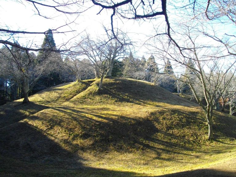
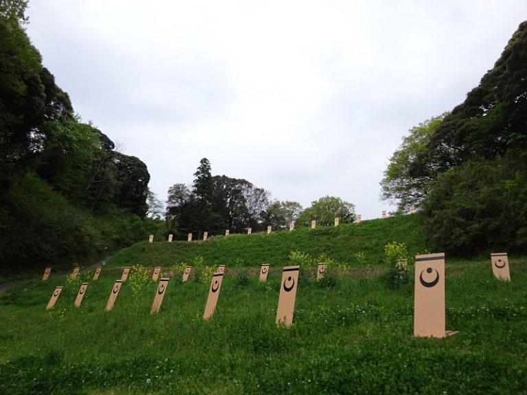
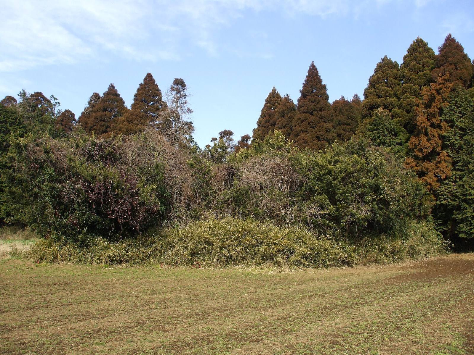
Danotsuka occupies the head of a small valley on a plateau beside a river that flows toward the Kujukuri coast. Its almost square, three-tier mound is encircled by two moats, while a horizontal-entry stone chamber, reached from outside through a passage, lies on its south side. The plateau forms part of a burial group organized into clusters by the valley.
Mound and setting
Position in the burial group
The mound stands at about 50 metres above sea level, within a burial group on a plateau roughly 44–50 metres high. A small valley running northeast from the river divides the group into three clusters, and Danotsuka lies in the northwestern cluster at the valley’s head. The group has 35 recorded mounds: three keyhole-shaped, three square, and 29 circular. The classification of three of these as tombs is uncertain.
Mound construction
The mound measures about 62–64 metres on each side and rises approximately 10 metres. Its three tiers are about 2, 3, and 5 metres high. The mound stands on ground sloping generally from northwest to southeast; higher ground to the west and north was cut and levelled. Most of the fill is Kanto loam, with some black soil. Alternating dark layers within the red loam may have helped stabilize the structure.
Large trenches were cut into the fill on the east, north, and west sides, roughly 20 metres from the mound’s centre. They extend from the mound into the underlying loam and measure about 4–5 metres across and more than 2 metres deep. Since they were made after some of the mound fill had been laid, they may have helped strengthen the structure rather than marking an earlier, smaller design.
Moats and embankment
The two moats extend the mound’s overall footprint to about 84 metres on each side. The inner moat is 3.8–5 metres wide and 0.5–1.1 metres deep. Outside it is an embankment about 4 metres wide, followed by an outer moat measuring 1.2–4.2 metres across and 0.4–0.8 metres deep. Both moats narrow on the east beside the valley, and the outer moat also narrows toward the east along the southern side.
Burial chamber and contents
Stone chamber
The 7.76-metre-long chamber lies on the mound’s south side, with its far end about 15 metres south of the centre. Its passage leads to an antechamber and then a rear chamber. Cut blocks of tuffaceous mudstone, a comparatively weak stone containing volcanic ash, form the structure. The chamber is about 2 metres high. Its floor is 1.3–1.5 metres wide, while the inward-sloping walls narrow the ceiling to 0.7–0.8 metres.
Clay packing behind the stonework, interlocking cuts in some blocks, and clay between ceiling stones helped support the chamber. The rear chamber collapsed and was repaired by cutting back into the mound. Clay covered the passage floor, while shells, chiefly Japanese hard clams, covered the antechamber and rear-chamber floors. The shells were probably gathered on the nearby open coast; they may have helped keep the floors dry, though their purpose is uncertain. Blocking stones in the passage had earth packed against their outer side.
Coffins and burials
Iron nails retaining fragments of wood show that cedar was used for coffins. At least one coffin was probably placed in each of the antechamber and rear chamber. Poor preservation of bones and teeth makes the number and arrangement of burials uncertain. A likely reconstruction includes seven adults: three men and three women in the antechamber, and one adult of uncertain sex in the rear chamber. The remains also suggest a young woman in the rear chamber and a child about six or seven years old. The child’s remains found in both rooms may belong to the same person, giving a possible total of nine individuals.
Grave goods and pottery
Finds include three pairs of earrings; curved magatama beads made of jasper, agate, and lead glass; faceted crystal and alkali-glass beads; amber barrel-shaped beads; glass round beads; a silver-inlaid sword; a small knife; iron arrowheads; horse fittings decorated with gilt bronze and silver; coffin nails; and Sue ware, a high-fired pottery, and Haji ware, unglazed earthenware. The sword dates to around the end of the sixth century, and the horse fittings are also considered late sixth-century objects. They were probably placed in the rear chamber with an adult whose sex is uncertain and who may have been male. The arrowheads date from the late sixth to early seventh century.
Fragments of twelve Sue-ware vessels came from the inner moat inside the chamber entrance. Their state and location suggest that they were deliberately broken and scattered there, perhaps during funerary rites for the chief whose burial led to the tomb’s construction. The vessels’ forms date to the 610s.