Château du Haut-Hattstatt: A Medieval Hilltop Castle in France


Site at a Glance
- Rating
- 3.8
- Popularity
- Very Low
- Country
- France
- Primary era
- Medieval
- Eras represented
- Medieval
- Civilizations
- Holy Roman Empire
- Site type
- Military
- Remains
- Castle
On this page12 sections
History
Château du Haut-Hattstatt is a medieval hilltop castle in France, built by the powerful Hattstatt family between about 1280 and 1282. Also known as Hoh-Hattstatt and Barbenstein, it occupied Barben Mountain above the routes linking the Alsatian plain with the Krebsbach valley. Its construction formed part of a territorial struggle between the Hattstatt and Girsberg families for control of the profitable mountain passes.
Foundation and strategic rivalry
On 4 October 1280, the heads of the three Hattstatt branches agreed to build the castle jointly. Each branch was to contribute thirteen marks of silver every year, although the obligation was reduced to ten marks in 1282. Construction proceeded in a single campaign and was probably nearing completion by April 1282, when guards and servants were hired. A document from that year states that the lords of Hattstatt had built the castle.
The new stronghold was called Hohen Hatstat in 1286, when a garrison was recorded there. Its guards and servants received an annual allowance of 74 quarts of grain, 16 pounds, and 5 shillings. The castle overlooked the Bildstoeckle Pass and allowed the Hattstatts to compete with the Girsbergs, who were established on the Staufen summit and sought influence over the Marbach Pass.
Lordship and changing ownership
In 1310, the co-owners agreed to devote income from jurisdiction and armament to the castle’s maintenance for five years. Around 1423, Haut-Hattstatt was a Habsburg fief, meaning that the Hattstatt lords held it under the wider authority of the Habsburg dynasty. Between 1430 and 1433, Antoine de Hattstatt transferred half of the property to the Duke of Lorraine in exchange for rights over Saint-Hippolyte.
The Hattstatt family later recovered its possessions. In 1456, however, Johann-Ulrich von Hattstatt and his son Johann-Oswald were placed under imperial ban, a legal sanction that removed a person from the protection of the Holy Roman Empire and exposed their property to seizure. During the resulting dispute, the castle was entrusted to Johann von Landeck.
Conflict and destruction
By 1462, Haut-Hattstatt was described as a refuge of robber knights. The citizens of Basel considered destroying it, although they did not carry out the plan. After the capture of Hohkönigsburg, an urban league also decided to besiege Haut-Hattstatt.
The decisive attack came during the conflict with Mulhouse in 1466. Pierre de Reguisheim imprisoned citizens of Mulhouse at the castle, prompting the intervention of Munster, which was allied with Mulhouse through the Decapolis, an alliance of ten imperial cities in Alsace. Munster’s militia besieged Haut-Hattstatt, burned it between 5 and 13 November, and then destroyed the remaining walls with gunpowder.
The castle was not rebuilt. Its strategic value had declined, while the Hattstatt family, like much of the high nobility, had moved from remote mountain castles to more comfortable urban residences. After the Hattstatt line became extinct, the Truchsesses of Rheinfelden inherited the site. They sold its stones to the city of Colmar for demolition in 1646 and 1647.
Later history and preservation
The ruins deteriorated over the following centuries. A view made by Rothmuller in 1839 preserves the appearance of the site during the nineteenth century, while Sebastian Münster’s Cosmography described it as a castle site or ruin. German forces occupied the summit during the First World War and caused further damage by cutting trenches and building underground shelters. Without later maintenance, the last surviving remains of the residential building collapsed in the early 2000s. Château du Haut-Hattstatt is listed in the general inventory of cultural heritage.
Remains
Summit buildings and defensive enclosure
Residential building
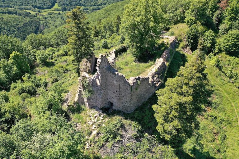
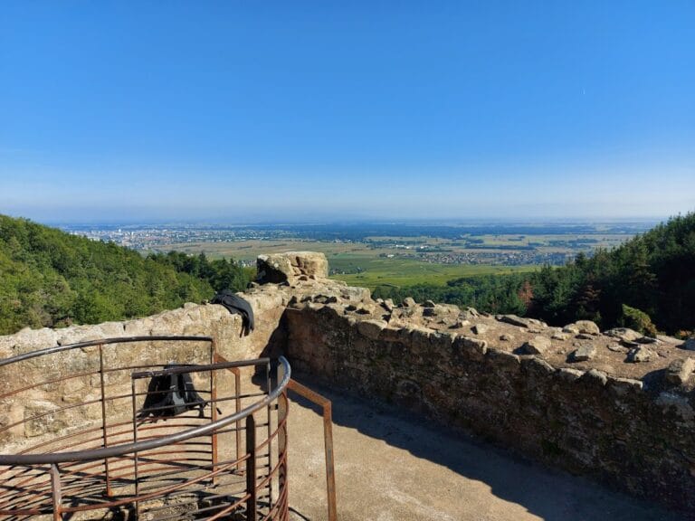
The castle occupied a granite summit at about 800 metres above sea level, on the mountain range separating the Krebsbach valley from the Alsatian plain. Behind a neck ditch, a defensive ditch cut across the narrow approach to the rocky summit, stood the main residential building, or logis. This roughly quadrangular structure measured about 21 by 13 metres and formed the elongated core of the castle. Haut-Hattstatt had no keep, the strongly fortified principal tower found at many medieval castles.
The lowest level of the logis contained arrow slits, traces of which survive archaeologically. The level above had rectangular windows divided by vertical stone members, together with built-in stone seats beside the deep openings. The third level either repeated this arrangement or used narrower windows without mullions and window seats. A probable fourth level contained only simple lighting slits. The high wall shown in Rothmuller’s 1839 view has since collapsed, leaving only a few foundation walls.
Lower courtyard and walls
A lower courtyard lay south of the residential building and below it. A perimeter wall enclosed the courtyard, while another wall probably separated this area from the logis. Only a few traces of these structures survive on the slope. A 1621 land survey suggests that a round tower stood at the southeast corner of the residential building, but no trace is visible on the ground, and the local topography makes such a tower unlikely.
Construction materials and masonry
Granite construction
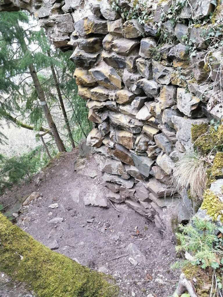
The principal building material was locally quarried biotite-bearing porphyritic granite. The stone was extracted while the surrounding ditches were being cut and was roughly shaped into blocks of generally quadrangular form. Individual blocks weighed about 35 to 55 kilograms, allowing one person to handle them.
The walls used rubble-core construction, with finished masonry faces on the inner and outer sides and a filling of smaller granite fragments and mortar between them. Regular courses were about 15 to 30 centimetres high. Because the blocks were only roughly dressed, the builders used many wedges and a substantial quantity of mortar. The core may be the only surviving part of mortar that has decomposed over time.
Sandstone and mortar
Sandstone elements, including capitals, have been found at the site, although their original positions within the castle cannot be determined. The mortar contained almost equal parts lime paste and sand. The sand probably came from the bed of the Runzbach, whose source lies a few hundred metres to the northwest, while the limestone used to make the lime probably came from the area around Schlossrain and Bickenberg north of Osenbach.
The materials and building methods are notably uniform across the site. This consistency points to a rapid construction campaign in the 1280s and to a castle that remained largely unchanged until its destruction. Poor preservation and the limitations of the surviving historical images leave parts of the original arrangement conjectural.
Nearby sites