Chartreuse d’Aillon: A Former Carthusian Monastery in France


Site at a Glance
- Rating
- 4.6
- Popularity
- Low
- Country
- France
- Primary era
- Early Modern
- External website
- Open
- Eras represented
- Medieval, Early Modern
- Civilizations
- Duchy of Savoy, Holy Roman Empire
- Site type
- Religious
- Remains
- Monastery
On this page12 sections
History
Chartreuse d’Aillon is a former Carthusian monastery in Aillon-le-Jeune, France, founded in the 12th century for the Order of Carthusians, a monastic order combining communal worship with solitary and contemplative living. Also known as the Mont-Sainte-Marie Charterhouse or Notre-Dame d’Aillon, it was dedicated to the Virgin Mary and belonged to the Carthusian province of Chartreuse. Historical work generally places its foundation charter in 1178, although dates including 1143, 1173, around 1183, and before 1178 have also been proposed.
Foundation and early community
Count Humbert III of Savoy is traditionally regarded as the monastery’s founder. His donation was made for the salvation of his family and himself, and granted the Carthusians rights over the land of Aillon, Lake La Thuile, the pastures of Vellein, lands at Lanelajour, the fief of Guy Siboud, and timber for heating. Several of his vassals also contributed land or property, including Nantelme and Villelme of Miolans, Boson of Apremont, Chabert of Varax, and Ponce of Conflens.
The monks probably came from Meyriat Charterhouse. Their first settlement may have been at Muret or at a place later called Saint-Bruno, while the date when they moved to the present site is unknown. They may have begun establishing themselves in the area as early as 1149. Around 1178, the community may have received the monastery’s domain as a pledge from a lord of Apremont. In 1189, it acquired the property permanently, and Aymon of Apremont is recorded as selling Mount Sainte-Marie to the monks.
Guy, probably Guy of Aosta, was present at the foundation as Bishop of Aosta and prior of Meyriat. He has been associated with the early community, although Laurent Morand considered him more likely to have organized it than to have served as its formal prior. A reference from 1158 mentions a Guigo prior de Allione. The monastery lay within the Diocese of Geneva and the deanery of Annecy, despite its position close to the boundary with the Diocese of Grenoble and the deanery of Savoie.
The Carthusian lands occupied an isolated part of the former parish of Aillon, including the valley known as Aillon, Lourdens, or Fully. Aillon was the third Carthusian house established in the southern part of the region, following Le Reposoir and Saint-Hugon. It also belonged to a wider group of Carthusian houses in the historic Diocese of Geneva, including Vallon, Oujon, and Pomier.
Expansion under the counts of Savoy
Successive counts of Savoy confirmed and enlarged the monastery’s endowments. Count Thomas I confirmed his father’s grants in 1216, made six additional donations during his reign, and placed the charterhouse under his protection. Count Amadeus IV granted land in the Montmélian plain in 1236, including the Lourdens estate at Cruet. He confirmed earlier donations in 1251 and left the monastery 1,000 sous in his will of 1252.
The community grew from seven or eight monks at its foundation to more than twenty. Lay brothers and donated workers supported them, serving under contracts rather than taking monastic vows. Most of the monks came from the surrounding region, though some arrived from elsewhere. In order to preserve the isolation of their religious retreat, the Carthusians obtained the removal of the inhabitants of Le Cimetière, then the parish center of Aillon. The circumstances of this action remain unclear.
In 1383, Count Amadeus VI of Savoy gave the fortified castle of Pierre-Châtel to the Carthusian order. The prior of Aillon became commander of the fortress, even though military administration conflicted with Carthusian rules. This arrangement lasted until 1583 and gave the prior a role beyond the secluded religious life of the charterhouse.
Economic power and religious discipline
By 1476, the monastery held about 3,000 hectares, chiefly forests, along with around ten farms in the Lourdens valley, property at Doucy, and vineyards in the Combe de Savoie. Its recorded workforce and livestock included twenty servants, 45 dairy cows, eight heifers and calves, 19 draft oxen, 24 bulls, 19 goats, and 24 mules and donkeys. These resources supported a substantial rural estate as well as the monastery’s religious community.
The Carthusians also developed metalworking and milling activities. Iron ore from the Hurtières valley in Maurienne, together with copper, lead, and silver ores, was carried by mule over the Col du Frêne. It was processed in Carthusian foundries and trip-hammer forges, where mechanically driven hammers shaped or worked metal. A foundry at Martinet dessus was established in the 17th or 18th century, while other installations stood on the Aillon stream and at Martinet dessous in Aillon-le-Vieux. Near the confluence of the Isère and Arc rivers at Albigny, the monks operated a trip-hammer, flour mill, and sawmill. Their ironworking ended after French troops occupied the Duchy of Savoy.
Discipline within the house was periodically criticized. A visitation in 1476 condemned the prior’s negligence and the monks’ failure to observe silence and other Carthusian obligations. Later concerns included tobacco use, unauthorized excursions, inappropriate conduct, and weak observance of church discipline. Fires also damaged the monastery. A major blaze in 1582 led to reconstruction under Prior Dom Fiacre Billard, and the complex was rebuilt during the 17th century.
Revolutionary confiscation and decline
In 1792, revolutionary France annexed the Duchy of Savoy. The monks refused to swear the required constitutional oath, so they were expelled and their property was confiscated. Some found refuge locally with François Bébert, who later became mayor of Arith, while others went to Turin. Approximately 400 French soldiers occupied the monastery.
The furnishings were sold in February 1793 under the supervision of the notary François-Marie Dumaz. In 1794, the remaining property in the commune of Aillon was divided into eleven lots. The bell towers and buildings were dismantled under the Albitte Decree, a revolutionary measure applied in Savoy, and one church bell was hidden. The monastery then became a quarry, with its stones sold locally.
The former monastery portal was reused in the parish church of Notre-Dame-de-l’Assomption in Aillon-le-Jeune, built in 1804. The new parish had been established independently that year. Morand recorded that the high altar was transferred in 1806 to Saint-Donat Church in Aillon-le-Vieux, although its present whereabouts are uncertain. By 1804, the charterhouse was largely ruined. Only the entrance building remained from the main complex, representing about one-tenth of the original buildings, while the Correrie chapel survived separately. Pilgrimages to the former monastery continued during the 19th century.
Preservation and modern use
From 1853, the surviving entrance building belonged to the Bérard brothers, who used it as a residence and agricultural facility. Interest in preserving the remains revived during the 1980s with the creation of the Association for the Safeguarding of the Charterhouse of Aillon. The deteriorating building was sold to the Cœur des Bauges intercommunal authority in 1990, and restoration followed, including repairs to the roof in 1994.
The existing buildings and the land corresponding to the former extent of the charterhouse were entered in the Supplementary Inventory of Historic Monuments in 1994, a French heritage-protection designation for historically important structures. The cemetery cross at the Correrie had been entered separately in 1944 and attributed to the 13th century. The restored main building became the Heritage Center of the Bauges Massif Regional Natural Park, inaugurated in 2008. The center closed at the end of the 2024 tourist season after the regional park withdrew from the project because it could no longer provide the necessary funding.
Remains
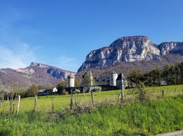
Chartreuse d’Aillon stood at about 1,026 meters above sea level, or 1,030 meters on the IGN map, on the southwestern edge of the Bauges Massif. The monastery occupied a narrow valley below the Grand Colombier, also called the Colombier d’Aillon. This valley extends for about ten kilometers and runs from southwest to northwest. The physical remains are divided between the former main monastery, or Maison Haute, and the Correrie, or Lower House, about 500 meters farther down the valley.
The former High House
The original Maison Haute covered approximately 1,000 square meters. Its plan was arranged in three successive parts: the Vestibule, the Small Cloister, and the Great Cloister. The Vestibule included the entrance building and the former obedience courtyard. Its north and south wings held workshops, stables, a chapel, dormitories for servants and lay brothers, and kitchens. The Small Cloister formed a rectangle about 10 by 12 meters and may have been used for conventual meetings. The Great Cloister gave access to sixteen individual monks’ cells. A chapter house, refectory, library, forge, and other buildings completed the monastic complex, most of which have disappeared.
Entrance building
The surviving entrance building was formerly known as the building of strangers and served as the monastery’s guesthouse. It is a 17th-century structure measuring 42 meters in length and two stories in height, aligned from northwest to southeast. Its western facade faces the former courtyard and has galleries on both levels. The lower gallery is formed by stone basket-handle arches, which have a flattened, gently curved profile, and supports a wooden gallery above. A steep slate roof covers the building and was restored in 1994.
The original portal was transferred to the parish church of Notre-Dame-de-l’Assomption in Aillon-le-Jeune. Its pediment carries the dates 1646 and 1670, together with the Latin inscription HUMBERTUS COMES III, recalling the donation associated with Humbert III. The door dated 1670 contains a peephole through which the monks could observe visitors. Behind the entrance building, in the former obedience courtyard, stands a circular stone basin held together by iron. It has been identified as an old well, although it is not connected to a water source, and excavations appear to have revealed an irrigation system.
The Correrie
The Correrie was the monastery’s rural and service center. It housed one monk and lay brothers, as well as a chapel, cemetery, and a grange operated by a tenant farmer. A granger was a tenant who ran a monastic farm and shared its agricultural produce with the owning institution. The grange was one of the community’s largest agricultural installations and produced vacherin cheese. Before a guesthouse was established at the main monastery in the 14th century, the Correrie also received visitors and pilgrims.
Correrie chapel
The present chapel is a simple single-nave building dedicated to Saint Michael the Archangel. Most of its visible architecture and its facade belong to the 17th century, probably reflecting Carthusian construction, although recent studies have suggested origins as early as the 13th century. Its exact date has not been established. The chapel runs from west to east, measures about 18 meters long and five meters wide, and has walls 1.8 meters thick.
Inside, a pointed-arch vault rises to an apex before ending in a narrower polygonal apse covered by a semi-dome. Four round-arched windows, two on each side, have openings that widen toward both the interior and exterior. The roof carries a copper-clad onion-dome bell tower, renovated in 1960. Its Baroque portal has a cornice, truncated pediment, and incorporated niche, with a window above that appears to have been reconstructed. Baroque decoration inside the chapel was restored in the 19th century, with decorative work by the painter Salvati. Some objects from the chapel are displayed in the charterhouse museum.
Cemetery and agricultural remains
A cemetery lies north of the Correrie chapel and retains several tombstones. Its cylindrical cross is probably from the 13th century and was carved from a single piece of stone. The cross has no inscription. Its upper section contains a swelling with an empty rectangular niche. Northwest of the chapel are traces of an old mill, while another circular stone basin bound with iron probably represents an old well.