Champtoceaux Castle: A Medieval Fortress on the Loire in France


Site at a Glance
- Rating
- 4
- Popularity
- Very Low
- Country
- France
- Primary era
- Medieval
- External website
- Open
- Eras represented
- Medieval, Early Modern, Modern
- Civilizations
- Duchy of Brittany
- Site type
- Military
- Remains
- Fortified Town
On this page16 sections
History
Champtoceaux Castle is a former fortified stronghold in France, at Orée d’Anjou, whose medieval fortress was established at the end of the tenth century on the site of earlier occupation. The location had been occupied from the Neolithic period, and Roman-period construction has also been found there. Its position above the Loire made it an important frontier site in the March of Brittany, a zone where Breton, Angevin, Poitevin, French, and later English interests met.
Early settlement and Christian associations
Gregory of Tours recorded a castrum at the site in the sixth century. A castrum was a fortified settlement or stronghold. The place was traditionally identified with Castrum Celsum, a name that later developed into Châteauceaux. Gilles Deric attributed its Christianization in the early seventh century to Saint Méen, a Breton Christian saint associated with early monastic foundations.
According to the historical tradition surrounding the site, the duke Austrapius was consecrated bishop at Châteauceaux around 560. The settlement briefly became the seat of a bishopric detached from the diocese of Poitiers. Chroniclers Eginhard and Fredegar also associated the stronghold with Pepin the Short, who may have stayed there during the eighth century. The site lay on the March of Brittany, facing Oudon and Ancenis, and Pepin may have celebrated Easter there with his wife Bertrada while receiving ambassadors of Almanzor, the caliph of Baghdad.
The formation of the medieval fortress
During the tenth century, Châteauceaux stood between the political spheres of the dukes of Brittany and the counts of Anjou and Poitou. Eble Manzer, count of Poitiers, ceded the town to the Normans occupying the Loire estuary. After Alain Barbetorte expelled them from the Nantes region in 938, Guillaume Tête d’Étoupe granted the town to Alain for life.
A fortress was established at the end of the tenth century. In 986, Renaud of Thuringia, viscount of Anjou, asked Guérech, count of Nantes, for permission to build a stronghold on the ruins of the earlier castrum. Guérech refused, but Renaud proceeded with the support of Foulques Nerra. By the middle of the eleventh century, the site was held by the brothers Geoffroy and Odéric, also known as Orry, of Champtoceaux.
In 1044, Geoffroy gave the Church of Saint John the Baptist to Marmoutier Abbey. The church became a priory, and Geoffroy Martel, count of Anjou, confirmed the gift. This confirmation indicates that Champtoceaux had moved from the sphere of the counts of Nantes into Angevin influence. Around 1060, Thibaud of Jarzé was lord of the town. Through the remarriage of his granddaughter Narmaise of Jarzé, Champtoceaux passed during the twelfth century to the Crespin family, which was of Norman origin and connected with the English court.
Plantagenet and Capetian struggles
Champtoceaux became involved in the long conflict between the Plantagenets and the Capetians. The Plantagenets were the English royal dynasty whose continental possessions brought them into repeated conflict with the Capetian kings of France. The fortress endured nine sieges between the twelfth and fifteenth centuries and frequently changed hands.
The first recorded siege probably took place in 1141, during a revolt by Angevin and Norman vassals against Geoffrey Plantagenet. Geoffrey took Champtoceaux, but Maurice of Craon, seneschal of Henry II Plantagenet, destroyed the fortress in 1172 during a later revolt by three of Henry’s sons, supported by forces from Anjou and Nantes. Geoffroy Crespin rebuilt it afterward.
Philippe Augustus seized Champtoceaux in 1203 during the confiscation of John Lackland’s continental possessions. The confiscation followed John’s murder of his nephew, Arthur I of Brittany. John recovered the town after landing at La Rochelle in 1206, but could not retain it. He reportedly took it again in 1214, before the French king reconquered it during the same year. Thibaut Crespin then swore allegiance to the king of France.
Thibaut later plundered and ransomed merchants travelling down the Loire below the fortress. He also rebelled with the Poitevin barons against Louis VIII. Pierre I of Brittany, allied with the French king, besieged Champtoceaux. Thibaut surrendered on 21 September 1224 and went into exile in England. The king granted the town to the duke of Brittany, although it remained within the county of Anjou, and Pierre I strengthened its defenses. The inhabitants were exempted from the salt tax, a privilege that continued until the French Revolution.
In 1229, Pierre I paid homage to Henry III of England and joined him in an effort to recover former Plantagenet territories. Louis IX, also known as Saint Louis, led a campaign against Champtoceaux, which capitulated. Pierre retook it after the French army had disbanded, but another French campaign in 1234 brought about a further surrender of the fortress.
Breton dynastic conflict and destruction
Champtoceaux was again drawn into a wider political struggle during the War of the Breton Succession, a dynastic conflict fought from 1341 to 1364 between the Montfort and Penthièvre claims to the Breton duchy. English and French support for the rival factions made the conflict part of the broader Anglo-French struggle. The French party seized Champtoceaux in 1341.
Under the Treaty of Guérande in 1367, the count of Anjou transferred the stronghold to Jean IV, duke of Brittany and son of Jean de Montfort. Jean IV fled to England in 1373 after a general uprising. Charles V sent French forces under Bertrand du Guesclin, a leading Breton commander serving the French crown, into the duchy, and Champtoceaux was among the fortresses that opened their gates to him. The town returned to the count of Anjou in 1377 and to the duke of Brittany under the second Treaty of Guérande in 1380. In 1390, the citadel was sold to Olivier de Clisson, a major Breton nobleman.
The decisive episode came in 1420. Marguerite de Clisson, dowager countess of Penthièvre, invited Jean V, duke of Brittany, and his brother, the count of Étampes, to Champtoceaux for a supposed Saint Valentine’s Day celebration and a reconciliation between the Penthièvre and Montfort families. On 14 February, Marguerite’s sons Olivier and Charles de Blois imprisoned Jean V in the castle’s second keep, known as the Devil’s Tower, and threatened to kill him.
The duchy rallied around Jeanne of France. An army of about 50,000, supported by English troops, reduced the Penthièvre strongholds one after another. At the end of May 1420, it besieged Champtoceaux under continuous artillery fire. Jean V was transferred to Clisson and released on 5 July, after which the fortress surrendered.
The Parliament of Brittany confiscated the Penthièvre family’s property and annexed it to the ducal domain. Jean V ordered Champtoceaux destroyed “down to the bare ground,” including its houses, churches, and walls, and gave the inhabitants three days to leave. Demolition continued for ten years, after which reoccupation of the fortified settlement was prohibited. A new town developed southeast of the ruins from 1431, while the former fortified site remained largely unoccupied on the besiegers’ circumvallation, a line of field fortifications constructed around a besieged place.
Later ownership and modern study
Jean V granted the place to his marshal Berrand de Dinan, but René of Anjou controlled its seigneurial revenues from 1444 to 1474 while asserting former Angevin rights. Louis XI, who inherited Angevin claims through his mother Marie, took Champtoceaux and restored it in 1480 to Nicole, niece of Olivier of Blois-Penthièvre and granddaughter of Marguerite de Clisson, and to her husband, Jean de Brosse of Boussac.
The Penthièvre family later ceded the town to the constable of Montmorency. Through marriage, it passed to the princes of Condé, who retained it until the Revolution. The rebuilt Saint John the Baptist Priory was destroyed during the Revolution. In the eighteenth century, Champtoceaux was attached to the bishopric of Nantes but administered by a seneschal, a high official responsible for governing and judging a lordship or district, who answered to the presidial court of Angers.
Historical study of the abandoned ruins began in the nineteenth century. During his 1826 journey along the Loire, the English Romantic painter William Turner produced drawings and watercolours of Champtoceaux and the Moulin-Pendu. The ruins were partially protected as historic monuments in 2009, while the Moulin-Pendu had received protection in 1975. The site is privately and municipally owned.
Remains
Champtoceaux’s former fortified town and castle occupy approximately 20 hectares on a defensible plateau. The Loire bounds the site to the north and the Voinard stream to the south. Older descriptions indicate that the stream may once have fed a pond along the fortress’s southern side. Steep slopes descend for approximately 70 metres around most of the plateau, with the northern flank the steepest. The eastern side descends more gently toward the present town, so a substantial ditch was excavated below the walls on the east, south, and southwest.
Three fortified enclosures
The hilltop was divided into three walled enclosures, arranged from east to west as the castle town, the bayle, and the castle. Together they contained approximately 2,300 metres of walls and 14 towers. The castle town covered about 9.5 hectares, the bayle about 1.2 hectares, and the castle about 1.33 hectares. A bayle, or lower bailey, was an enclosed area adjoining the principal castle and used for subordinate or service functions. The bayle was separated from the town by a double ditch, while another ditch divided it from the castle.
Castle town
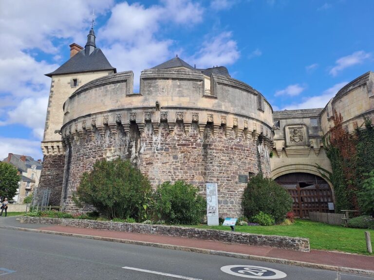
The eastern and southern town ramparts survive to about five metres in height, while the northern side is harder to discern. The town-side gateway is the most visible element of the fortress, although its original fabric survives at foundation level. It was later reconstructed in a highly fanciful and historically implausible form. An old cadastral plan records a path along the southwestern slope, which may represent another entrance to the castle town or to the bayle, although that identification remains uncertain.
Bayle
The sloping bayle lies below the former town plateau. Its double ditch contains masonry remains within the central embankment. At the northern end, the bases of the two towers belonging to the entrance châtelet toward the town survive. A châtelet was a fortified gatehouse. The bayle’s position between the town and castle formed part of the site’s layered defensive organization.
Castle
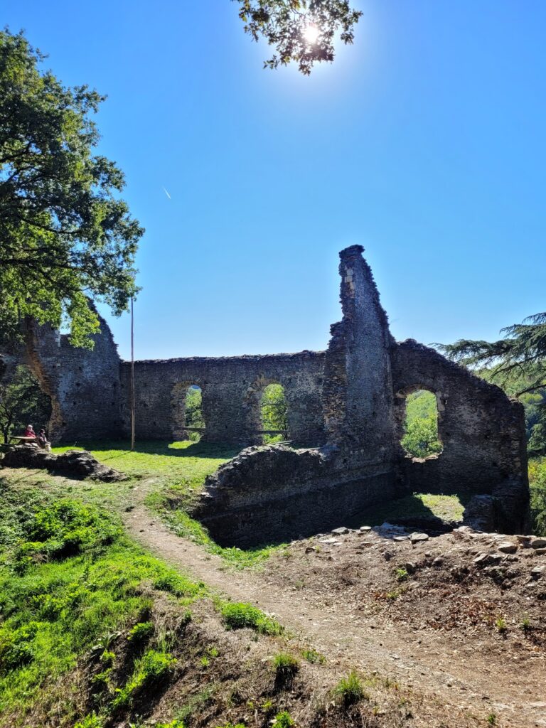
The castle connected with the bayle through a two-towered entrance châtelet at its northeast corner. A pier that supported a bridge remains in the middle of the ditch. The northern rampart survives to about two metres in height, while the other sides survive at foundation level.
Two mottes stand within the castle’s defensive perimeter. A motte was a raised earthen mound used as the base of a fortified residence or tower. The larger mound lies to the northeast and carries remains of a substantial tower together with traces of ramparts. The second, at the western tip of the spur, is separated from the rest of the castle by a ditch and contains the foundations of a keep, the principal strong defensive tower of a castle.
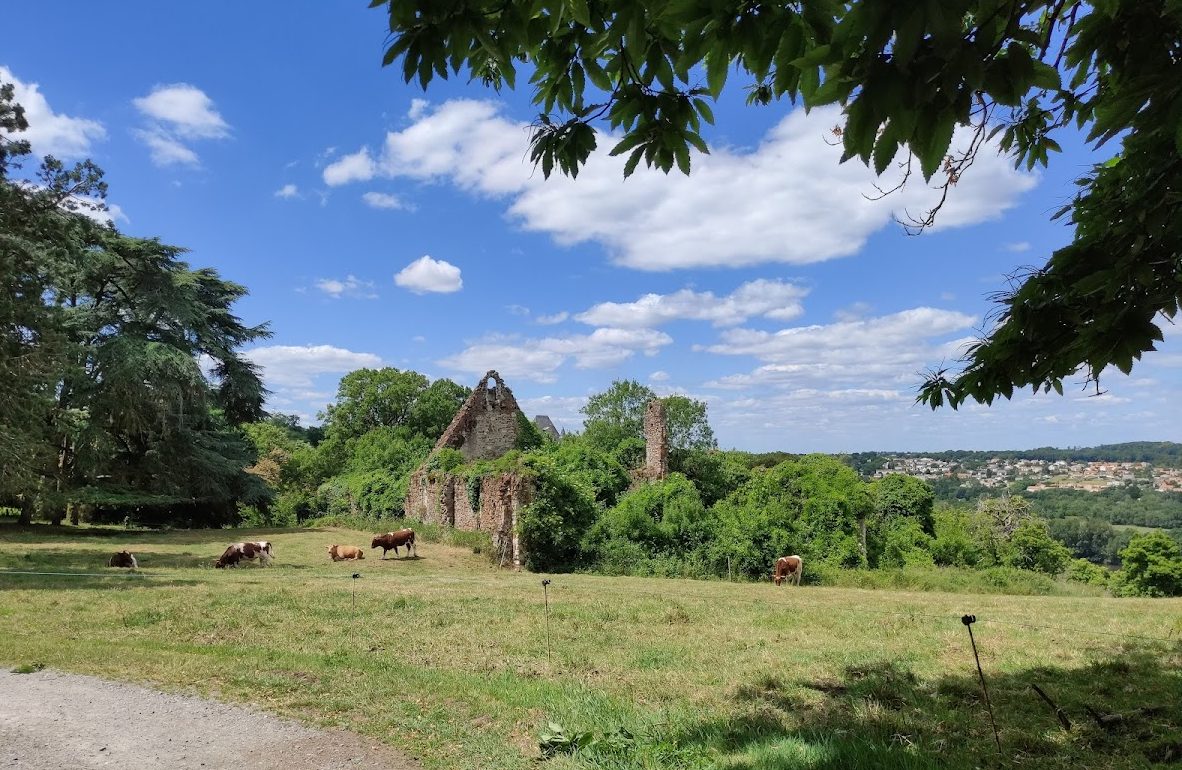
The castle also retains remains of the Saint Peter castle chapel, buildings on its eastern and southern sides, a stairway leading to the keep, and a cistern. An underground passage reaches the surface through two collapse shafts. Its full extent could not be determined because of the danger of collapse. The ruins are heavily overgrown, and the limited later occupation and rebuilding left the archaeological remains relatively undisturbed after the fifteenth-century destruction.
Religious and later structures
Saint John the Baptist Priory
The former Saint John the Baptist Priory stands northeast of the esplanade, an open level area. Rebuilt after the siege of 1420, it retains substantial remains that appear to date from the late fifteenth or early sixteenth century. Its rebuilding belongs to the later history of the settlement after the fortress itself had been destroyed.
Saint Mary Magdalene Church
A parish church dedicated to Saint Mary Magdalene was also associated with the fortified settlement. In a plan drawn in 1913, Abbé Boutin placed the church between the motte and the bayle ditch.
Château de la Colinière
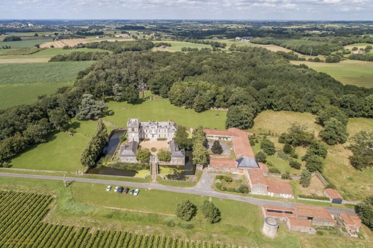
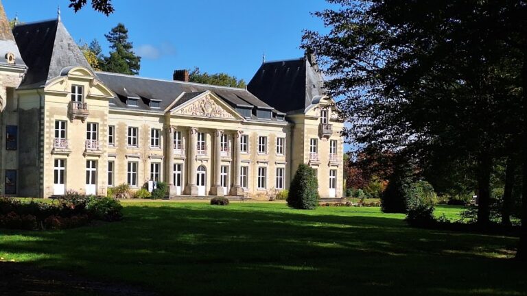
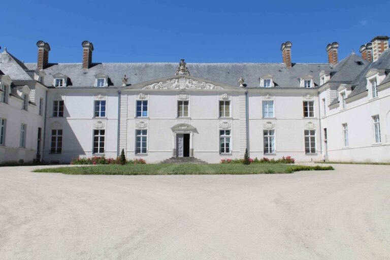
The Château de la Colinière was built in the seventeenth century and altered in the nineteenth century by the addition of a central pavilion with a belvedere, a structure or platform designed to provide a broad view. A nineteenth-century neo-Gothic reconstruction of the châtelet east of the medieval citadel now forms the entrance to the château park. Near the château is a vaulted cavity extending approximately 15 metres and continuing into three small chambers.
Moulin-Pendu
The Moulin-Pendu was built on the Loire below the fortified site. It probably also served as a toll-collection point on the river, linking the industrial or administrative feature to the waterway below Champtoceaux’s plateau.