Castrum Grinario: A Roman Fort and Settlement at Köngen, Germany
Site at a Glance
- Popularity
- Medium
- Country
- Germany
- Primary era
- Classical
- Eras represented
- Classical, Modern
- Civilizations
- German, Roman
- Site type
- Military
- Remains
- Fort
On this page13 sections
History
Castrum Grinario, a Roman fort and associated civilian settlement at Köngen, Germany, was probably founded under Emperor Domitian around AD 85/90, although construction may have taken place closer to AD 98. The fort began as a timber-and-earth installation and was rebuilt in stone shortly after AD 120. Its position on the Neckar-Odenwald Limes, Rome’s frontier system, and beside a major road made it an important military junction.
Fort on the Roman frontier
The fort stood on the Roman road between Mainz and Augsburg. At Köngen, the Lautertal Limes branched from the Neckar-Odenwald frontier and linked it to the Alb Limes by way of small forts at Dettingen unter Teck and Clarenna, near present-day Römerstein-Donnstetten. The civilian settlement’s ancient name, Grinario, also appears on the Tabula Peutingeriana, a medieval copy of a Roman road map.
An unnamed auxiliary cohort, a military unit serving alongside the legions, occupied the fort. It combined infantry and cavalry and numbered about 500 soldiers. When Rome’s frontier was probably advanced around AD 159, the fort was abandoned. The garrison may have moved to Lorch.
Civilian Grinario
The civilian settlement may have begun around AD 90–100, somewhat after the fort’s establishment. It continued to grow after the soldiers departed, taking over the former fort area for civilian use. At first it was administered by the fort commander, then by neighboring Sumelocenna, or Rottenburg, the principal town of the surrounding Roman administrative territory.
People connected with the military were among the settlement’s early residents. Traders, craftspeople, innkeepers, and later discharged soldiers also lived there. Trade, metalworking, and pottery-making supported its economy. Officials known as beneficiarii, assigned to special duties, maintained a station in the settlement and provided security on public roads as well as exercising customs powers.
A major fire struck Grinario toward the end of the second century, but the settlement recovered and prospered again in the early third century. Its final phase came during the Alemannic expansion of AD 233–260. The settlement was violently destroyed in the mid-third century, and its surviving inhabitants left.
Excavation and preservation
Johann Eberhard Roser began excavations in the settlement area in 1783/84. Further work followed in 1843/44 and in 1882 under Konrad Miller. General Eduard von Kallee identified the fort in 1885, and the Reich Limes Commission, a German body that investigated and documented Roman frontier remains, examined it systematically in 1896. Two inscribed stones found in 1910 confirmed Grinario as the ancient name.
After rescue excavations during the second half of the twentieth century, the fort became a registered cultural monument in 1974 under Baden-Württemberg’s monument-protection law. A small museum and open-air archaeological area were established in 1978, and a larger archaeological-park project was completed in 1988.
Remains
The site occupies a terrace on the left bank of the Neckar, opposite the Lauter’s confluence with the river. In the Burgfeld area, the plateau rises about 30 metres above the Neckar. The nearly square stone fort formed the core of a much more extensive roadside settlement, whose buildings and roads spread beyond its walls.
The fort
Walls, gates, and towers
The fort covered about 2.4 hectares and measured approximately 151.8/150.3 metres by 161.4/159.6 metres. Its enclosing stone wall was, on average, 1.10–1.20 metres thick. Towers guarded its rounded corners, while pairs of towers flanked each of its four gates. Ten additional towers stood along the wall, four in the forward section of the camp and six in the rear. The main gate faced southeast toward the Neckar.
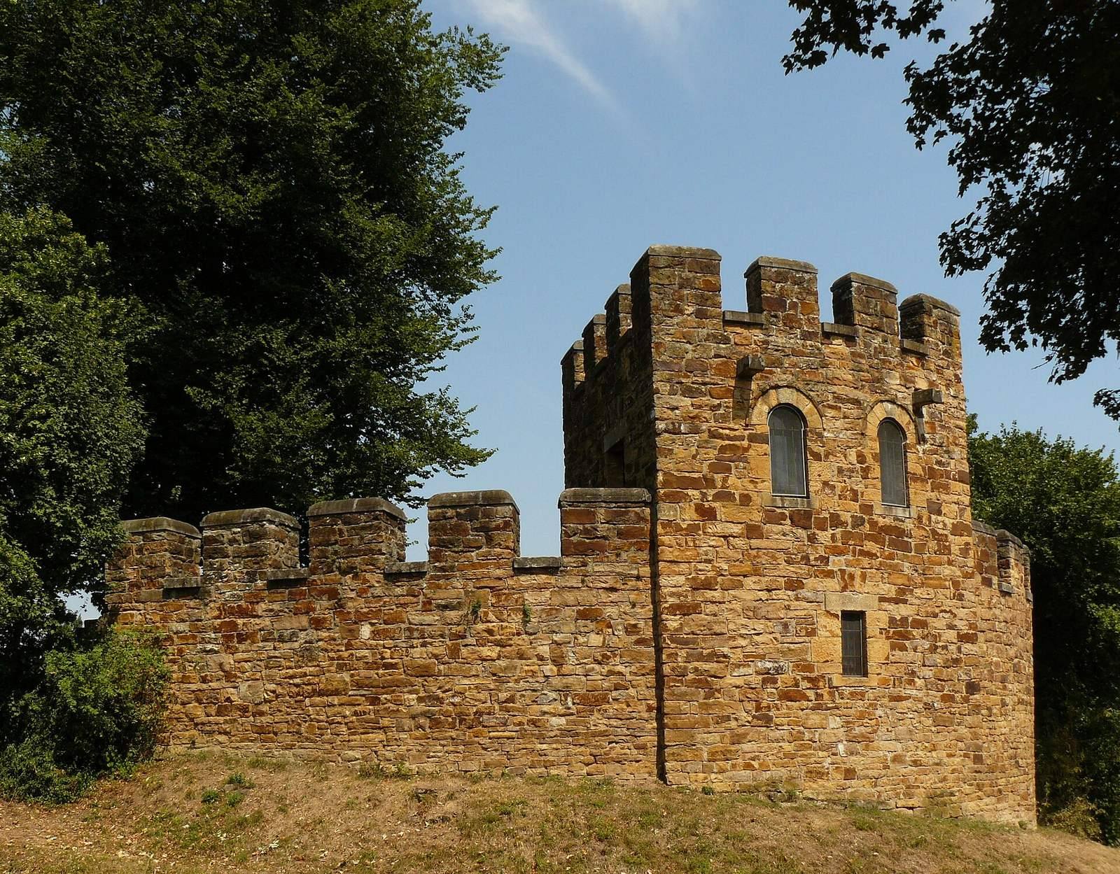
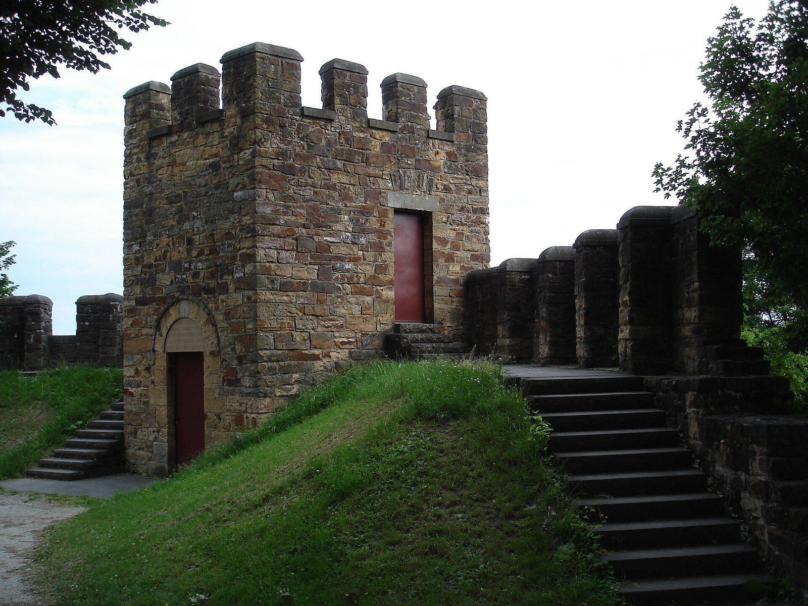
The fort’s southern corner and a defensive tower have been reconstructed on their original foundations. Their crenellations follow a medieval-style form adopted for the Saalburg reconstruction, although that design is historically inaccurate for a Roman fort. In the archaeological park, the lines of excavated fort roads and building plans are marked out.
Headquarters and internal buildings
Excavations revealed the partly destroyed headquarters building near the fort’s centre and its shrine for the unit’s standards. Unlike the usual arrangement in Roman forts, this shrine had no basement. A larger building of unknown function was also excavated in the northern rear section.
Other parts of the internal plan are inferred by comparison with other forts rather than from excavated buildings at Köngen. These proposed features include a commander’s residence, hospital, granary, stables, and workshops, with the stables and workshops assigned to the rear section. The forward area is thought to have held three barracks on each side of the main internal road. Each barrack would have contained ten shared living groups of eight soldiers, which together formed a larger military unit called a century.
Public bath
A public bath was built inside the former fort area after the garrison’s departure. Its ground plan, reconstructed in the park, covers nearly 740 square metres. The complex included a cold room with two cold-water pools, a warm room with two warm-water pools, a tepid room, and a sweat room.
The civilian settlement
Roadside layout and cemetery
The settlement extended north and south of the fort, especially to its west, southwest, and north, along roads leading toward Sumelocenna and Cannstatt. It stretched for more than a kilometre along this route and covered just over 10 hectares. At its broadest, it was probably no more than about 200 metres wide from east to west. Many homes and businesses stood in elongated plots set at a slight angle to the roads. Excavations revealed stone houses as well as buildings made with different timber and half-timber methods.
A wall enclosed the cemetery at the settlement’s northern edge. About 250 graves have been excavated there, all cremation burials.
Officials and places of worship
The station of the beneficiarii lay in the settlement centre, just south and west of the fort. About 200 metres south of the fort stood a small temple dedicated to Jupiter Dolichenus, a Roman god whose worship originated at Doliche in what is now southeastern Turkey.
Wells and finds
A wooden lining from a Köngen well was dated by tree-ring analysis to a tree-felling date of AD 140, plus or minus ten years. A ladle and kettle were found together in another settlement well, and a bucket was also recovered. A smooth, cup-shaped plate of Terra Sigillata, fine Roman tableware, dates to around AD 150. Its roughly cut ownership inscription assigns it to the shared living group of a standard-bearer named Lupus. The potter was Reginus, whose workshop may have been at Heiligenberg in Alsace or at Rheinzabern.
The finds also include 319 decorated fragments of Terra Sigillata bowls attributed to Rheinzabern. Among them are wares associated with the potters Primitivus and Julius II–Julianus I. Their production probably began in the first third of the third century and continued beyond AD 233; Rheinzabern’s pottery production probably ended around AD 260/270. These dates provide an approximate timeframe for the Köngen pieces. A hoard of 615 silver coins, discovered in 1967, is associated with the turbulent period of the settlement’s destruction.
Copies of Roman stone monuments are displayed in the archaeological park, while the originals are held in the associated Roman Museum. Other finds are kept in the archaeological collection of the Württemberg State Museum at the Old Castle in Stuttgart.