Montbazon Castle: A Medieval Fortress in France
Site at a Glance
- Country
- France
- Primary era
- Medieval
- Eras represented
- Medieval, Modern
- Civilizations
- French
- Site type
- Military
- Remains
- Castle
On this page20 sections
History
Montbazon Castle is a fortified complex on a rocky promontory in France. Established at the end of the 10th or beginning of the 11th century, it guarded the Tours-Poitiers road, a crossing of the Indre, and river navigation during the rivalry between the ruling houses of Anjou and Blois. Its foundation is generally credited to Fulk Nerra, count of Anjou, as part of a wider effort to secure Touraine with a chain of fortresses.
Founding and early Angevin rule
A charter issued by Robert II the Pious, king of France, between 996 and 1006 may refer to Fulk Nerra building a fortified stronghold without permission on land belonging to Saint-Paul de Cormery Abbey, a Benedictine religious community. The earliest history of the fortress remains uncertain: the first strong tower, or keep, may have been wooden and stood on an artificial mound, or it may have been built in stone before the mound was raised against its southern base. The stone-first interpretation is favored by more recent research. The fortress was later captured by the House of Blois.
Between about 1020 and 1110, the keep was partly lowered to different heights on its sides, then raised by two storeys, repaired at its base, and joined to an attached access structure called a forebuilding. This work may have followed the fortress’s recovery by Geoffrey Martel, Fulk Nerra’s son and a later Angevin ruler. Probably during the reign of Henry II Plantagenet, king of England and ruler of Angevin lands in France, a ditch and enclosing wall were added south of the keep between 1160 and 1180. A chapel was built north of the tower during the 12th century, partly over an earlier structure that may also have served a religious purpose.
Royal control and lordly residence
At the beginning of the 13th century, Philip Augustus captured the fortress. Its enclosing wall was rebuilt, a tower was added at the southwest corner, and another enclosure strengthened the exposed southern approach. A 2015 archaeological survey identified an additional enclosure north of the keep, apparently intended to protect the promontory. The date of an enclosure around the lower courts is less certain: it may belong to the 15th century or have been built soon after the 13th-century works.
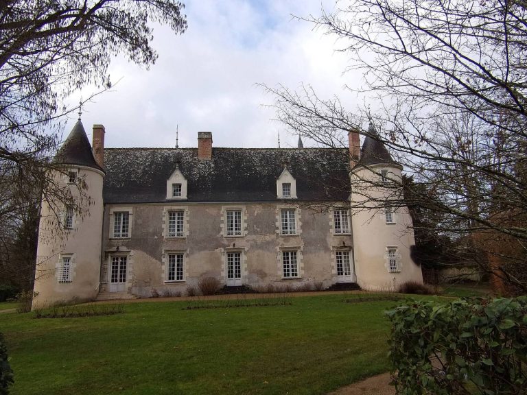
Around 1425, Guy de La Rochefoucauld built a new castle opposite the keep. The lords of Montbazon used it as a residence and received distinguished guests there. Antoinette de Maignelais married André de Villequier at the castle on 3 November 1450, in the presence of Charles VII, who returned for the winter of 1458-1459. Louis XI stayed at Montbazon in 1472 and 1480. In 1560, Louis VI de Rohan-Guéméné welcomed Catherine de Medici, Francis II, and Mary Stuart, the Scottish queen who became queen consort of France. In April 1589, his son Louis VII de Rohan-Montbazon received the future Henry IV.
The fortress also served as a prison. Cardinal Jean de la Balue, a senior official of the Roman Catholic Church, was arrested at Amboise on 23 May 1469 for treason against the king. He was held at Montbazon for several months, either in the keep or in the new castle, before being transferred to Onzain in January or February 1470.
Decline and dismantling
From the beginning of the 17th century, Hercule de Rohan-Montbazon and his descendants favored other residences. The new castle deteriorated and was demolished in 1746; its rubble was used to reinforce the road to Spain. Saint George’s chapel and much of an enclosing wall were also taken down, while the keep remained standing because its size made demolition difficult.
By 1790, deteriorating walls threatened the presbytery and houses below the castle. The municipality received permission to demolish them in October 1791, after the keep’s upper floor and much of its attached access structure had collapsed that August. In 1793, residents removed the remaining wall crenellations as symbols of despotism. The property of people who had left France during the Revolution, including the Rohan family, was confiscated and auctioned in 1796; a local glazier bought the keep. Lightning split its eastern wall from top to bottom in 1797.
Changing uses and modern conservation
In the early 19th century, the keep was used as a warehouse. In 1823, a Chappe telegraph station was installed on its southwest corner as part of the Paris-Bayonne line. This optical system transmitted messages through visible signals, and an operator’s hut stood on the summit. An electric telegraph replaced it in 1853. Joseph Delaville Le Roulx bought the site in 1860 and arranged to reinforce the keep for a 9.5-metre statue of the Virgin and Child. Empress Eugénie de Montijo, wife of Napoleon III, financed the statue at the urging of the parish priest, Abbé Chauvin. The project sought to attract pilgrims travelling toward Santiago de Compostela, and the statue was installed in 1866, the year Delaville Le Roulx died.
William Perry Dudley, an American architect and landscape designer, acquired the property in 1922 and carried out extensive work over more than three decades. He rebuilt a tower in the western enclosure, added a residence, changed access to the site, introduced crenellations, cleared the entrance to underground passages, and redesigned the park. In 1957, the keep was reinforced internally with concrete to support the statue’s weight, and a gauge was placed across the eastern-wall crack. Dudley lived at the castle until 1939 with the American painter Lilian Whitteker, who remained there until 1970.
The keep received historic-monument protection in 1926, extended to the whole castle site in 2012. After Dudley’s death in 1965, the property passed to his second wife and their daughter despite his bequest to the town. By the early 1980s, the unattended site had been looted, including the removal of park statues and stained glass from the residence. Harry and Jacqueline Atterton acquired the property in 1999 and began restoration work; a real-estate group that bought it in 2009 continued the program. In 2024, the site was classified as a historic monument, replacing the keep’s earlier listing.
Interpretations of the fortress have changed as its architecture has been studied. Louis Bousrez published an early investigation of the keep in 1895. In 1969, medieval historian Marcel Deyres proposed a sequence beginning with a wooden tower on an artificial mound; Bernard Bachrach challenged that interpretation in 1979. Nicolas Faucherre advanced further hypotheses in 2002, while treating them as provisional. From that year, archaeologist Marie-Denise Dalayeun’s architectural analysis, excavations, and investigations through 2015 refined the chronology. The order of building phases is clearer than their exact dates because written evidence is limited and later repairs obscured earlier fabric.
Remains
The fortress occupies a rocky ridge running south to north, about 30 metres above the river. The Indre valley and the valley of the Gironde, a small intermittent stream, protect two sides; the Gironde also formed part of the town’s moat. A large medieval ditch separates the site from the plateau. Behind the keep, the enclosed area extends about 160 metres by 60 metres and covers roughly 1.2 hectares. The ground descends from about 81.5 metres above sea level near the keep to 73.5 metres at the northern end. Its layout could accommodate a garrison, a lord’s household, or people seeking shelter during conflict.
Most of the complex was built with locally available lake-deposit limestone, flint, and millstone, generally laid as roughly squared rubble. Sand from the Indre’s banks was used in mortar, and nearby forests supplied timber for floors and roof framing. White chalk from Blois appears in the earliest phase of the southern enclosure and may have come from the adjacent dry ditch. Some spring-deposited limestone, or travertine, in the earliest keep may have been brought by river from an unknown source; some blocks were reused from an earlier unidentified building. Yellow tuffeau, a soft limestone common in the Loire Valley, was cut into medium-sized blocks for walls. Some stones were reused in three successive structures.
The keep and forebuilding
The keep
The keep’s original footprint may have measured 20 by 15 metres, with two levels. It now stands about 26 to 28 metres high, though it may once have reached at least 36 metres with another storey. Its interior measures 15 by 9 metres. The two lowest levels are the oldest. Their walls use mainly flint and lake-deposit limestone rubble, with some stone laid in a repeating angled pattern. Reused travertine forms corners and buttresses. The later upper levels use similar materials but more irregular masonry, with tuffeau blocks in the corner bonding and rebuilt sections of the buttresses. Openings for temporary scaffolding beams pierce the walls at irregular intervals.
The keep’s buttresses were built with the walls they support. Those on the eastern face are semicircular, while the northern face has semicircular or rectangular examples. The southern wall is thicker than the others and is reinforced at its base by an artificial earthen slope. This side faced the most exposed approach; the steep face of the promontory and the Indre provided natural protection elsewhere. Floors rested on ledges along the north side and on beams embedded in the opposite wall. They may have included trapdoors, with ladders or wooden stairs connecting levels.
The original lowest level may have served for storage. A lengthwise partition of timber posts divided it into two rooms and was apparently replaced around the 12th century by a load-bearing wall that incorporated the earlier partition. From about that time through the 15th century, building debris and other material, including domestic waste, accumulated in the space. The fill is now more than six metres deep. Openings in the eastern face appear to belong to the late Middle Ages. A doorway at ground level in the west wall, leading into the filled space, seems to be a later insertion, possibly made in the 1820s to provide access inside the tower to the summit.
The level above the filled space probably had a floor about a metre above the present interior ground level. A doorway on its north side, roughly six metres above modern exterior ground level, was initially reached by an outside ladder or wooden stairs. After the forebuilding was added, a doorway on the west side connected the two structures. This level also had two eastern windows that were later sealed. The higher level is thought to have served as the lord’s residence and reception room. Latrines set into its eastern wall had tuffeau frames and drains running down the outside of the tower. Two north-facing windows, probably added in the 12th century, were remade as paired openings in the 15th century and restored in the 20th. A western opening is interpreted as a doorway to the forebuilding roof. Heating may have come from a central hearth or, more probably, portable braziers.
The tower’s upper portion has been reduced by at least eight metres and altered by the telegraph installation, the statue and its supporting vault, and a reinforced-concrete belt. Beam sockets survive above the belt. The use of the upper storey is uncertain: it may have accommodated the lord’s family or guards. At the northeast summit stands the 9.5-metre Virgin and Child statue. Made from riveted copper plates, it is hollow and partly filled with stones and concrete. Its surface darkened over time, giving it the appearance associated with a Black Madonna. A masonry vault at the keep’s fourth level supports the statue’s pedestal, while the internal concrete belt strengthens the tower.
The forebuilding
The forebuilding originally rose to the height of the keep’s first floor. It had two levels and measured about 7 by 4 metres inside. Its only known entrance was a west-facing door at the keep’s first-floor level, opening directly between the two buildings. An internal wooden or stone stair may have reached the lower level, which may have been used for storage; a well may have occupied its southwest corner. A chapel on the upper level has also been proposed, though its use remains uncertain.
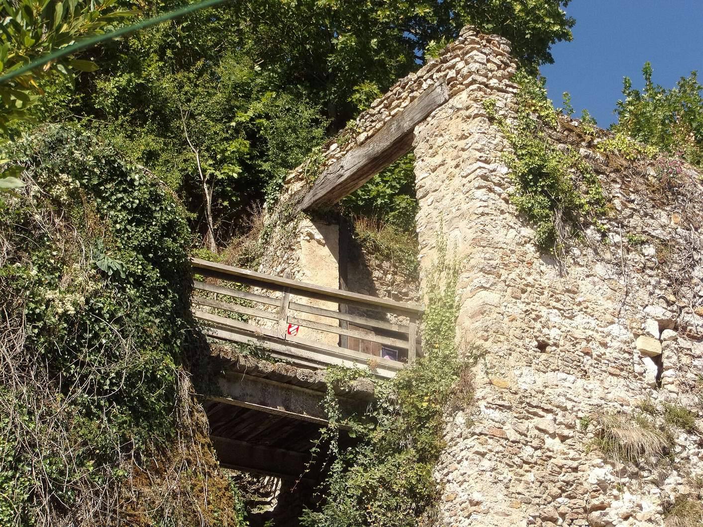
Part of the forebuilding survives in its west wall, strengthened by three buttresses and pierced by two round-arched windows, and in a short section of the north return wall. The marks where lost walls met the keep help establish the building’s footprint. A jamb from a window or doorway remains in the northern fragment. Travertine blocks in the masonry may have been reused from the keep.
Defensive enclosures and castle courts
The southern enclosure and towers
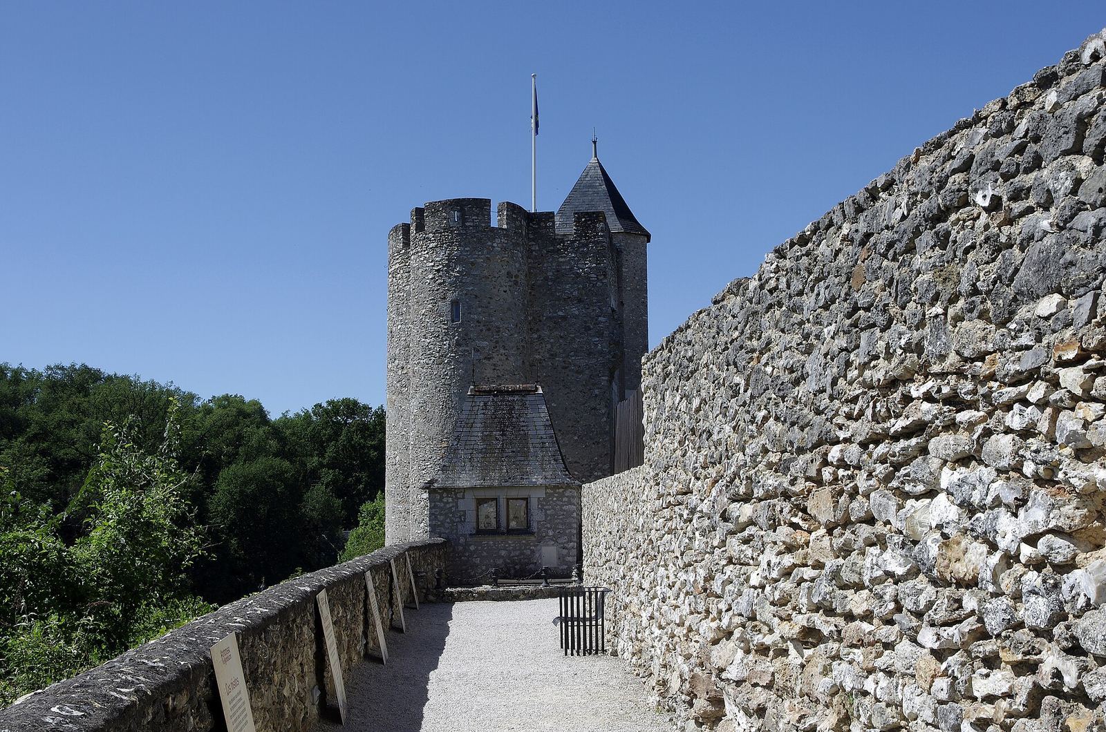
A protective wall enclosed the keep and forebuilding, defining a high court at the level of the mound-like earthwork. The court may have served as a lord’s garden. The enclosure meets the keep on the east and the forebuilding on the west. Its southern wall was largely levelled during the 20th century, though traces of narrow openings for shooting missiles survive. A solid tower at the southeast corner appears to have supported the structure. At the southwest corner, the later tower known as the Philippian Tower has an attached protective structure, latrines, three storeys divided by floors, and narrow openings for shooting at each level. These features indicate a defensive purpose. Its crenellations, and those on the enclosure’s western wall, date from the 20th century.
The outer enclosures and access
The southern enclosure belongs to the 13th century and survives in fragments beside the forebuilding, near the keep’s northwest corner, and west of the access ramp. The enclosures around the site were built during the 13th and 15th centuries, although the date of the later one remains uncertain. It once protected the lower courts north of the fortress and connected to the town wall and the Mills Gate on the east. At least two defensive towers stood along it, one to the north and another to the west; the western tower is linked to the later Lilian Tower.
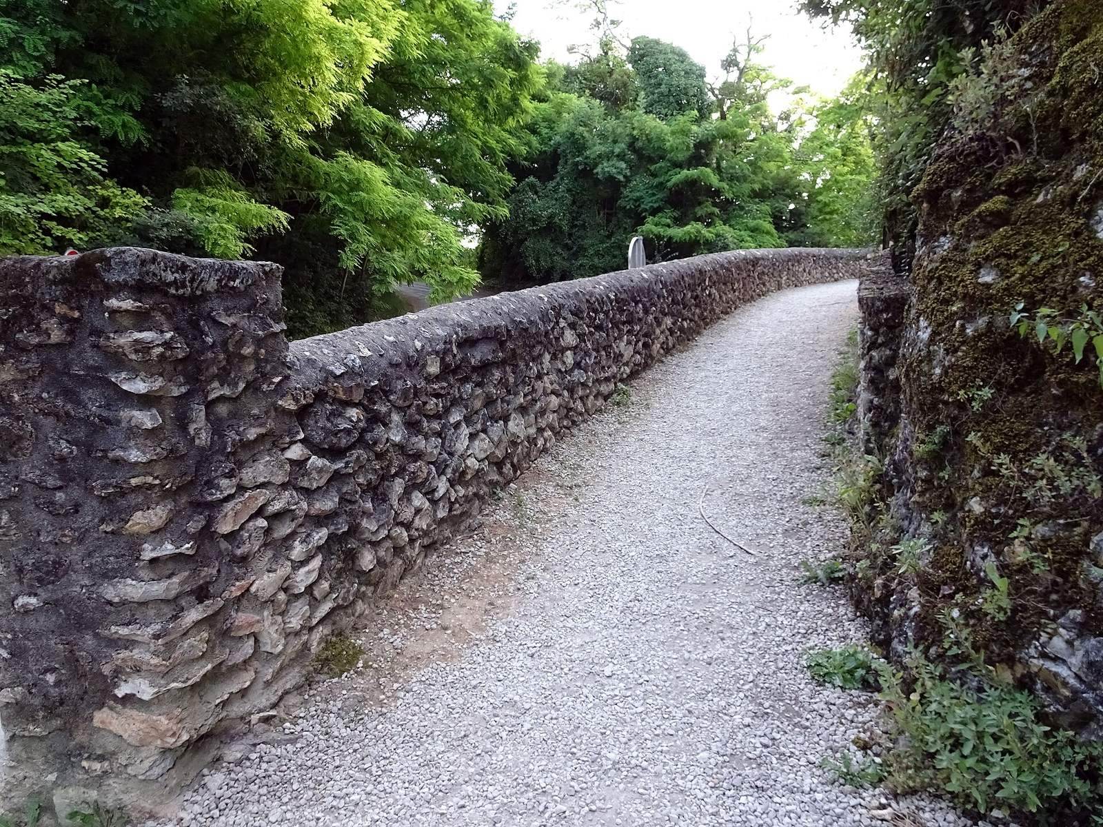
An access ramp ran from south to east and crossed a movable drawbridge. Most enclosure walls were dismantled as the fortress lost its defensive role and stone was needed for other building projects. Many of the perimeter walls seen today are modern reconstructions, often carried out by Dudley, and appear to follow earlier lines. Landslides have damaged the northern enclosure and its tower. On 14 December 2019, a further collapse affected the hillside northeast of the site and part of the enclosure, with debris falling into a lane between houses. The promontory remains at risk of further movement along its edge and lower slopes.
The new castle
Built around 1425, the new castle extended east to west across the enclosed court for about 50 metres and measured roughly 20 metres wide. It divided the area into two lower courts. No contemporary image or description establishes its original design. Recollections written down in the early 19th century describe a large, two-storey building with broad windows divided by vertical supports.
Chapels and underground spaces
Saint George’s chapel
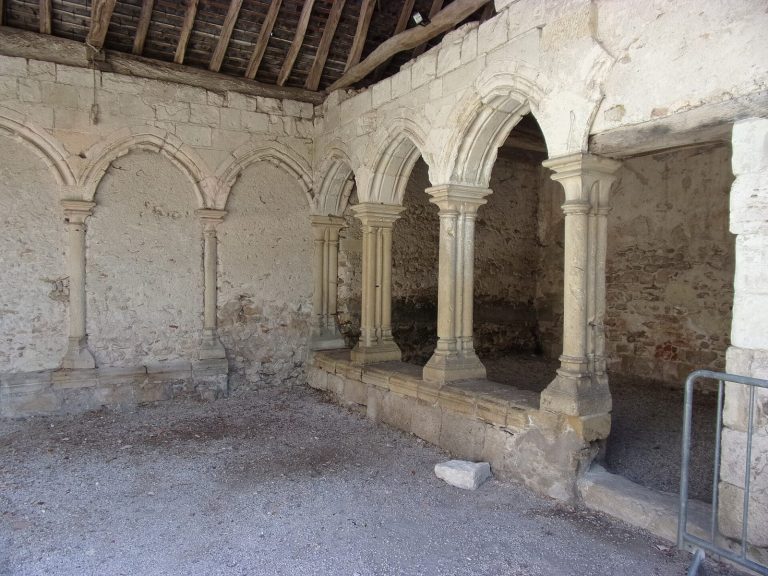
The medieval chapel dedicated to Saint George, a Christian martyr venerated as a saint, was probably built in the 12th century, partly over earlier foundations. Its simple nave was at least 23.5 metres long and led to a chancel with a flat end. Two chapels flanked the chancel, each ending in a semicircular apse. The southern chapel, 9.5 metres wide, may have been reserved for the lord and served more than once as a burial chapel.
The separate castle chapel
A second chapel appears to have stood elsewhere in the castle complex. It temporarily served as a metalworking workshop around the 14th century or somewhat earlier. Excavations in the early 2010s exposed its lowest wall courses. Its known plan resembles that of Notre-Dame de Loches, a church served by a chapter of clergy, though later changes make the comparison difficult to assess.
Underground quarries and passages
The underground network originally extended about 14 kilometres beneath the town on three levels, reaching depths of at least 14 metres. Most passages were quarries from which building stone was extracted, and many were later given vaulted ceilings. Numerous sections have collapsed naturally or been deliberately filled. One branch may have led toward the village centre. Work at the church in 1851 exposed evidence of an underground passage, while the idea that it continued beneath the Indre to the opposite bank was disproved. The network’s use as storage cellars is more likely than use as a refuge.
Later additions and landscape
Lilian Tower and William’s Lodge
The tower Dudley rebuilt in the western enclosure, now known as Lilian Tower, may have been the last surviving structure from the 15th-century castle. His reconstruction gave it a medieval-style appearance and crenellations. Against the enclosure to its east, Dudley built William’s Lodge, a neo-Gothic residence with a gazebo facing the town. Its ground floor was arranged as a kitchen, while bedrooms occupied the attic beneath dormer windows. Dudley designed the plans, drawing inspiration from the manor of La Fresnaye at Monts. Stained glass was stolen from the residence in the 1980s and replaced with plain glazing.
The park
Dudley redesigned the park, adding statues that he made or commissioned from local sculptors, planting rows of vines, and creating a Gothic garden south of the keep. The park’s statues were later stolen.