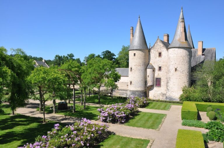
Castle of Vitré: A Medieval Fortified Enclosure in France


Site at a Glance
- Rating
- 4.5
- Popularity
- Medium
- Country
- France
- Primary era
- Medieval
- External website
- Open
- Eras represented
- Medieval, Early Modern
- Civilizations
- Duchy of Brittany
- Site type
- Military
- Remains
- Wall
On this page17 sections
History
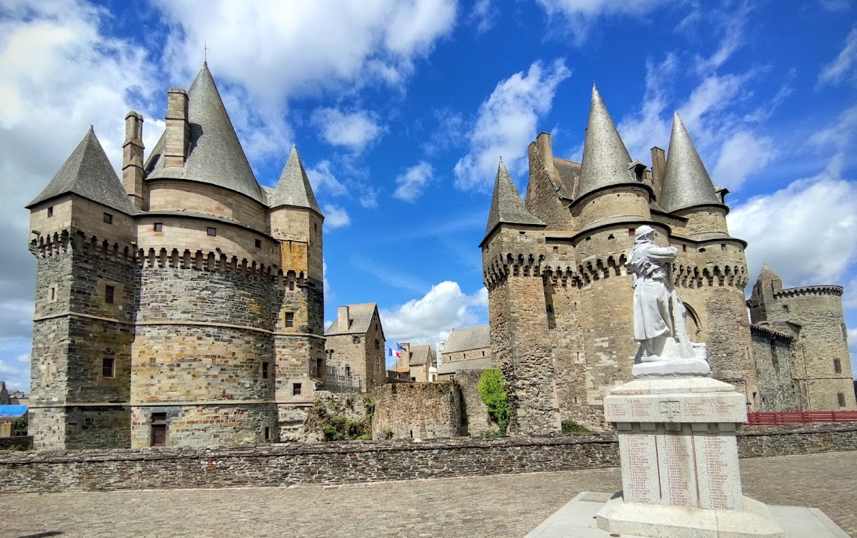
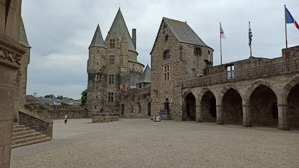
Castle of Vitré is a medieval fortified enclosure in Vitré, France, erected and strengthened from the thirteenth to the seventeenth century to protect the town. Its surviving thirteenth-century works are considered the best-preserved fortifications of their period in Brittany. The enclosure followed the rocky plateau occupied by the castle and the old town around Notre-Dame Church, transforming a previously dispersed settlement into a defended urban center.
Before the urban enclosure
Before the fortifications were built, Vitré was relatively dispersed. The town’s early layout, roads, and religious buildings do not indicate an earlier system of defenses. The creation of the enclosure therefore represented a major reorganization of the settlement as well as a military undertaking.
The thirteenth-century enclosure
Baron André III of Vitré built the principal urban enclosure between about 1220 and 1240. A baron was a high-ranking feudal lord who governed a territorial barony, and André’s title identified him as the medieval lord of Vitré. He was the brother-in-law of the Duke of Brittany and had taken part in the Crusades, the medieval Western European military expeditions often undertaken in the eastern Mediterranean under religious auspices. During a conflict with the duke, André aligned Vitré’s defenses with the system developed under Philip Augustus, king of France from 1180 to 1223.
The work required the excavation of deep defensive ditches. Twenty-four houses were demolished, and the town’s Saint-Nicolas and Saint-Yves hospitals, including the Hôtel-Dieu, a charitable hospital often supported by a religious institution, were transferred to the Rachapt district on the road to Saint-Malo. The enclosure originally included about fifteen towers, three principal gates, and two smaller pedestrian entrances.
Artillery and the Wars of Religion
During the fifteenth century, the conflict between Duke Francis II of Brittany and the French kingdom encouraged the reinforcement of Breton towns against gunpowder artillery. At Vitré, work began in 1465 and continued with further strengthening in 1487. The three principal gates, the Tour de la Bridole, and the low outer defenses were altered, while the curtain walls, the stretches of wall between towers, were raised by about three metres.
In 1582, Philippe Emmanuel of Lorraine-Vaudémont, Duke of Mercœur and Penthièvre, became governor of Brittany. Vitré was one of the duchy’s few Huguenot cities. Huguenots were French Protestants, especially Calvinists, during the sixteenth-century Wars of Religion. Protestants held the walled town while Catholics were expelled to the suburbs. Catholics from Vitré then appealed to 53 parishes in the surrounding Pays de Vitré to besiege the town under Mercœur’s command.
The siege began on 23 March 1589 and lasted five months. Three towers on the northeastern enclosure, including the Tour de la Fresnaye, were destroyed and replaced by the Tour Rompue. In 1591, a stone spur and counterscarp were constructed along the Rue de l’Éperon, the Promenade du Val, the Rue du Val Cantache, and the approach to the Pont Marin. A counterscarp was the outer slope or wall on the far side of a ditch.
Urban change and conservation
During the first half of the nineteenth century, new districts developed south of the walled town, and the municipal council sought to connect them with the old center. The three principal entrance towers were demolished in stages: the Porte d’En-Haut in 1834, the Gâtesel gate in 1838, and the Porte d’Embas in 1846. New streets opened through the medieval center before the railway arrived in 1857, causing almost all the southern ramparts to disappear. Sections at the castle and Place Saint-Yves survived because their locations were less suitable for urban development.
Interest in medieval heritage during the nineteenth century led to the reconstruction of parts of the ramparts at Place Saint-Yves and the castle. In 1987, the Tour des Claviers was rediscovered during construction on the Rue de la Borderie. The new residential building was raised so that the tower could remain visible beneath it.
Vitré’s historic center and medieval suburbs, covering 32 hectares, became a legally protected remarkable heritage site in 1994. Alterations within such areas are subject to review by the French state’s Architect of Buildings of France. The Tour des Prisonniers, Tour de la Bridole, and Porte d’Embas had already received individual historic-monument protection before the entire fortified enclosure was listed on 15 January 2014. The protection record also includes a further listing from 2024.
More recent conservation has included renovation of part of the northern ramparts above the Notre-Dame priory for the installation of the House of World Cultures, a French institution concerned with intangible cultural heritage. Archaeological work connected with road improvements revealed the foundations of vanished ramparts at the former Porte d’En-Haut and Porte d’Embas. The Tour de la Bridole was renovated in 2012, and the fortifications along the Promenade du Val underwent a major conservation and reinforcement campaign between 2015 and 2020.
Remains
Plateau, walls, and ditches
The fortified enclosure follows the contours of a rocky plateau occupied by the Castle of Vitré and the old town around Notre-Dame Church. It covers approximately eight hectares and measures about 500 metres from end to end and about 200 metres across. Most of the surviving walls and towers are concentrated north and east of the walled town, particularly along the Promenade du Val.
The site lies within the Armorican Massif, where beige sandstone meets schist formations including argillite, black micaceous siltite, and locally ferruginous oolite. These locally available stones were used in the fortifications. The original thirteenth-century enclosure used lustrous schist from the excavated ditches as rubble masonry, while beige Vitré sandstone formed the projecting offsets.
The northern side overlooks the Vilaine valley. A pond, marshes, and a steep escarpment about 30 metres high strengthened this natural boundary, while the Vernouzet stream created a protective depression to the south. The eastern side, facing Laval and the French kingdom, was the principal defensive weakness because the plateau continued without a natural barrier. Quarrying for the ramparts created ditches approximately 12 metres deep and 20 metres wide south and east of the town. Springs and fountains in the moats were used in 1681 by suburban inhabitants for laundry, orchards, and gardens.
Gates and access points
Porte d’En-Haut
The Porte d’En-Haut stood on the eastern side toward France and formed one of the three principal entrances. In 1465 it received machicolations, projecting parapets with openings through which defenders could attack people below. A projecting spur-shaped outwork and drawbridge strengthened its approach. The gate was demolished in 1834, while archaeological work connected with later road improvements marked the foundations of the former entrance and adjacent ramparts.
Porte d’Embas
The Porte d’Embas faced west toward Rennes and was protected by a barbican, an advanced defense before a gate. Archaeological excavations before the redevelopment of Place Saint-Yves in 1998 traced the barbican’s outline at ground level. Two towers once stood behind it, and a suspended chimney and a boulevard casemate, a protected chamber used for artillery or other military purposes, survive. The gate itself was demolished in 1846, and its former position is marked at ground level.
Gâtesel gate and the posterns
The Gâtesel gate faced south toward Châteaubriant. Like the other principal entrances, it was arranged as a defended passage with doors, murder holes, and a portcullis, a vertically lowered defensive gate. The gate was demolished in 1838. Two smaller posterns, or secondary pedestrian gates, provided additional access: the Saint-Pierre postern on Place Notre-Dame facing Notre-Dame Church, and another at the castle.
Towers and artillery defenses
Thirteenth-century towers
The original enclosure contained about fifteen towers. Their arrow slits had simple embrasures beneath lintels, sometimes accompanied by semicircular relieving arches. The walls were linked by a wall-walk, the passage along the top of a fortified wall, and the southern section included six small sentry boxes. These features belonged to the defensive system created around the thirteenth-century town.
Tour de la Bridole and Tour de Gâtesel
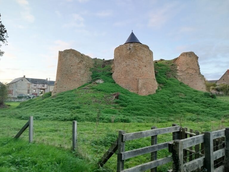
In 1465, the Tour de la Bridole and the Tour de Gâtesel were adapted to meet the demands of gunpowder artillery, along with the gates and the low outer defenses. In 1487, each tower was strengthened with a horseshoe-shaped gun tower. Their design followed examples at other Breton strongholds, including the Tours Surienne and Raoul at Fougères, the Tour Bilouanne at Saint-Malo, and defenses at Dinan and Guérande. The Tour de la Bridole was renovated in 2012 and received a pepper-pot roof intended to reproduce its original form.
Tour de la Fresnaye and Tour Rompue
The northeastern defenses included the Tour de la Fresnaye, which was destroyed during the five-month siege of 1589. It was replaced by the Tour Rompue, preserving the evidence of the enclosure’s transformation during the Wars of Religion.
Tour des Claviers
The Tour des Claviers was rediscovered in 1987 beneath a modern residential building on the Rue de la Borderie. The building’s foundations rest on the tower, but its construction was raised so that the medieval structure remains visible below it.
Later outer works and restored masonry
The stone spur and counterscarp built in 1591 remain visible along the Rue de l’Éperon, the Promenade du Val, the Rue du Val Cantache, and the route toward the Pont Marin. The northern ramparts renovated above the Notre-Dame priory are covered with complete lime render, reflecting the interpretation that medieval walls were coated with protective plaster. Nearby, the Saint-Pierre postern was restored in 2016 with its jointed masonry left visible.