Castillo Cauche: An Almohad Road Fortress in Spain


Site at a Glance
- Rating
- 5
- Popularity
- Very Low
- Country
- Spain
- Primary era
- Medieval
- Eras represented
- Medieval, Early Modern
- Civilizations
- Almohad, Crown of Castile, Spanish
- Site type
- Military
- Remains
- Castle
On this page9 sections
History
Castillo Cauche is a fortification in Spain, near Villanueva de Cauche in the municipality of Antequera, Málaga, generally dated to the Almohad period, when this North African Islamic dynasty ruled much of al-Andalus during the twelfth and early thirteenth centuries. Its position served the former road between Madina Antaquira and Málaga, particularly where the route crossed the mountain passes of Las Pedrizas and La Fresneda.
Origins and Islamic rule
The fortress may have had an earlier origin during the emirate period, the earlier phase of Islamic rule in al-Andalus. The Chronicle of the Moor Rasis names a castle called Cabeche among the important strongholds of Rayya, the administrative district associated with the Málaga region. The surviving castle, however, does not match the expected form, location, or building technique of a high-altitude fortress from that earlier period. La Fresneda, the pass most often used historically, lies at approximately 1,500 metres above sea level, while Castillo Cauche was connected more directly with control of the road and its approach.
Castilian conquest and incorporation into Antequera
Don Lope de Mendoza and Don Lorenzo Suárez de Figueroa took the castle with little resistance in 1410. Fernán Pérez de Guzmán’s chronicle of the reign of John II of Castile, who ruled from 1406 to 1454, records the event. In the same year, Castillo Cauche came under the jurisdiction of Antequera together with Jébar and Aznalmara. The castle was donated to the council of Antequera in 1414.
Decline and later settlement
The conquest of Málaga in 1487 by Isabella I of Castile and Ferdinand II of Aragon, known as the Catholic Monarchs, removed the fortress from the active frontier and ended its military effectiveness. The monarchs ordered its destruction, after which the site was abandoned. In 1509, the council of Antequera asked for the repopulation of the villages of Cauche and Belda within its territory.
The surviving remains later became part of the Cortijo of the Marquise of Villanueva de Cauche. The settlement that developed around the cortijo was arranged in relation to the former fortress, with its streets directed toward the ruins. Castillo Cauche is protected by the generic protection established in the decree of 22 April 1949 and by Spain’s Historical Heritage Law 16/1985. It was also declared a monument in a notice published in the Boletín Oficial del Estado on 29 June 1985.
Remains
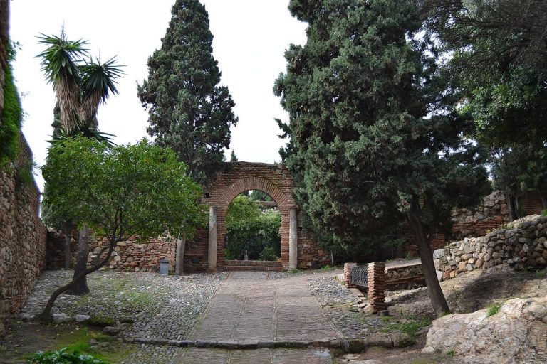
The surviving complex combines fragmentary Almohad defensive works with the later cortijo and a sixteenth-century chapel. The principal castle probably occupied a trapezoidal enclosure of about 2,700 square metres, while a separate secondary defensive enclosure, or albacar, probably provided another line of protection and covered approximately 6,400 square metres.
Fortress walls and defensive enclosures
The main castle probably had a perimeter of about 210 metres. The outer albacar, a secondary enclosure that could shelter people and livestock beyond the principal fortified area, probably had a perimeter of approximately 320 metres. Several wall sections survive, especially on the western side. Because a stream created a drop in the ground, later walls were placed on top of earlier ones, whose first courses can still be distinguished.
One surviving rammed-earth wall is approximately 7 metres long and almost 2 metres wide. Rammed earth was formed by compacting soil into a wall structure, and the openings for the timber supports used during construction remain visible. The wall is now badly deteriorated, but these construction traces preserve evidence of the techniques used in the fortress.
Cortijo and courtyard
The present cortijo has a square plan organized around a central courtyard. Noble coats of arms belonging to the family that has owned all the surrounding lands since the sixteenth century remain set along the side facing the courtyard. The later complex incorporates the site of the former fortress and forms the physical centre of the present settlement.
Chapel and reused Roman stones
A chapel was built against the northern side of the complex during the sixteenth century. Its tower is divided into five sections and measures 3.30 by 4.40 metres in plan. The tower may have reused one of the larger earlier structures belonging to the cortijo.
Four Roman inscribed stone slabs from the nearby ancient city of Aratispi were incorporated into two walls at the base of the tower’s first section. The slabs came from a place known as Cauche el Viejo, or the Cauche oil mill, and connect the later building with the remains of the ancient settlement in the surrounding area.
Lines of sight and the road
Castillo Cauche has a line of sight toward Torre de Zambra. It may also have communicated with two defensive towers that may once have stood at the summit and on the slope of the Sierra del Co. Its visual control was not extensive, so the fortress’s strategic value probably rested chiefly on its position beside the road and its control of the La Fresneda mountain pass.