Castelo dos Mouros de Vilarinho dos Galegos: A Fortified Archaeological Settlement in Portugal
Site at a Glance
- Rating
- 4.5
- Popularity
- Very Low
- Country
- Portugal
- Primary era
- Iron Age
- External website
- Open
- Eras represented
- Iron Age, Classical
- Civilizations
- Roman
- Site type
- Military
- Remains
- Fortified Town
On this page12 sections
History
Castelo dos Mouros de Vilarinho dos Galegos is a fortified archaeological settlement in Portugal, at Vilarinho dos Galegos in the municipality of Mogadouro. Also known as Castelinho, the Fortified Settlement of Vilarinho dos Galegos, and the Castro of Vilarinho dos Galegos, it was occupied from the Iron Age into the Modern period. A castro is a fortified settlement associated with prehistoric or ancient communities of the Iberian Peninsula, rather than necessarily a medieval castle.
Iron Age and Roman occupation
The settlement’s earliest principal domestic phase belongs to the Iron Age, when iron became an important material for tools and weapons before Roman political control was fully established in the region. Excavated remains show that the community lived within a defended site and undertook farming, animal husbandry, hunting, spinning, weaving, and ironworking.
A later Roman phase introduced rectangular stone buildings, at least in their foundations, with compact rammed-earth floors and tiled roofs. The settlement continued to be used through successive periods, and archaeological material from the Iron Age to the Modern period preserves evidence for changing ways of life, productive activities, and social relations.
Archaeological investigation and protection
Excavations in 2011 and 2015 formed part of a project to study and enhance the site. The work was scientifically directed by archaeologist António Pereira Dinis of CITCEM, a Portuguese university research centre devoted to the study of culture, space, and memory, with assistance from archaeologist Emanuel Campos of the Municipality of Mogadouro. University of Minho archaeology students and Portuguese and foreign volunteers also took part.
Castelo dos Mouros de Vilarinho dos Galegos was classified as a Monument of Municipal Interest in 2016 and as a Site of Public Interest in 2023. These classifications recognize its cultural importance at municipal and national levels, while further classification has also been in progress.
Remains
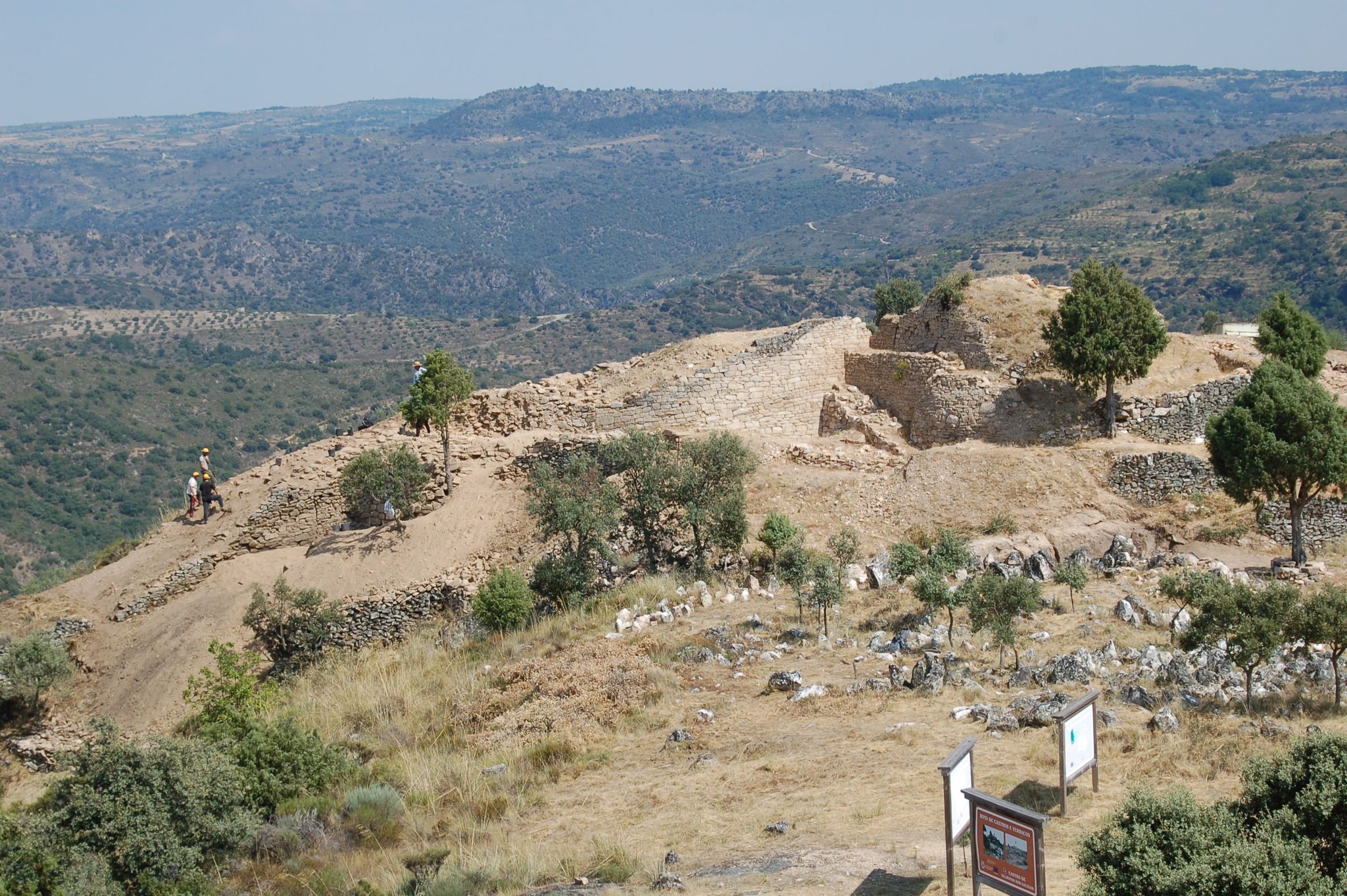
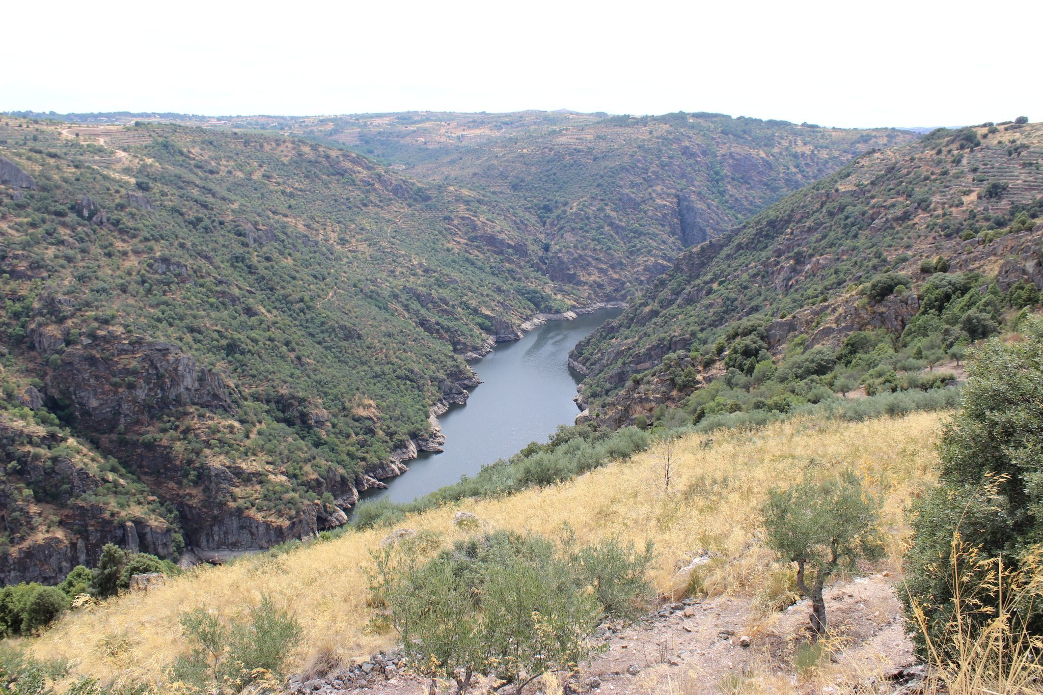
The settlement occupies a small elevation about 600 metres above sea level, on the cliffs of the Douro River where the Vilarinho stream meets the river, within the Douro International Natural Park. Very steep rocky slopes protect roughly three-quarters of its perimeter. Beyond the defensive works, a broad, subcircular level platform extends between escarpments to the north and south, while its gentler eastern side leads towards the valley along a zigzag path.
Defensive works
Stone barrier and ditch
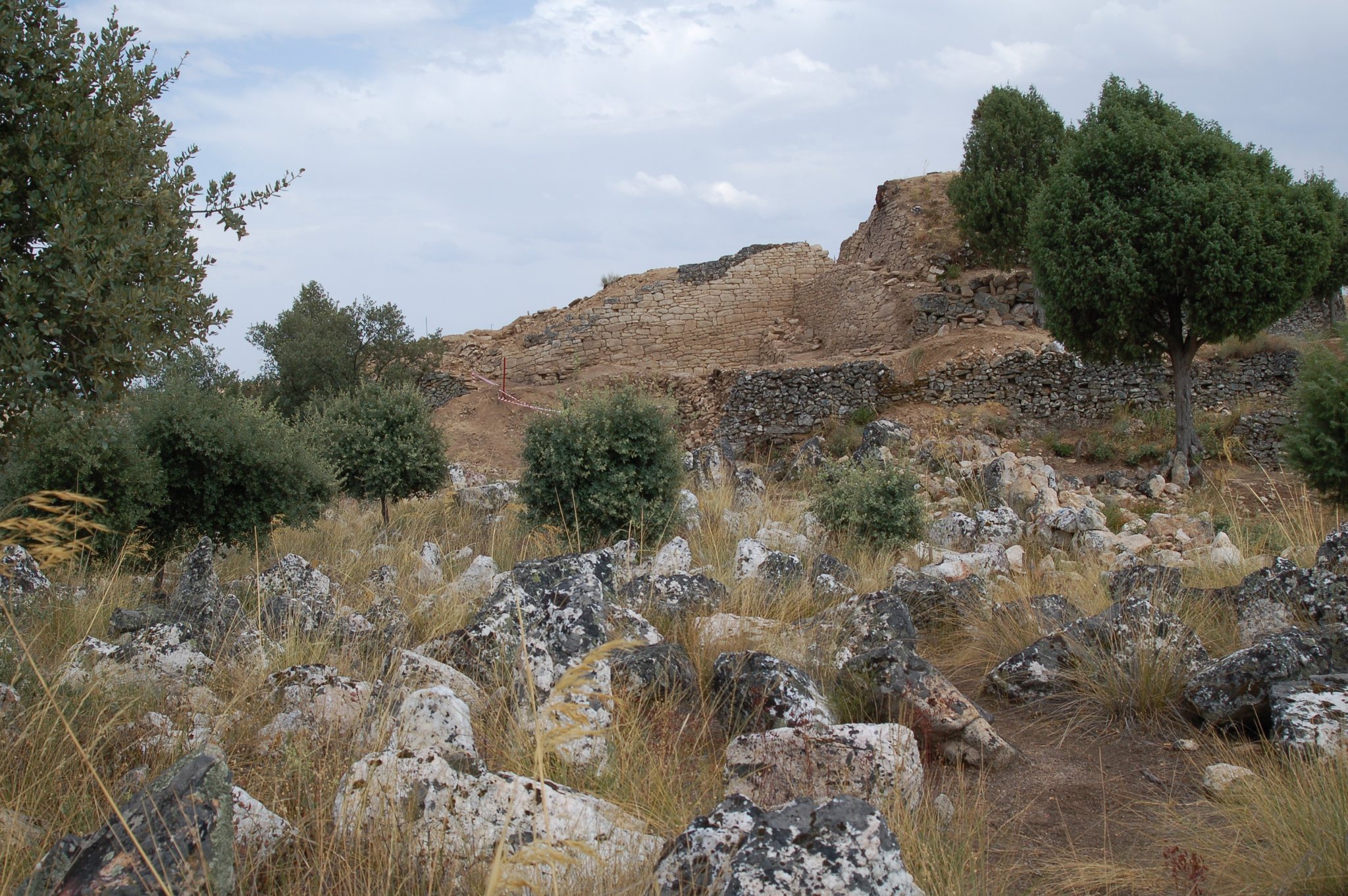
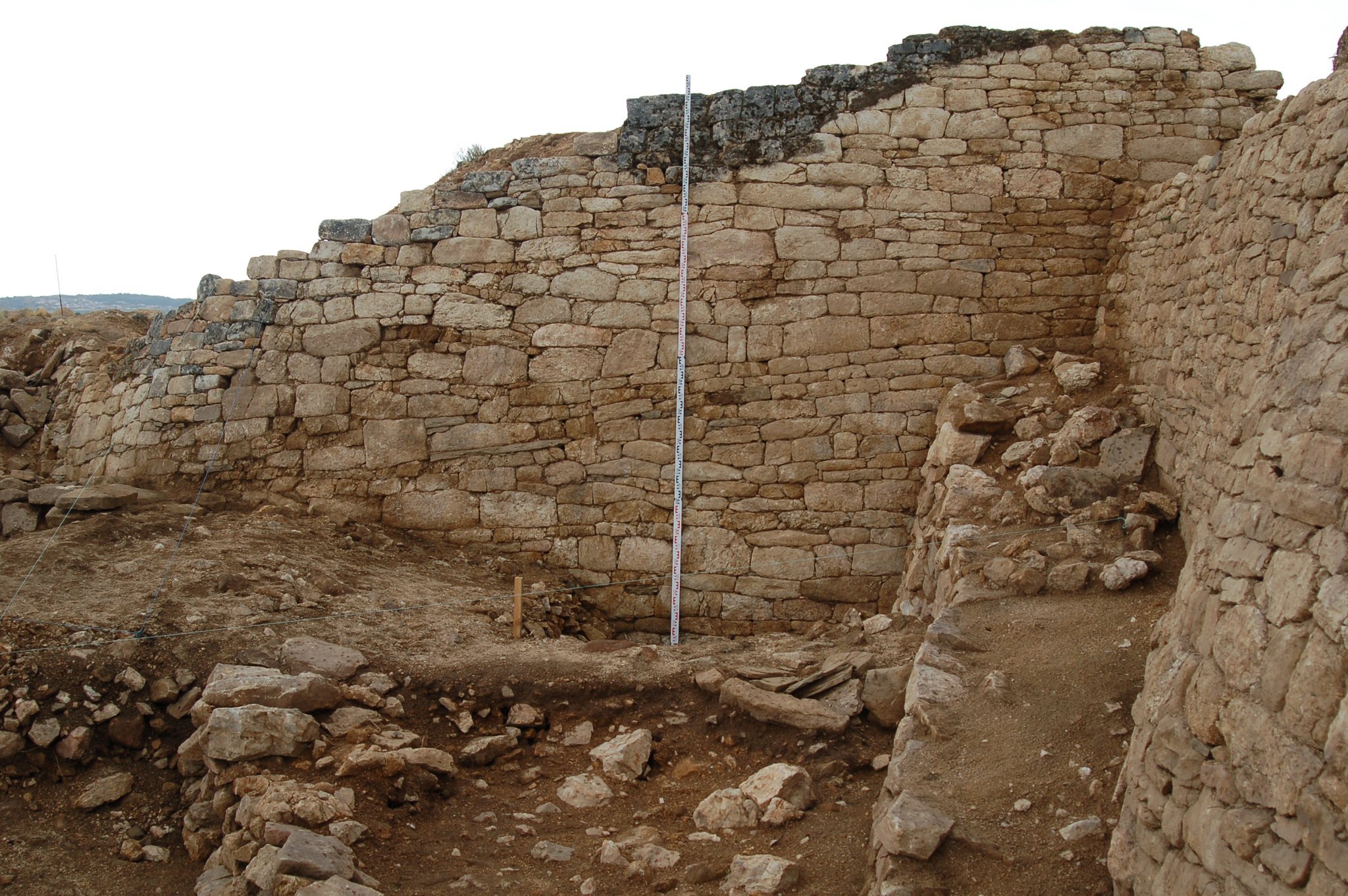
The defensive system combined a field of pointed quartz stones, a broad and deep ditch cut into granite bedrock, a stone wall, and a turret. The pointed stones exposed people and animals attempting to cross the approach, while the ditch added a second obstacle. The wall had a sloping profile, about 9 metres wide at its base and probably around 7 metres high. On its inner side, successive levels probably carried ramps to the top.
Wall and turret
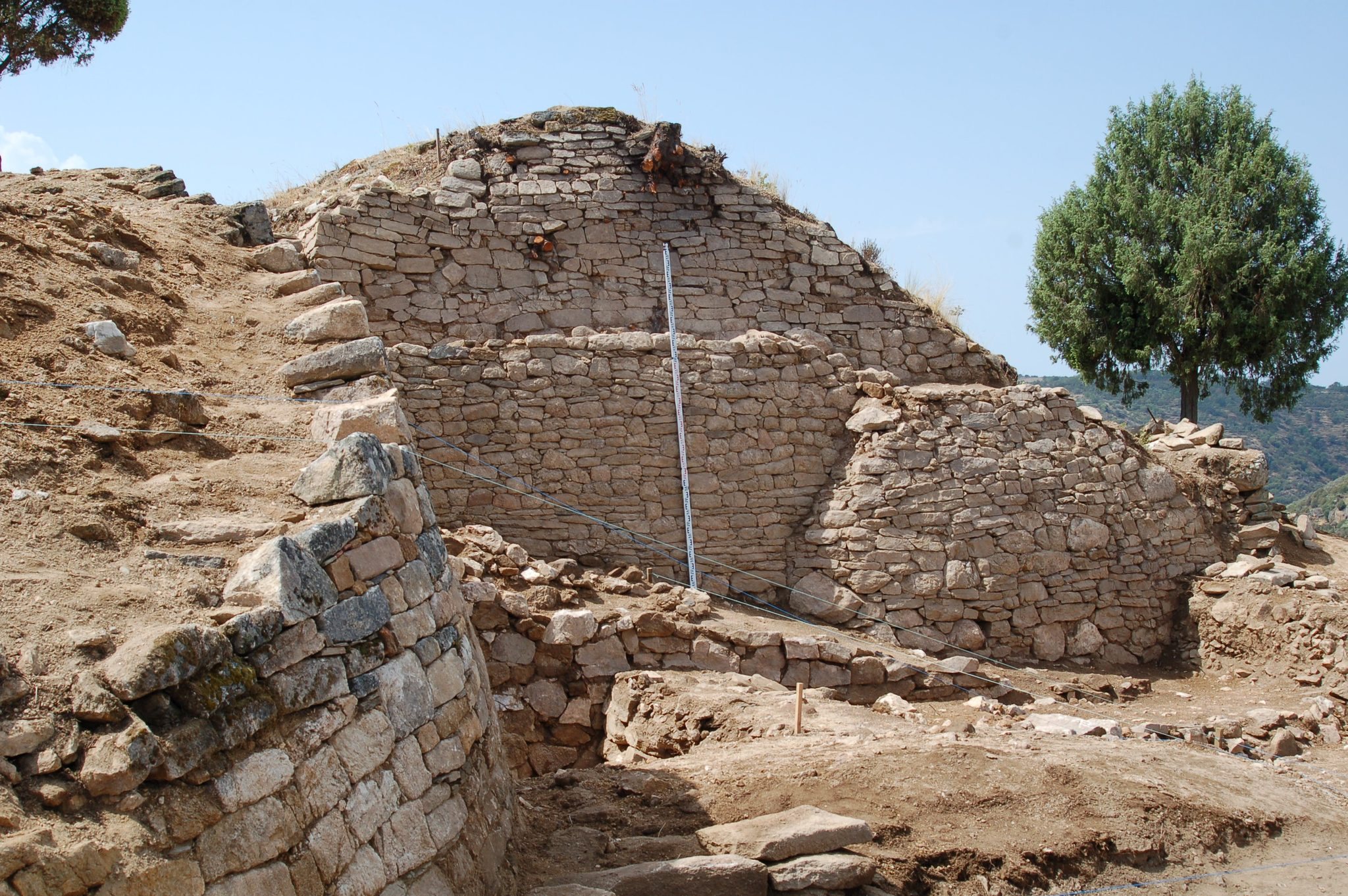
The wall runs about 46.5 metres from south to north before turning east into a rounded section. Its northern stretch survives to 5.2 metres high, while the southern section reaches up to 3 metres and is more poorly preserved because stone was removed and terraces were made for olive cultivation. A generally semicircular turret stood between the wall and ditch. Its heavy stone mass was supported by a crescent-shaped buttress and parallel reinforcing walls, especially well preserved on the northern side.
Entrance and angular tower
The original entrance was a corridor in the southern sector, approximately 7.5 metres long and 3.3 metres wide. Its enclosing walls still rose more than 2.5 metres. The passage was later closed with walls and filled with stone and earth, although the reason for this alteration remains unknown. A massive angular tower was subsequently built over the earlier turret structures and became the highest part of the complex. A stone stairway attached to its southern face led to the summit.
Settlement platform
Iron Age dwellings
The broad platform probably held the settlement’s dwellings. Centuries of agricultural use disturbed the archaeological layers and left the habitation structures extensively dismantled. Iron Age domestic remains include compact clay or rammed-earth floors containing small pebbles. One floor preserved postholes, indicating a building made with perishable materials.
Roman buildings
The later Roman domestic structures were rectangular and had stone foundations, compact rammed-earth floors, and tiled roofs. Two were built against the inner face of the defensive wall. Other buildings may survive beneath large collapsed masses of defensive stonework, linking the domestic area to the fortified perimeter.
Objects and working activities
Excavated materials span the Iron Age to the Modern period. Agriculture is represented by seeds, stone mills, and large ceramic containers. Numerous animal-bone fragments, sometimes found near combustion structures, reflect the preparation and consumption of animal food. Spinning and weaving are represented among the craft activities, while ironworking is indicated by slag and heat-resistant material. Pegs and nails were probably made regularly for construction.