Castellum of Holzheimer Unterwald: A Roman Frontier Fort
Site at a Glance
- Popularity
- Very Low
- Country
- Germany
- Primary era
- Classical
- Eras represented
- Classical
- Civilizations
- Roman
- Site type
- Military
- Remains
- Fort
On this page19 sections
History
The Castellum of Holzheimer Unterwald is a small Roman fort at Pohlheim, Germany, probably built during the reign of Trajan as part of the Upper Germanic Limes, Rome’s frontier system in what is now Germany. It formed part of a chain of military installations established to secure the frontier and monitor movement across the region.
Roman expansion and the frontier
Before the fort was built, Roman forces used the Wetterau as a base for campaigns against the Chatti, a Germanic people of central Germany. Rome’s expansion was halted after the recall of Germanicus, a Roman general and member of the imperial family, in AD 16. The military installations in the area were then abandoned.
Rome returned to the region under Emperor Vespasian, establishing forts and roads to secure the Wetterau and Main valley. Following the wars against the Chatti in AD 83–85, Emperor Domitian’s government began developing the Limes. The frontier was strengthened further from the period of Trajan onward.
The fort in service
The fort was probably established under Trajan and remained occupied from his reign until the middle of the third century. Its garrison is unidentified and may have included soldiers assigned from the auxiliary forts at Arnsburg or Butzbach. Auxiliary troops served outside the Roman legions and were often recruited from provincial populations. The small fort may have held around 20 to 30 soldiers.
Its position may have allowed the garrison to watch a pass across the frontier. In the earliest phase, a route may have run directly through the fort. The site also gave a view northwest toward the Lahn and allowed observation of the exposed northwestern side of a projecting section of the Limes.
An undated later phase changed the fort’s access and internal arrangement. These alterations may reflect a smaller garrison or a shift in the troops’ priorities, with greater attention to security and water supply.
Germanic pressure and Roman withdrawal
Pressure on the frontier grew during the second half of the second century. Raids and larger incursions repeatedly crossed the Limes. After the last major attacks of AD 259–260, Rome withdrew from lands east of the Rhine, including its frontier forts.
Investigation and preservation
Regional historian Johann Philipp Dieffenbach first described the fort in writing in 1843. Excavations led by Carl Gareis began in 1879, but poor execution and records contributed to mistaken interpretations. The Reich Limes Commission, a German body set up to investigate and document the Roman frontier, carried out further work in 1894 under local commissioner Friedrich Kofler.
Looting threatened the site from the early 1970s. Rescue excavations directed by archaeologist Gabriele Seitz followed between 1988 and 1991. In 1995, the Archaeological Society in Hesse conserved and partly reconstructed the fort. Since 2005, the fort and nearby Limes installations have been included in a UNESCO World Heritage property, and the site is protected under Hessian heritage law.
Remains
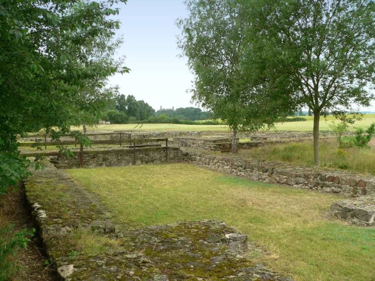
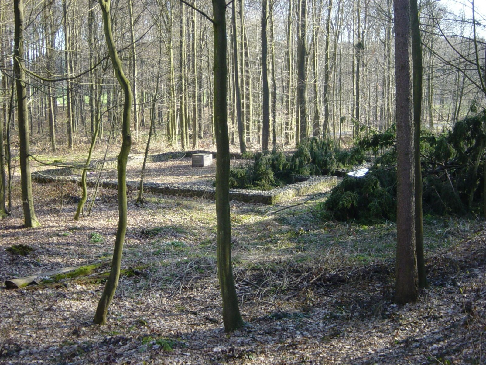
The fort lies in wooded hill country around Großen-Linden, between Holzheim, Grüningen, and Lang-Göns. Its conserved foundations and partial reconstruction reveal a compact, roughly rectangular stone enclosure, divided internally by a paved lane. The fort stood beside a straight stretch of the frontier, with other remains of the Limes and its watchtowers extending through the surrounding landscape.
Fort architecture
Plan and defensive circuit
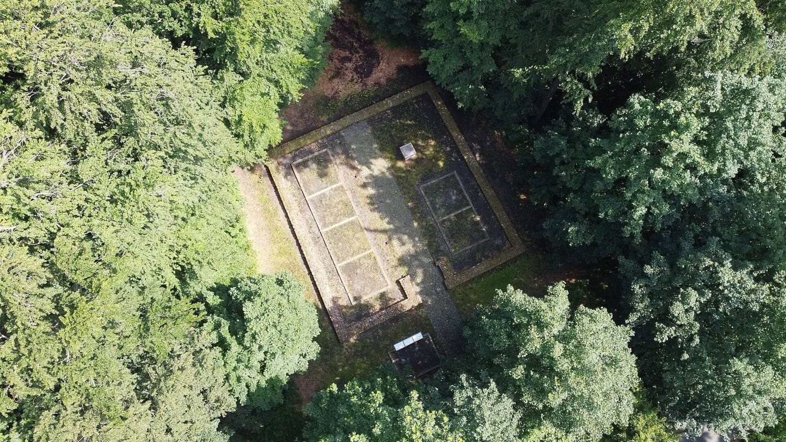
The stone fort measured about 18.60 by 19.40 metres and covered roughly 360 square metres. Its usable interior occupied just under 290 square metres. Including the ditch in front, the original footprint exceeded 600 square metres, around half an actus quadratus, a Roman square measure of land. It was among the smallest forts of its type on the Upper Germanic Limes. Excavation identified two building phases but did not establish their dates.
The defensive wall was about one metre thick, built with two outer faces of locally sourced basalt. Its corners met at sharp angles. A narrow strip of level ground separated the wall from a V-shaped ditch immediately outside it, about two metres wide and one metre deep.
Entrances and gate tower
The front of the fort faced northwest toward the Limes. Its entrance passage was 2.50 metres wide, with gate walls recessed 1.80 metres into the structure. The fort’s sole watchtower stood above this gate. A second entrance, 1.20 metres wide, opened on the southeast side. It was closed during a later phase, and white mortar joints mark the blocked opening in the reconstructed remains.
Barracks and internal lane
A paved lane ran through the fort, separating two timber-framed barracks. Each measured 13.80 by 3.60 metres and had a gallery about 1.50 metres wide facing the lane. Four single-room living spaces occupied each barrack. Each space covered a little over 12 square metres and was used for sleeping, cooking, and eating. Room use remains uncertain: the occupants may have included soldiers and riding animals.
Later well
During the later phase, the southern end of the southwest barrack was shortened by two rooms. A well was dug in the space created by this alteration. Its circular construction pit was two metres across and 9.50 metres deep; within it, the square well shaft measured 1.10 metres on each side.
Frontier line and watchtowers
The Limes near the fort
The fort stood directly beside an 8.5-kilometre straight section of the Upper Germanic Limes running southwest to northeast, between watchtowers numbered Wp 4/33 and Wp 4/49. “Wp” is the numbering abbreviation used for Limes watchtowers. Beyond Wp 4/49, the frontier turned sharply east-northeast, then curved toward the fort at Hainhaus. In woodland, the earthen boundary remains distinct for about half a kilometre beyond the fort. Farther into farmland it is lower but still forms a visible field boundary, before eventually fading from view. Traces of tower sites are slight along the stretch leading to Wp 4/49.
Watchtower site marked by mounds
A separate watchtower location was marked by two mounds about 35 metres apart. The Reich Limes Commission identified a tower there in 1896. A survey in 2005 confirmed a stone tower at the site and indicated that an earlier timber tower may have preceded it.
Watchtower at Wp 4/49
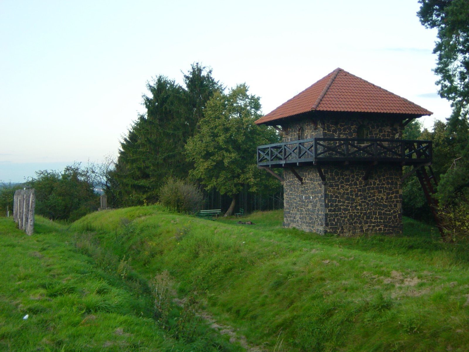
The original tower position at Wp 4/49 is marked by a low mound about 1.50 metres high and 18.90 metres across. The Reich Limes Commission recorded a square stone tower there, with sides measuring 5.90 metres and walls 90 centimetres thick. It stood 15 metres behind the crest of the Limes wall. A reconstruction now stands slightly southwest of the original position. It is considered inaccurate: it is one storey too low, its tiled roof has been judged non-Roman, and the original walls are thought to have been plastered.
Finds from the fort
Coins
A hoard from the fort contained 35 coins: 34 silver denarii and one copper-alloy sestertius. The sequence begins with a coin of Emperor Vitellius dated AD 69 and includes a coin of Marcus Aurelius struck for his wife Faustina no later than AD 176. Fourteen other individual coins, including denarii, sestertii, and asses, represent Vespasian, Trajan, Hadrian, and Antoninus Pius. Their dates range from AD 69 to AD 161.
Pottery
The pottery includes South Gaulish terra sigillata, fine Roman tableware with a glossy, often red coating, supporting a construction date in Trajan’s reign. Middle and East Gaulish examples from Trier and Rheinzabern indicate use into the first third of the third century. Occasional rough-walled Urmitz ware points to use into the second third of that century. Relief-decorated vessels of the Drag. 37 form, a classified shape of terra sigillata, were also found.
Germanic objects and scratched names
A Germanic shield boss, the raised central fitting of a shield, and Germanic pottery have been interpreted as evidence of a growing Germanic presence in the Roman-held frontier zone from the second half of the second century. Scratched marks on the glossy surfaces of personal dining vessels preserve parts of four soldiers’ names. One may read Maternus; another begins VICT-, while two survive only as incomplete forms ending in -IVS and -VPI.