Carrowmore: A Neolithic Tomb Cemetery in County Sligo
Site at a Glance
- Popularity
- High
- Country
- Ireland
- Primary era
- Stone Age
- Eras represented
- Stone Age
- Civilizations
- Unclassified
- Site type
- Burial
- Remains
- Necropolis
On this page13 sections
History
Neolithic construction and chronology
Carrowmore is a Neolithic cemetery of large-stone tombs on the Coolera Peninsula in County Sligo, Ireland. Its monuments were built broadly between about 3750 and 3000 BC, and the complex is counted among Ireland’s four major megalithic-tomb clusters. It may include some of the country’s earliest passage tombs, burial monuments with chambers reached by a passage. The name Carrowmore means the great quarter.
Carrowmore belongs to the Irish Passage Tomb Tradition, a prehistoric practice of building large-stone burial monuments. The grouping of tombs, their forms, and finds from some chambers have helped archaeologists understand how this tradition developed in Ireland.
The chronology was revised after an earlier interpretation by Swedish archaeologist Göran Burenhult. His excavations and radiocarbon work had led him to argue that hunter-gatherers of the Mesolithic, the period before the New Stone Age, built and used the tombs. He interpreted a sample from Tomb 3 as dating to about 5400 BC. A critical reassessment, drawing on 25 additional radiocarbon dates, placed the monuments broadly between about 3750 and 3000 BC. Evidence from nearby lakes indicates that farming activity coincided with, or began before, the monuments’ use.
Burial, ritual, and later use
Most Neolithic burials at Carrowmore appear to have involved cremation. Chambers held the remains of several people and were used again at intervals during the Bronze and Iron Ages, later prehistoric periods named for the metals prominent in toolmaking. These later uses included burials and deposits of objects.
Carrowmore is understood as a focal point in a prehistoric ritual landscape. Megalithic monuments may have served for ceremonies and celebrations, marked parts of the landscape, and commemorated family lines or people of high status. The construction of larger cairns, including Listoghil and the cairn on Knocknarea, may reflect a later, more ambitious phase of tomb building.
Ancient DNA analysis found a kinship link between a man buried at Listoghil and three people buried at Newgrange, Millin Bay, and Carrowkeel. Chemical evidence from human remains also points to a more protein-rich diet than that of the wider Neolithic population. Together, these findings have been interpreted as possible evidence for an elite family line buried at prestigious sites.
Antiquarian records and archaeological research
Antiquarian digging in the nineteenth century disturbed some tombs. Local landlord Rodger Walker excavated largely to collect antiquities and kept limited records; some objects he recovered are now at Alnwick Castle in Northumberland. George Petrie surveyed and numbered the monuments in 1837, then presented his observations to the Royal Irish Academy the following year. He argued against interpretations of Carrowmore as a group of Druid temples or altars. William Gregory Wood-Martin carried out the first recorded excavations in the 1880s.
Artist Gabriel Beranger visited in 1779 and drew monuments that were later damaged or destroyed. Photographers W. A. Green and R. J. Welch made further records in the early twentieth century. Quarrying and field clearance from the eighteenth century into the early twentieth century removed monuments. Estimates of the original number exceed 80, and some proposals exceed 200; 25 losses are specifically recorded since 1800.
Burenhult led excavation campaigns in 1977–1982 and 1994–1998, during which ten tombs were wholly or partly excavated. Listoghil was excavated between 1996 and 1998. Separately, roadworks at Maugheraboy, about three kilometres away, revealed a contemporary causewayed enclosure, a prehistoric space defined by interrupted ditches or banks.
Protection of the monument and its setting
Carrowmore is protected as a National Monument. In 1983 Sligo County Council proposed a municipal landfill on a quarry site about 100 yards from part of the complex. Five local residents challenged the proposal. The High Court initially permitted it under conditions, but the Supreme Court ruled against the Council in 1989. The ruling explicitly recognized that protection could extend to an architectural landscape, considering monuments together with their surroundings.
The State bought about 25 acres, including monuments and a small cottage, in 1989–1990. Further purchases later brought most of the complex into public ownership.
Remains
Setting and overall arrangement
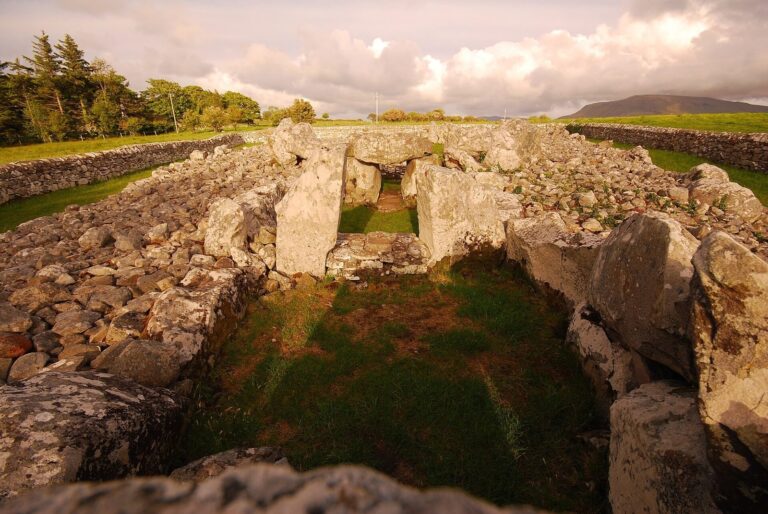
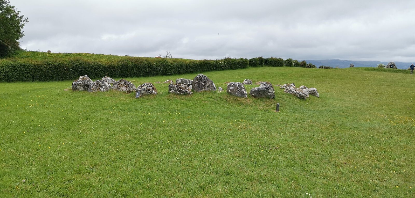
The cemetery occupies a small plateau between about 36.5 and 59 metres above sea level. It extends roughly one kilometre from north to south and 600 metres from east to west. Thirty monuments survive, mostly arranged in rows, with most of the smaller tombs clustered around Listoghil on the plateau’s high point.
The surrounding prehistoric landscape includes Knocknarea, about 350 metres high, to the west, crowned by the large cairn of Miosgán Médhbh. To the east, two large cairns in Carns townland overlook Lough Gill, while four passage tombs occupy peaks of the Ballygawley Mountains along the peninsula’s eastern edge.
Satellite tombs and stone circles
Typical tomb construction
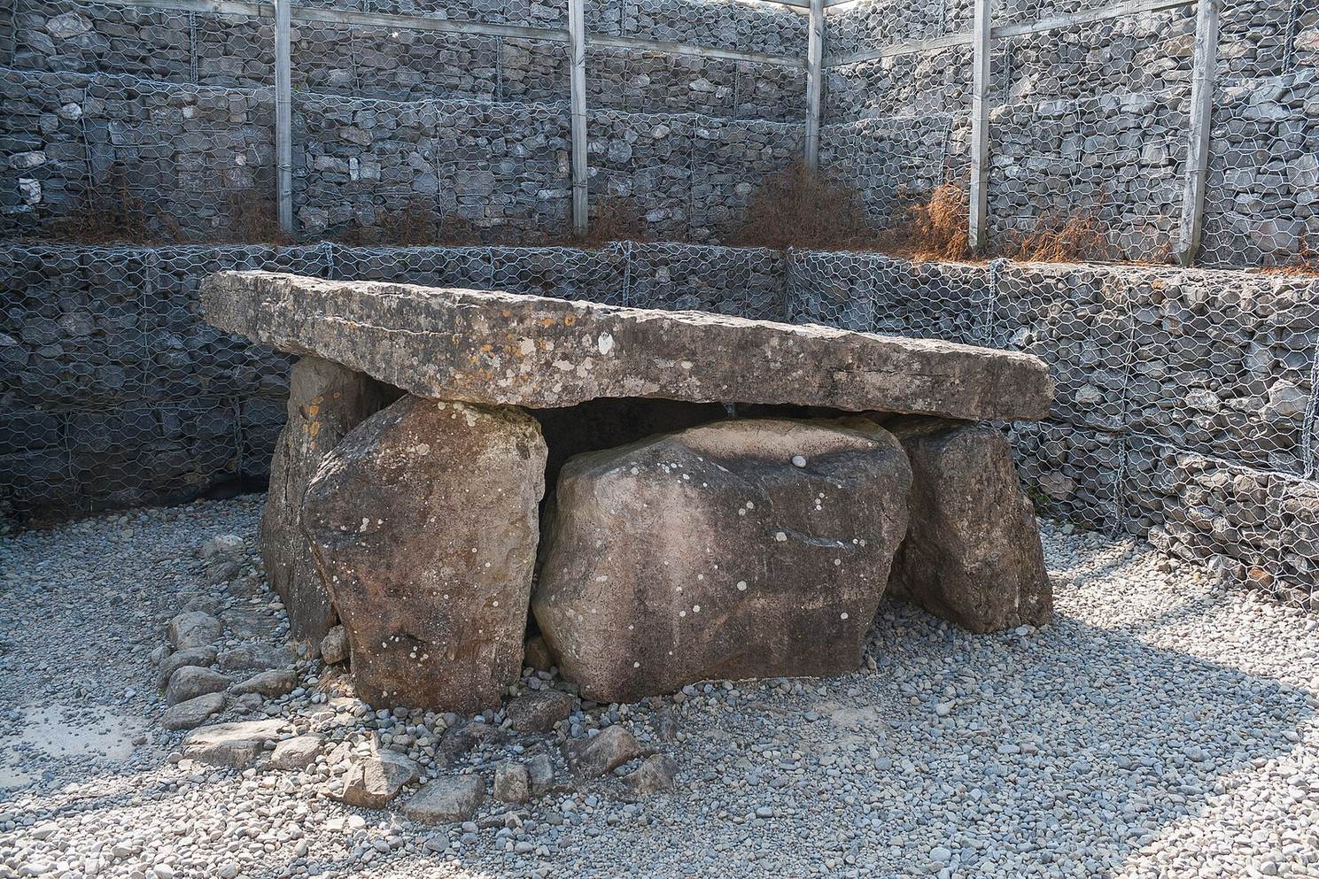
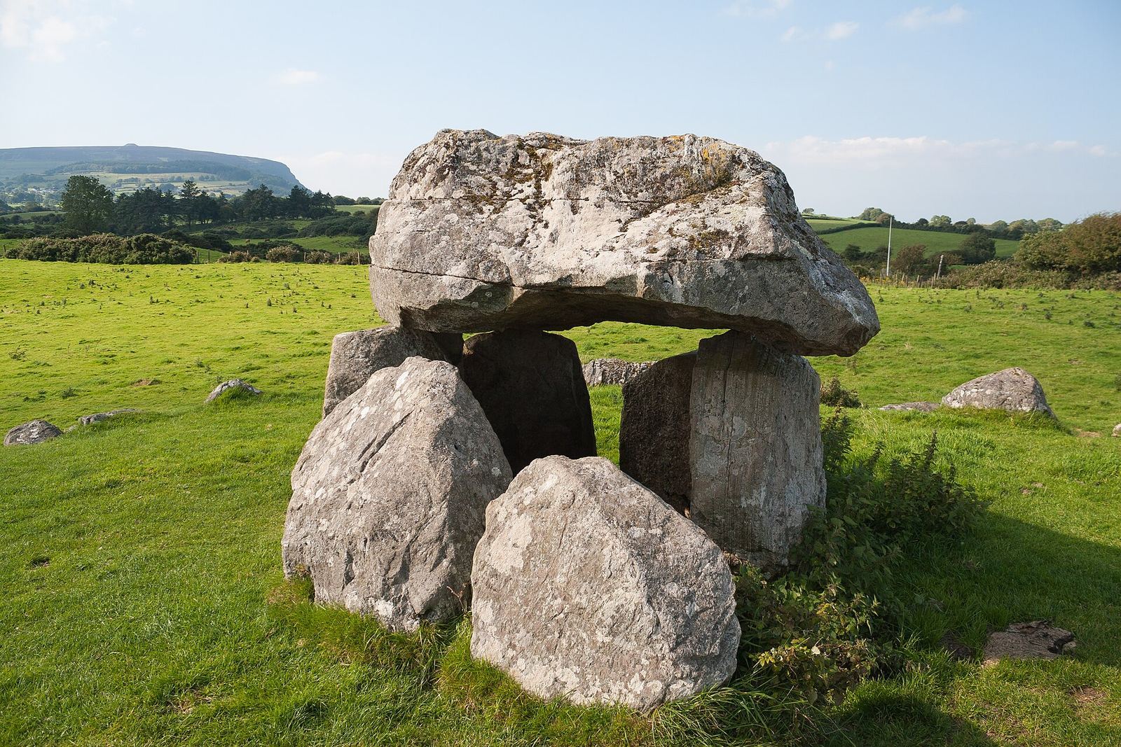
In their original form, the satellite tombs had a dolmen-like centre: five upright stones supported a roughly conical capstone over a small, five-sided burial chamber. Each centre stood within a circle of boulders about 12 to 15 metres across, usually made up of 30 to 40 stones, most commonly gneiss. Some monuments also have a second, inner circle. Entrance stones, at times arranged in rough double rows, extend from the central structure and generally face the central cairn area rather than a compass direction. The tombs stood on small level platforms of earth and stone, with packed stone around the bases of the uprights. Tomb 7 is a dolmen within one of these stone circles.
Tomb 27
Tomb 27 is one of the complex’s larger monuments and has a cross-shaped passage-tomb plan. Its chamber arrangement has been compared with later examples at Newgrange and Carrowkeel; four central pillars have also been compared with the design at Dowth. The roof has been lost. It may have consisted of stone slabs or may have been formed by laying successive stones inward to create a roof.
Listoghil and excavated finds
Listoghil
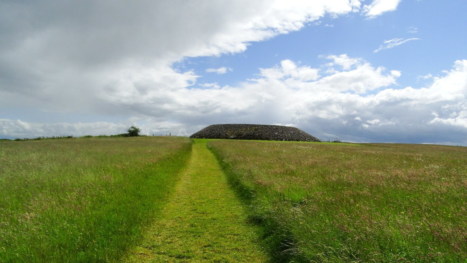
Listoghil, also called Tomb 51, was built around 3500 BC. It measures 34 metres in diameter and has a distinctive box-shaped chamber. Its stone cairn sets it apart among Carrowmore’s monuments. Marks on the leading edge of the stone covering the entrance may represent the site’s only identified megalithic art. Three large boulders found beside the central chamber and beneath the cairn may be remains of a destroyed passage or of an earlier large-stone structure.
Burial objects and ritual traces
Listoghil contained both unburned and cremated human remains. Objects found in Carrowmore’s tombs include pins made from antler and bone, beads, pendants, stone and clay balls, fragments of quartz, shellfish remains, and small quantities of Neolithic pottery known as Carrowkeel ware. Quartz accompanied most burials and held ritual importance in the passage-tomb tradition.