Capdepera Castle: A Medieval Fortified Settlement in Mallorca
Site at a Glance
- Rating
- 4.5
- Popularity
- Medium
- Country
- Spain
- Primary era
- Medieval
- External website
- Open
- Eras represented
- Medieval, Early Modern, Modern
- Civilizations
- Crown of Aragon, Kingdom of Majorca
- Site type
- Military
- Remains
- Castle
On this page19 sections
History
Capdepera Castle is a former fortified settlement in Capdepera, Spain, built under the medieval kings of the House of Barcelona from 1300 through the fourteenth century. Its walls and gates were completed by 1342, while its towers were finished by 1386. The castle occupies a strategically important position in northeastern Mallorca, opposite Menorca and beside the maritime route through the Menorca Channel.
Before the fortified settlement
The hill had been occupied in prehistoric times and later stood within Roman Mallorca, which was under Roman rule from the second century BC to the fifth century AD. Before the medieval castle was built, the site contained a Muslim fortification. The lower part of its Torre d’en Miquel Nunis survives within the later enclosure. The first documented mention of Capdepera Castle dates to 1337.
Its strategic importance grew after James I of Aragon conquered Mallorca in 1229. The position allowed the island’s rulers to observe the sea route toward Muslim-controlled Menorca. In June 1231, James I ordered more than 300 fires to be lit around Capdepera, creating the appearance of a large invading army across the water.
On 17 June, Menorcan representatives signed the Treaty of Capdepera inside the Torre d’en Miquel Nunis. Menorca recognized James I and his successors as overlords, agreed to surrender the fortress of Medina Manūrqa, now Ciutadella, and accepted an annual tribute in kind. The agreement was signed by the qadi, a Muslim judge, and legal scholar Abu Abd Allah Muhammad, by the island’s sheikhs, and by Abu Uthman Said, the future ruler of Menorca. Abu Uthman Said governed the island from 1232 until his death in 1282. The treaty document is now held by the French National Library in Paris.
Foundation and growth
In 1300, James II of Majorca planned a fortified town around the older tower. The projected enclosure, protected by walls and a moat, covered 82,525 square metres. Its purposes were to gather the scattered population of eastern Mallorca, defend and administer a sparsely settled region, and monitor the maritime route to Menorca.
Many local inhabitants resisted moving into the planned town because its confined space was unsuitable for keeping animals. As a result, the occupied settlement covered less than one-tenth of the projected area. It began with about 50 houses and approximately 200 inhabitants. By the end of the sixteenth century, it had grown to about 150 houses. Repeated attacks by Ottoman corsairs encouraged people from the surrounding countryside to seek protection inside the walls.
From the seventeenth century, increasing numbers of residents settled below the castle. In 1789, only 25 houses within the fortification remained inhabited, compared with 208 outside it. The settlement’s changing population reflected both the decline of its defensive purpose and the growth of the town beneath the hill.
Military decline and later conservation
Local inhabitants provided the castle’s defence until the Bourbon administrative reforms of the early eighteenth century, associated on Mallorca with the 1715 Nueva Planta decree. These reforms reorganized royal administration in territories brought under Bourbon rule. Defence then passed to a small mounted unit of dragoons commanded by a governor, who lived in the newly built Governor’s House.
Civilian occupation continued to contract. Twelve houses were inhabited by civilians in 1820, and only four in 1865. The military garrison left in 1854, and the castle was auctioned in 1862. The church resumed use in 1871, while some towers and rooms retained limited occupation. The rest of the site was largely abandoned.
Small-scale agriculture continued within the enclosure. Representatives of the owners cultivated parts of the ground, where prickly pears, carob trees, figs, and oaks also grew. During the late nineteenth century, collapsed sections of the walls were rebuilt, and the defences received historicizing battlements and loopholes. The castle saw little use apart from the church after 1920.
A stairway linking the town with the Portalet was built from 1954 to improve access to the castle. On 9 May 1983, the owners transferred the property to the municipality by deed, after which a municipal castle foundation was established to conserve, repair, and restore the monument. Excavations at the southwest wall uncovered fragments of houses from the former settlement, while repeated conservation projects repaired the church and recovered collapsed wall sections. Since 1993, Capdepera Castle has been protected as a Spanish Monument and Bien de Interés Cultural, Spain’s highest level of protection for historical heritage. A fatal fall from the stone wall walk in 2013 led to the installation of a metal safety railing along the route later that year.
Remains
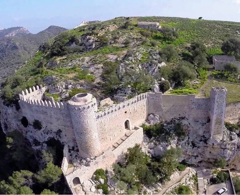
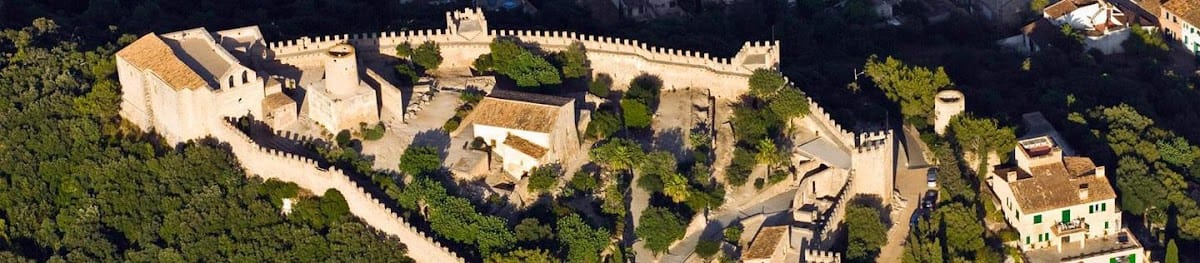
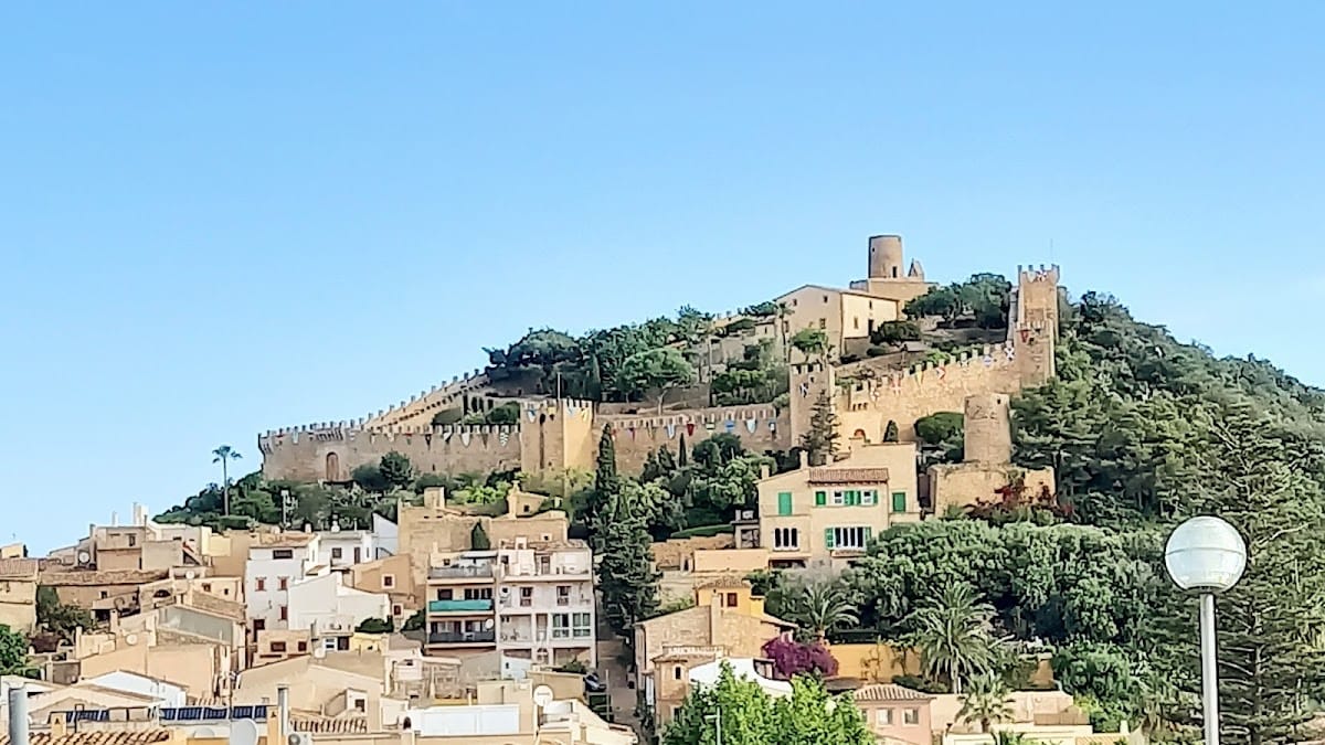
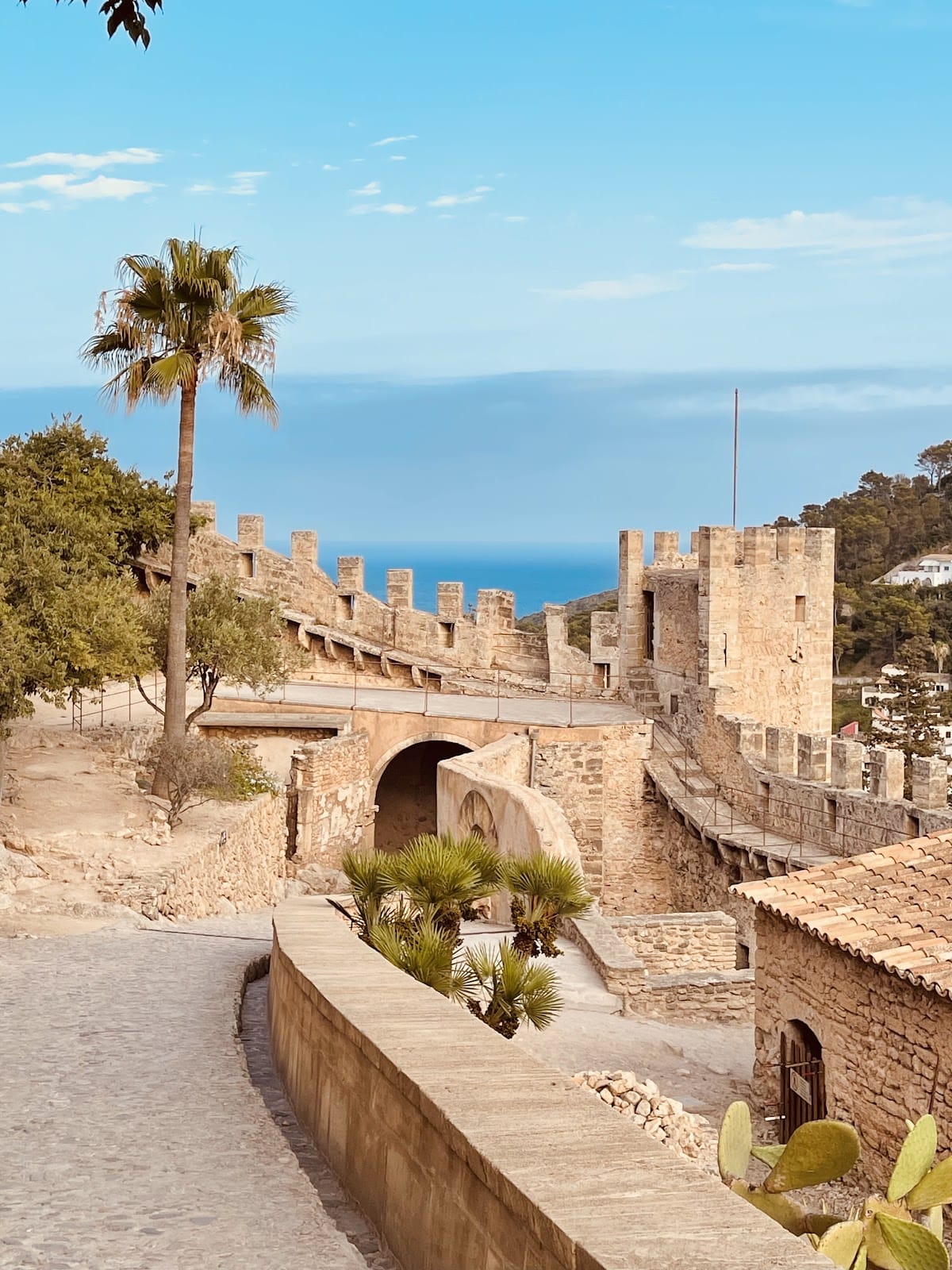
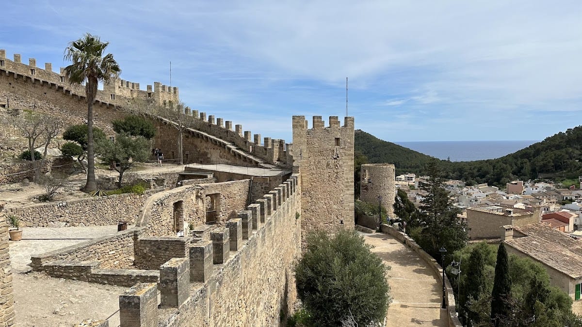
Capdepera Castle occupies the upper part of the 159-metre Puig de Capdepera, about 1.9 kilometres from Mallorca’s east coast. Its surviving fortified enclosure covers approximately 8,069 square metres and follows an almost triangular plan that rises toward the north. The entrance lies at the lower end, while the ground climbs toward the church at the highest point. Limestone masonry, including locally used Marès stone, forms the principal construction material. The elevated position gives the enclosure views across parts of northeastern Mallorca and toward the coast and the channel separating Mallorca from Menorca.
Walls and entrances
Eastern and southern defences
The eastern wall extends for approximately 75 metres and includes the Torre d’en Banya and Torre de ses Dames. At its southern end, the wall turns for about 25 metres toward the Torre de sa Boira and the Portalet. These towers and wall sections form part of the enclosure’s defensive perimeter, which follows the rising ground of the hill.
Southwestern defences
The southwest wall is approximately 80 metres long. The Torre des Costerans stands at its centre, while the Portal del Rei en Jaume occupies its western end. Machicolations, projecting openings in a parapet used to observe or attack people below, survive above the Portal del Rei en Jaume, the Portalet, and the Torre d’en Banya.
Gates and internal road
The Portal del Rei en Jaume was originally the principal gate and was completely remodelled in the late seventeenth or early eighteenth century. A second entrance was added on the southeastern side in the early sixteenth century. The Portalet, beside the Torre de sa Boira, became the main entrance in its present sixteenth-century form.
A straight road connected the two principal entrances, running parallel to the southwest wall in front of houses built against it. Other streets followed an east-west direction and climbed the interior slope in stages toward the Torre d’en Miquel Nunis. This arrangement reflects the way the fortified settlement adapted its streets and houses to the hill’s incline.
Islamic tower and northern high point
Torre d’en Miquel Nunis
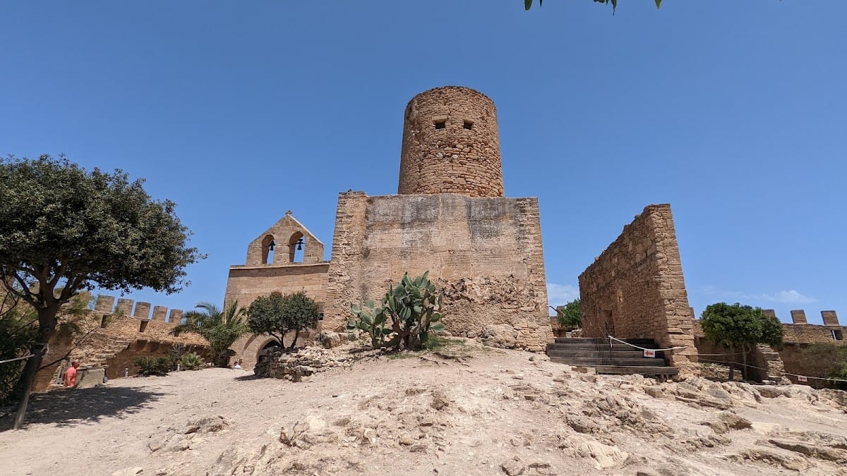
The Torre d’en Miquel Nunis occupies the highest point of the enclosure and dates from the Islamic period of Mallorca, between the tenth and twelfth centuries. Its lower section rests on a square masonry base. The tower was originally built of earth and stood about 10 metres high, nearly twice its present height.
In the nineteenth century, an attempt was made to convert the tower into a mill. About half of the old square structure was removed, and work began on a circular mill building. The military governor halted the project, but a spiral staircase associated with the attempted conversion remains inside the tower.
Church and water supply
Església de Nostra Senyora de l’Esperança
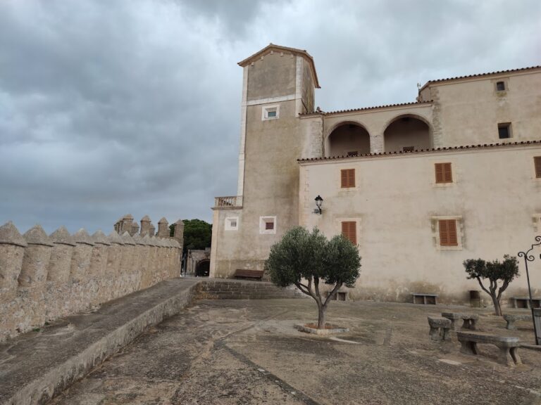
The Església de Nostra Senyora de l’Esperança stands at the northern corner of the enclosure. Developed between the fourteenth and eighteenth centuries, its northwest and northeast sides form part of the outer fortification wall. A platform immediately to the southeast connects the church with the wall walk and parapet, incorporating the building into the defensive layout.
The original church was a small chapel, probably roofed with tiles supported by a wooden framework. Its surviving altar figure is a Gothic-style Christ carved from orange wood and dated to the late fourteenth or early fifteenth century. The faded figure hangs in a present side chapel that occupies the former altar area; its crown of thorns and cross are missing.
At the end of the sixteenth century, the church was enlarged toward the northeast. This established the present orientation of the nave and moved the altar to the northeast. Side chapels were added in the early eighteenth century, including a Baroque chapel dedicated to the Virgin of the Rosary, created in 1703. The church had earlier been dedicated to Saint John and was rededicated to Our Lady of Hope, the Verge de l’Esperança, in 1871. The present statue dates from 1966, when a sculptor from Madrid completed a Gothic-style figure using its surviving head and hands.
Fourteenth-century cistern
A fourteenth-century cistern stands directly beside the church on its southeastern side. It collected rainwater and had a shaft and well rim for raising water in the manner of a draw well. Its small capacity indicates a supply intended mainly for emergencies such as sieges, an important provision for a fortress without natural springs.
Settlement buildings and archaeological remains
Former houses
The fortified village contained as many as 150 generally small, modestly built houses. Some were attached to the outer or retaining walls that stabilized the rising ground. Only fragments of these dwellings survive, but excavation at the southwest wall revealed part of a house that has since been restored.
House of the Lady
The House of the Lady lies within the Torre de ses Dames. Together with the Governor’s House, it is one of the few surviving buildings associated with the houses of the former settlement.
Casa del Governador
The Casa del Governador, or Governor’s House, stands 15 metres south of the Torre d’en Miquel Nunis. Built in the eighteenth century for the governor responsible for the military unit stationed at the castle, it now houses the castle museum, which presents the history of Capdepera and the municipality’s traditional palm-leaf plaiting industry.
Cañamel Tower
The Cañamel Tower is identified as one of Mallorca’s historically important defensive towers, adding to the network of military structures associated with the castle and its surrounding territory.
Nearby sites