Calydon Fortress: Defenses of an Ancient Greek City
Site at a Glance
- Popularity
- Very Low
- Country
- Greece
- Primary era
- Classical
- Eras represented
- Classical
- Civilizations
- Ancient Greek
- Site type
- Military
- Remains
- Wall
On this page13 sections
History
Calydon Fortress preserves the defenses of Calydon, an ancient Greek city in Aetolia, Greece, which Homer included among the cities of the region. The city’s legendary past was associated with Oeneus, a king; Tydeus, a warrior hero; and Meleager, hero of the Calydonian boar hunt.
Tradition and political change
Stories also linked the nearby Evinos River with Heracles and Nessus. Nessus was a centaur, a mythical being with a human upper body and a horse’s body, who served as the river’s ferryman until Heracles killed him.
After the Peloponnesian War, the major conflict between Athens, Sparta, and their allies, Achaeans, an ancient Greek people, occupied Calydon. The city was no longer considered Aetolian. From 369 BC, it belonged to the Aetolian League, a political and military federation of communities in Aetolia.
Growth of the fortifications
The city’s defenses developed in stages as Calydon expanded, rather than according to one unified plan. The thick northern wall of the acropolis, the fortified high part of an ancient Greek city, may be among the earliest sections, despite later changes. The thinner, buttressed northeastern wall is probably later.
Roman resettlement
After his victory at Actium, a decisive naval battle in which Octavian, later known as Augustus, defeated Mark Antony and Cleopatra, Augustus emptied Calydon to help populate Nicopolis in Epirus. The sanctuary of Artemis, a Greek goddess associated with wild places and animals, was stripped. Its treasury and the goddess’s statue were moved to a temple in Patras.
Identification and excavation
Once known as Kastro de Kurtaga, the site was identified as Calydon by the British topographer and antiquarian William Martin Leake in 1809. Greek and Danish teams excavated the Laphrion, Calydon’s sanctuary precinct, from 1925 to 1932, uncovering and studying its temples on the promontory.
Remains
Landscape and enclosure
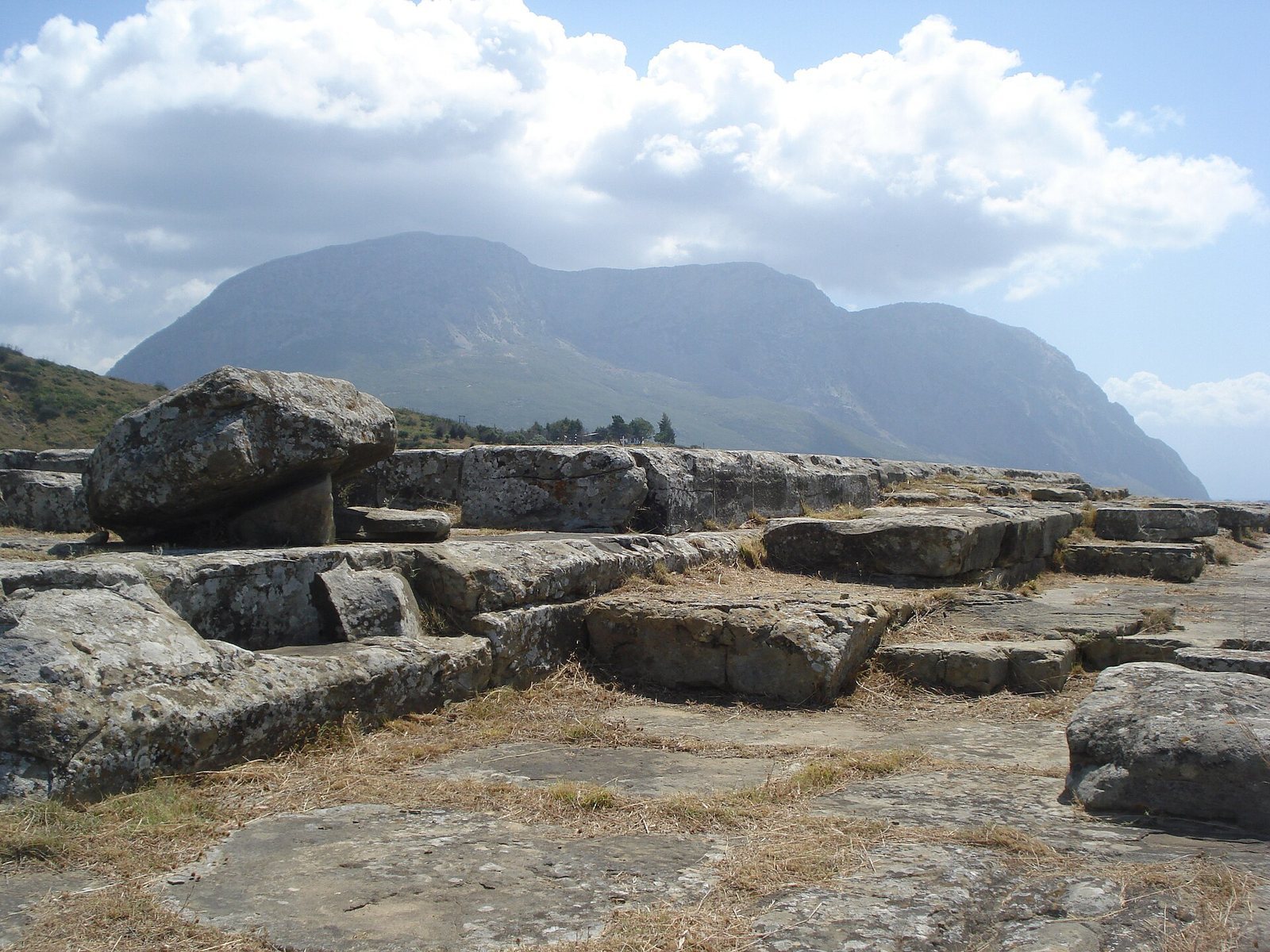
The site occupies two heights and nearby slopes forming a spur south of the Arakynthos range. The Laphrion sanctuary stands on a rocky promontory. Northeast of it, two hills meet at a narrow pass around a small, olive-covered valley crossed by a stream. Another stream runs west of the sanctuary hill toward Arakynthos and marks the western edge of the lower city.
The fortification rises to the summit of the western hill, which forms the acropolis, then follows a ridge roughly east to west. Beyond the pass, the wall descends and bends south around the eastern hill, enclosing most of it. The wall’s ends may have been intended to meet in the valley.
Gates
Principal entrance
The principal entrance stood at the end of the sacred road, about 300 m north of Laphrion, and is described as being on the city’s southern side. Its opening was nearly 5 m wide and was defended by two square towers. Poor preservation and vegetation make the gate difficult to distinguish.
Northwestern gate
A second gate stands beside the stream on the northwestern stretch of wall. Its opening is angled against the wall, which is 2.5 m thick at this point. A projecting defensive feature nearly 4 m across is immediately to the right on entering. The surviving gate masonry, made of large blocks, rises to no more than three courses. The passage narrows from 3 m wide on its inner side to 2.5 m at the exterior.
Inside the passage, a rectangular recess is 2.8 m long and set back 1 m from the inner face of the left gatepost; a wall 1 m thick bounds it at the rear. Each gatepost has a rounded niche near its outer end. The right niche is 0.8 m long, while the left is 0.4 m long and shortened by the recess. These niches may have held locking mechanisms. Shallow, stepped cuts in the stonework include one 7 cm deep at a junction, paired steps at corners of the recess and left gatepost, and another at the inner end of the passage.
Walls and defensive works
Northern acropolis wall
The northern acropolis wall and the northeastern city wall are the best-preserved stretches of the enclosure. The northern wall extends for about 250 m and survives to roughly 4 m high, with up to ten courses of nearly rectangular blocks. Its defenses combine towers set at right angles to the wall with outward-projecting sections. Five towers and at least four projections remain along the line. Tower spacing increases from west to east, ranging from about 20 to 50 m, and the towers have paired stepped cuts at their corners.
The local sandstone is crumbly and has weathered in the maritime climate. In the better-preserved masonry, the blocks have strongly projecting outer faces. The best-preserved main wall is 3 m thick, with two outer stone faces and an interior core of earth and large stones. Its blocks are laid in fairly regular courses that alternate in height.
Northeastern wall
The eastern continuation of the city wall is about 1 m thick. Its two stone faces, each 0.4–0.6 m thick, enclose a narrow core of earth and small stones. Interior buttresses recur at intervals of about 5 m. They may have reinforced the wall and supported a walkway along it. Four outward-projecting sections provide flanking defense. The fortifications are deteriorated and show damage from both ancient and more recent periods, while their masonry retains evidence of attention to visual effect.