Cadbury Castle: A Long-Lived Hillfort in Somerset
Site at a Glance
- Popularity
- Very High
- Country
- United Kingdom
- Primary era
- Iron Age
- Eras represented
- Stone Age, Bronze Age, Iron Age, Classical, Medieval
- Civilizations
- English, Roman
- Site type
- Military
- Remains
- Fort
On this page12 sections
History
Cadbury Castle is a hillfort at South Cadbury in the United Kingdom, occupied from the Neolithic, an early prehistoric period, onward. Its summit developed into a defended settlement during the Iron Age and later became an important post-Roman stronghold.
Early settlement and Iron Age development
The earliest settlement was a small farming community without enclosing defences. Bones from this phase were radiocarbon dated to about 3500 and 3300 BC. Occupation continued during the Late Bronze Age, before the Iron Age, when people on the hill were using ovens.
Around 300 BC, cultivation on the summit ended as the settlement became more established. Its defences expanded over the following centuries, with additional lines added during the 1st century BC. Evidence of metalworking and housing points to permanent occupation. A possible sequence of shrines also suggests religious activity, though their connection with Celtic traditions involving multiple deities remains an interpretation.
Roman occupation and later activity
The fort appears to have been taken by force during the Roman conquest of Britain. Excavations at its southwest gate uncovered evidence of severe violence, weapons and destruction by fire. Richard Tabor connected this violence to the Roman invasion of AD 43 or 44, while Leslie Alcock placed it around AD 70. Historian Michael Havinden characterized the conflict as determined resistance by the Durotriges and Dobunni, ancient British peoples, against Legio II Augusta, a Roman legion commanded by Vespasian, who later became emperor. The defences were weakened further later in the 1st century, after a Roman army barracks had been built on the hilltop.
Activity increased again in the late 3rd and 4th centuries. A Romano-British temple, a religious building shaped by Roman-era Britain, may have been constructed during this period.
Post-Roman stronghold
After Roman administration withdrew from Britain, the hill was probably used from about AD 470 until sometime after 580. Its refortified inner defences enclosed an area about twice the size of any other known fort of that period. Cadbury was probably the principal stronghold of a Brythonic ruler, a leader from Britain’s Brittonic-speaking peoples. His household may have included family members, a fighting retinue, servants and horses.
Saxon and medieval use
Between 1010 and 1020, the hill was occupied as a temporary Saxon mint, a place where coins were made, replacing the mint at Ilchester. The Domesday Book, a survey of English landholding and resources made in 1086, records the site within the feudal barony of North Cadbury, held by Turstin FitzRolf. Some limited fortification may have followed in the 13th century.
Arthurian tradition and archaeological research
The local identification of Cadbury Castle with Camelot, the legendary court of King Arthur, first appeared in writing in 1542, when the English antiquary John Leland recorded the tradition. In modern times, Geoffrey Ashe argued that the site had been a base for the historical Arthur, but this view has not been widely accepted. Another interpretation sees the hill as a refuge and defensive position for people of Dumnonia, a Brittonic polity in southwestern Britain, against attacks from the east. If the tradition placing Arthur’s conception at Tintagel is accepted, he may have been a prince of Dumnonia who used Cadbury as a stronghold on its eastern frontier.
James Bennett excavated the site in 1890, followed by Harold St George Gray in 1913. Leslie Alcock led major excavations from 1966 to 1970, revealing a long sequence of occupation. Investigations of the ramparts and southwest gate produced one of southern Britain’s deepest and most complex excavated Iron Age sequences, extending from the Late Bronze Age into the Early Iron Age. Since 1992, the South Cadbury Environs Project has studied the hillfort and surrounding landscape within an area extending 8 km from the site, using geophysical surveys, sampling, test pits, excavation and spatial mapping. Local volunteers and university researchers have taken part. The hillfort is a Scheduled Monument, a nationally important archaeological site protected by law in England, and is on the Heritage at Risk Register because of scrub and tree growth.
Remains
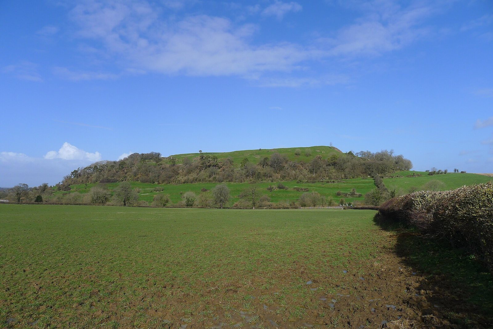
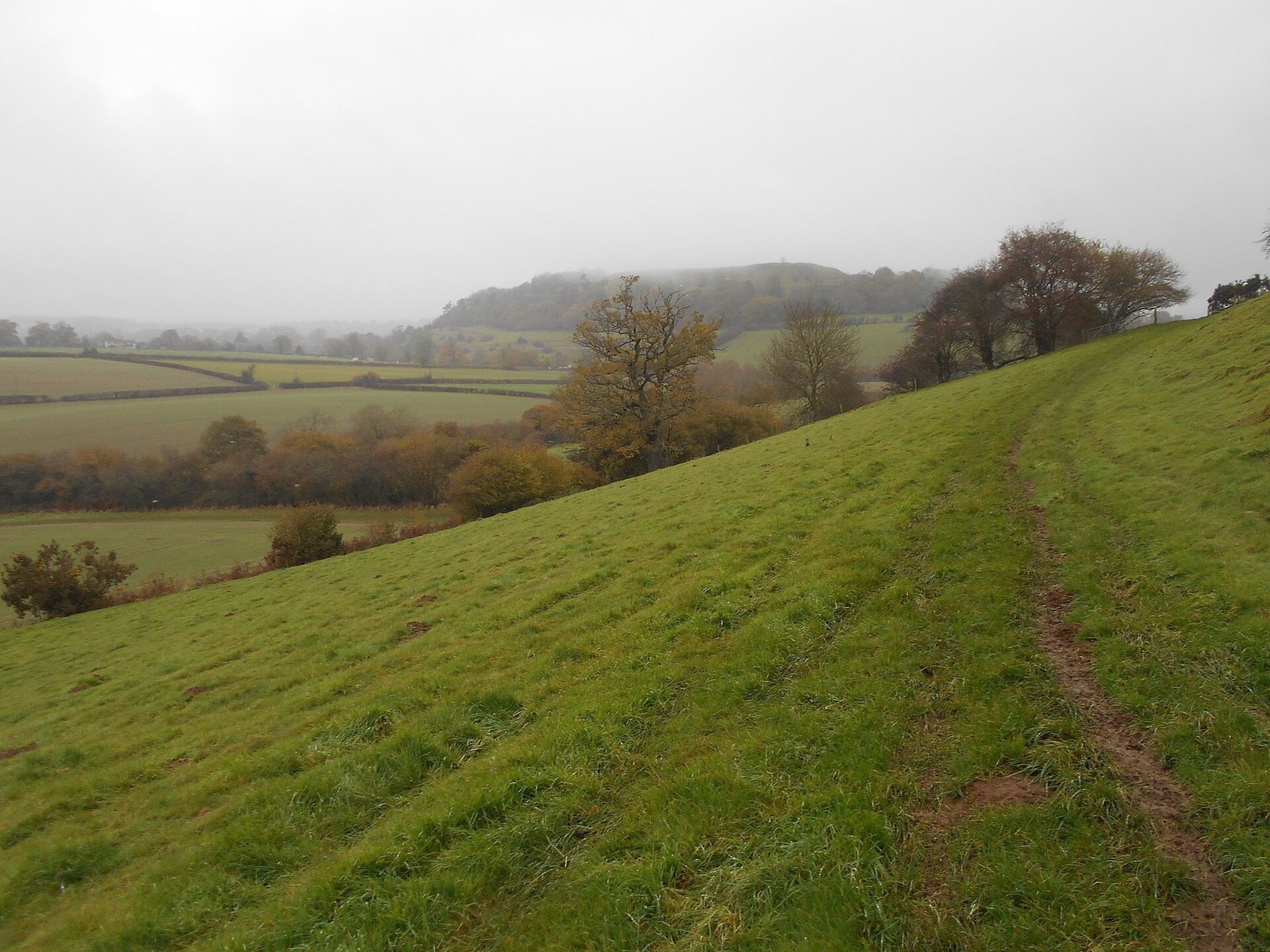
The hillfort occupies a 7.28-hectare summit plateau on Cadbury Hill, a limestone hill at the southern edge of the Somerset Levels. The summit is 153 m above sea level and lies on Lias, a geological formation of limestone and shale. Lowland extends to the north, while the archaeologically rich rural plateau of Sigwells overlooks the hillfort. Terraced earthwork banks and ditches encircle the hill among a stand of trees. Four ramparts are described on the northwest and southern sides, and two on the east; the inner bank is 1.2 km long.
Settlement remains
Neolithic traces
Pits and postholes associated with pottery and flint mark the earliest settlement. Beneath the later Iron Age defences, a bank probably formed as a cultivation terrace through early ploughing on the slope. Such a terrace is also known as a lynchet.
Bronze Age features and finds
Ovens show Late Bronze Age activity on the hill. A bronze shield of the recognized Yetholm type was recovered in the wider archaeological area. Its manufacture is broadly dated to 1350–1150 BC; radiocarbon evidence places its deposition in the 10th century BC, while metallurgical evidence suggests it was made about two centuries earlier. A metalworking building and an associated enclosure lie about 2 km southeast of the hillfort and date broadly to the time the shield was made.
Iron Age structures
Iron Age remains include a stone enclosure reinforced with timber supports, foundations of rectangular houses and later circular dwellings, evidence of metalworking, and extensive earthwork and timber defences. Possible small rectangular temples or shrines have also been proposed. They have been interpreted as connected with Celtic polytheism, religious traditions involving multiple deities.
Post-Roman hall and pottery
Remains of a substantial post-Roman Great Hall indicate a building measuring 20 by 10 m. Eastern Mediterranean pottery fragments from this phase point to far-reaching trade connections.