Cabrenç Towers: A Medieval Fortified Complex in France


Site at a Glance
- Rating
- 4.9
- Popularity
- Very Low
- Country
- France
- Primary era
- Medieval
- Eras represented
- Medieval, Modern
- Civilizations
- Crown of Aragon
- Site type
- Military
- Remains
- Castle
On this page9 sections
History
Cabrenç Towers is a medieval fortified complex in France, near Serralongue, whose principal castle is associated with the ninth century. It was the original seat of the Barony of Cabrenys, a territorial lordship whose possessions extended across Vallespir and several settlements, while its name was also transferred to Maçanet de Cabrenys in Alt Empordà. The complex developed across several summits on the ridge separating Vallespir from Alt Empordà and the basins of the Muga and Tech rivers.
The baronial seat
Until the tenth century, Cabrenç Castle housed the lieutenants of the Counts of Besalú, medieval Catalan rulers of the County of Besalú. The Barons of Cabrenys then continued to reside there until the fourteenth century, when the barony’s principal residence moved to Maçanet. A second castle was built at Serralongue during the sixteenth century, further changing the relationship between the barony and its original stronghold.
The middle and northern towers belong mainly to the thirteenth and fourteenth centuries, when the fortified complex expanded beyond the southern castle. Their positions on separate summits created a group of defensive structures along the ridge rather than a single compact enclosure.
Destruction and preservation
Late in the seventeenth century, the complex was destroyed with explosives on the orders of Sébastien Le Prestre, Marquis of Vauban. Vauban was a French military engineer and marshal under Louis XIV. The destruction followed the castle’s use as a refuge by the Angelets de la Terra, Catalan insurgents who rebelled against French authority in northern Catalonia during the 1660s and 1670s.
The Association pour la sauvegarde du château et les tours de Cabrenç was founded on 21 April 1986 to preserve the remains, organizing fundraising as well as conservation and restoration work. The middle tower and castle ruins received protection as French historic monuments in 1988, followed by the northern tower in 1994. The remains are jointly owned by the communes of Lamanère and Serralongue. A relay antenna and an orientation table have also been installed at the site.
Remains
The fortification occupies a steep rocky ridge at about 1,334 metres above sea level and is arranged across three principal defensive positions. The main castle stands on the southern summit at approximately 1,326 metres. About 100 metres farther north is the middle tower, while the northern tower rises roughly 300 metres beyond the principal castle on the northernmost summit.
The southern castle
Keep and enclosure
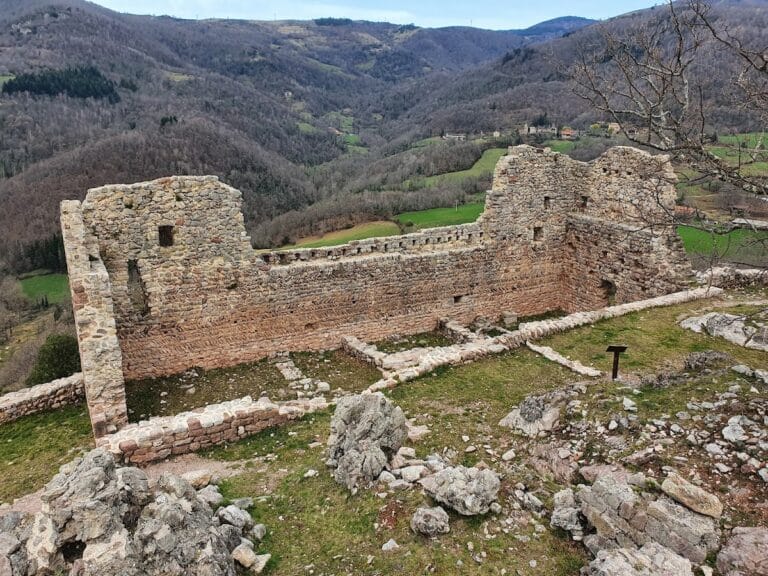
The southern castle included a keep and the chapel of Saint Michael within an enclosure protected by a wall about 1.5 metres thick. Cliffs descending 20 to 40 metres below the summit strengthened its natural defenses. The northern part of the castle appears to have contained a hall-tower measuring about 18 by 11 metres. Its semicircular barrel vault reached approximately 6 metres in height, and its northern wall was 2.30 metres thick.
Approximately 45 metres of the castle wall survive to a height of about 2 metres. A principal entrance roughly 2 metres wide can still be distinguished on the northern side, giving an indication of how access was controlled within the enclosure.
Chapel of Saint Michael
The chapel of Saint Michael measured about 5 by 4 metres and had a semicircular apse. Its entrance faced south, and a staircase descended approximately 16 metres from the chapel to the lower enclosure. The rounded apse and vaulted form are associated with Romanesque architecture, a medieval style characterized by strong masonry, rounded arches, and vaults.
Middle tower complex
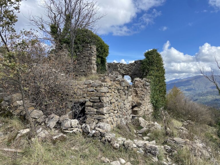
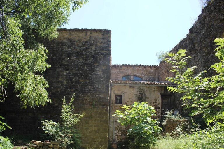
The middle tower stands on a rocky outcrop at approximately 1,310 metres. Its complex contains a six-sided tower, an adjoining tower with an interior square plan measuring 4 by 4 metres and about 5 metres in height, and the remains of an enclosing wall set roughly 25 metres away. The adjoining tower has an entrance and a small semicircular-arched window on its eastern facade.
The surviving enclosure wall has a facade slightly more than 10 metres long and about 90 centimetres thick. Its central entrance is flanked by eleven loopholes, narrow openings through which weapons could be used. The complex was built in several phases, probably during the thirteenth and fourteenth centuries. Popular tradition calls the middle tower the barony’s prison, although that function is not otherwise established.
Northern signal tower
The northern tower stands on the highest northern position of the group, at approximately 1,291 metres, and rises about 12 metres. Its exterior plan is irregularly hexagonal, while the interior is rectangular, measuring about 3.70 by 4.20 metres. Three storeys contain slightly pointed vaults. The levels are connected by a narrow passage approximately 70 centimetres wide and by unusually high steps built into the eastern wall.
On the eastern side, a doorway set about 1.30 metres above the exterior ground leads to the lowest chamber. The middle chamber has two windows or loopholes and a fireplace, while the upper level contains a large rectangular opening. Traditionally called the Signal Tower, it was believed to communicate by signals with the towers of Mir, Cos, and Batera. Another description associates it with smoke signals sent when an invasion approached from the south.
The northern tower is the best-preserved part of the complex. Its walls and openings have been restored, and a footbridge, access staircase, and observation platform have been added at the top.
Nearby sites