Byrsa: The Citadel and Archaeological Centre of Ancient Carthage
Site at a Glance
- Rating
- 4.6
- Popularity
- Medium
- Country
- Tunisia
- Primary era
- Classical
- External website
- Open
- Eras represented
- Iron Age, Classical, Modern
- Civilizations
- Carthaginian, Roman
- Site type
- Civic
- Remains
- Forum
On this page23 sections
History
Byrsa is the hill and citadel of ancient Carthage in Tunisia, a central stronghold of the Punic city traditionally associated with its foundation around 814 BCE. Rising approximately 57 metres, it is the highest point of Carthage and formed the elevated centre of the early settlement. Byrsa also became the Roman colony’s monumental administrative and religious centre before later religious and museum buildings transformed the summit.
Foundation and Punic Carthage
Tradition links the foundation of Carthage with Elissa, or Dido, the Tyrian princess described as the city’s founder and first queen. Ancient chronologies place the foundation around 814 BCE, although some date ranges extend from 826 to 814 BCE. Foundation traditions identify Byrsa as the hill enclosed by Dido and as the centre of the first settlement.
The traditional explanation of the name Byrsa comes from the Greek word for “hide” or “oxhide.” In the foundation story, Dido cut an oxhide into strips to enclose the land granted to her. Other explanations connect the name with Semitic words for an escarpment or fortress, or with a term meaning “sheep well.” Its exact origin remains uncertain.
In the Punic city, Byrsa served as an acropolis, meaning a fortified elevated part of an ancient city, as well as a citadel and densely inhabited central district. The principal temple of Eshmoun, a major god associated with healing, traditionally stood on the summit. Routes and a staircase traditionally described as having sixty steps connected the hill with the lower city.
Punic Development and Destruction
Occupation of Byrsa developed through successive phases. An archaic necropolis occupied the southern part of the hill, metalworking installations operated on the slopes between the fifth and third centuries BCE, and a residential quarter was established in the early second century BCE during a period of economic prosperity. This later neighbourhood is conventionally known as the Hannibal Quarter, although its direct connection with Hannibal’s building activity remains an attribution rather than a demonstrated fact.
During the Third Punic War, Rome’s final conflict with Carthage, Byrsa became the city’s last defensive position. The Roman commander Scipio Aemilianus captured Carthage in 146 BCE, ending the siege with the destruction of the Punic city. The summit was subsequently levelled, limiting the identification of the original citadel and the temple traditionally associated with Eshmoun.
Roman Reorganization
After the Roman destruction, the hill remained without securely attested occupation for approximately a century. An attempt associated with Caius Gracchus in 123 BCE failed. Julius Caesar later revived the colonization project, and Augustus, the first Roman emperor, established Colonia Iulia Karthago from 29 BCE.
The Augustan foundation transformed Byrsa into the monumental centre of the Roman colony. Engineers cut down the summit and redistributed the earth across the slopes as extensive fills, creating a broad artificial platform for the forum and other public buildings. The reshaping of the former Punic citadel also expressed Rome’s political appropriation of the city.
Carthage underwent major building works after a fire around 150 CE, followed by further interventions during the Antonine and Severan periods. The Roman complex served the administrative, political, and religious functions of the capital of the province of Africa. The proconsul, a senior Roman governor acting on behalf of the emperor, exercised judicial authority there.
Several features belonged to later Roman phases rather than to the original Augustan plan. These included a sanctuary connected with the imperial family and the Metroon, a sanctuary of Cybele, the Anatolian mother goddess whose worship spread through the Greek and Roman worlds. A building excavated between 1930 and 1933 as the Palace of the Proconsuls has also been interpreted more cautiously as part of the wider Roman monumental complex.
Later History and Modern Investigation
After Roman Carthage declined and was abandoned, Byrsa remained largely unused for more than a millennium, while building materials were removed and possible later installations were added. Medieval cisterns prompted the suggestion that occupation continued intermittently. The hill has also been proposed, with uncertainty, as the location of a Carthaginian ribat.
A chapel dedicated to Louis IX of France was authorized by Hussein II Bey in 1830 and built in 1840 and 1841 after confirmation by Ahmed I Bey. It commemorated Louis IX’s death in Tunis during the Eighth Crusade in 1270 and provided a place of prayer for French sailors. Renovated in 1875, 1910, and 1925, the chapel closed in 1943 and was demolished from January 1950. A recumbent effigy, also called the Saint Louis cenotaph, marks its former location.
The White Fathers established themselves on Byrsa in 1875. Their seminary combined religious and archaeological purposes and housed material recovered from excavations. The museum founded there, first called the Lavigerie Museum, became the National Museum of Carthage in 1964 and presents material ranging from the Phoenician-Punic period through the Byzantine period.
The Saint Louis Cathedral was built between 1884 and 1890 during the colonial period. It became the primatial church of Africa when that title was restored to Cardinal Charles Lavigerie, who held the archbishoprics of Algiers and Carthage. The cathedral was deconsecrated in 1964 and has been used for cultural exhibitions since 1993.
Charles Ernest Beulé began excavations on Byrsa in 1859, and Alfred Louis Delattre continued them from 1880, especially after 1893. Their work included Punic tombs, possible fortifications, remains associated with the Temple of Eshmoun, and a mass burial containing several hundred skeletons and coins from the early second century BCE. Christian Tuxen Falbe and Beulé investigated the western slope and exposed cisterns, while Beulé also uncovered the Roman apses later known as the Apses of Beulé.
Further excavations were conducted by Charles Saumagne between 1924 and 1933, Gabriel-Guillaume Lapeyre mainly in the 1930s, and Jean Ferron and Maurice Pinard between 1952 and 1959. During the UNESCO international campaign to safeguard Carthage, French teams directed by Jean-Paul Morel and Serge Lancel investigated the Punic remains, while Pierre Gros and Jean Deneauve studied the Roman complex. Their work clarified the organization of Byrsa and contributed to a reconstruction of the hill in the second century CE, now displayed as a model in the National Museum of Carthage.
In 1994, Morel discovered the tomb of the Young Man of Byrsa during landscaping work. The individual, aged approximately 19 to 24, was named Ariche, meaning “desired man.” The burial enabled anthropological reconstruction and contributed to interpretations of Carthage’s connections across the Mediterranean. Byrsa forms part of the archaeological site of Carthage, whose ruins were recognized as a UNESCO World Heritage site in 1979.
Remains
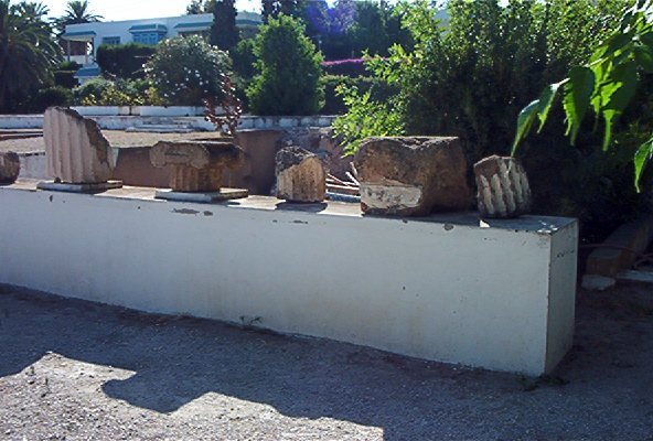
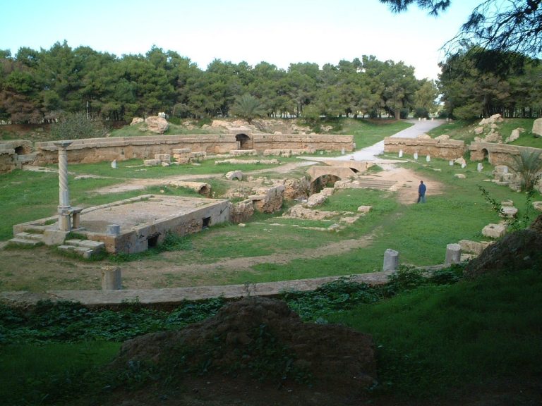
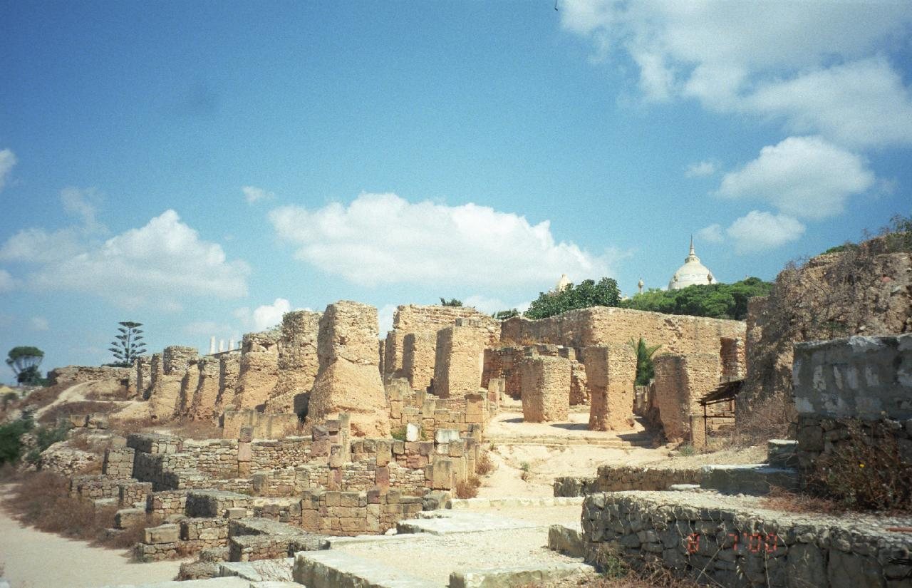
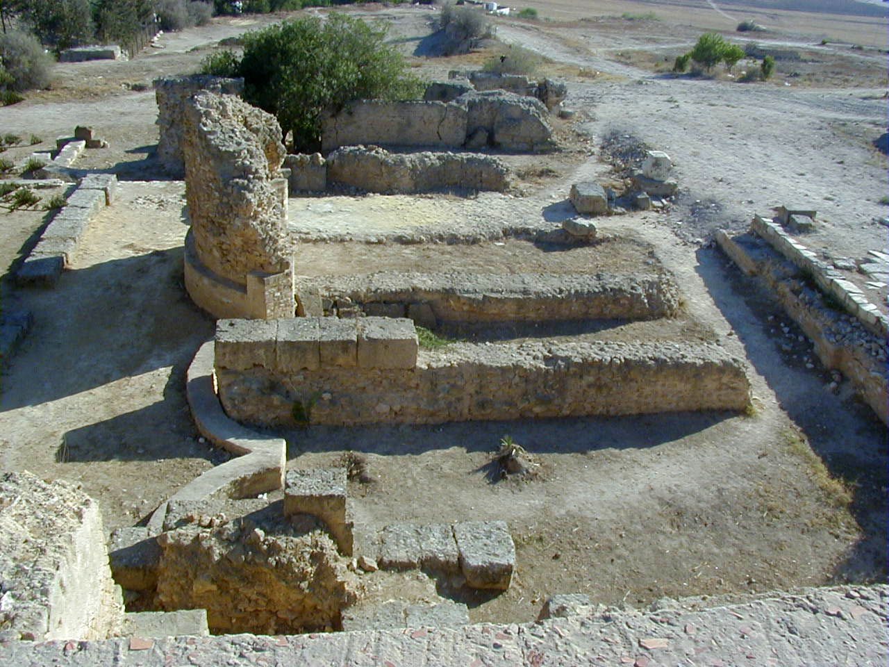
Byrsa now consists of an archaeological open-air zone spread across the hill’s slopes and Roman platform, together with the former cathedral and the National Museum of Carthage on the summit. The Punic remains survive mainly beneath Roman fills and along the slopes, while the Roman centre survives through foundations, retaining structures, paving traces, and scattered architectural elements. The former cathedral and museum cover parts of the Roman monumental centre, including the central forum and the Capitol.
Punic Slopes and Residential District
Hannibal Quarter
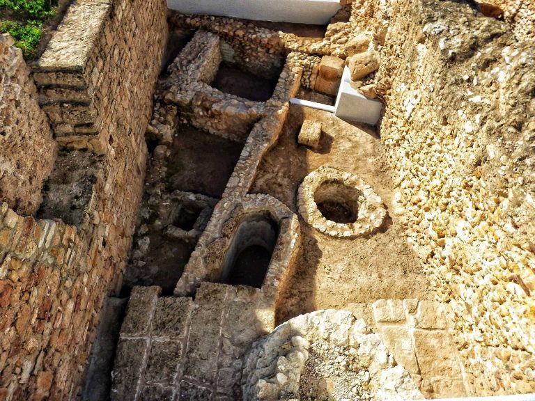
The late Punic residential district on the southern slope was laid out as an orthogonal neighbourhood adapted to the hill’s relief. Streets changed direction to accommodate the terrain, and stairways were built within them to negotiate the slopes. Houses generally had a commercial space at the front, a long corridor on the right, and a courtyard surrounded by small domestic rooms.
The houses included drainage channels and private cisterns. Some also had a small settling basin for collecting rainwater. The largest foundations reached approximately 100 square metres, although some houses may have extended through several levels. Their floors included decorated mosaic pavements known as pavimenta punica, and small portable baths made from fired clay were also found in the quarter.
Water Management and Metalworking
Punic water management relied on household cisterns rather than an aqueduct network. Used water was collected in deep settling basins beneath the streets, while reservoirs on the hill may have supplied water for ritual washing in temples. The Fountain of a Thousand Amphorae, an important large Punic fountain, was found on the nearby hill of Bordj Djedid.
Metalworking installations occupied parts of the slopes between the fifth and third centuries BCE. One working area contained ashes, charcoal, vitrified slag, and fragments of coarse pottery, providing evidence of industrial activity within the Punic settlement.
Punic Burials
Archaic Necropolis
The archaic necropolis on the south-western and southern slopes contains tombs dated mainly to the seventh and sixth centuries BCE. Rectangular blocks laid without mortar formed the tombs, which were covered by flat stone slabs and relieving arrangements and closed by monolithic slabs. Excavations usually found one to three bodies in each tomb. Some burials were reused between the late fourth and second centuries BCE.
Mass Graves
Two mass graves near the Punic necropolis contained several hundred bodies and more than 200 coins dating to the beginning of the second century BCE. The remains have been interpreted as possible evidence of violence suffered by the inhabitants of Punic Carthage, although the identity of the victims remains uncertain.
Tomb of the Young Man of Byrsa
The burial discovered in 1994 was reached through a shaft approximately four metres deep, leading to a chamber with two sandstone sarcophagi. One sarcophagus was empty. The other contained the well-preserved remains of a man approximately 19 to 24 years old and about 170 centimetres tall.
The tomb contained two Carthaginian amphorae, a lamp, an ivory cosmetic box, several amulets, and the remains of a sacrificial goose. These objects date to the late sixth century BCE. The remains were used for facial reconstruction and genetic analysis. The individual belonged to the rare maternal haplogroup U5b2c1, associated in the interpretation of the find with ancestry from the northern Mediterranean, probably the Iberian Peninsula.
Roman Platform and Civic Centre
Artificial Platform
Roman engineers levelled an area of approximately three to four hectares and created fills that sometimes exceeded eight metres in depth. Retaining walls and foundations reaching the original ground level stabilized the artificial platform, which was approximately 160 metres wide.
The groma, the geometric centre of the Roman colony, stood at the intersection of the main north-south and east-west streets, the cardo and decumanus. The new city’s blocks followed a regular grid, with units described as approximately 141 by 35 metres. The platform’s drainage and rainwater-disposal systems ran along the porticoes towards the sewer.
Forum and Temples
The Roman centre included two monumental squares, measuring approximately 13,000 and 12,000 square metres. The principal forum lay on the axis of the decumanus, with porticoes on its northern and southern sides and a basilica on its eastern side. A second square also had porticoes, a building on its western side, and a large terrace to the south.
The first Roman phase used Punic building material, including sandstone from El Haouaria. Its principal temple was a peripteral building, meaning that it was surrounded by a continuous external colonnade, and measured approximately 26 by 57 metres. Two stairways from the cardo led to the platform.
A later phase associated with the Antonine period used opus caementicium, Roman concrete used for foundations, retaining structures, and large architectural masses. The large temple was restored within its original footprint, while the general layout was retained and the porticoes were narrowed. A building approximately 65 by 22 metres closed the second square on its western side, and a structure at the north-west corner has been identified as a possible library.
Retaining Structures and Basilica
The Apses of Beulé formed part of the Roman retaining system supporting the raised monumental complex. Six apses were exposed on the south-east side in 1859, and approximately 90 metres of the retaining wall was known by 1892. A southern retaining wall incorporated reused amphorae. Roman foundations made from lime concrete penetrated the hill’s tufa bedrock, with foundation piles spaced approximately 4.60 metres apart to support substantial buildings above the slope.
Opposite the museum, the visible Roman remains include foundations and structures identified as the judicial basilica, which abutted the Apses of Beulé. South of the former cathedral are remains interpreted as a basilical hall and a trifolium room, tentatively associated with the proconsular palace.
Other Roman Features
Sanctuaries and Inscriptions
An altar dedicated to the imperial family, the Gens Augusta, confirmed a sanctuary or temple associated with Augustus. The altar was found after falling from the platform and is now preserved in the National Bardo Museum. A fragmentary inscription found beneath the cathedral mentions a Temple of Concord.
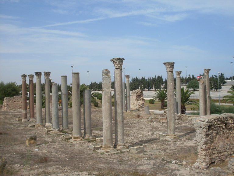
An alignment of columns on the eastern slope belonged to the building identified as the Metroon, the sanctuary associated with Cybele. The so-called Palace of the Proconsuls was excavated in the same general area. Two reliefs of Victories found in the late nineteenth century are now displayed in the National Museum of Carthage. One shows a cornucopia and the other a trophy.
House of the Crowning of Ariadne
The House of the Crowning of Ariadne was excavated in the Roman area. Its mosaics included a scene depicting the Crowning of Venus. These mosaics were removed to the National Bardo Museum.
Later Buildings on the Summit
Saint Louis Cathedral
The former Saint Louis Cathedral is a Romano-Byzantine building in the form of a Latin cross. It measures approximately 65 metres in length and 30 metres in width and has two large square towers and three aisles. Its construction over part of the Roman centre affected the survival and visibility of earlier remains.
National Museum and Modern Structures
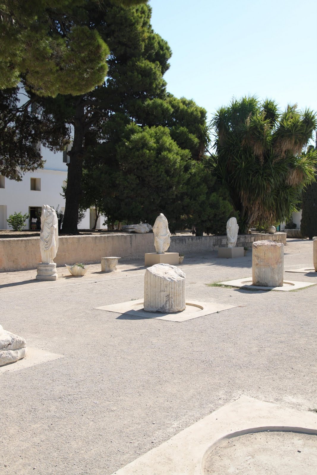
The National Museum of Carthage occupies part of the summit beside the former cathedral. Its collections present material from the Phoenician-Punic, Roman, and Byzantine periods. Other civil buildings placed on the hill between the late nineteenth and early twentieth centuries included Villa Salammbô, built by the Belgian consulate in 1894, Villa Marie-Thérèse associated with Captain Émile Driant, the Hotel Saint Louis established in 1897, a post office built in 1905, and Villas Laye and Levet, built in 1912.