Burrough Hill: An Iron Age Hillfort in Leicestershire
Site at a Glance
- Popularity
- Medium
- Country
- United Kingdom
- Primary era
- Iron Age
- Eras represented
- Iron Age, Medieval
- Civilizations
- Unclassified
- Site type
- Military
- Remains
- Fort
On this page15 sections
History
Burrough Hill is an Early Iron Age hillfort, a defended settlement enclosed by earthworks, at Burrough on the Hill in Leicestershire, United Kingdom. Human activity in the area reaches back at least to the Mesolithic, the period of early hunter-gatherer societies. Settlement probably began in the Late Bronze Age or Early Iron Age, and the hillfort itself was founded in the Early Iron Age.
Iron Age and Roman-period activity
The fort’s development after its founding remains unclear. It is uncertain whether a settlement outside the defences was occupied alongside the hillfort or belonged to a separate phase. Activity was most intensive between 100 BC and AD 50. Artefacts indicate that people at the site had trade connections extending over a wide area.
The hillfort gradually declined toward the end of the Iron Age. A layer of discarded material containing Roman pottery is evidence of this change. The site probably continued in use at some point between the 1st and 4th centuries AD, when Britain was under Roman rule, with habitation then concentrated in the northern part of the fort.
Medieval use and antiquarian interest
During the medieval period, people farmed the hillfort and surrounding land, and a local fair was held on the hill. In the 16th century, the English antiquarian and writer John Leland described dancing and games there on Whit Monday. He also dug into earthworks near the entrance out of curiosity, in what may be the earliest archaeological field report of Burrough Hill. Farming continued until the parish was enclosed in the 17th century.
In the 19th century, the Melton Hunt used the hill for steeple-chasing, a form of horse racing over obstacles.
Archaeological investigation and modern use
The first professional excavation took place in 1935, but its recording was inadequate and the exact location of the trench is uncertain. Further work in 1960, 1967, 1970, and 1971 combined geophysical surveys with excavation. The results were generally published poorly, and the site remained little understood.
A five-year excavation began in 2010, led by the University of Leicester’s School of Archaeology and Ancient History and University of Leicester Archaeological Services. The project aimed to clarify the purpose of regional hillforts, which were less understood than Iron Age farmsteads and undefended settlements, and also provided field training for students. Archaeologist Jeremy Taylor described sites such as Burrough Hill as the closest equivalent to a town before places such as Leicester existed. Finds from the later excavations have also been interpreted as evidence of differences in status and access to material goods between the hillfort and small farmsteads of the same period.
Burrough Hill is a Scheduled Monument, a nationally important archaeological site protected against unauthorized change. The Ernest Cook Trust owns the site and has leased the 86-acre country park containing the hillfort to Leicestershire County Council since 1970. The parkland remains in agricultural use, mainly for crops, with some cattle and sheep.
Remains
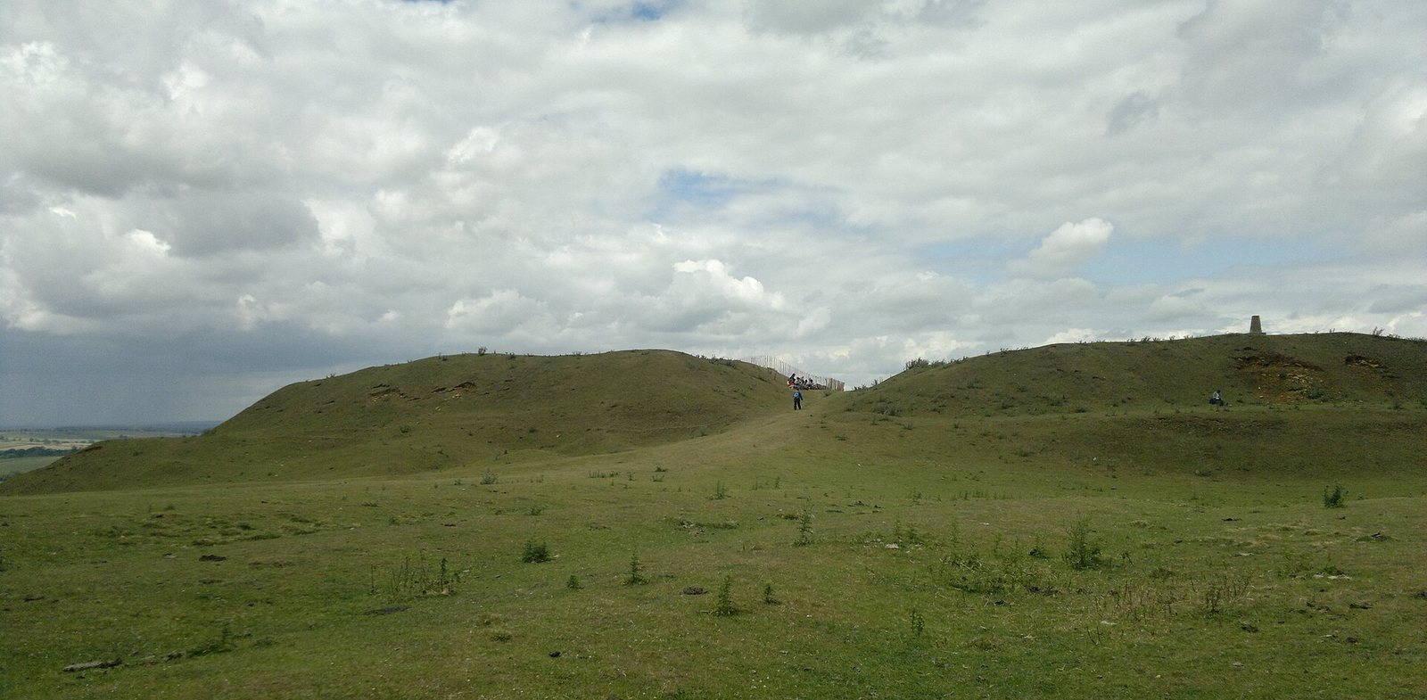
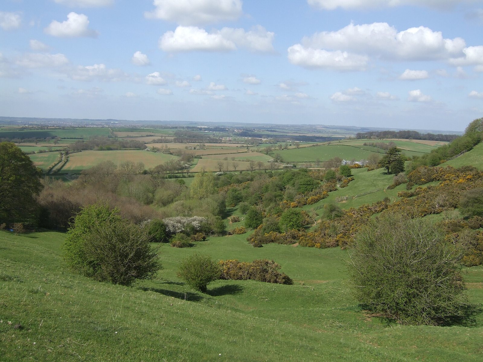
The fort occupies an ironstone promontory about 200 metres above sea level, shaped by prehistoric ice ages. Its trapezoidal enclosure covers about 12 acres (4.8 hectares) and looks out over the surrounding countryside. The bedrock is marlstone, a limestone containing relatively little iron; there was little effort to extract iron from it. Differences in iron content give the rock shades ranging from orange to light brown.
Enclosure and entrance
Ramparts and ditch
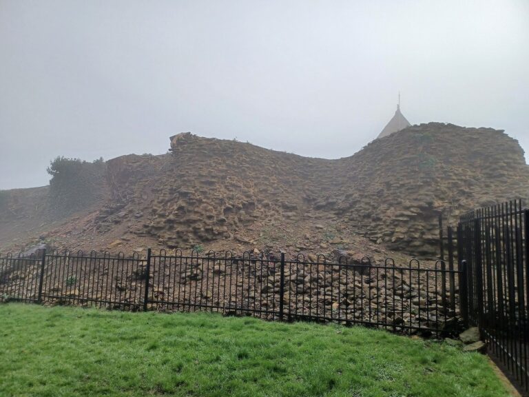
A single ditch and rampart surround the fort. Built from stone and earth, the rampart rises about 3 metres above the interior and was originally higher. A counterscarp, the outer slope of a defensive ditch, lies 5 to 6 metres beyond the northern rampart. Although later activity created gaps in the defences, the earthworks generally survive well.
Southeast entrance
The main entrance lies on the southeast side, where a gap in the defences turns inward. Its passage extends about 45 metres into the fort and is bordered by banks about 2 metres high, probably once taller. The passage would have had a stone facing. A chamber measuring about 5 by 10 metres was built into the banks and may have served as a guardhouse. Evidence from timber posts suggests a wooden gallery may have crossed above the entrance, allowing people to pass over the ramparts beside it. The long entrance passage also increased the distance an entrant had to travel. Its design and the adjacent chamber have parallels at Eddisbury in Cheshire and The Wrekin in Shropshire. A second entrance may have stood to the southwest.
Settlement inside and outside the fort
Interior features
A 2010 magnetometry survey, which detects changes in the ground’s magnetic properties to locate buried features, identified more than 400 circular patterns inside the fort. Their purpose is uncertain, and they were less numerous in the southeast. Their dimensions and number, considered alongside comparable excavated features, suggest that some may have been storage pits. Curved patterns probably indicate roundhouses grouped near the northern, western, and southern ramparts.
External settlement and field traces
Curved patterns beyond the ramparts suggest that roundhouses also formed an external settlement, enclosed by a ditch. Traces of quarrying from the post-medieval period lie outside the main entrance. In the wider parkland, medieval ridge-and-furrow earthworks preserve the lines of ploughed fields. These consist of long raised cultivation strips separated by furrows, and traces of later agricultural use also remain.
Excavated features and finds
Early excavations
The 1935 excavation covered about 360 square feet (33 square metres) outside the fort, somewhere to its east. It produced animal bones and twelve pieces of Iron Age and Roman pottery. In 1960, a proton-magnetometer survey covered about half of the fort. Some of the features it identified were excavated and proved to be storage pits. Finds included animal bones, quern stones for grinding grain, and sherds of Iron Age and Roman pottery.
Excavation at the entrance in 1960 revealed a cobbled surface leading into the fort and a feature that may have been a guardhouse. Animal bones and Iron Age and Roman pottery were recovered there, along with a brooch associated with the La Tène culture, an Iron Age tradition recognized in part through distinctive metalwork.
Northern pits and rampart trenches
In 1967, excavators examined pit-like features within a 50-by-50-foot (15.25-by-15.25-metre) area in the northern interior. Twelve pits contained Iron Age and Roman pottery, animal bones, and charcoal. Roman pottery and coins from the 3rd and 4th centuries were found in the soil above them.
Excavations in 1970 and 1971 opened several trenches in the interior near the northern rampart, covering about 680 square feet (63 square metres) in total. One trench crossed the rampart to reveal a section through it.
Finds from later excavations
Later work focused on large storage pits filled with domestic refuse. The finds included about 100 Iron Age metal objects, one of the largest groups of Iron Age metalwork from the East Midlands. Other objects included a bone die and gaming pieces, a polished bone flute, and a finely decorated blue glass bead from a necklace.