Klettenberg Castle Ruins: A Medieval Hilltop Fortress in Germany


Site at a Glance
- Rating
- 3.5
- Popularity
- Very Low
- Country
- Germany
- Primary era
- Medieval
- Eras represented
- Medieval, Early Modern
- Civilizations
- Holy Roman Empire
- Site type
- Military
- Remains
- Castle
On this page8 sections
History
Klettenberg Castle Ruins are the remains of a hilltop fortress in Germany, in Klettenberg, a locality of Hohenstein in Thuringia. Saxon nobles established the castle around 1087 on a projecting spur to protect Ellrich, Walkenried, and the now-deserted settlement of Malmerode. The fortress occupied a strategic position on the southern edge of the Harz, and its founder was Volkmar de Walkenried.
Early Castle and County
Before the fortress was built, the hill was probably used as a cult and sacrificial site associated with Krodo, a Germanic or medieval legendary deity linked in local traditions with the Harz region. The designation “Tempel,” meaning “temple,” supports this interpretation, although the earlier use of the hill remains uncertain.
At the beginning of the thirteenth century, the County of Klettenberg was wealthy and richly endowed. A feud among its heirs weakened the territory, and the Counts of Hohenstein acquired half of the county in 1256 and the remainder in 1267. The female members of the Clettenburg family then left the castle and entered ecclesiastical service. Klettenberg was absorbed into the County of Hohnstein and ceased to exist as a separate county.
Hohenstein Rule and Destruction
From about the middle of the fourteenth century, the Counts of Hohnstein no longer lived at the castle. The von Tettenborn family continued to hold a castle-man’s seat there and, during the seventeenth century, held the fief of the Clettenberg manor. A fief was property granted by a superior lord to a dependent holder in return for specified obligations. The Hohenstein counts used the designation Hohenstein-Klettenberg until 1488, while the Counts of Hohenstein-Klettenberg formed a distinct genealogical line.
A fire destroyed the castle in 1480, but it was subsequently rebuilt. The Counts of Hohenstein died out in 1593, and until that time the castle was administered by vogts, officials who exercised governmental or judicial authority on behalf of a territorial lord.
The castle suffered repeated damage during the Thirty Years’ War, the European conflict fought from 1618 to 1648 over political and religious divisions. Johann Tserclaes, Count of Tilly, a leading Catholic commander, had the fortress occupied and repaired. Harz riflemen destroyed it in 1627, after which troops from Halberstadt took control. Tilly’s forces attacked it again in 1631, and Swedish troops occupied the castle from 1636.
Manor Estate and Later Use
Despite the damage and deterioration, the Counts of Sayn-Wittgenstein lived at the castle from 1648 to 1699. By then, the castle and the Lohra estate had become fiefs of Electoral Brandenburg, having previously belonged to Halberstadt. The noble families of Schwarzburg and Hohenstein challenged this arrangement through restitution proceedings, legal claims seeking the return or restoration of transferred property or rights.
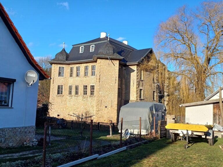
At the end of the seventeenth century, the Counts of Sayn-Wittgenstein demolished the old upper castle and built a new wing. This later became a manor estate, a landed property incorporating its agricultural administration. Ehrenreich Ernst von Rochow, who lived from 1733 to 1807, was among its holders and belonged to the community of heirs of Friedrich Eberhard von Rochow-Reckahn. Around the same period, the later Enlightenment writer Rudolph Zacharias Becker worked at Klettenberg Castle, first as a private tutor and later as a tutor in the household. The lower castle served as a farmyard for a long period and now houses the municipal administration.
Remains
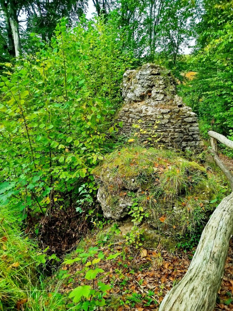
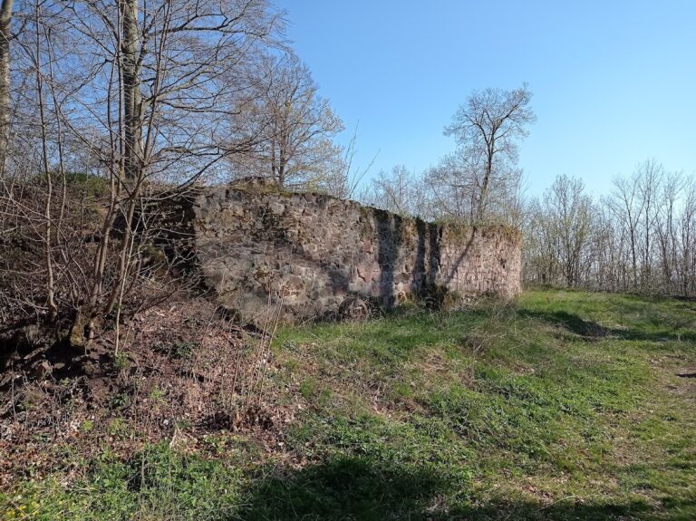
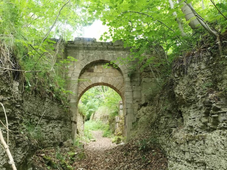
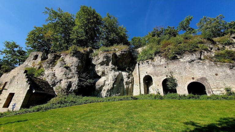
The surviving remains occupy the rocky summit of Klettenberg. The fortress was built as a hilltop enclosure from dolomite rubble stone, with an upper castle on a plateau measuring approximately 10 by 17 metres and a lower castle below it. The upper area preserves connected sections of the enclosing wall and the walls of a round tower, while only fragments of the main castle core remain.
Upper and Lower Castle
Upper Castle
The upper castle stood on the small summit plateau and formed the principal fortified area. Sections of its enceinte wall, the wall enclosing the castle, remain connected, and parts of a round tower survive with them. The late seventeenth-century demolition of the old upper castle and construction of a new wing altered this area, leaving fragments of the earlier core alongside the surviving wall sections and tower remains.
Lower Castle
The lower castle developed a long agricultural use as a farmyard. Its surviving buildings now accommodate the municipal administration, preserving the lower part of the complex in a later functional form.
Nearby sites