Burg Kalden: A Ruined Castle in Bavaria, Germany


Site at a Glance
- Rating
- 4.4
- Popularity
- Low
- Country
- Germany
- Primary era
- Early Modern
- External website
- Open
- Eras represented
- Medieval, Early Modern
- Civilizations
- Holy Roman Empire
- Site type
- Military
- Remains
- Castle
On this page7 sections
History
Burg Kalden, also known as Neu-Kalden, is a ruined castle in Germany, north of Altusried in Bavaria, built in 1515. It replaced the older Burg Alt-Kalden, whose unstable location had suffered landslides and structural losses during the Middle Ages.
Alt-Kalden and the Lords of the Castle
Burg Alt-Kalden, about 300 metres north of the later castle, was first mentioned in 1128. In that year, a family called the Callindin was recorded in the service of Kempten Abbey, an ecclesiastical institution whose abbot held territorial authority within the Holy Roman Empire. The castle and its lordship changed hands repeatedly. The Lords of Rothenstein acquired them in 1384, the Lords of Pappenheim purchased them in 1409, and the Rothensteins regained them in 1412. The Pappenheims returned to possession through inheritance in 1482.
Geological instability undermined Alt-Kalden during the Middle Ages, and the older castle had been destroyed before 1500. Its difficulties led to the creation of a replacement farther south rather than the continued development of the original site.
Construction and Abandonment of Neu-Kalden
Joachim von Pappenheim built Neu-Kalden in 1515, approximately 300 metres south of Burg Alt-Kalden. The Pappenheims were a powerful noble family whose members held the hereditary office of Imperial Marshal in the Holy Roman Empire. In 1692, the complex was sold to the Princely Abbey of Kempten, a monastic institution whose abbot also exercised the authority of a territorial prince. The castle was abandoned at the same time because further landslides threatened the site.
Around 1840, Neu-Kalden was largely demolished, leaving a fragment of a tower. The municipality of Altusried acquired the ruin site in 1985. The castle grounds are protected as an archaeological monument by the Bavarian State Office for Monument Protection under monument number D-7-8127-0027.
Remains
Hill Spur and Defensive Boundary
Neu-Kalden occupied a broad hill spur about 90 metres above the Iller, at an elevation of approximately 710 metres. A ravine protected the western side, while the ground fell steeply eastward toward the river. On the side connected to the adjoining plateau, a neck ditch, or defensive ditch cut across a narrow land connection, measured about 25 to 30 metres wide. At the southwest corner, it continued into the ravine.
Gate Tower and Castle Walls
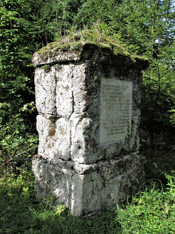
The present ramp-like approach to the castle plateau is flanked by a round gate tower with an external diameter of about 6 metres. The surviving ruin is chiefly the remains of this tower, which was repaired in 1977, especially along its northern rear side and the top of its wall. Its regularly arranged masonry combines flat, rounded stream stones, Nagelfluh blocks, a conglomerate rock made from rounded stones cemented together, and sandstone rubble. Fragments of roof tiles occur in the infill, while the inner wall on the first floor is built from stream stones.
An east-facing door outside the curtain wall was inserted later, replacing an earlier loophole, a narrow opening for observation or missile fire. The ground and first floors had flat ceilings, and each contained three slit loopholes. Sections of the curtain wall remain beside the tower, including interlocking wall joints about 4 metres high. Further wall fragments lie west of the tower, and parallel wall lines indicate the former presence of house-like buildings.
Remains of Burg Alt-Kalden
The earlier Burg Alt-Kalden lies about 300 metres north of the Neu-Kalden plateau. Its difficult-to-reach remains include ridge-like edges formed by collapse and the last fragments of walls built from tuff, a porous stone formed from volcanic ash. The landslide-affected site also preserves a prominent geological profile, with gravel in its upper section and sand and marl below.