Bilsk Hillfort: A Scythian-Period Fortified Settlement in Ukraine
Site at a Glance
- Popularity
- Medium
- Country
- Ukraine
- Primary era
- Iron Age
- Eras represented
- Bronze Age, Iron Age
- Civilizations
- Scythian
- Site type
- City
On this page16 sections
History
Scythian-period center
Bilsk hillfort is a fortified settlement in Poltava Oblast, Ukraine, which became a major political and cultural center during the Scythian period. Here, that term refers to an archaeological era associated with ancient peoples of the Eurasian steppe, generally dated from the late eighth to the early third century BC. The oldest cultural layers belong to the Bronze Age Zrubna and Bondarikha archaeological cultures. The first remains from the Scythian period date to the eighth and seventh centuries BC.
The Western and Eastern fortifications were established in the seventh and sixth centuries BC, then linked by the defenses of the Great Bilsk hillfort. The Kuzemyn fortification was added in the fifth century BC. Bilsk became a center of the Vorskla group, an archaeological grouping of Scythian-period sites associated with the river. Its inhabitants included the Budini, Gelonians, and Neuri, and probably other peoples. Bilsk has been proposed as the location of Gelonus, a city described by Herodotus, the ancient Greek historian, but the identification remains disputed.
One interpretation sees Bilsk developing from a center of a tribal union into an urban settlement with an economy based on crafts and trade. Its people farmed, tended gardens and livestock, hunted, and practiced household industries. Trade routes connected the settlement with a wide region. A river route led from a landing near Kuzemyn along the Vorskla and Dnieper to Olbia, an ancient Greek city on the Dnieper-Bug estuary. Overland paths crossed the Vorskla ford and followed the Muravsky Trail toward Crimea and its Greek cities. Other routes ran toward the Perevolochna crossing or across the Psel-Sula interfluve along the Romodanivsky Route, connecting western and southwestern routes with forest-steppe communities through crossings at Kremenchuk and Hradyzk.
Decline and later occupation
During the third century BC, political and economic changes in southern Eastern Europe, influenced in part by climate, disrupted Bilsk’s economic and cultural connections. Agricultural yields declined, as did crafts and trade, and settlement life gradually ebbed. Bilsk consequently ceased to function as a major center.
In later periods, small settlements associated with the Kyiv, Chernyakhiv, and Penkivka archaeological cultures occupied parts of the site. Isolated finds are linked to the Saltiv and Romny cultures and to the Pechenegs. The Eastern settlement was also occupied during the period of Kievan Rus’, a medieval East Slavic polity. Cultural layers within the Great Bilsk fortification date to the early seventeenth century.
Those seventeenth-century layers are associated with saltpeter production and settlement by migrants from Right-bank Ukraine and Cossacks. Saltpeter, or potassium nitrate, was used in gunpowder. From the sixteenth through the eighteenth centuries, saltpeter extraction also took place within the fortifications and partly damaged them. Looting excavations affected the hillfort and the adjacent burial ground.
Recognition and archaeological research
A map made by Guillaume de Beauplan in the mid-seventeenth century placed the ancient settlement near Bilsk. Opanas Shafronsky later described two earthwork forts joined by an earthen line and measured their defenses, though he could not determine when or by whom they had been built. In 1857, Philaret Gumilevsky mentioned the Western and Eastern fortifications and the Great Hillfort rampart without treating them as one complex.
Aleksei Bobrinsky later surveyed the site, published a detailed description and plan of the Western fortification, and identified a Scythian-period layer there. He treated the Eastern fortification as separate and applied the name Bilsk hillfort only to the Western one. Vasyl Liaskoronsky published plans that did not recognize Kuzemyn and mistakenly attributed the Great Bilsk ramparts to the Serpent’s Wall, a name for ancient linear earthworks in Ukraine.
Vasily Gorodtsov carried out the first archaeological excavations in 1906, investigating parts of the Western fortification and Great Hillfort and excavating 22 nearby burial mounds. His work established that the defenses formed a three-part complex connected by the Great Hillfort ramparts. Systematic research by Kharkiv University expeditions began in 1954 under Boris Shramko. A Moscow University team led by Boris Grakov took part in excavations from 1958 to 1960, and a Donetsk University team led by Alla Moruzhenko worked at the Western fortification in 1968. Iryna Shramko led the Kharkiv University expedition from 1987.
A joint Ukrainian-German expedition worked at Bilsk from 1992 to 2006. Its leaders were Vyacheslav Murzin from 1992 to 2002, E. V. Chernenko in 2003 and 2004, and S. V. Makhortykh in 2005 and 2006, alongside University of Hamburg professor R. Rolle. Kharkiv National University’s Scythian expedition, led by Iryna Shramko, conducted sustained excavations during the 2010s. The Bilsk Historic-Cultural Reserve was established on 19 May 2005, and the hillfort is protected as an archaeological monument of national importance.
Remains
Fortified layout
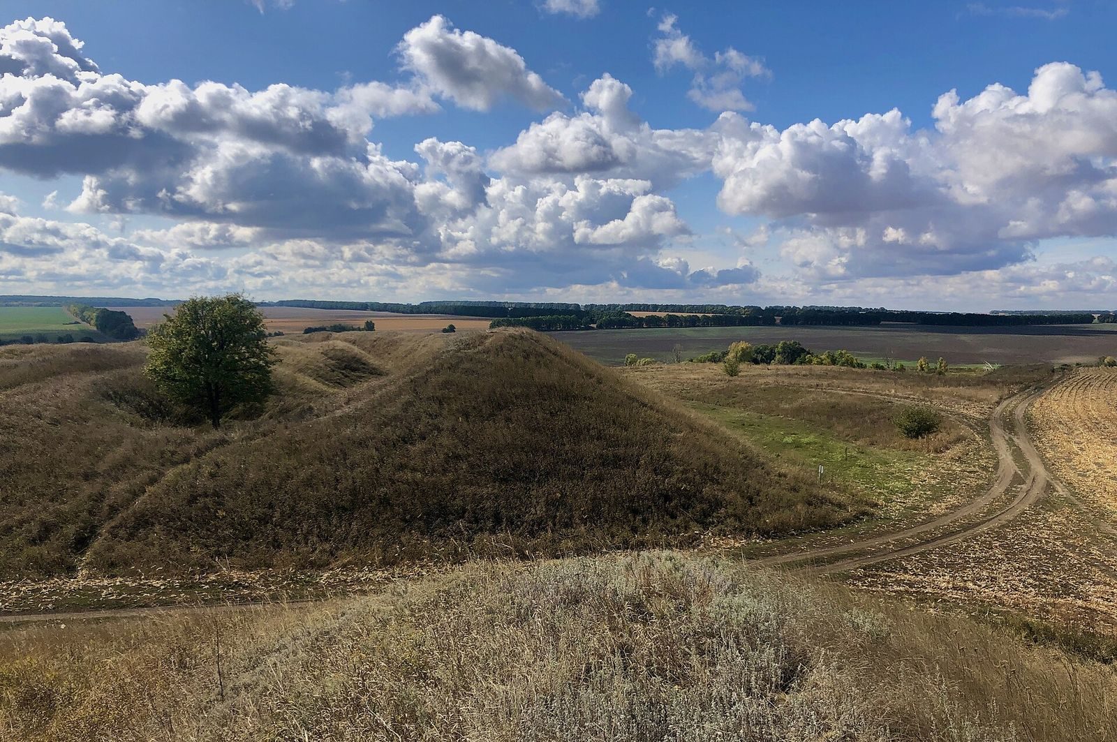
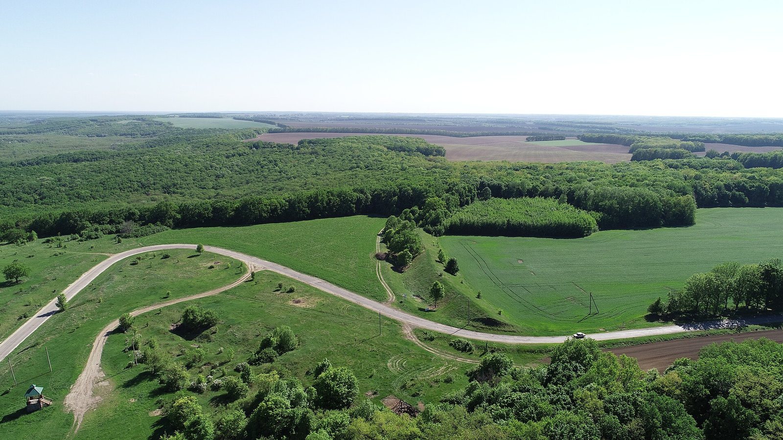
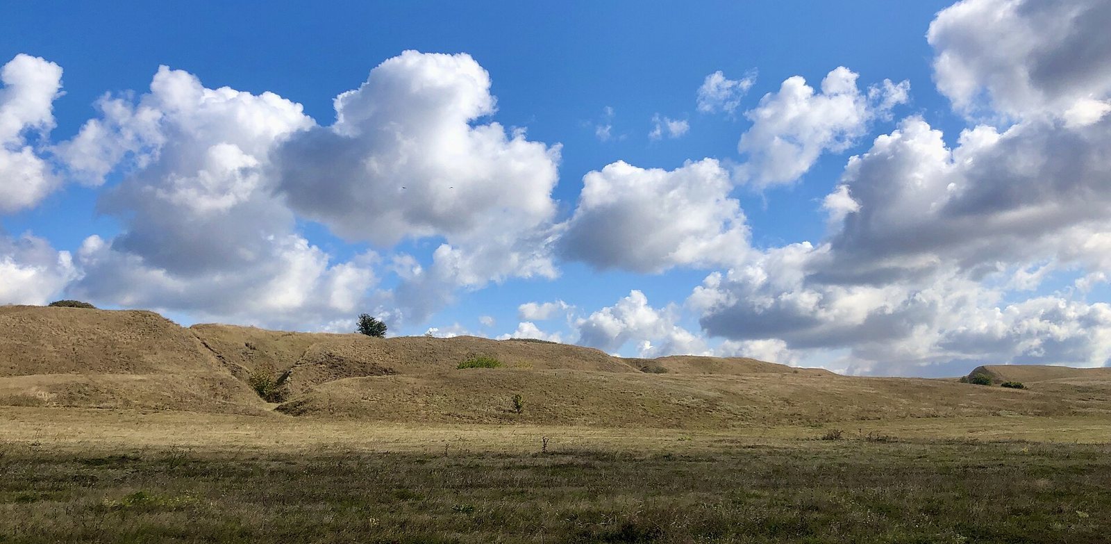
The complex occupies elevated, projecting ground between the Vorskla and the Sukha Hrun, a right-bank tributary of the Psel. It lies near the villages of Bilsk in Poltava Oblast and Kuzemyn in Sumy Oblast. The settlement covers about 4,400 hectares, and its ramparts extend for 33,833 metres. It is described as the largest Scythian-period fortification in Eastern Europe. The layout comprises the Kuzemyn, Western Bilsk, and Eastern Bilsk fortified settlements, joined by the Great Bilsk fortification. Deep ditches, high earthen ramparts, wooden walls, and towers formed the defenses.
Western and Eastern fortifications
The Western fortification stands on the right bank of the Sukha Hrun and has defensive works 3,270 metres long. The Eastern fortification is on the right bank of the Vorskla, with defenses extending 3,870 metres. Their construction began in the seventh and sixth centuries BC.
Kuzemyn fortification
Kuzemyn covers 15.4 hectares and has defensive works 898 metres long. This fortified settlement was established in the fifth century BC.
Great Bilsk fortification
The Great Bilsk fortification links the other fortified settlements, and its ramparts extend for 25,995 metres. A southern rampart runs through its middle. Excavations showed that in the fifth century BC this rampart divided the southern part from the territory centered on the Eastern Bilsk settlement.
Dwellings, storage, and workshops
Homes and farmsteads
At the Eastern settlement, excavations revealed partly underground and above-ground dwellings, including timber buildings made from horizontal logs. Farmsteads had discernible arrangements, and two-storey wooden buildings were also found.
Storage and production areas
Domestic and agricultural features included cellars, grain-storage pits, barns, drying rooms, and large enclosures for cattle. Workshop remains point to blacksmithing, bronze casting, jewelry production, pottery, and bone carving.
Religious places and archaeological finds
Temples and figurines
Remains of altars and temples have been found, including a wooden temple with columns. One temple may have been used to observe astronomical phenomena. Numerous ceramic figurines depict people, animals, and birds; other objects have been interpreted as evidence of local agricultural fertility cults.
Imported and everyday objects
Finds include imported painted pottery, Rhodian-Ionian ceramics, and transport amphorae, large vessels used to carry and store goods, associated with Chios, Proto-Thasos, and Thasos. Glassware and glass beads have also been found, alongside tools, horse harness, objects made from bone and horn, flint pieces, and metal objects.
Burial landscape
Barvinkova Hora is a burial site near the Eastern Bilsk settlement. Tsaryna Mohyla marks the highest point of the hillfort.